ORH_wxman
-
Posts
93,099 -
Joined
-
Last visited
Content Type
Profiles
Blogs
Forums
American Weather
Media Demo
Store
Gallery
Everything posted by ORH_wxman
-
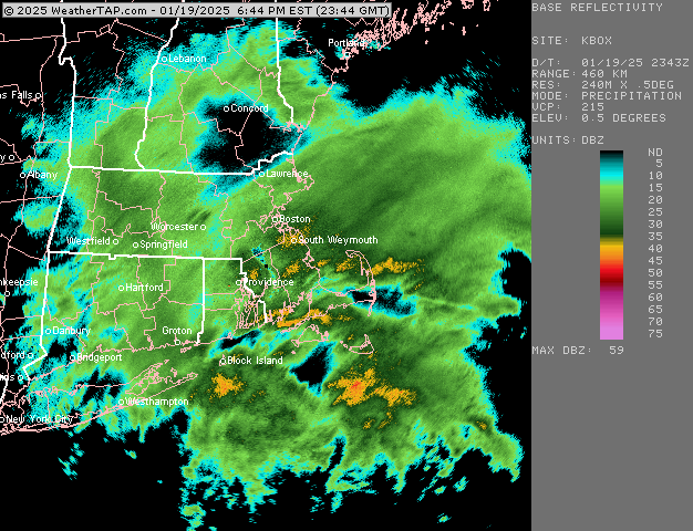
It’s trying. Maybe we can grab some fluff if it holds
-
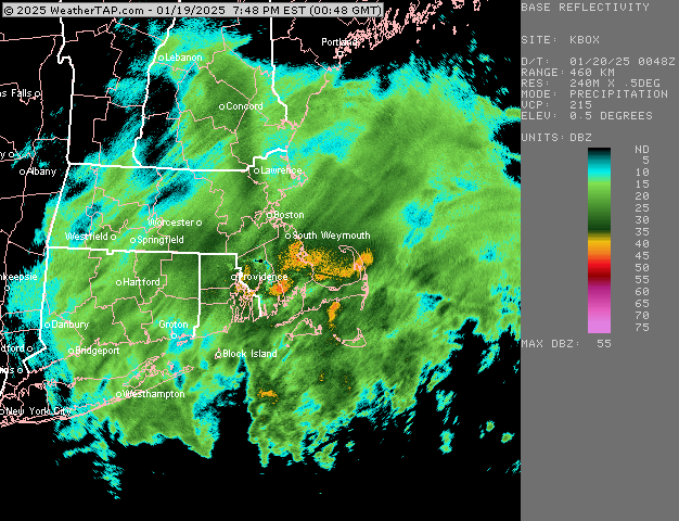
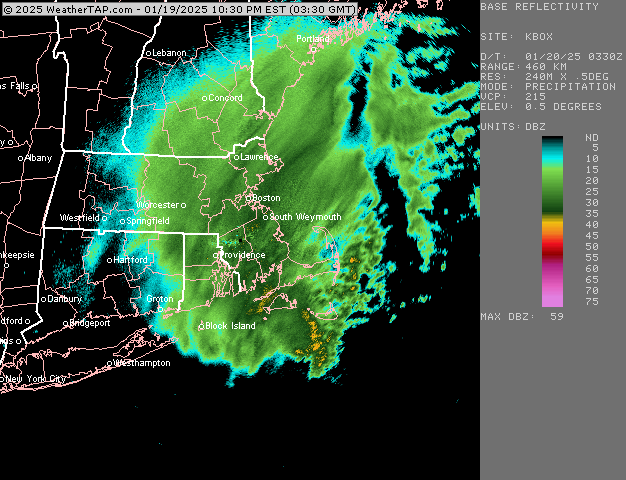
Here’s the OKX loop. Maybe CT peeps can pick up some fluff from this
-
That’s looking really good for your area
-
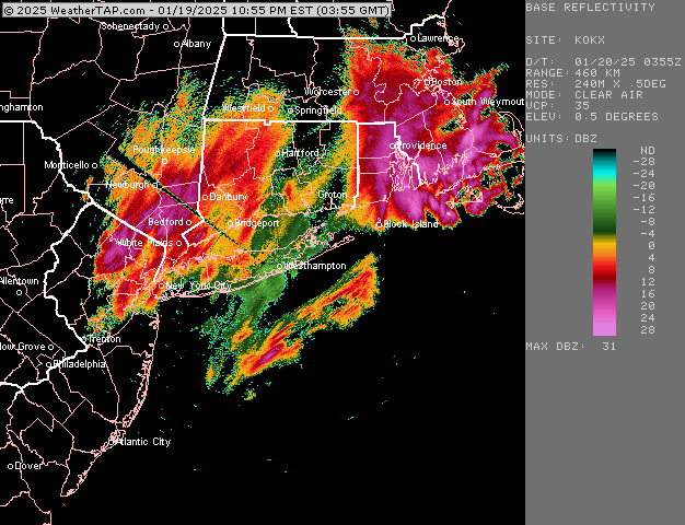
That band looks like it’s nuking Scooter out east
-
Pushing 4” here. Maybe just a hair under with the final batch of serious goods about to hit. Can’t complain.
-
Prob only have about an hour left in the good stuff, but this is a really nice finale.
-
Really perfect snow growth right now here. Prob similar near you as you are in similar banding. Perfect night to have the spotlights on.
-
Ok this is legit 2”/hr at minimum right now. Absolute dumpage of optimal dendrites at 27F
-
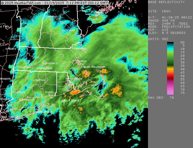
Heaviest of the storm now. Not gonna last super long but these are the moments we wait for in winter. Eyeballing about 3” so far.
-
Pounding right now. Next 2 hours is the show
-
The rare legit heavy snow here right now in this band
-
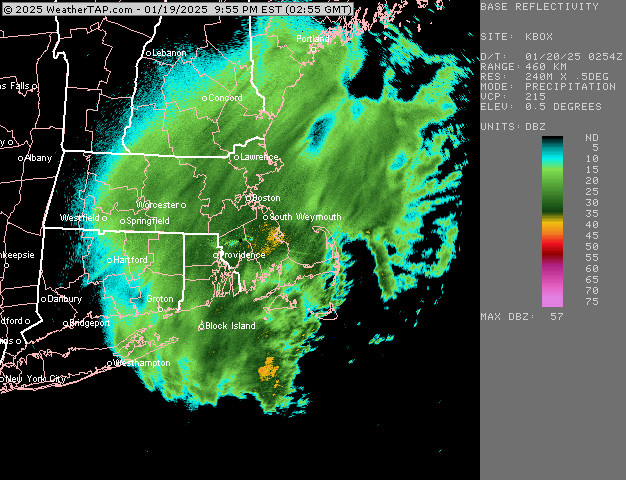
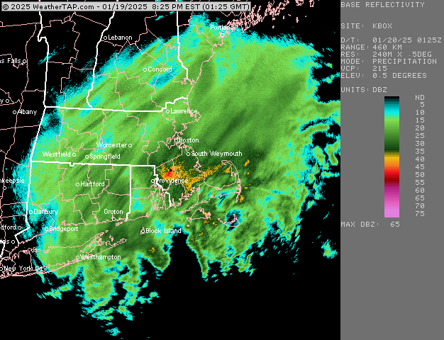
Radar has definitely improved some but I also expected it to. It looked pretty ragged earlier. The question is how long we can rip 1-2” per hour stuff. If it’s only a couple hours worth then it’s gonna be hard to break 4-5”…but I’m getting a little more optimistic to try and beat that.
-
Really ramping up here right now…legit moderate now…prob around an inch new
-
Ineedsnow intensity equation is just move the decimal place over one: light snow = greater than 5 mile vis moderate = between 2.5 and 5 mile heavy snow = 2.5 miles or less.
-
RAP has been looking healthier recently but HRRR has been staying a bit flaccid. I want to see a bit more WCB stuff trying to push north in the waters south of LI/SE MA/RI.
-
Thinking 3-6 here. Maybe 4-8 if we do good ratios.
-
At the end of the day it looks close to a typical 70/30 euro win (talking inside of 72h….it lost the medium range battle). Unless this can tuck in a bit more than guidance currently says. It’s still a decent event but widespread 8-12 with higher lollis doesn’t look very likely which is basically what GFS/Canadian guidance had at one point (with much less near coast)
-
HRRR and RAP are pretty weak sauce at the moment. I’d like to see them ramp up a bit today.
-
06z euro ramped back up. Gonna be interesting to nowcast this today.
-
That’s around an inch of QPF BOS on that GFS run and the midlevel look supported it that run. Pretty healthy and a little closer to some of those previous GFS runs on the midlevel look except displaced a bit further east. We’ll see if we can get a little last second trend stronger with that initial WCB.
-
If we can get the WCB more established between now and go-time, then we’d prob see QPF increase across the region. You want to be drawing in that extra moisture into the CCB over the top of that legit cold dome to the west and we can wring it out.
-
or what he said…similar thinking
-
You have a bit of elevation too, right? That will prob help you in the first hour or two. I’d prob peg ratios for like 13 to 1 there but it wouldn’t surprise me if you got into a weenie band and went close to 16 or 18 to 1.