ORH_wxman
-
Posts
93,099 -
Joined
-
Last visited
Content Type
Profiles
Blogs
Forums
American Weather
Media Demo
Store
Gallery
Everything posted by ORH_wxman
-
Yeah mid-Cape had about 8-9” but I think some weenie spots near the canal had a foot. The pack after that one was into historic levels down there. There’s probably a few spots that had 60”+ that month for totals and the pack was over 40”.
-
Yeah gradient patterns can be boom or bust....if you just keep ending up on the wrong side of the gradient in each storm system, then it's garbage. But they can be prolific as we've seen in the past too. We'll see how it looks as we get closer....it might not even end up like that, but it's been fairly consistent advertising it.
-
We were also pretty sure as far east as the mid-Cape had over 100" of snow that winter....there's no real good coops east of E Wareham, but we figured the snow totals were fairly uniform (not necessarily in each storm, but in the aggregate since some storms like 12/26/04 favored further east) between the Warehamd coop and mid-Cape. I think Wareham coop had something like 105" which is crazy insane for them...and considering they probably lost a few inches due to coop measuring. They are good there, but not totally pristine. Just an incredible winter there.
-
Based on my grandparents house in Yarmouth and my memory of talking with Phil (capecodweather.net), we think they had about 33-36" in Yarmouth on the mid-Cape. But yeah, measuring perfectly accurately was nearly impossible because the winds were just incredible. A lot of houses had drifts right up to the roof....it wasn't just in isolated weenie spots....it was widespread 10-12 foot drifting. A lot of people forget this, but like 3 days later, there was another Cape-centric storm that dumped a solid 7-12" on top of the blizzard snows....we had like 4-6" back here, but I remember thinking that was bad timing for them considering they hadn't finished digging out of the blizzard. The pics after the 1/26/05 storm were crazy.
-
It's basically a perpetual gradient pattern right into March.
-
Those things better not come back for a long time. They did a number on the forest behind my house. There was one year you could just here all of them eating the leaves every time you went outside.
-
The ‘05 blizzard was exhilarating on the models though…it kept coming north every single run it seemed like and got bigger and bigger too. It was one of those storms that trends better and better right up to go-time. I remember @wdrag had an amazing AFD the day before I believe talking about how the ETA model was now closing off H5 which was going to help capture the sfc a bit more and bring higher snow totals. Some of METARS out of FMH were epic in that storm. You also know the storm was impressive with the airmass when ACK flips over to rain for a time but still grabs 24”.
-
You were near the dryslot cutoff. ORH had 2 feet but not too far south had dryslotting that made it more like 14-17”.
-
Yeah skiing is definitely way better in cold/dry winters. Also, up north a lot of places do well in upslope and leftover lake effect in cold/dry patterns. The upslope zones have been basically nature’s snow guns for the last few weeks.
-
Euro only had one run that really smoked us. It otherwise was raising the red flags on widespread 7”+. So I’d say it handled the storm the best inside of 72 hours. It failed in the medium range though (D5-6). Maybe Ukie gets some kudos too…it was pretty consistently meh on big warning totals. A lot of runs were in that 4-6” range.
-
Agreed. If there’s some snow OTG, I’ll def take cold and dry. At least it feels like winter out there with snow and ice all around and seeing all the ponds/lakes frozen here. Last two winters felt like fooking Vancouver…40s and rain every 3 days. Awful. But if it’s bare ground, I dunno…might take the warmth, but I really hate rain too. The “ideal” torch winter is prob very dry like ‘01-02.
-
End of month/first couple days of Feb is probably the only weak signal at the moment.
-
Weeklies weren't warm for second half of February....they had a gradient pattern....lots of cold in northern tier of CONUS. We're kind of on the line near average. Take with a grain of salt this far out of course....but if we do go back into the COD or even skew toward the cold MJO phases, then maybe we don't get the usual Februayr Nina torch and instead keep it closer to normal.
-
The bottom layer of snow here is not fluff, its like this pasty stuff that froze...top 4" or so is powder. Not worried about losing snow cover outside of some sun torched spot next to a busy street with a south facing slope. The boredom is the bigger worry. Hopefully some of that energy ejects from southwest ala GGEM (06z GFS does it too except a day or two later) and we can maybe score something at the end of the month.
-
Down to 2F here but -7 down the hill.
-
Still a couple hours to go in the good stuff. Wonder if someone can grab a 10 spot there. Good luck breaking that record.
-
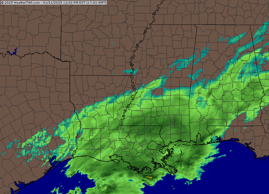
I love how it’s 24F in Pensacola too. Not even marginal.
-
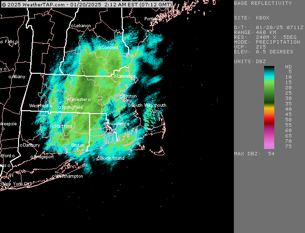
Yes. The radar is snow textured too. It’s not full of convection like you typically see down there.
-
This is crazy radar for down there
-
Got down to 3F here. Looks like it’s about -5F at the bottom of the hill.
-
Next Monday looks like best chance. Mid-week the Cape might get a C-2” type scraping. But I’d be shocked if it came NW of that.
-
After years of 2-4” events, 6” starts to look like a foot. I remember those fond years of my childhood.
-
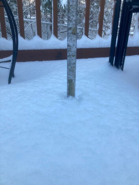
That 2 hours between about 930-1130 probably dropped about 3.5-4”…it was excellent snow growth in those heavier bands. Thought it was going to finish closer to 5” but that overnight band dropped another inch of pure blower fluff.
-
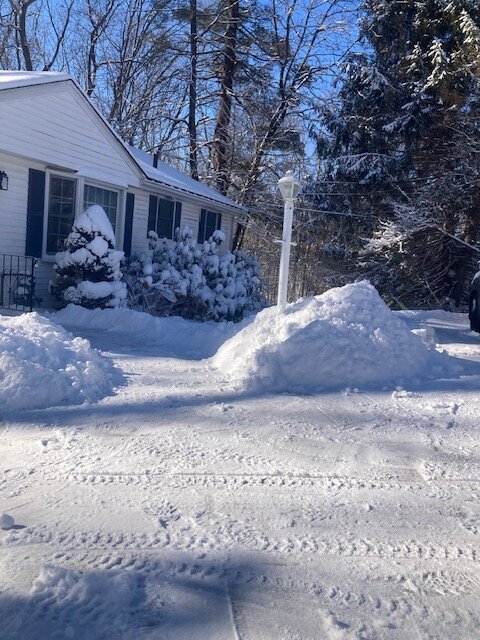
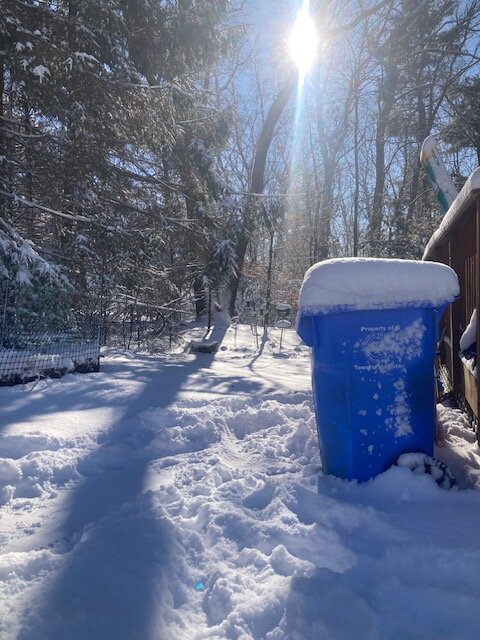
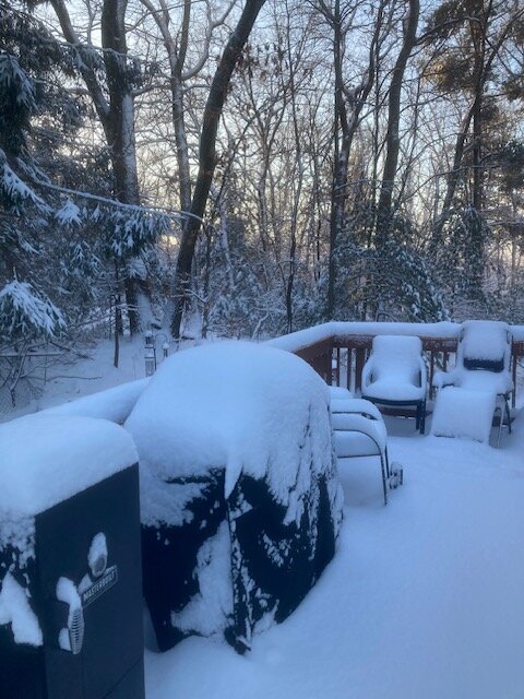
About 6” in Holliston. Very picturesque snow
-
Big fatties falling in this band