baltosquid
-
Posts
1,235 -
Joined
-
Last visited
Content Type
Profiles
Blogs
Forums
American Weather
Media Demo
Store
Gallery
Everything posted by baltosquid
-
 Quite gusty behind the front. Hopefully no power loss. Not really much lightning though.
 -
Man, if only that dry air wasn’t bearing down on 95. Wish we could steal a couple hours more of this.
-
In Harford county, at work. I really wanna see what this looks like under that band as it moves east… but Baltimore looks like it’s having a grand old time! Wish I was there. As is, mixing here, more and more snow by the minute.
-
That band on radar looks legit. Hopefully it tanks temperatures on 95 at least enough to get some wild snow tv
-
snow depth is of course lower.

-
Outta gas and Outta Time: Early March Winter Storm finale
baltosquid replied to Ji's topic in Mid Atlantic
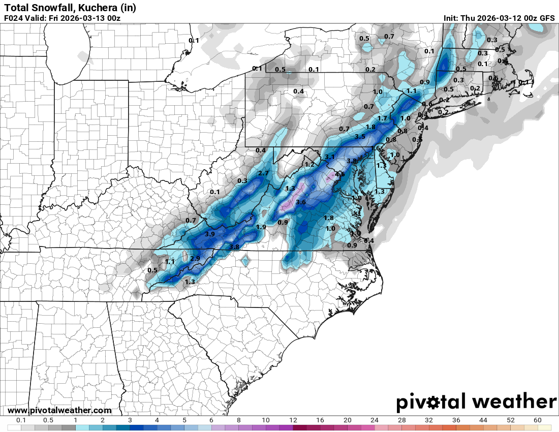
Eyeballing a half inch on the deck in Canton, lightly snowing still but radar suggests end will come in a few minutes -
EPS, EPS-AIFS, GEPS all have the trough beating back the torch somewhat mid month. GEFS is warmest. But on balance, definitely does seem like a mid month chill is on the way. Hopefully enough of one to give us a shot.
-
Outta gas and Outta Time: Early March Winter Storm finale
baltosquid replied to Ji's topic in Mid Atlantic
You are not crazy, pivotal does that for some reason. Maybe because the scale adjusts slightly for each run to better fit all totals but idk edit: actually it is not changing the bar length at all so I guess it’s just something with how pivotal processes the gif -
Outta gas and Outta Time: Early March Winter Storm finale
baltosquid replied to Ji's topic in Mid Atlantic
if you believe the RRFS, that band will be legit lol.
-
Outta gas and Outta Time: Early March Winter Storm finale
baltosquid replied to Ji's topic in Mid Atlantic
Feels like at times it is too dry/weak but it’s generally pretty consistent with that imo so makes it easier to work with than if it was erratic. Definitely worthwhile if not quite as much as its peers. -
Also btw pivotal says it’s snowing but frankly the soundings to me look like rain.
-
Touch less amped. Still snows but it has begun to give up
-
GFS pretty similar early on.
-
RGEM also no. Tick north but still a ways to go for results.
-
ICON looks like a no at 12hrs.
-
I think we’ll see the GFS just flatten a little from where it is now. That would get something like the euro shows now, maybe with a broader area of wet snow tv.
-
Both NAMs still not biting
-
The indomitable SREF is coming to our side
-
Definitely trending more amped across guidance. Need similar adjustments at 18z and 00z to get to something like the GFS though.
-
Yeah snow tv during the day for several hours, maybe with some heavier bands in there, when the hypothetical event was never big is a win in my book
-
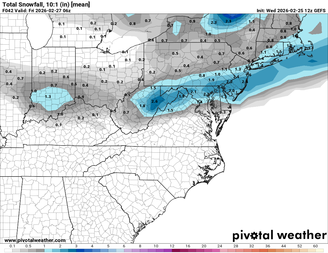
Not high utility so close but the 12z GEFS has no complaints with its operational. edit: I will add that the probability for snowfall greater than 1 inch 10:1 is 50-60%. If there is a red flag, the fact that we’re only at slightly better than a coin flip for that one day out would probably be it. 1 inch 10:1 will certainly not result in anything more than a car topper in reality given the temps, if that, so 40-50% shot to fall below that is essentially saying a 40-50% chance of snow tv or non event.

-
Touch more amped in the end and precip a tick north but still mostly dry for us and no snow.
-
But then it looks about the same two frames later. Don’t think it will come north much
-
UKMET more amped early on
-
Outta gas and Outta Time: Early March Winter Storm finale
baltosquid replied to Ji's topic in Mid Atlantic
Includes Thursday stuff, 24hr still a good warning level event for many though