
.gif.a8150e126cebc480193fad2934fe975c.gif)
Torch Tiger
-
Posts
16,406 -
Joined
-
Last visited
Content Type
Profiles
Blogs
Forums
American Weather
Media Demo
Store
Gallery
Everything posted by Torch Tiger
-
Yeah, sucks. We all wanted heavy rain
-
Hopefully Saturday is a flooder with training storms, especially south of pike!
-
not bad. Grilled some chicken and ripping back a drink
-
pollen-out hitting hard!
-
Nice day, could be better yet could be much worse. Take
-
There is some child-like novelty to the first snow and holiday snows, and occasionally interesting events, otherwise its just a beat down of darkness and nasty
-
Far superior to arguing 38 or 43 nastiness in January.. or better, coating or 1-2" what a waste
-
look
-
83-88 is pretty much spot-on for mid-summer highs, that's what we will be seeing for many many days. Sure the dews will be hit-miss
-
Cold crew is reeling with the shit pattern behind us. Nothing left to troll
-
why are you using 1am besides, trolling obviously
-
Take this
-
No prolonged cool anytime soon
-
Saw a coyote cross 3A in Billerica earlier. They can run all of 30mph
-
-
Yeah that period has been looking good for at least a couple days of low 90's
-
Yeah true...going forward looks great though. No looking back
-
Everything is awesome!
-
no other shots of this happening? that's strange
-
What's your average high up there at 1k? 63-65?
-
Looks dry and mild through Saturday, a few showers Sunday/early Monday then retorch next week. Overall summer vibes
-
It was far better than this last POS. no one should ever consider making a thread for that last one - mods dropped ball badly
-
lol hurricane bob and eventually 1991 halloween forever changed the landscape
-
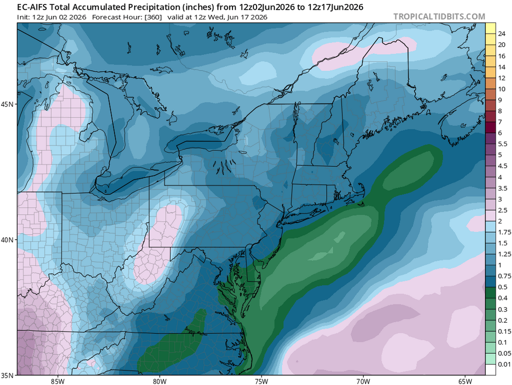
Gorgeous afternoon out there. 12z Euro still heavy with the Stein
-
Plus a side of Oct. 91
.thumb.gif.f92b16c631a1d15d405ed77b33f0710d.gif)


