Cary67
-
Posts
1,567 -
Joined
-
Last visited
Content Type
Profiles
Blogs
Forums
American Weather
Media Demo
Store
Gallery
Everything posted by Cary67
-
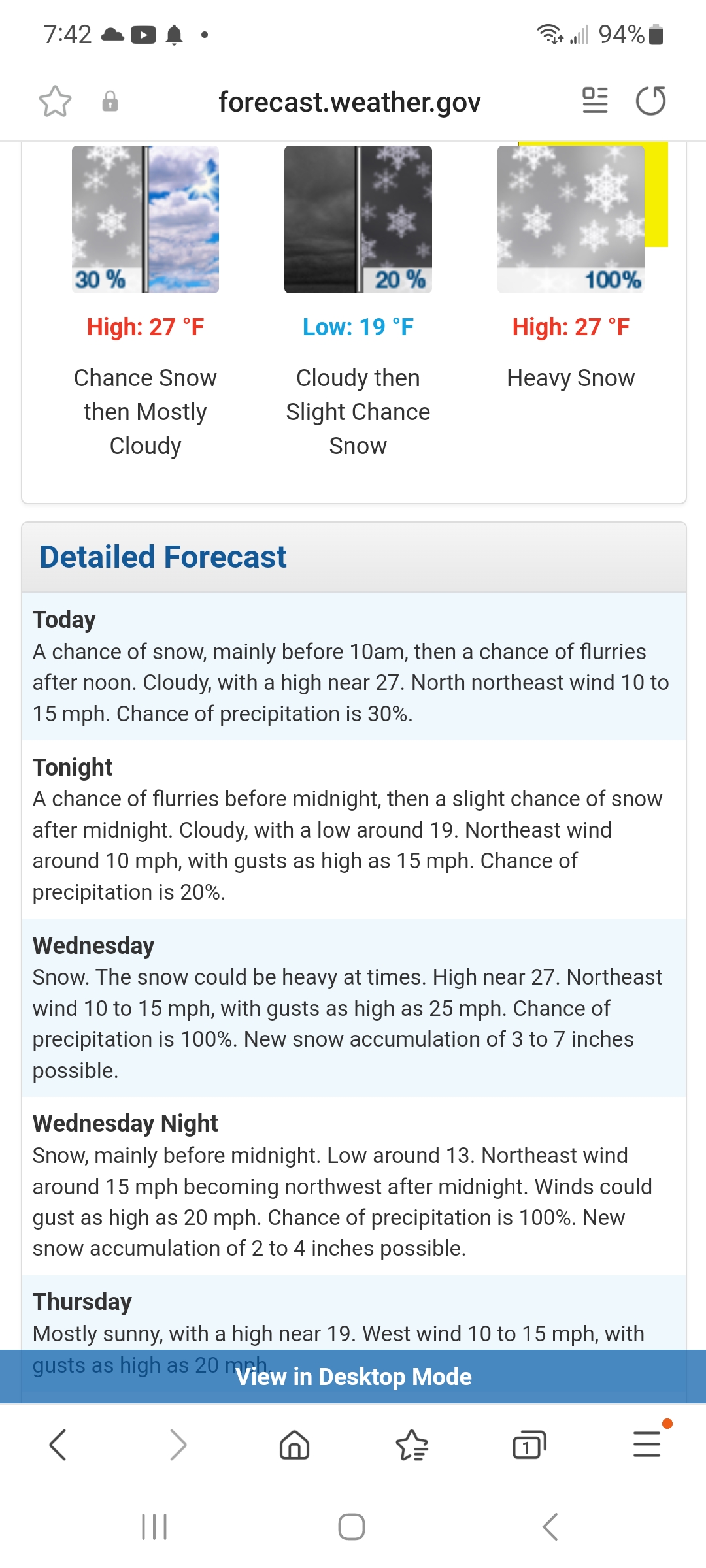
Winter 2024-25 Medium/Long Range Discussion
Cary67 replied to michsnowfreak's topic in Lakes/Ohio Valley
A little SE shift and MLI snow futility could be in jeopardy.lol -
Winter 2024-25 Medium/Long Range Discussion
Cary67 replied to michsnowfreak's topic in Lakes/Ohio Valley
That's referred to as Memorial Day weekend in this area -
-
Close to doubling ORD
-
Winter 2024-25 Medium/Long Range Discussion
Cary67 replied to michsnowfreak's topic in Lakes/Ohio Valley
Should blow that up and frame it. Winter 24-25 -
Winter 2024-25 Medium/Long Range Discussion
Cary67 replied to michsnowfreak's topic in Lakes/Ohio Valley
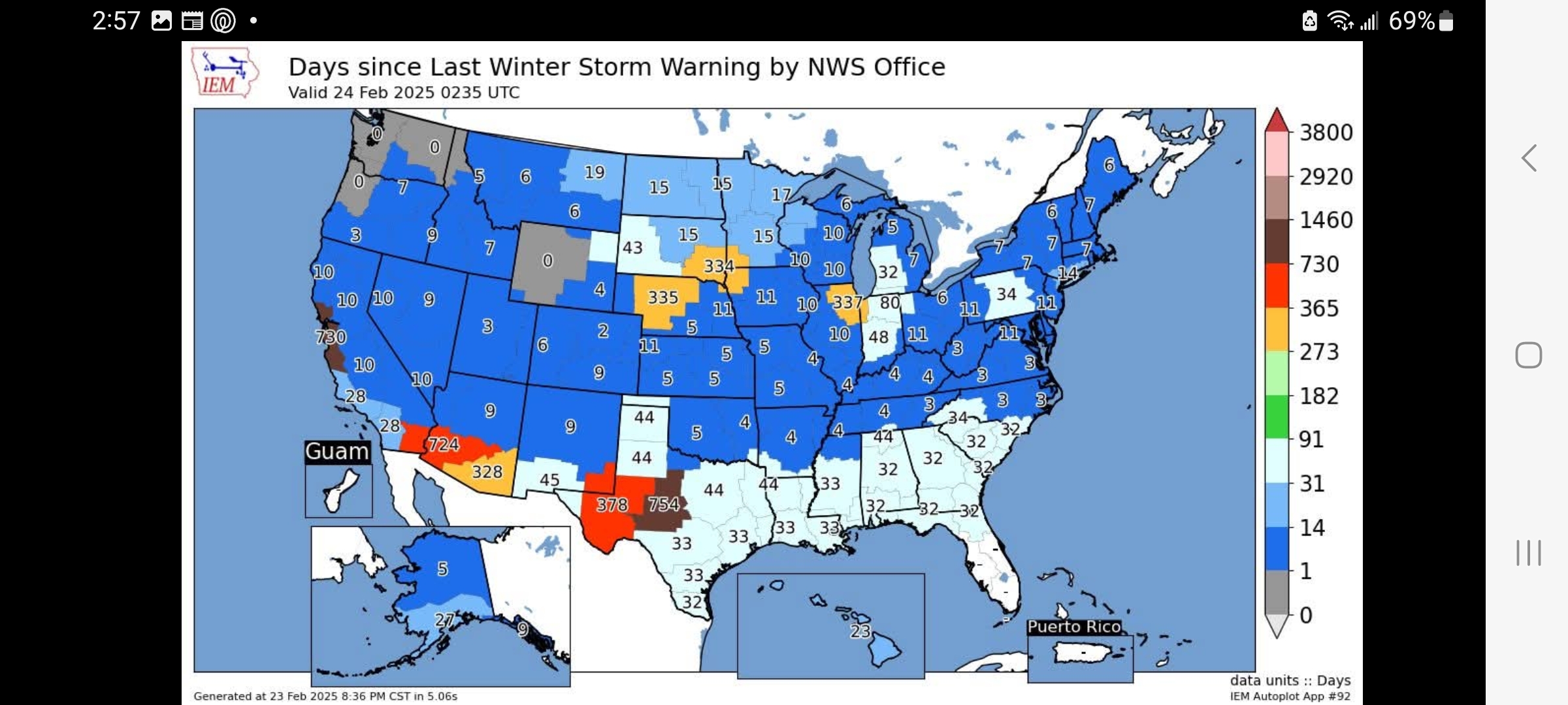
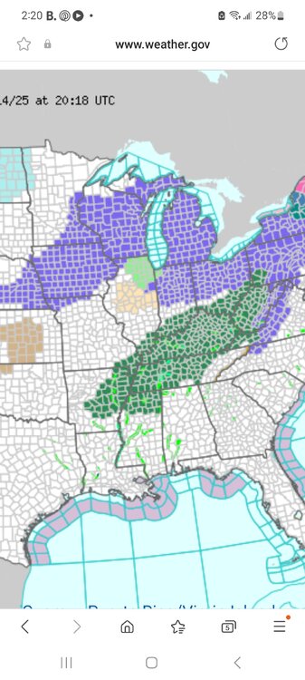
If only we could dodge the cold air following like the snow. The advisory layout somewhat mimics crudely the areas affected the most by these systems. -
2" down here
-
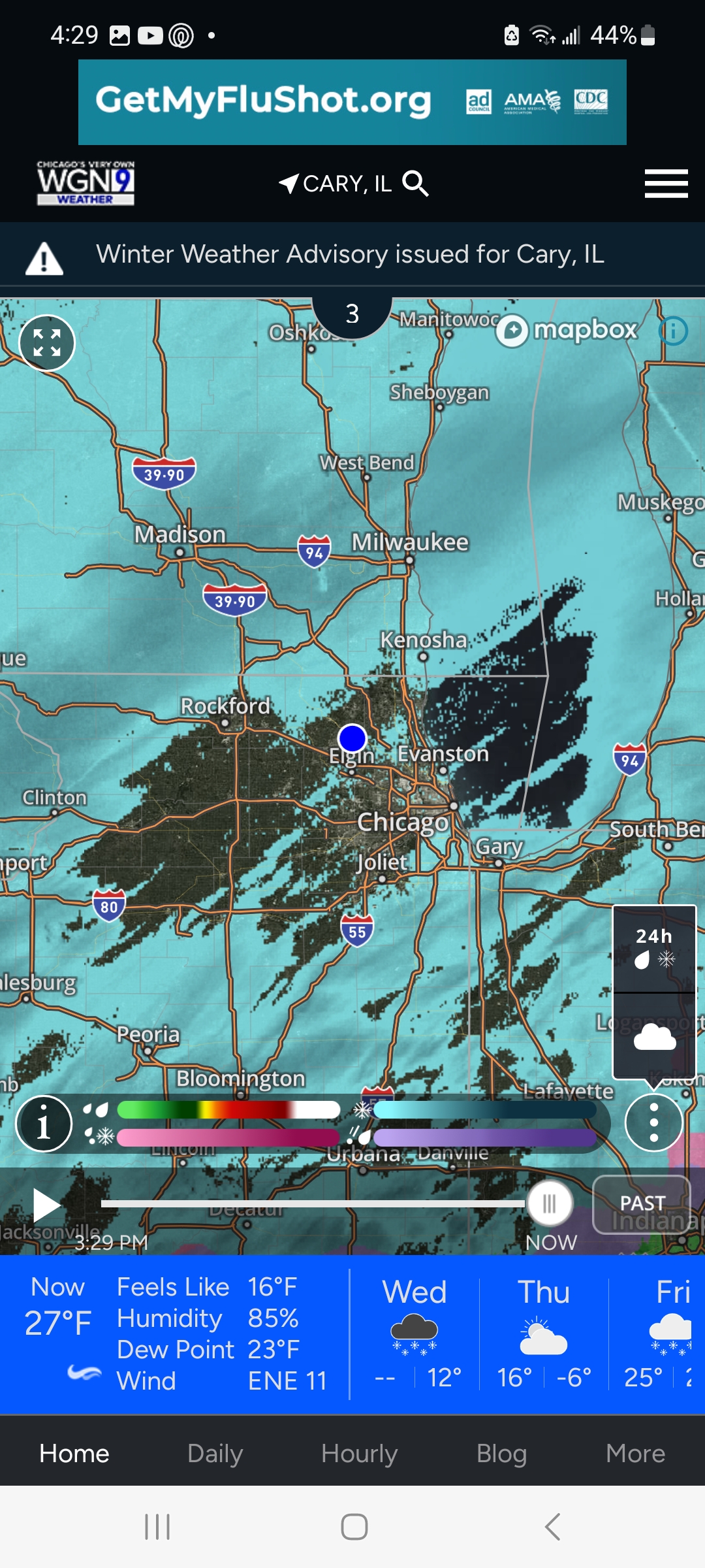
Looks like it should be ripping but isn't. Lightly snowing +SN now
-
Don't do it
-
Not expecting much on the Euro
-
Dream crusher post on time
-
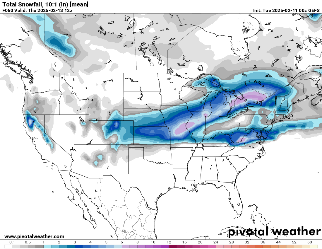
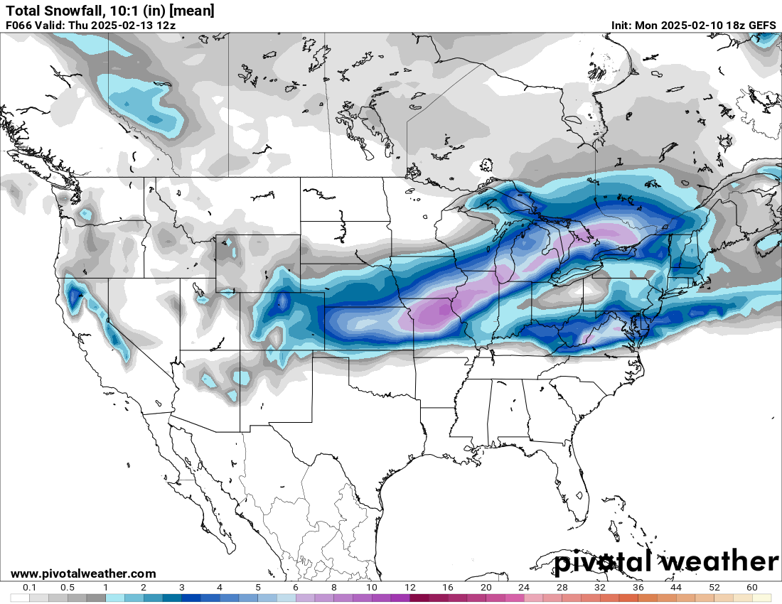
Speculation on how far NW this could step?
-

-

-
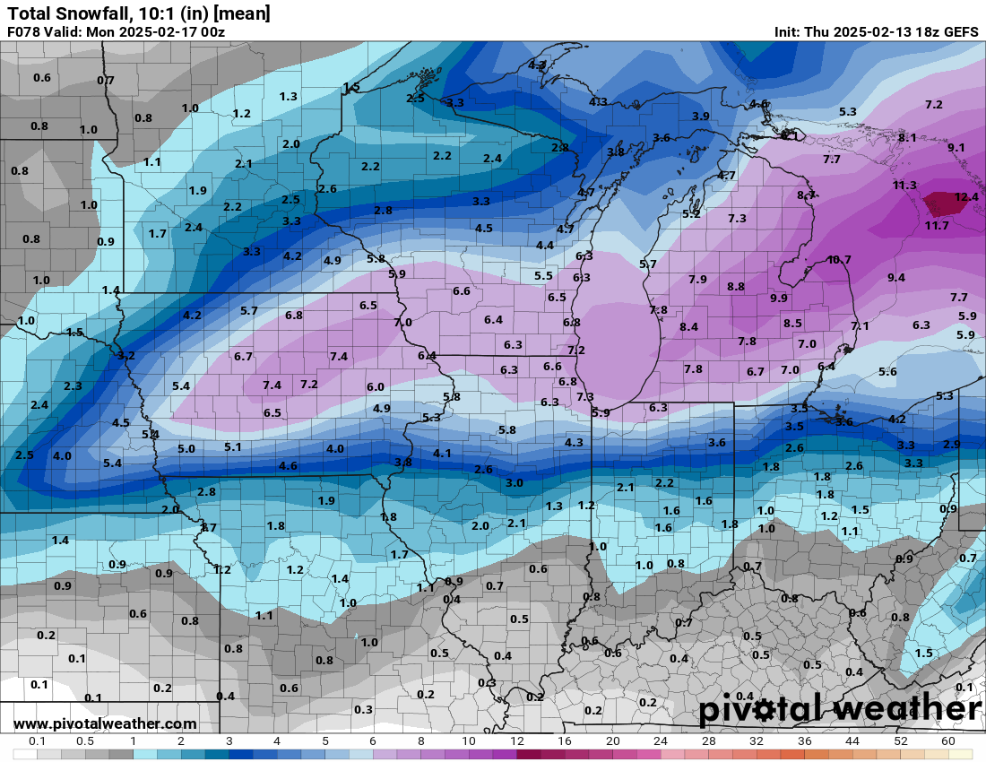
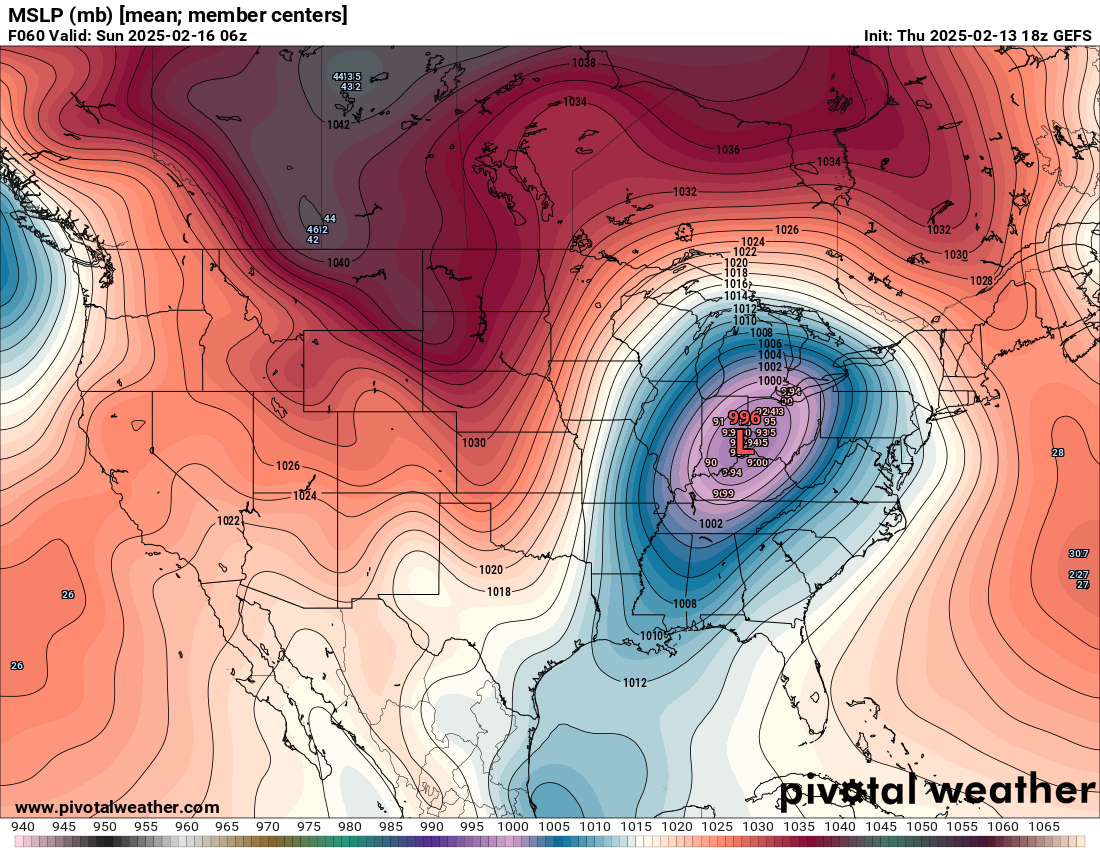
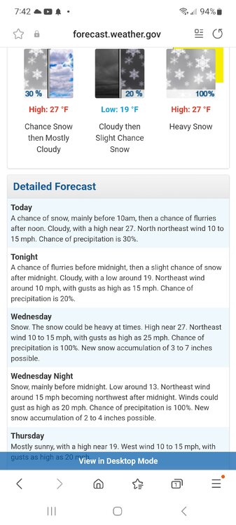
Optimistically will go with another 2-3" to snuff out grass blades for awhile.
-
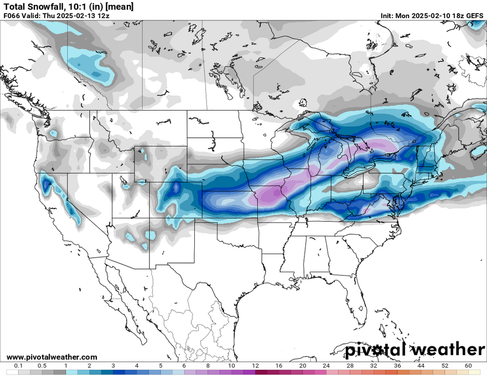
Quite the spread from 10.6" at RFD
-
2.7"
-
Thought posting Kuchera totals was dubious unless specifically warranted
-
Only need to track about 6 more of these systems to reach seasonal snow averages. Or about three seasons worth of favorable pattern windows. NWS forecast still robust on this though
-

-
Winter 2024-25 Medium/Long Range Discussion
Cary67 replied to michsnowfreak's topic in Lakes/Ohio Valley
I think from Kankakee to South Bend to Detroit and points SE into OV upcoming pattern looks promising. Maybe metro Chicago gets some lake enhancement to amp up totals especially for 12th-13th system.Would like to see an amped up system moving from Terre Haute to Indy to DTW but not seeing op models show that so far. Maybe ens have some stronger solutions? -
Hopefully won't fall apart like snowstorm in Minnesota did for today
-
Just when I thought I could put the snowblower back in the shed....
-
Winter 2024-25 Medium/Long Range Discussion
Cary67 replied to michsnowfreak's topic in Lakes/Ohio Valley
BAMwx based out of Indy. From his discussion I would be excited over the next few weeks if I was in the OV from Indy SE right up into New England. Later talks about vortex dump of cold air near the 25th. Madison to Chicago area sounds like CAD watch in effect again.