StantonParkHoya
-
Posts
2,159 -
Joined
-
Last visited
Content Type
Profiles
Blogs
Forums
American Weather
Media Demo
Store
Gallery
Everything posted by StantonParkHoya
-
 widremann was a menace!
 -
Let’s get weird with some long range NAM
-
Hmm… interested to see the mean. Couple big dogs for RDU in there. they may be pulling me back in!
-
Just wish it didn’t look like it was rendered on a Game Boy from 1992
-
Ice ice baby
-
Wake County has more population. Not everyone is in Raleigh proper
-
Thank you. I can step away now. Enjoy mountain folk!
-
It may be time to call time of death for RDU @eyewall
-
I wonder if southern sliders are possible anymore
-
Difficult to make it work when it travels up I-95
-
Snow thump keeps getting better and better for everyone in the South except NC
-
Mid to long range discussion- 2025
StantonParkHoya replied to wncsnow's topic in Southeastern States
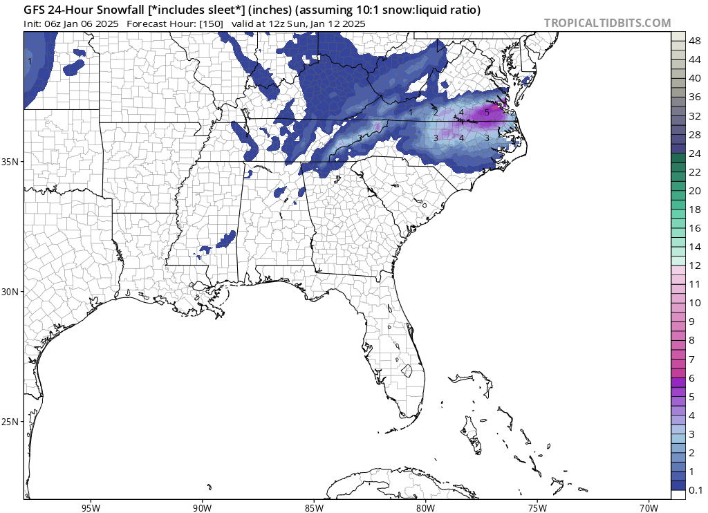
For RDU, if we’re going to deal with mixing, we may as well go all in and burn the boats. Let the big dog eat even if it means less pure snow. -
Mid to long range discussion- 2025
StantonParkHoya replied to wncsnow's topic in Southeastern States
For as much as I love the ocean during summer, I loathe it during winter. No one else at our latitude has to deal with the thermal issues we do. -
Mid to long range discussion- 2025
StantonParkHoya replied to wncsnow's topic in Southeastern States
Blend the UK and Euro and RDU is good for 2-3 inches. I’d cash out. -
Mid to long range discussion- 2025
StantonParkHoya replied to wncsnow's topic in Southeastern States
I don’t even know what this means. No models show an apps runner. -
Mid to long range discussion- 2025
StantonParkHoya replied to wncsnow's topic in Southeastern States
Definitely don’t love that NC has to wait for the UL energy to swing through on the back side to get their snow portion here -
Mid to long range discussion- 2025
StantonParkHoya replied to wncsnow's topic in Southeastern States
-
Mid to long range discussion- 2025
StantonParkHoya replied to wncsnow's topic in Southeastern States
A half+ inch of freezing rain is a disaster. I’d rather we have no storm at all. -
Mid to long range discussion- 2025
StantonParkHoya replied to wncsnow's topic in Southeastern States
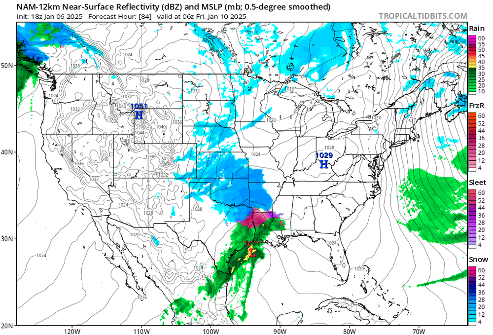
Man, I was sure after 18z that if we could slow down the phase by 6 hours we’d get clobbered. We got that at 0z and still couldn’t make it work. I don’t know -
Mid to long range discussion- 2025
StantonParkHoya replied to wncsnow's topic in Southeastern States
A little tough to tell. Track was RDU special but thermals looked a little warm oddly. -
I’m at 32.7 when I was progged to be at 41 right now… got a feeling tomorrow am is going to be interesting
-
Mid to long range discussion- 2025
StantonParkHoya replied to wncsnow's topic in Southeastern States
-
Mid to long range discussion- 2025
StantonParkHoya replied to wncsnow's topic in Southeastern States
Is 18z Euro stuck? -
Mid to long range discussion- 2025
StantonParkHoya replied to wncsnow's topic in Southeastern States
Yep, if it phased 6 hours later we’d be jumping up and down -
Mid to long range discussion- 2025
StantonParkHoya replied to wncsnow's topic in Southeastern States
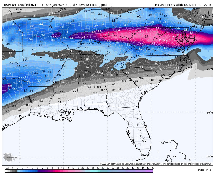
DC-NYC completely obliterated to the point of natural disaster