StantonParkHoya
-
Posts
2,159 -
Joined
-
Last visited
Content Type
Profiles
Blogs
Forums
American Weather
Media Demo
Store
Gallery
Everything posted by StantonParkHoya
-
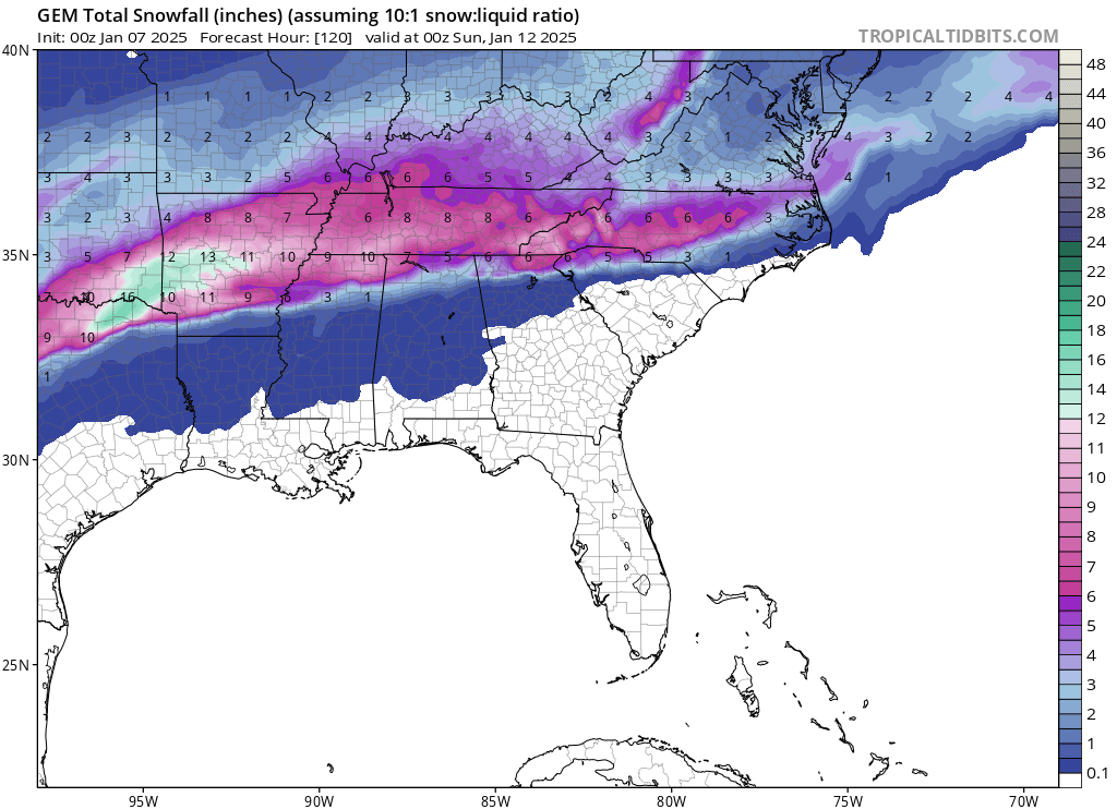
 We’re parsing the hell out of what just looks like a general 1-3 for most
 -
Mike Maze hates us
-
Idk. I love the track.
-
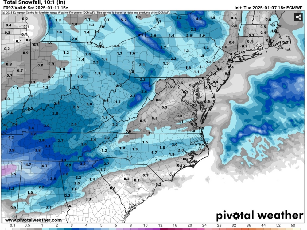
SLP track a good deal further off the coast — about 50-60 miles off Lookout
-
That’s the 12z
-
The high temps on Saturday are a little suspect, particularly if sheets of concrete are on the ground. No way we hit 40.
-
Try driving from like downtown Raleigh to Oxford. It’s like visiting Canada.
-
Well Wake is like 40 miles across so it’s really like two counties
-
GFS has the snow starting at like 3pm Friday afternoon…
-
Raleigh folks need that front end thump to hit hit
-
Don’t have snow maps for Euro Ai but SLP track about 20 miles off Morehead City, 546 line in Johnston Co. Probably a snow to sleet to snow set up for RDU.
-
Still not good for RDU but trending better I suppose
-
In my experience, it usually comes in a few hours before modeled time so thinking 5ish for RDU
-
What was the outcome on the UKie?
-
12z ICON all snow for RDU
-
Does @NCsandhills do anything besides tagging people with weenie and incorrect buttons?
-
Would actually be really good for NC if it kept going. Where’s the DGEX???
-
Isn’t the RDU target zone 40 miles off Lookout?
-
Sure wish the GFS would fold soon
-
GFS is by far the most western track of all the global
-
GFS seems to be the warmest model over Texas. Others have Dallas under deep blues by 72 hrs whereas GFS shows rain
-
Can I just get 15-20 miles SE
-
WRAL just showed RDU with a 62% chance of 1+ inches of snow per Euro
-
The SREFs don’t care about you though. Rule #1. They will kill you and roll you in a ditch. Rip your heart out, then laugh about it.