WSchew
-
Posts
72 -
Joined
-
Last visited
Content Type
Profiles
Blogs
Forums
American Weather
Media Demo
Store
Gallery
Everything posted by WSchew
-
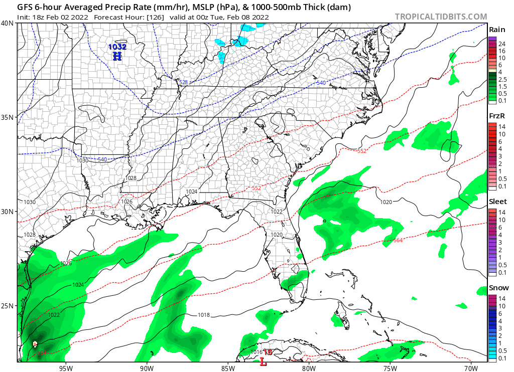
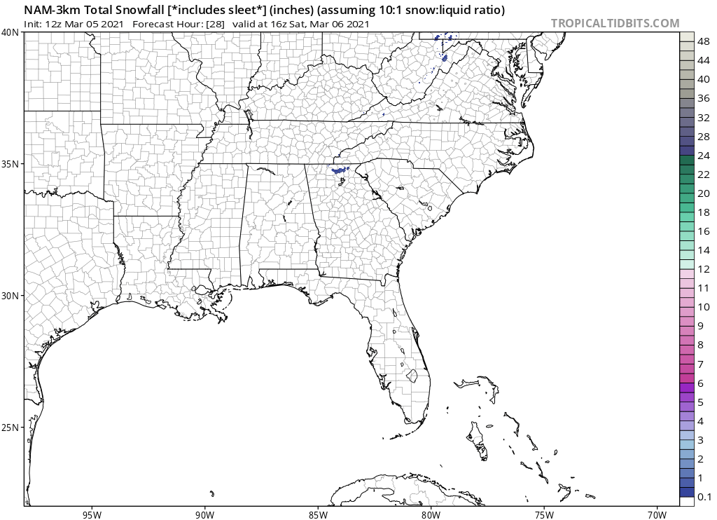
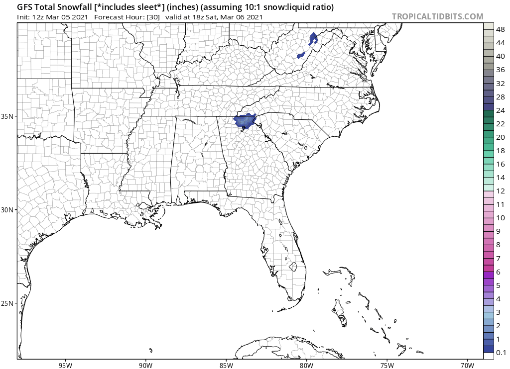
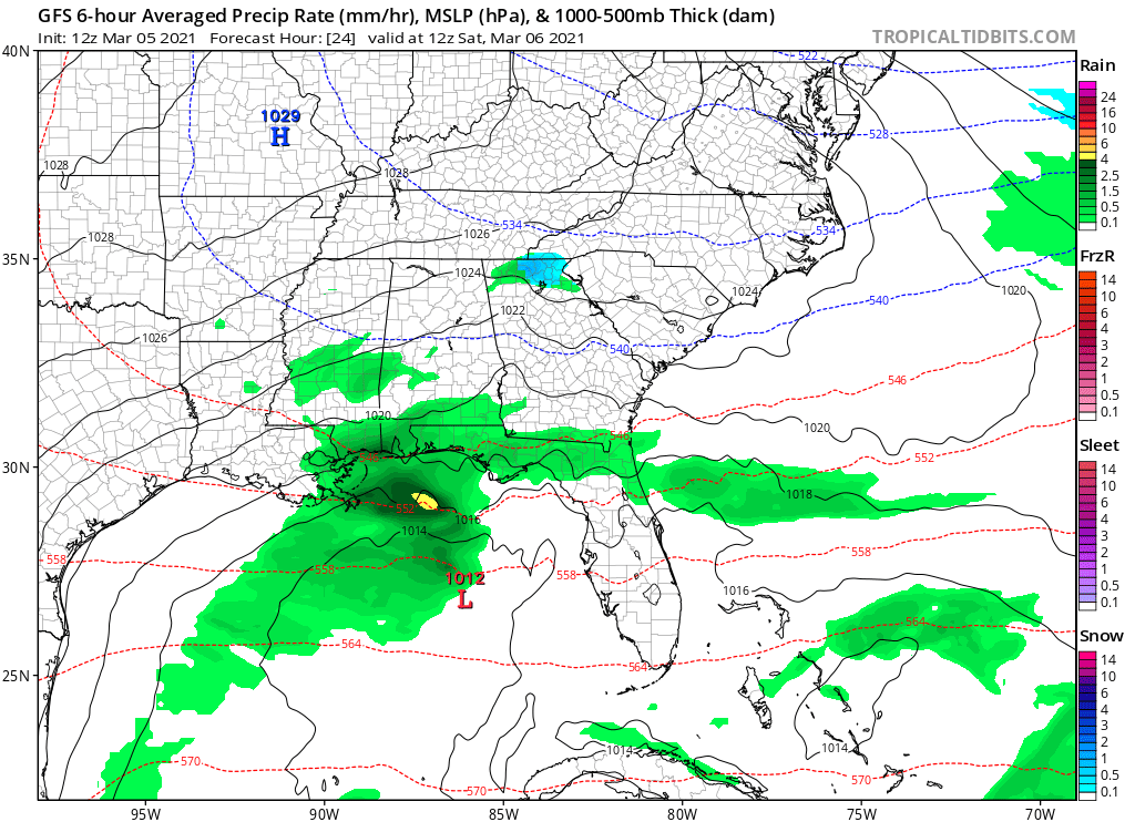
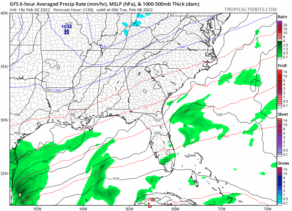
GFS NW trend for the Monday night system: But, as mentioned, the surf temps just aren’t quite there. Nearly iso-thermal up thru about 800mb. With enough dynamics it could pull some flakes to the surface. Worth a keeping an eye on I guess… especially since our weekend system trended in the opposite direction at this lead time.
-
Poof

-

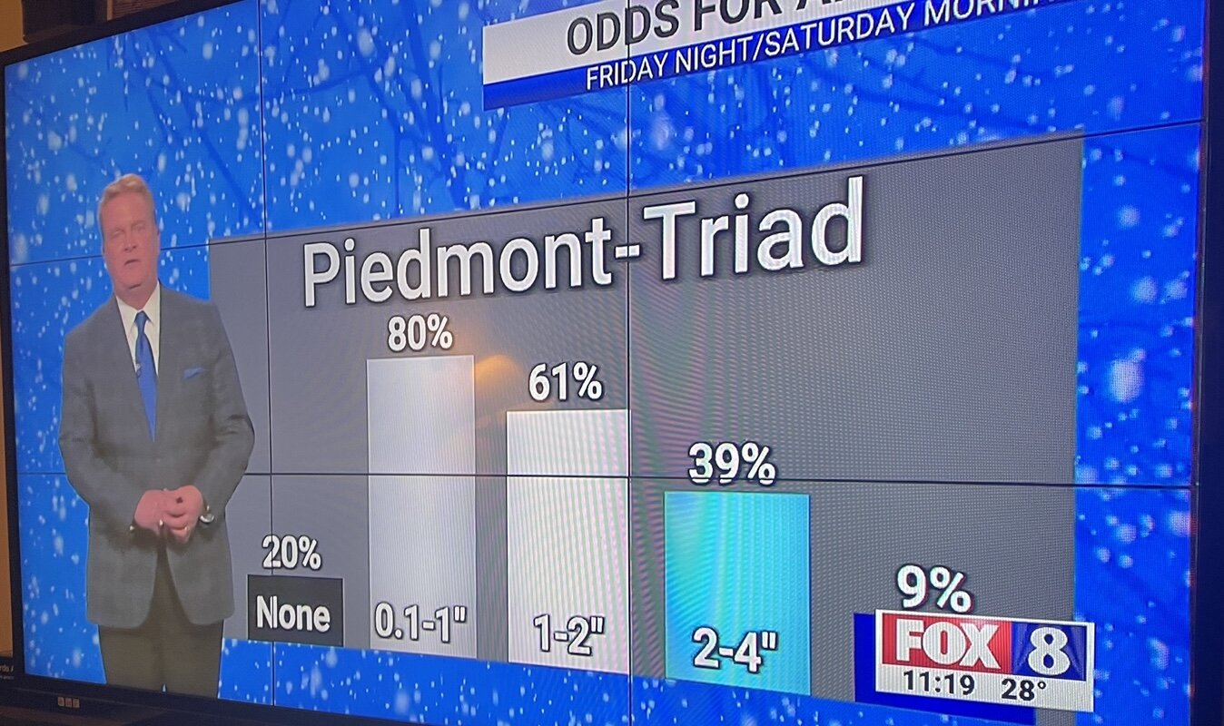
1/28-1/29 Winter Storm Obs Thread
WSchew replied to Prismshine Productions's topic in Southeastern States
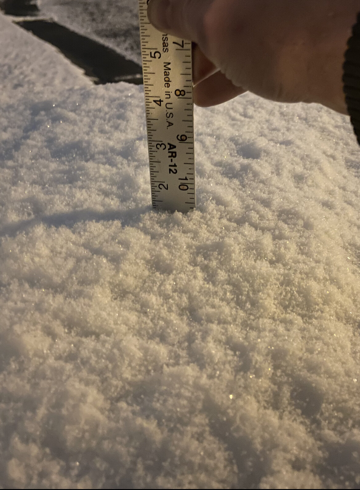
1.2” 3 miles wsw of downtown Winston
-
Potential 1/28-1/30 2022 winter storm
WSchew replied to Prismshine Productions's topic in Southeastern States


-
Potential 1/28-1/30 2022 winter storm
WSchew replied to Prismshine Productions's topic in Southeastern States
The northern stream energy associated with the mid/upper level trough looks to be potent enough to produce a light 1-2” event throughout most of NC Piedmont. -
0.6-0.7” measured with calipers here in Winston. Really stoked for folks east of here. RGEM was rock solid for this one
-
I poked my head out to look up at my best floodlight and can confirm a few tiny flakes here near Hanes mall in Winston. TWC just showed a live shot in the heart of downtown Raleigh. A good light snow was coming down and maybe 1/2 on everything.
-
Widespread virga showing up on radar right now for NW NC. Good opportunity for some fun with trigonometry while we patiently wait for a flurry, right?! Using google maps and FCX radar at 0.5 deg, estimate the distance from the radar site to the nearest radar echo. I got roughy 50 miles from the radar dome to some light echos showing up at VA/NC state line at i77. Multiply the distance by tangent of 0.5 degrees, convert to feet and you get 2300 feet. Adjust for elevation of the FXC dome (2,900 ft) and it’s snowing at 5,200 ft above sea level, or about 4,400 ft above our heads here in the Triad! I can smell my flurry! Of course this assumes moisture/precip is isotropic, so probably a bit on the conservative side since the dome is to the NW… Anyway, glad to see you folks down east in the game tonight! Looking forward to the obs flooding in this evening.
-
GSP radar showing small streak of moisture now in N Rutherford county. Trajectory aimed along the escarpment as depicted by many of the models. This looks to be the front edge of moisture currently causing flurries in SW NC mountain zones. The return is pretty close to the radar site but doubt it’s reaching the ground at that elevation. Any obs out that way?
-
Just started seeing flakes mix in at 35.4 degrees. SW Winston
-
34 and mostly snow here in Winston. Grass is white
-
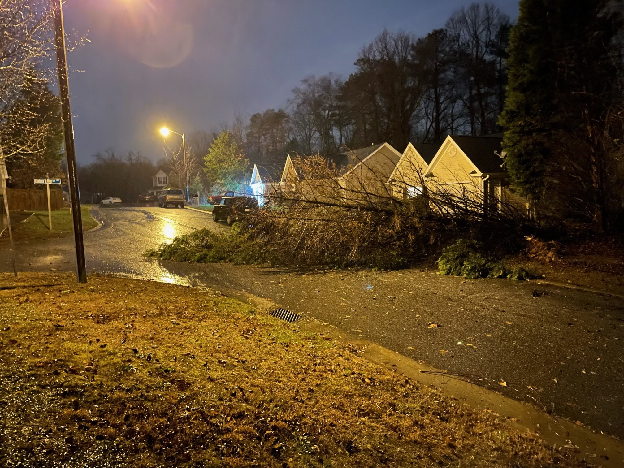
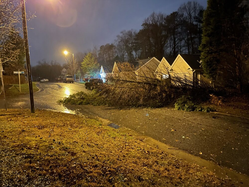
Woke up to a couple Cyprus in the road here in Winston near Stratford. Currently 37.0 with rain and a few sleet pellets
-
(Insert sarcastic comment here):
-
Hold the phone NE GA folks! GFS threw a bone.


-
All we need to do is sit here and wait for that NW trend lol. Otherwise, maybe that northern stream energy has more moisture than advertised... I’ll wait another day or two to book a tee time. “Don’t give up, don’t ever give up.”
-
Considering this is likely our last threat to track, why don’t we try something different? What say we start a thread absurdly early (like today) to circumvent any conspiracies surrounding when it’s created?
-
I’m curious about lapse rates right near the surface... It’s clearly right above freezing at 0-10ft above ground level (33.1), but the tops of the trees don’t seem to be melting off any ice. Is there any ballon data or other obs. available that has enough resolution to accurately depict temp at 50-100 ft off the ground?
-
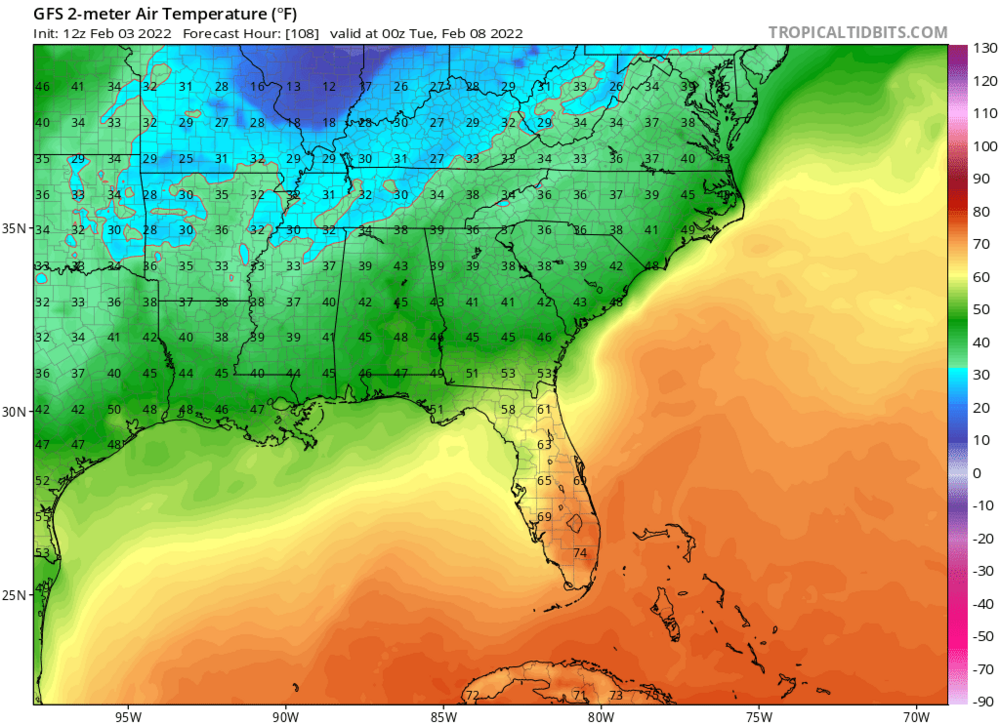
NAM is teasing us with a cold air chasing moisture scenario on Friday morning... Temps in the low-mid 30s in the blue

-
Just over a glaze so far here on the west side of Winston, measured 0.06”. The grass even has some accural. Temp 31.3/30.4 and slowly rising from a low of 30.4 at 5am this morning. Light frz rain/mist at the moment with moderate returns filling in from the west.
-
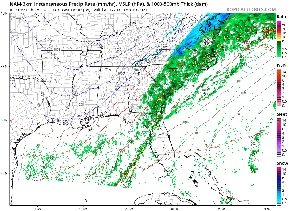
3K NAM 2m temp trend loop at 10am Thursday. Hoping that last frame is the start of a new trend

-
Yup. 3k NAM definitely looks a touch warmer at 06z compared to 00z. Retreats the 32 deg line up to NC/VA line during the day Thursday and keeps it there thru Friday... Initialized cold and dry air pretty well here in the Triad depicting about 27/19, I’m sitting at 26.4/18.5 currently.
-
Temp was 33.2 at 11am but has dropped back down to 32.0 at noon.
-
Bottomed out at 32.0, up to 32.7 now on west side of Winston. We had a dusting of sleet last night and there’s a light glaze in the tree tops.
-
I appreciate the specifics of dissecting each and every model run, but my main takeaway at this juncture is this: All the major ingredients are in place for an ice storm in CAD areas... We won’t know details for at least another 4 days Yes that’s cliché, but it can’t be said enough.
-
Can’t wait to see a region wide expected snowfall map. Surely the CWFA borders won’t be obvious