OrdIowPitMsp
-
Posts
2,815 -
Joined
-
Last visited
Content Type
Profiles
Blogs
Forums
American Weather
Media Demo
Store
Gallery
Everything posted by OrdIowPitMsp
-
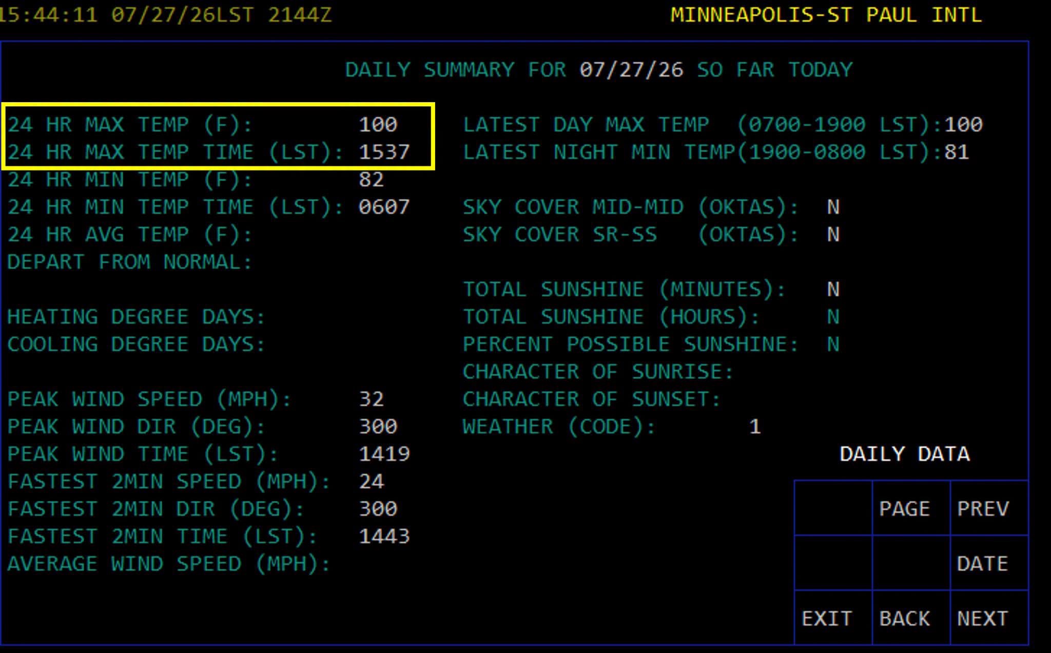
Triple digits in the Twin Cities! First 100 temp since 2022, every 4 years right on the climo norm

-
Can’t say I’m jealous of the destructive storms, but definitely jealous of the precipitation. My yard is crispy. Stay safe out there
-
Already 94 at MSP. Maybe today is the day we break 100
-
82/81 at MSP this morning. Here’s a tidbit from KMPX At 2 AM, the dew point at MSP climbed to 81. This has only happened on a few days in recorded history. Per the Minnesota State Climatology Office, an 81 degree dew point was measured on July 17, 2011; July 18, 2011; July 19, 2011; and July 30, 1999. The all-time record is 82 set back on July 19, 2011.
-
Dewpoint mixed out into the mid 60s so we had easy today even with a high of 98.
-
Should I post the weather observations from KSUX instead?
-
Rapid City, SD set their all time record high temperature at both its recording stations today with records going back to 1888. 112 at KRAP, 110 downtown.
-
Point had us up to 94 today, low stratus hung around a lot longer than expected and we briefly topped out at 86.
-
Yeah it’s snowpack or nothing for them as my understanding goes too. I was strictly referring to the fire situation.
-
73 yesterday. Mid 50s this morning. Excellent break from the heat. Can’t beat sleeping with the windows open.
-
At least the monsoon is showing up in Colorado, Arizona, New Mexico
-
WRONG! I guess my information was bad, this puts us in 3rd place. The record is 14 days in 1936, followed by 11 days in 1948. There was a logjam at 3rd place but 2026 will now hold the spot.
-
0.17” of precipitation from the dying line of convection this morning
-
Today is the 10th consecutive 90 at MSP, setting a new record. (False) While the daily high temperatures weren’t noteworthy, the duration certainly was. I’d classify this as a historic heatwave around Minnesota.
-
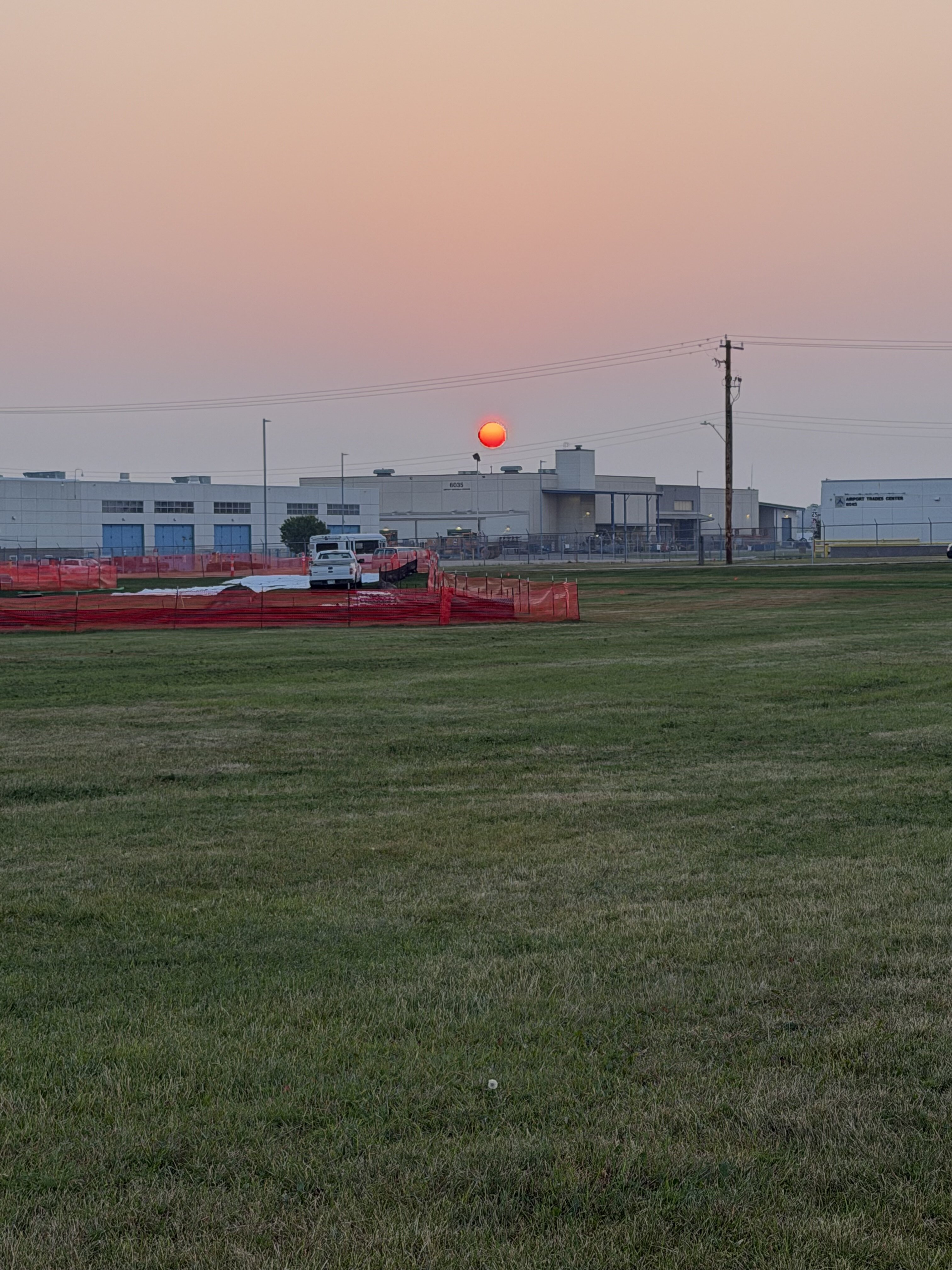
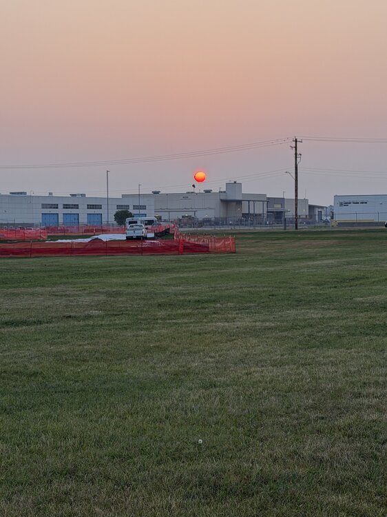
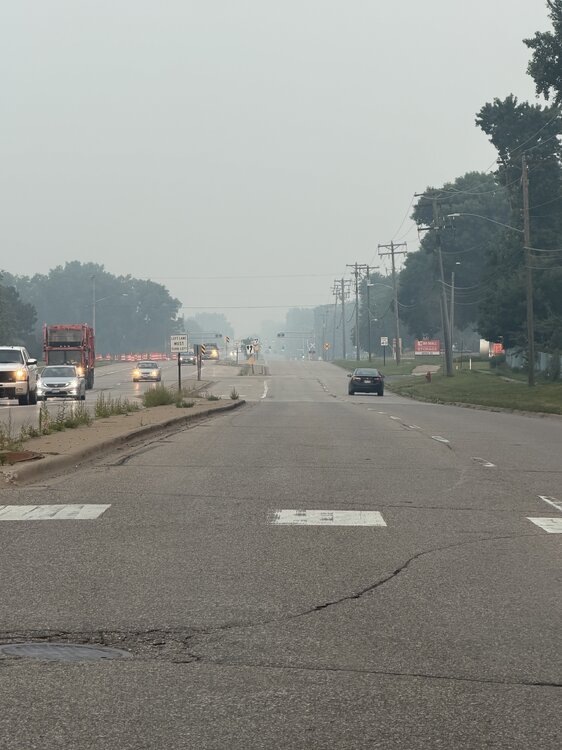
Smoke is back. Sunrise at the airport dog park this morning.
-
Blessed to have traded AQI for Dews. I’ll take an AQI of 56 with a 70 DP over what we endured yesterday.
-
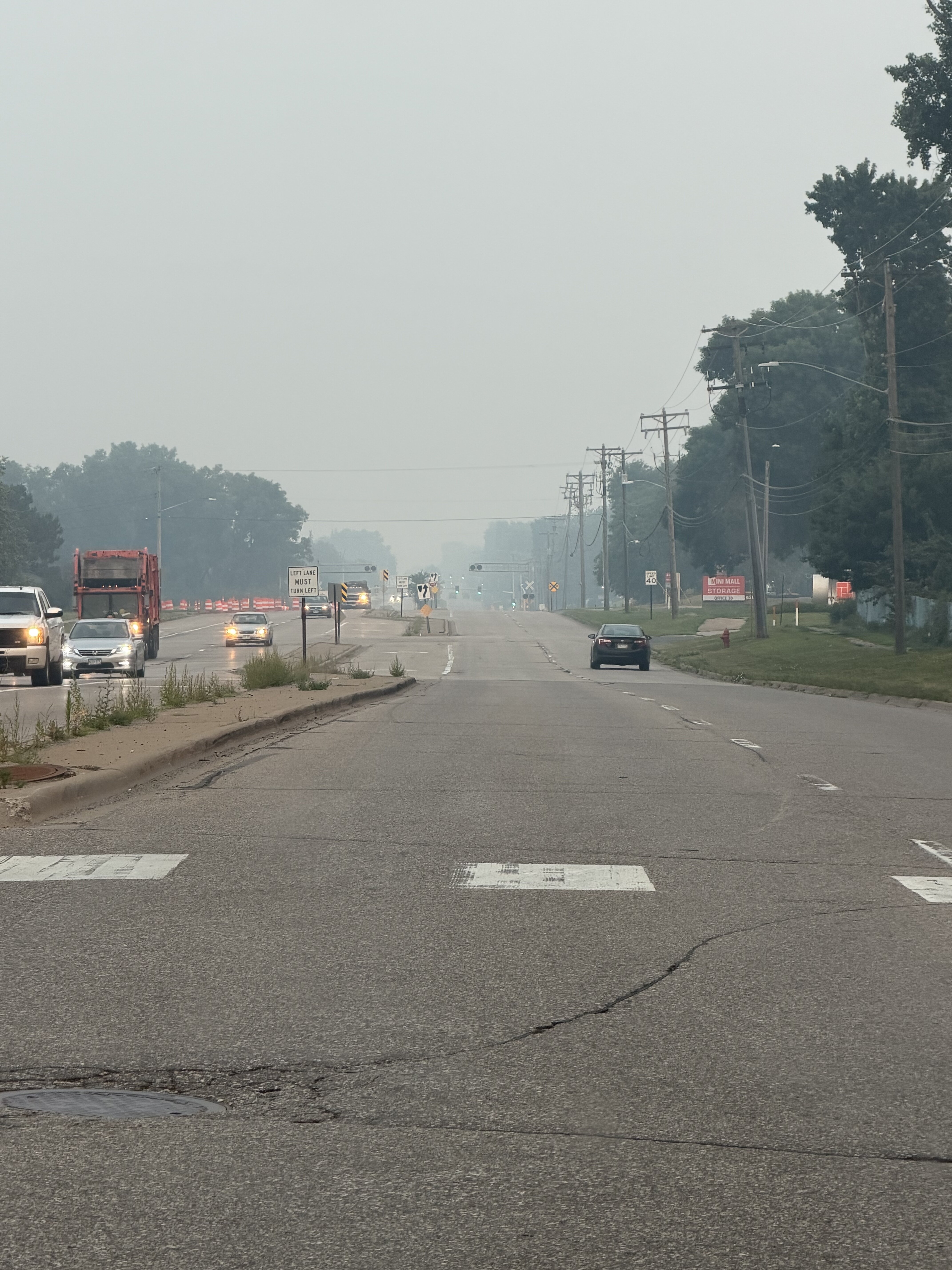
Smoke has on a relative sense moved out of my area. AQI below 200 and visibly has improved to 8-9mi after being 1-3mi most of the day. Historic smoke event without a doubt.
-
Not being forced. I have stop work authority and plan on exercising it today.
-
530 was the peak AQI in Minneapolis overnight. Eyes and throat burn working outside in this crap. Good times
-
AQI is 483 right now in Minneapolis.
-
Smoke hit like a freight train a few minutes ago. I don’t miss that pungent odor one bit
-
Multiple monitors from Duluth to Marquette in the 600-800+ range. Can’t remember ever seeing anything above 600. So far no smoke here, but the highest dewpoints of this heatwave so far.
-
94 today. Surprised how acclimated I’ve become, but I guess the same thing happens in winter.
-
They are adding smoke to the forecast here as well. Said it might impact highs. We’ve had 4 consecutive 90+ highs and the record is 9.
-
93 for the afternoon high. Crazy having warmer temps to my north. International Falls got to 97.