

kvegas-wx
-
Posts
2,073 -
Joined
-
Last visited
Content Type
Profiles
Blogs
Forums
American Weather
Media Demo
Store
Gallery
Posts posted by kvegas-wx
-
-
37 minutes ago, CentralNC said:
Maybe your farm won't...
Yeah, I'm headed up tomorrow to check the gennie. Stuart could be on the southern end of the snow, or pinkies deep in ice/sleet. Kind of have to prepare for all of it.
Not expecting much here in the Triad outside of some glazing. Certainly looks cold enough at the onset for some accretions.
-
 1
1
-
-
11 minutes ago, Ghicks said:
so who is gonna start making accumulation of snow ice maps
Posters in the mid-atlantic forum. We wont have any electricity to post about it anyway.
-
2
-
 3
3
-
-
We had some first calls out at this range for the Thursday event. Anybody ready to take a stab at Saturday night?
-
1
-
-
11 minutes ago, griteater said:
That's an amazing looking pattern on the GFS days 10-15. Cold shot, then everything starts moving west from Greenland thru N Canada, then cold air heads south. Make it happen


That looks delicious! Valentine's Day bombogenesis....make it happen! We seriously need a better February for this subforum or psychiatric help will be required.
-
5
-
-
25 minutes ago, tarheelwx said:
Love a good ice storm. Been a long time.
TW
Well there goes a perfectly good weekend in the Triad......(installs new chainsaw blade)
-
2
-
-
1 hour ago, Grayman said:
Congrats. I rode round 15 miles of my area never saw a flake. I’m out
Dude, you're in ROCKINGHAM. Did you ever expect to see a flake yesterday? You're just burning gas at midnight.
-
 1
1
-
-
1 minute ago, Ghicks said:
mount airy nc was shut out last night.. nothing except rain.. oh well.. im sure we will have more of the same sunday. lol
That was very weird to watch. Same in Stuart. We got the flip and then poof! Nothing.
-
Peace out. Gotta sleep. Hope everyone nets at least a quick ground cover!
-
Finally cracking 40° at the farm in Stuart. Steady rain for about an hour now.
-
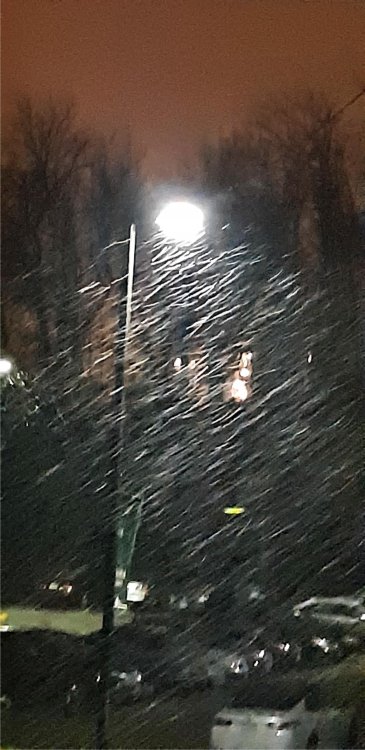
Just now, Tealsnowball said:
Full-on snow now. It didn't take long to change over completely. Picture provided (the quality is a bit poor at night).
Well, you win first report I suppose. Congrats and enjoy it!!
-
1
-
1
-
-
42 and a very cold breeze at the farm in Stuart VA. Real feel down in the mid 30's. Rain is coming down solid now.
-
One thing very noticeable is the wind picking up. Enough to ring my storm bell! Started blowing right when the rain arrived. Flag is whipping!
-
Rain inbound to the Triad. It's nowcasting time. Good Luck everyone. I think our theme song for the evening will be in tribute to late and great Kenny Rogers. Cue up The Gambler please.........you got to know when to hold 'em, know when to fold 'em, know when to walk away and know when to run, you never count your snow totals, when your sittin' in the 40's, cuz we're all gonna wash away, when the rain is done.

-
53 blistering degrees in the heart of the Triad and the cloud deck is visible to the west over INT. I'll be drinking Pina Coladas and getting caught in the rain tonight.

-
46 minutes ago, PantherJustin said:
This is going to be very active in about 8hrs lol
For reals!
(Strolls in with a slight grin and some swagger in his step. Scans the room to see who is here early, looking to see where the action might be late this evening as the room fills up. Finds the punch bowl and empties 3 airplane bottles under his sleeve. Winks at the cocktail waitress serving the meat tray. He knows this is gonna be one hell of a night)

-
1
-
3
-
-
4 minutes ago, calculus1 said:
You're probably looking at the more likely (though still debatable) Kuchera output rather than the 10:1 output that was posted above.
I'm filtered for 10:1 output. I'm sure I'm screwing something up but after looking at models until midnight last night, I have model fatigue.
-
7 minutes ago, magpiemaniac said:
The HRRR is the Oprah of models. You get snow and you get snow and you get snow and you get snow...

I swear I'm looking at the same 18z on TT and only seeing 3 inches across most of the state. It's almost like I'm missing the last frame or something. Either way, impressive!
-
HRRR with a nice 2-3 inches for a good chunk of central NC. When was the last time we saw nearly every model evolve "into" a storm within 60 hours?
-
1
-
-
1 minute ago, frazdaddy said:
We can do an obs thread if need be.
But only after the entire I85 corridor has at least 2" on the ground. We'll need a running start to truly overcome the jinx.

Edit - how cool would it be to end up with back to back surprise events only 3 days apart! I love model suspense.
-
1
-
 1
1
-
-
Step away from the keyboard now if you are even thinking about starting a thread for this one. Just leave it here, just this once, and see what happens. Then we'll have conclusive proof of our jinx.
-
3
-
8
-
-
Just now, magpiemaniac said:
Yeah. Someone explain this without the customary, “Ah, it’s just the GFS.”


What in the Joe Bastardi is going on here?? Somebody please offer a red tag quality explanation cuz I'm lost among these bi-polar models today.
-
3
-
-
9 minutes ago, WinstonSalemArlington said:
Are you a brotha by chance?
Just dealing with my inner Chad Ocho-Cinco. Seems to come out more every year during the playoffs when my Bengals are sitting at home. I think Chad would have been an excellent weather personality.
-
1
-
-
20 minutes ago, BullCityWx said:
Looks like the 3k has up to 2” for a significant chunk of Orange and Durham.
Child please......
-
2
-
-
Just now, PackGrad05 said:
If the NAM verifies with the wedge tomorrow and temperatures in northern/central NC don't get quite as high as originally predicted, that would bode better for temperatures cooling off quicker wednesday night
Yeah, I just saw what @Grayman posted regarding the NAM temp forecast. I agree this is a plausible scenario. I'm just not buying it this go round. This has 35 and rain written all over it. Even during the Jan 8th event we ended up 2-3 degrees above forecast here in the triad and only for a brief moment did rates overcome temps. And I think the NAM was off on that one within 24 hours as well, assuming my memory serves me correctly.


Mid to Long Term Discussion 2021
in Southeastern States
Posted
Wow, they went all in too. 6" plus some ice! Dont think that will resonate across the foothills. For example, my farm is at 1,400' elevation in Patrick County but Meadows of Dan on the opposite side of the county is over 3,000'. Literally 15 miles difference. Tough to forecast this area with "catch-all" language.