kvegas-wx
-
Posts
2,388 -
Joined
-
Last visited
Content Type
Profiles
Blogs
Forums
American Weather
Media Demo
Store
Gallery
Everything posted by kvegas-wx
-
9 hour race incoming. Finish at 2am again. But damn we need the rain.
-
Tornado warning issued for the triad. I understand issuing a large scale warning to get everyone's attention, but this just feels so messy, scattered and wrong. Not sure the word I want to use. Overly broad maybe? Sun is out literally 5 minutes before this line hits Walkertown and Kernersville. Crazy!! I can see it coming. Edit - done. 10 minutes of rain. Absolute nothingburger for the triad.
-
First lightning here in the triad as this first line passes thru. Very heavy rain in bursts, gusty winds but nothing serious at all. So far a nothingburger. Hope it stays that way. Edit - within 10 minutes the sun is back and some blue skies are out. Going to get some mid day heating in advance of the main line for sure.
-
The February 22-23 Late Season Miracle: JV Disco/Banter Thread
kvegas-wx replied to bncho's topic in Mid Atlantic
This forum is gonna need a cliff diving thread. Signed, Your friends in the SE Forum. -
Let me get down to Daytona on friday guys and you can have the blizzard of your dreams while I am gone. I've got big plans at Buc'cees, the beach resort and race weekend. I'm not repeating the Clash this past weekend.
-
Snowing, but lightly on the farm cams in Stuart. Nothing in Kernersville.
-
Sleet-o-rama in Kernersville! Edit - and seemingly right over to rain.
-
Its Fab Feb and our sun angle is back!! Time to hook up the ag plow instead of the snow plow and get ready for growing season! Man the fireball felt warm today. Good to see ya boy!
-
That was a complete sarcasm post...just in case it was somehow lost in translation.
-
Getting my foot of snow was fun and all, but here it is 12 hours later and my roads aren't plowed and I can't get to Bojangles to get my chicken filet biscuit combo. I'm gonna head on over to Facebook and the Neighborhood App to raise hell about my tax dollars not being utilized to plow my driveway.
-
The “I bring the mojo” Jan 30-Feb 1 potential winter storm
kvegas-wx replied to lilj4425's topic in Southeastern States
M-in-law lives in Little Washington. Blizzard all night. Last report was 12-13" but hard to measure from blowing snow. She said it was still snowing about an hour ago and the weatherman said something about 21". She's not going out to measure. We will indeed see some 2'+ totals across the coastal counties. Unreal!!! Edit - just talked to her and they ended right at 12". She said the weatherman was talking about 21" totals elsewhere on the OBX counties. Any idea where someone got almost 2'?? -
January 30th- Feb 1st ULL and coastal storm obs
kvegas-wx replied to JoshM's topic in Southeastern States
https://www.facebook.com/share/r/1MwsJzSdee/ Banks Blizzard 2026 Good Lord!!! -
January 30th- Feb 1st ULL and coastal storm obs
kvegas-wx replied to JoshM's topic in Southeastern States
Looks plowable. Sit tight, you may still squeak out 3-4" by the time you wake up. -
The “I bring the mojo” Jan 30-Feb 1 potential winter storm
kvegas-wx replied to lilj4425's topic in Southeastern States
@lilj4425 You Rock Blue Turd!!! -
January 30th- Feb 1st ULL and coastal storm obs
kvegas-wx replied to JoshM's topic in Southeastern States
My farm cams confirm! And still snowing!
-
January 30th- Feb 1st ULL and coastal storm obs
kvegas-wx replied to JoshM's topic in Southeastern States
It must be 75 and sunny in Elizabethtown and Smithfield in that dry slot. That has to be one of the crazier weather phenomina I've seen. -
January 30th- Feb 1st ULL and coastal storm obs
kvegas-wx replied to JoshM's topic in Southeastern States
Dog days of winter??
- 937 replies
-
- 16
-

-
January 30th- Feb 1st ULL and coastal storm obs
kvegas-wx replied to JoshM's topic in Southeastern States
Coming down sideways
-
January 30th- Feb 1st ULL and coastal storm obs
kvegas-wx replied to JoshM's topic in Southeastern States
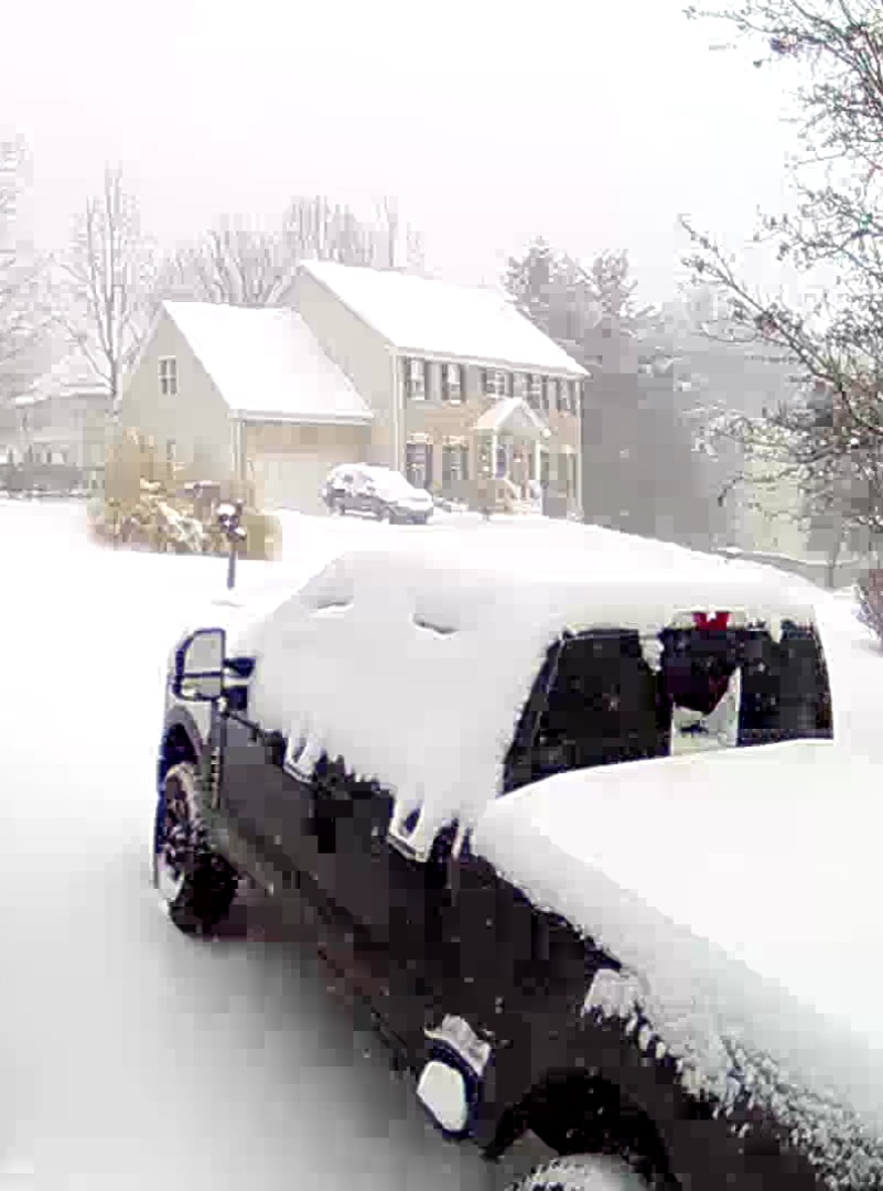
Absolutely getting smoked in Kernersville again. Puking snow and the wind gusts are legit. -
The “I bring the mojo” Jan 30-Feb 1 potential winter storm
kvegas-wx replied to lilj4425's topic in Southeastern States
Thats nuts. I'm not trying be mean here, just observing. But it is insane that over 50 miles we can observe sun and no accums at your location and near white conditions and 7" of snow in Winston. Eyewall's drive back from GSO earlier must have been unbelievable. -
The “I bring the mojo” Jan 30-Feb 1 potential winter storm
kvegas-wx replied to lilj4425's topic in Southeastern States
I was looking more towards CLT to Statesville where many sites are already reporting 4-8". Wonder if RAH is going to update soon with their own additional snow forecast? -
The “I bring the mojo” Jan 30-Feb 1 potential winter storm
kvegas-wx replied to lilj4425's topic in Southeastern States
Wait, wait, wait.......ADDITIONAL snowfall thru this evening?!?!? We will clip 10-16" in many locations if that is accurate. -
January 30th- Feb 1st ULL and coastal storm obs
kvegas-wx replied to JoshM's topic in Southeastern States
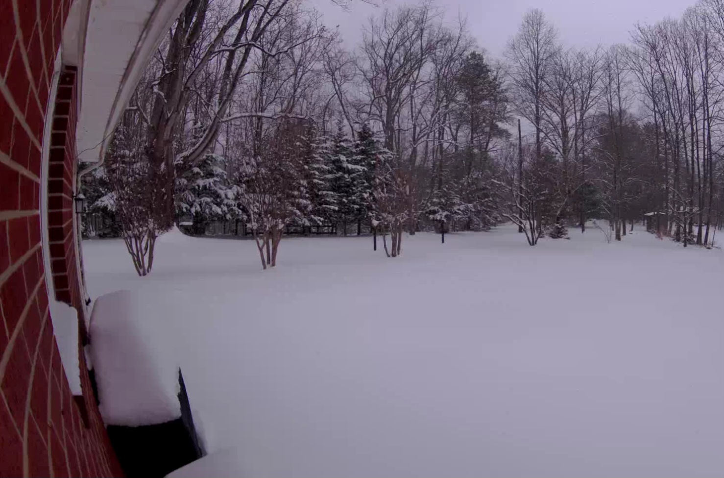
97.5% blizzard outside in Kernersville. My snowboard got cleared by wind at roughly 4 inches. There are right at 2" now on the board. So we are approaching the high water mark of our forecast with no end in sight. Absolute gem of a storm. 9" on the snow pole at the farm in Stuart VA. -
If you live in Durham, your number has been called. Please exit to the obs forum and begin posting. You're about to join the fun!
-
January 30th- Feb 1st ULL and coastal storm obs
kvegas-wx replied to JoshM's topic in Southeastern States
I can certainly see a path to 9-10" here in the triad given whats on the ground and the upstream returns. We have HOURS of this left.