Silver Meteor
-
Posts
238 -
Joined
-
Last visited
Content Type
Profiles
Blogs
Forums
American Weather
Media Demo
Store
Gallery
Everything posted by Silver Meteor
-
Big Heat (and storms?) Week into July 4th Weekend
Silver Meteor replied to yoda's topic in Mid Atlantic
Thought you were joking until I looked it up ...
-
Big Heat (and storms?) Week into July 4th Weekend
Silver Meteor replied to yoda's topic in Mid Atlantic
Anyone else watching the July 5th fireworks in DC? Going to be a lot of exhausted people tonight. -
Occasional Thoughts on Climate Change
Silver Meteor replied to donsutherland1's topic in Climate Change
Ten Hottest Days in Washington, D.C. History https://knoji.com/article/10-hottest-days-in-washington-dc-history/ -
Occasional Thoughts on Climate Change
Silver Meteor replied to donsutherland1's topic in Climate Change
The deeper you look the more you find narrative-driven quackery. https://grokipedia.com/page/World_Weather_Attribution -
2026 Atlantic Hurricane Season
Silver Meteor replied to Stormchaserchuck1's topic in Tropical Headquarters
Atlantic: 10/5/2 ACE 82 -
Occasional Thoughts on Climate Change
Silver Meteor replied to donsutherland1's topic in Climate Change
And an Azores Low?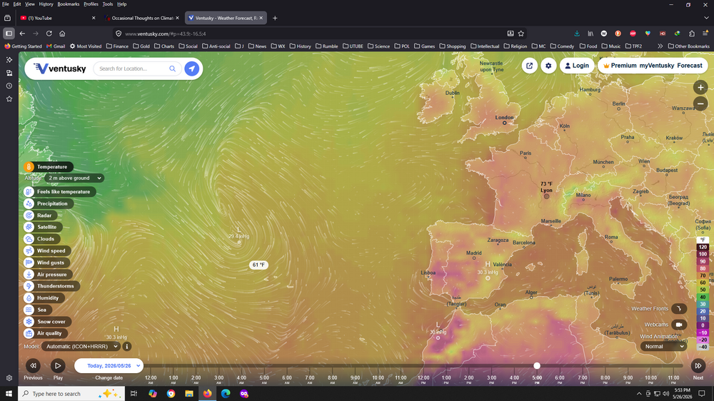
-
Would love to have one right now because it's roasting here in Eastern N.C. (Worse yet it will be four more days before we break below 90F for a high.) Sure hope this is not a sign of things to come for the next several months. SIGH.
-
Snowing nicely in Utah's Wasatch Mountains tonight. https://www.brightonresort.com/conditions
-
Occasional Thoughts on Climate Change
Silver Meteor replied to donsutherland1's topic in Climate Change
Some good replies on this one (especially the one about banks): https://x.com/mazemoore/status/2055376238345076837 -
Cold and cloudy for the East, warm, sunny and dry for the West, that pretty much describes this winter. Snowfall in the Rockies has been much below normal with some resorts now closing early. Brighton, Utah which I follow regularly has had 233" of snow so far while the full season average is 500". Down in the Salt Lake Valley my cousin says only 1" this winter. Could be water shortages ahead. Currently an historic heat wave is underway with temps at monthly extremes. Here in Eastern North Carolina 28F yesterday and 30F this morning, very cold for us. https://www.powder.com/news/lake-tahoe-resorts-close-heat-wave
-
Ski Resorts Close Early https://www.powder.com/news/lake-tahoe-resorts-close-heat-wave
-
Southern MD / Lower Eastern Shore weather discussion
Silver Meteor replied to AnEndlessMaze's topic in Mid Atlantic
Watching the radar over Delaware last night I noticed "yellow sparkles" showing up with some of the most intense and persistent snow bands. They matched up well with the areas of highest reported snow, especially the Seaford to Laurel area. -
Feb 22nd/23rd "There's no way..." Obs Thread
Silver Meteor replied to Maestrobjwa's topic in Mid Atlantic
I've been keeping an eye on radar throughout the night. Was amazing to see Delaware getting dumped on non-stop. Storm has been slowly and steadily pulling away for a while now. Probably just flurries by daybreak. https://radar.weather.gov/station/kdox/standard -
Feb 22nd/23rd "There's no way..." Obs Thread
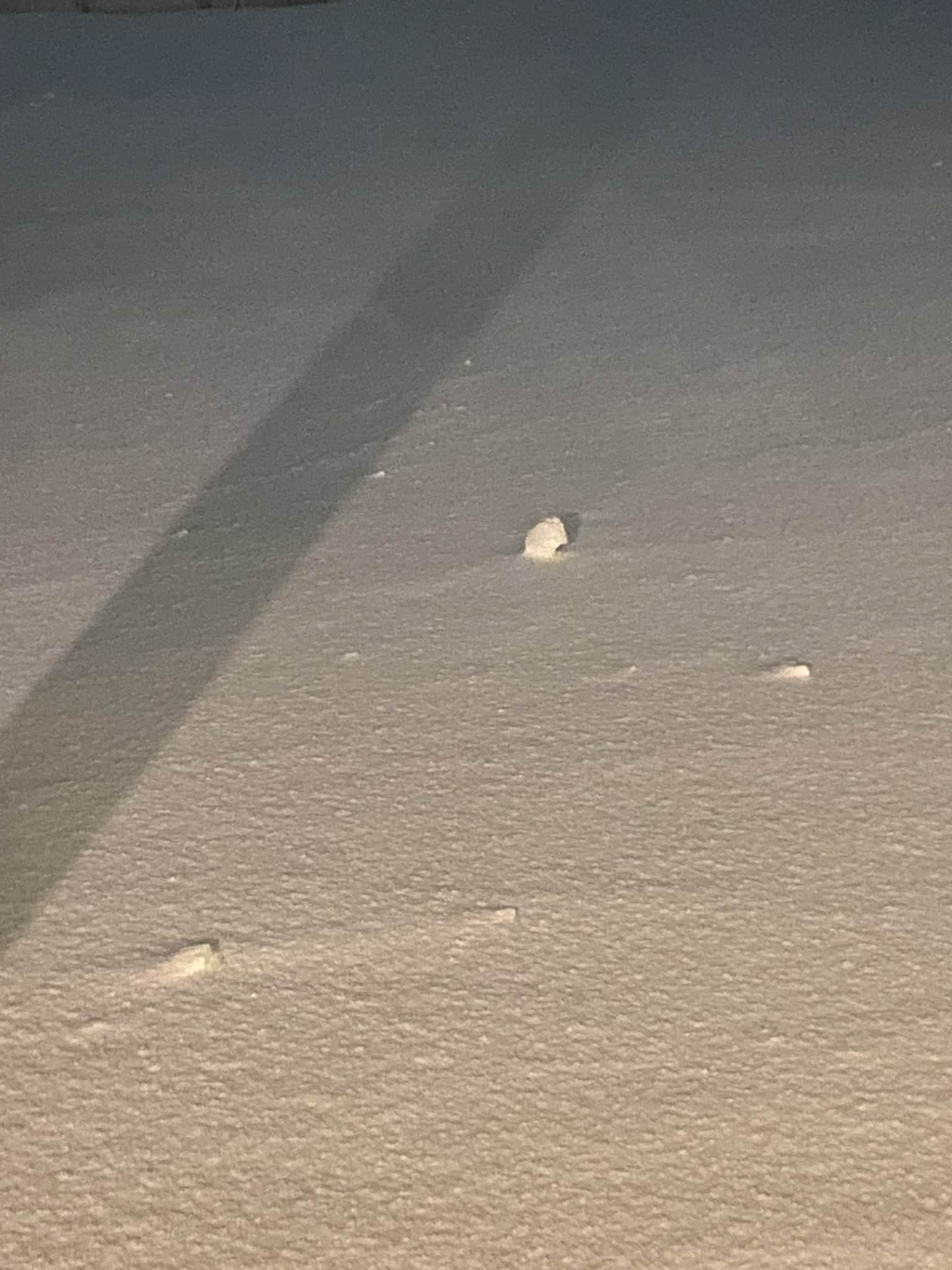
Silver Meteor replied to Maestrobjwa's topic in Mid Atlantic
Laurel Delaware: Lady friend of mine in Laurel is a total snow freak. Not a weather geek but a snow freak. Anyway, she just told me the wind made snowballs in her backyard. I said that sounds pretty weird ... so she sent me this pic: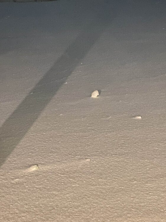
-
Feb 22nd/23rd "There's no way..." Obs Thread
Silver Meteor replied to Maestrobjwa's topic in Mid Atlantic
Speaking of "incredible," I actually once lived in the tiny town of Fenwick, Delaware! Was in a small mobile home park called "Cape Windsor" on the left hand side just over the Rt. 54 bridge with canals along our few streets that opened to the bay giving a fantastic view of Ocean City. Long ago, I think early '90s? We had a bona-fide blizzard with heavy snow and storm force winds on the coast. Went to full white-out conditions. Small street in front was blown free of snow while a drift reached to my roof. Beach blizzards are at the top of the charts! -
Feb 22nd/23rd "There's no way..." Obs Thread
Silver Meteor replied to Maestrobjwa's topic in Mid Atlantic
Hello. Would appreciate it if you would comment on this website. It shows the swirling wind vortex near the coast yet at the same time shows a "Low" noticeably farther offshore. How are these dynamic graphics created? Accuracy? https://www.ventusky.com/wind-speed-map/10m-above-ground#p=37.74;-76.31;6&w=0xIAb9A9A -
Feb 22nd/23rd "There's no way..." Obs Thread
Silver Meteor replied to Maestrobjwa's topic in Mid Atlantic
Seems to me the EURO was correct in not "tucking in" the surface low like so many other models did. It's well offshore and has been since leaving the Carolina coast. https://www.spc.noaa.gov/exper/mesoanalysis/new/viewsector.php?sector=17# -
Feb 22nd/23rd "There's no way..." Obs Thread
Silver Meteor replied to Maestrobjwa's topic in Mid Atlantic
The Low is forming now on the Carolina Coast: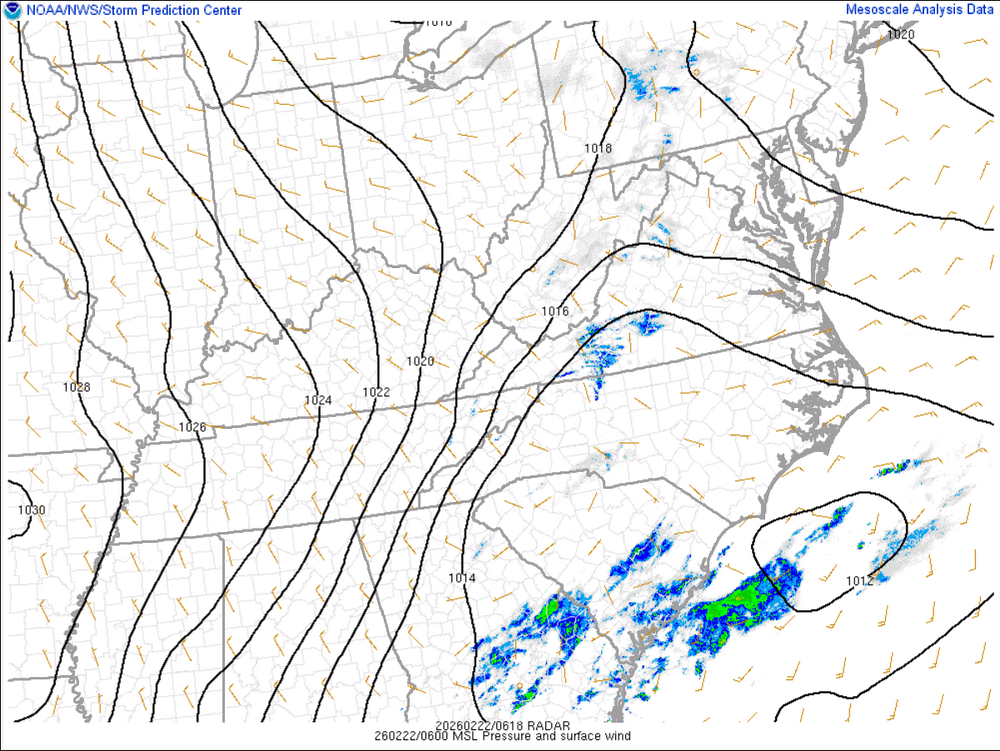
-
2/22-23 "There's no way..." Storm Part 2
Silver Meteor replied to Maestrobjwa's topic in Mid Atlantic
What happened to all the heavy snow on the Delmarva? Did it all melt? -
2/22-23 "There's no way..." Storm Part 2
Silver Meteor replied to Maestrobjwa's topic in Mid Atlantic
I imagine DT is utterly apoplectic. -
2/22-23 "There's no way..." Storm Part 2
Silver Meteor replied to Maestrobjwa's topic in Mid Atlantic
It struck on a Sunday night. I was supposed to report for my first day of work at DTNSRDC in Carderock, Md (Potomac River near Bethesda) Monday morning but of course that never happened. In fact, it wasn't until the next Monday that work opened. Expecting a tolerable 4" of overnight snow I woke up to what I thought was fog outside. With the onset of daylight I about fainted when I realized that "fog" was torrential snow. Cars were completely buried and drifts were to the top of storefronts. Tractors were used to clear Georgia Avenue (Georgian Towers in Silver Spring.) https://vlab.noaa.gov/web/nws-heritage/-/unpredictable-the-president-s-day-storm-of-1979 -
Classic DC area winter storm. Seen it countless times.
-
The most snowfall ever recorded in a single winter in Maryland was during the winter of 2009–10, when 262.5 inches of snow fell at Keysers Ridge.
-
January 30th- Feb 1st ULL and coastal storm obs
Silver Meteor replied to JoshM's topic in Southeastern States
Storm chaser in Greenville, NC: -
January 30th- Feb 1st ULL and coastal storm obs
Silver Meteor replied to JoshM's topic in Southeastern States
Here in Greenville, NC I suspect we're going to beat the all-time record of 13" set in 1896.