EMontpelierWhiteout
-
Posts
223 -
Joined
-
Last visited
Content Type
Profiles
Blogs
Forums
American Weather
Media Demo
Store
Gallery
Everything posted by EMontpelierWhiteout
-
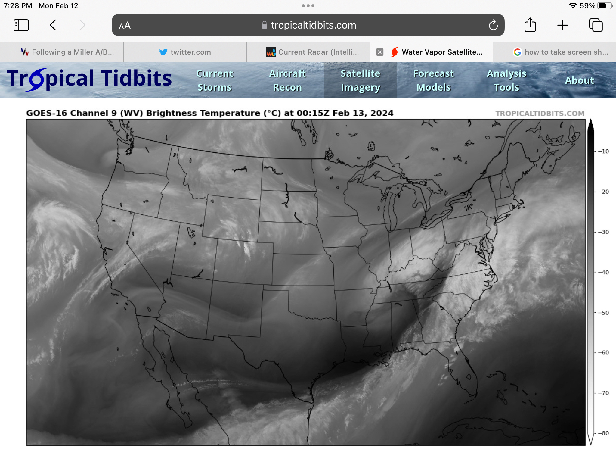
Also, center of circulation appears to be more in western third of Tennessee rather than eastern half depicted by 7:00 PM GFS and Euro modeling position.
-
Time to start focusing on actual storm evolution on satellite and radar. I like the SW Ohio marker discussed earlier.
-
Time to grab the ski gear and head for the high point on Nantucket
-
Same sentiment here. Happy for those south of the VT border finally cashing in, but just a bit to freshen things up would be nice. Seems like storms with the right airmass to get both a northern and southern NE hit is a thing of the past.
-
The late in the game NW trends on these southern streamers have all been within 96 hours. Too soon to spike the football.
-
I’d love NNE mountain jackpot to verify.
-
Still too early and with a lot of model spread on amount of phasing and resulting track. I remember the days of yore when the Euro ruled in these events at this timeframe and nail biting in this case for a whiff would have been far less. NW trends in GFS as coastal events approach have been pretty reliable this year as SNE forum members know all too well.
-
I kind of like it.
-
I find the Stowe snow report to be pretty accurate to conditions. No real bs making it sound better than it is like some other resorts. Yes, a “fun challenge” has been the pretty common “not so great but you are not going to die” refrain for some of these post-marginal events or dry periods.
-
Thanks for the info on this. Interesting and good to know.
-
Yes, I’ve noticed a huge grooming difference Gondala runs versus blues off Forerunner this year. Interesting to hear groomers have their set trails.
-
It was a Flop... February 2024 Disco. Thread
EMontpelierWhiteout replied to Prismshine Productions's topic in New England
Environment Canada says another 25 cm. That’s 10”. -
It was just spectacular scenery on the mountain today, and although certainly not the best snow conditions, the morning was pretty good, especially on Perry and Gondolier.
-
Thanks for the post. It put a smile on my face. So great that you are out there on the mountain.
-
Sorry to hear about your dog. Always so hard when you have to put a pet down.
-
2” just a little north of you in East Montpelier. Solid moderate to heavy snow right now. I was in Waterbury for start of the event and noticeably warmer and lighter snow there. Snow picked up and 3F temp difference between Waterbury and Montpelier exits on 89. Jives with Powderfreaks no snow in Stowe earlier.
-
Get used to it. Global trends are not your friend.
-
Best front end thump I ever experienced was in the 2007 Valentines storm. 10” in 3 hours of perfect dendrites. Snowshoed in it. Amazing memory.
-
Yes love it. Deep winter feel.
-
7” on the nose here. Single measurement but this stuff is so light I assume no compaction. Event pretty much over here. Forecast this morning was for 3-6 so overperformer up in this part of NNE.
-
First flakes about 15 minutes ago. Looking forward to an all snow event.
-
First flakes in N Central VT are falling. Looking forward to light snow all day with some moderate bursts this PM as low deepens and moves into GOM. 3-6” expected.
-
Higher qpf + lower ratios = lower qpf + higher ratios
-
Some good model trends today throwing more moisture further NW. With high snow to liquid ratios, I think we’ll see some yellow shading along the spine in subsequent updates.
-
A good snow squall never disappoints. We had two distinct lines today with near white out conditions that added a quick two inches at the house. Combined with the winds it completely relandscaped the yard. Weather is so cool.