RDRY
-
Posts
795 -
Joined
-
Last visited
Content Type
Profiles
Blogs
Forums
American Weather
Media Demo
Store
Gallery
Everything posted by RDRY
-
Here's hoping this GFS run ingests bad initialization data, and is discarded.
-
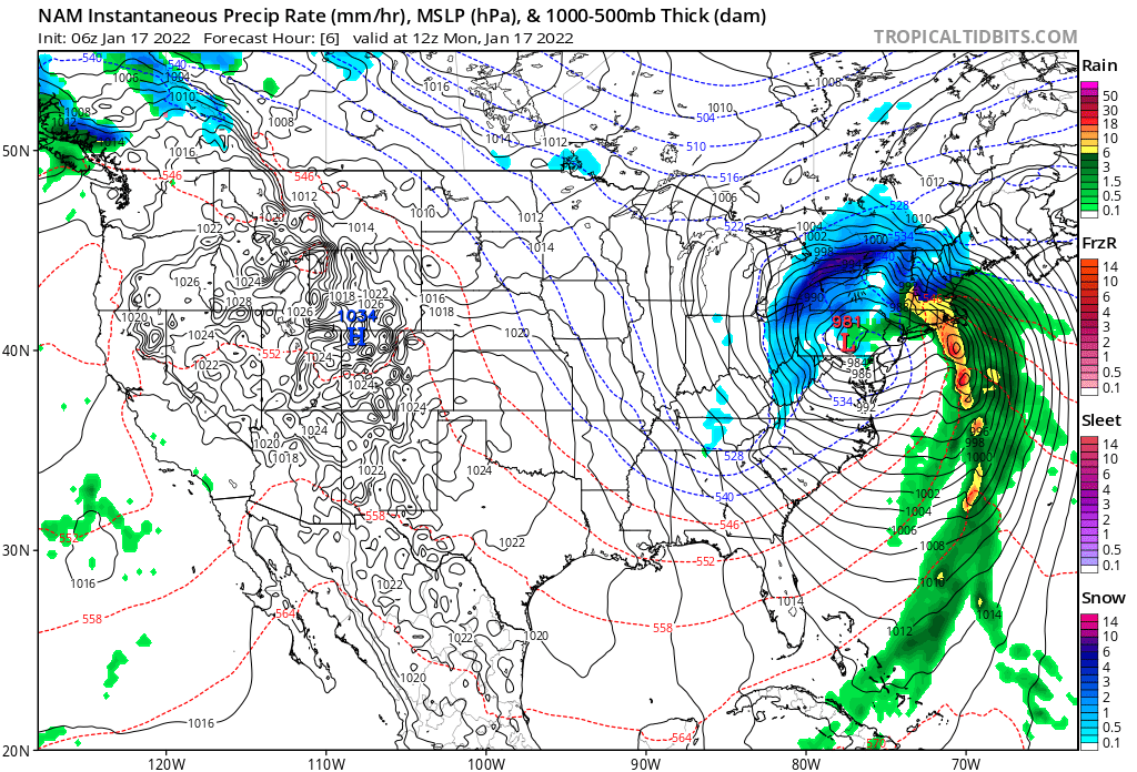
Looks like the Berks get in on some decent wraparound snows and probably some upslope with the NAM -- the upper levels looked better than 6z, but the surface didn't really reflect it.
-
Yup. Back in the ballgame.
-
Such a touchy setup. SW in California; PV dropping south; speed, depth and orientation of the trough; surface placement of the coastal low. Any of them with major downstream impacts. And still enough lead time.
-
The western ridge keeps nudging ever-so-slightly higher the past 4 GFS runs.
-
Is this really a significant model failure? 60+ hours out, they sampled the California energy slightly different, which cut it off from the emerging trough, so the trough doesn't dig as far south, doesn't sharpen up as much, and the storm develops a few hundred miles east.
-
Probably shifted south along with the low. Same reason the midwest low shifted south and east from previous run.
-
And the ICON is Daniel Jones.
-
Well, now I'm expecting flurries and calm winds.
-
I heard the ICON runs on Lotus.
-
Trough now slightly negative at 75 on the NAM. Useful.
-
Extrapolating past 90 hrs, does this move north or east of north?
-
Looks like it's pulled from the GFS. 2-6 for the Berks -- ouch!!
-
Indeed. But it looks like the GFS surface is not quite in sync with its upper levels.
-
GFS is a stubborn SOB. Takes its sweet time getting there.
-
Too bad the surface low isn't placed on that closed contour to its west.
-
Southwest energy held back a bit more on this EURO run. Could be trouble.
-
Classic GFS -- getting there in increments.
-
Not as good as 6z with the southern energy, but certainly better than 12z. Actually, at 96 hours, this looks almost exactly the same as yesterday's 0z.
-
All that energy getting dumped into a pretty confined space.
-

-
Reality being the very next model run.
-
Looks like it stayed snow in most of western Mass. EURO > NAM. The 6z NAM wrong right up to game time.