

Paleocene
-
Posts
2,054 -
Joined
-
Last visited
Content Type
Profiles
Blogs
Forums
American Weather
Media Demo
Store
Gallery
Everything posted by Paleocene
-

Jan 24-26 Weekend Snow and Sleetfest Model Thread Part Tres
Paleocene replied to H2O's topic in Mid Atlantic
These are the warmest surface temps I've seen. WAY warmer than the NAM 3km and globals at the same time. I say toss. -
Jan 24-26 Weekend Snow and Sleetfest Model Thread Part Tres
Paleocene replied to H2O's topic in Mid Atlantic
Latest HRRR has south of i-66/50 holding as snow thru 15z, then flipping around the metros at 16z. 0.6" QPF pre-flip -
Jan 24-26 Weekend Snow and Sleetfest Model Thread Part Tres
Paleocene replied to H2O's topic in Mid Atlantic
32/7. dropping quick in the heat island. goodbye, above freezing temps! -
Jan 24-26 Weekend Snow and Sleetfest Model Thread Part Tres
Paleocene replied to H2O's topic in Mid Atlantic
I was at giant today and the dude in front of me was telling the cashier we were going to get 2". Me, pulling up AMWX on my phone: -
January 24-26: Miracle or Mirage JV/Banter Thread!
Paleocene replied to SnowenOutThere's topic in Mid Atlantic
This is the banter thread so this is appropriate. I was just younger than you then. I was in central PA and our front yard had a small hill/slope. I remember swinging myself between footprints while lying flat on my stomach on the slope, imagining I was mario or donkey kong or some other 1990s game lol -
January 24-26: Miracle or Mirage JV/Banter Thread!
Paleocene replied to SnowenOutThere's topic in Mid Atlantic
I am with you on this lol. 1994 I think. I was only 5 but I remember the glaciers. It was nuts. What I don't want is for people (myself included) to lose power. Otherwise, bring on the ice -
January 24-26: Miracle or Mirage JV/Banter Thread!
Paleocene replied to SnowenOutThere's topic in Mid Atlantic
let's all cliff jump over the NAM and ICON. the thread is unreadable. It's gonna snow, then ice. end of story and that's been the deal since weds. -
January 24-26: Miracle or Mirage JV/Banter Thread!
Paleocene replied to SnowenOutThere's topic in Mid Atlantic
Me, riding the sleet line at 1pm Sunday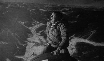
-
Jan 24-26 Weekend Snow and Sleetfest Model Thread Part Tres
Paleocene replied to H2O's topic in Mid Atlantic
On the long range 18z HRRR, snow enters the region from the SW between 10pm-midnight saturday night. Not sure how long it will take to saturate the air. -
January 24-26: Miracle or Mirage JV/Banter Thread!
Paleocene replied to SnowenOutThere's topic in Mid Atlantic
This. Lord is it so bad sometimes. -
January 24-26: Miracle or Mirage JV/Banter Thread!
Paleocene replied to SnowenOutThere's topic in Mid Atlantic
Indeed. The dark side of "the big ones are always sniffed out early" -
January 24-26: Miracle or Mirage JV/Banter Thread!
Paleocene replied to SnowenOutThere's topic in Mid Atlantic
Can't believe we have to do another day of model watching all day tomorrow. Then radar hallucinations and short range cliff jumping on Saturday. Some may not survive -
It is also a QPF nuke (in my experience, it generally overdoes precip).
-
NAM (sigh, why are we doing this to ourselves) trend with QPF is slower/lower today. And maybe a hair dryer, but that may just be because of the slower? This is only through 18z sunday, as far as can be compared over past 12 hours
-
I have no super intelligent commentary to offer on the differences between the EPS and GEFS, but i thought I would make this gif which shows the differences in SLP. Valid Sunday evening/Monday 00z. Easy way to visualize why the GFS 12z was more "friendly" to those of us along/east of 95. We want that low and transfer to the coast to be more south. I assume at this range its probably time to stop looking at ensembles too
-
In Silver Spring, I will take this and run. Especially if we hold through 18z (or after)
-
January 24-26: Miracle or Mirage JV/Banter Thread!
Paleocene replied to SnowenOutThere's topic in Mid Atlantic
For the metros, I am hoping that if we do get a good deal of sleet it to some extent mirrors what happened on the Valentine's Day 2007 storm. @psuhoffmanhas referenced this storm, saying that our totals could end up pretty similar to what happened north of here in the central PA area. I was there at the time, a senior in high school. The 2007 storm as I understand it was mostly sleet in the immediate DC area. But not up north. I remember it like yesterday, man I am old. It was supposed to be senior skip day. My cool friends skipped school, but myself and my loser friends went to our first class, which was AP calculus. Our teacher naturally gave a quiz on senior skip day, that one was not allowed to make up if you missed school lol. It was a missed forecast and call for school by the district, because by the time we were done with our first class at 9:00 a.m., it was already accumulating snow in the parking lots. And on the streets. The snow came in hot and heavy, and the district called an early dismissal. I remember huge accumulating flakes. Myself and other seniors, respecting the rest of skip day, had simply walked out the door after the calculus quiz, times were different back then I guess. By noon the roads were awful and later in the day it started to change to sleep. We probably got about 8 in of snow, and then the sleet began. It was a glacier of sleet that completely crushed over the snow. It was extremely glittery and sparkly the next morning. And the roads were a disaster. Basically, there were two two tire ruts in each lane, where the glacier had been pounded through. The rest of the road surface was glacierized. Plows were useless. My school district canceled school the rest of the week, IIRC, which was extremely uncommon for Central PA. The only time that had happened otherwise was PD2. It was very challenging to walk around the rest of that week lol. Very cold February. I wish I had pictures, but that was back before people were really carrying. Camera phones. Probably have some lost on an SD card or an old hard drive... -
I was wondering about this too and haven't seen it discussed much. The models all give a wind output, you can check them. For example this panel shows wind *gusts* above the surface when the low is forming off the coast sunday evening. Pretty breezy, but IDK if this would verify blizzard in the metros. Worse to the east.
-
NAM is always amped, that's what the A stands for.
-
January 24-26: Miracle or Mirage JV/Banter Thread!
Paleocene replied to SnowenOutThere's topic in Mid Atlantic
Yeoman is one of our greatest trolls and allowed to post whatever whenever for some reason. Generally funny -
January 24-26: Miracle or Mirage JV/Banter Thread!
Paleocene replied to SnowenOutThere's topic in Mid Atlantic
Lol no worries. Just joking. Someone on a junk account posted that quote during a snowstorm last year or the year before and it's stuck with me -
January 24-26: Miracle or Mirage JV/Banter Thread!
Paleocene replied to SnowenOutThere's topic in Mid Atlantic
So, summary of 12-18z is "rain in Georgetown?" -
If you look at the total QPF map on the ICON (especially if you compare runs) you can see why it's a junk model. Weird patches and holes all over the place compared to the varsity models. IDK why I'm even bothering to dissect it. On to the GOOFY
-
ICON is way more amped with totals compared to its 12z run, especially across the midwest. As discussed, more amped early out west = more norther with the precip
-
I'll let someone more qualified than me comment on meaning, but here's ICON 18z (top) versus 12z (bottom). Valid Saturday 12z. Baja wave looks more organized and more positively tilted. Northern stream energy has a different position too


