Newman
-
Posts
2,485 -
Joined
-
Last visited
Content Type
Profiles
Blogs
Forums
American Weather
Media Demo
Store
Gallery
Everything posted by Newman
-
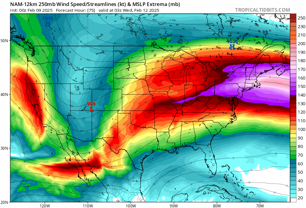
 The NAM allows for a more expansive precip shield with a 180-190kt upper level jet screaming over northern New England, putting Eastern PA, NJ, and NYC in a favorable right entrance region. The flatter models aren't really all that different with MSLP placement, it's the jet and SER flex that's different
 -
Upper level jet streak has been trending towards a better position with the 11/12 storm on the NAM. Better upper-level divergence in the right entrance region of the jet bringing a more expansive precip shield north. NAM gets 0.6" of QPF to Philly!

-
Even with the favorable regional models coming in at 18z, I'm not sold on the magnitude of QPF depicted yet. Still think accumulating snow gets into much of SE PA, but a 1-3 or 2-4 ordeal is the way to go right now
-
RGEM is a really solid hit. Low end WSW for much of SE PA
-
The GFS and CMC have it too, Euro is just a bit warmer. Question will be if we can get a HP to anchor in SE Canada and how much CAD holds on.
-
NAM also shows the thump of sleet/snow Wednesday night less than 24 hours after the Tuesday night storm pulls away
.thumb.png.c2ea2537d9c83f825912ad91b78e75bf.png)
-
First call from NWS. Seems reasonable and what my call would be right now. I told my folk yesterday in Fleetwood my first call is 1-3"
.thumb.png.a60a96207270a9c705cadcb58f8e5b3c.png)
-
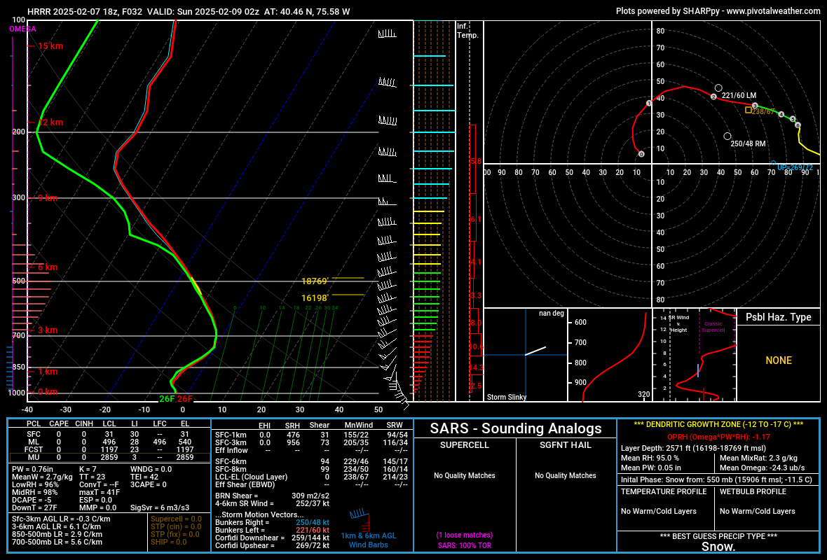
Long-range 18z HRRR shifted quite a bit cooler compared to its earlier 12z run. I took a sounding from near KABE at 02 UTC and you can see the warm nose between 700-850mb creeping close to freezing. The next hour mark it switches over to sleet, but at this time we're going to town with deep lift and saturation in the DGZ. The HRRR indicates ~0.1-0.2" of QPF during this hour, so you could thump a quick 1-3" if that's correct. Really depends on how intrusive that warm layer is. We saw with the storm earlier this week the HRRR was way too cold, which is it's typical bias. Either way, I don't foresee much ZR in the Lehigh Valley and Berks, it'll be mostly sleet IMO with a glaze of ZR. Down in Montgomery, Bucks, Chester I see the higher ZR accretion. SW of 95 is probably mostly rain or a light glaze of ice on cold surfaces. As a side note, look at that hodograph and low-level WAA/veering lol

-
And another storm after Valentine's on the GFS, tries for a triple phase. Insanity
-
That 12z HRRR run is really snowy for much of Berks and the Lehigh Valley. I think it's out to lunch, it's the only model that mutes the WAA and keeps it at bay. The entire profile stays below freezing for most of the storm. I guess it's hard to know whether the warmer (NAM) or colder (HRRR) models will win out as of now. The typical model biases are being shown...
-
Final total of 7/8" in Fleetwood, season total is just under 16"
-
My folk in Fleetwood have about 0.5-0.75"
-
That 12 GFS run is hit after hit of snow and/or ice for PA
-
The low in Laramie last night was -25
-
1/19/25 Eagles Playoff Winter Storm obs
Newman replied to Ralph Wiggum's topic in Philadelphia Region
My folk in Fleetwood measured between 7.5-8 inches around the yard and on the snow board. -
1/19/25 Eagles Playoff Winter Storm obs
Newman replied to Ralph Wiggum's topic in Philadelphia Region
KRDG has been reporting mod or heavy snow for 3 hours straight now. -
Brother in Lititz just measured a bit over 4" in grass
-
Sunday 1/19 Eagles Game Snow and Stuff
Newman replied to Ralph Wiggum's topic in Philadelphia Region
18z HRRR looks solid for most across the CWA, WSW criteria met for Berks and the Lehigh valley. Upper Bucks, Chesco, Montgomery as well. Philly itself flirts with the snow/mix line for much of the game tomorrow, but ultimately remains on the "snow" side of the line. Worst conditions in Philly are probably when the storm is pulling through with the last hour or two as temps crash and ratios/rates are enhanced a bit. So, I would expect a snow or snow/mix during the entire game tomorrow with the 4th quarter possibly being the worst. -
We got a surprise 5" or so of snow in Laramie last night. Was only expecting 1-3" max.
-
GFS looks like it'll be just a bit more tucked than 12z, unless the kicker behind it does it's part
-
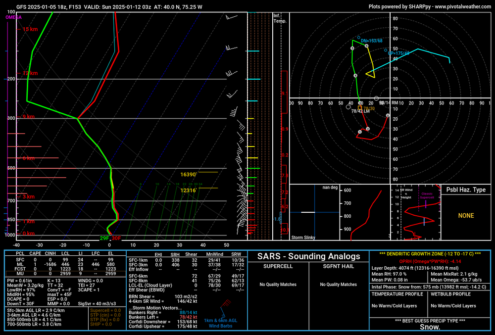
I was just looking at the sounding at PHL around the height of the storm. You can see that warm nose at 850. The column is still below freezing verbatim, but in reality we all know how these things go if they're that tucked.
-
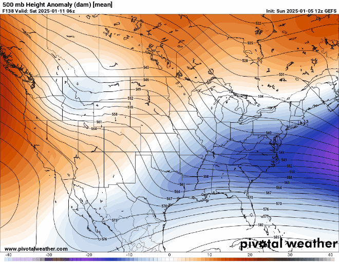
As of right now, I would lean still towards this being a Mid-Atlantic special as compared to an I-95 bomb up the coast to Boston. If there's no phase, well then we have no storm. If there is a phase, the decaying NAO block and 50/50 low should limit how north this got AND there appears to be a kicker wave on it's heels coming down the ridge over the west coast. Anything can happen, but just my early thoughts. We'll see lots of shifting around, probably some good and bad, in the coming days. I would be shocked if the current storm cyclogenesis process looks the same in 5 days
-
Verbatim if we took the GFS as is, it actually reaches the latitude of about the DelMarVa and then gets kicked east. It's almost a perfect track for the Mid-Atlantic states. You can actually see a warm nose/WAA in Philly at 850mb, the flow off the Atlantic would certainly bring mixing issues into play for those over the coastal plain. But at this juncture it doesn't matter as you said, let's get the storm to solidify on models first.
-
Major shift on the GEFS
-
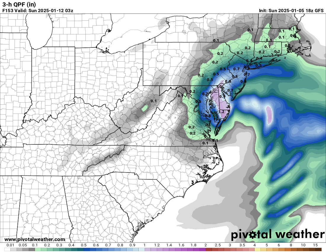
That GFS drops a solid 1"+ of QPF in some locations along I-95 in only 3 hours. That, at a minimum in such a dynamic storm, would drop like 15 inches or more of snow in only 3 hours
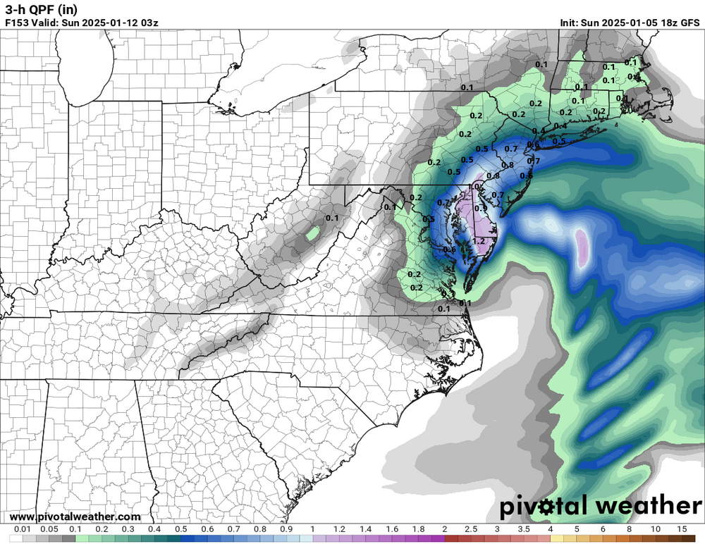


.png.dc9b1369b1f81b0169cbe631f1115551.png)
.png.338822fa6a20ab3ec480c6a6c20c4836.png)