

Scarlet Pimpernel
-
Posts
7,345 -
Joined
-
Last visited
Content Type
Profiles
Blogs
Forums
American Weather
Media Demo
Store
Gallery
Posts posted by Scarlet Pimpernel
-
-
7 hours ago, mappy said:
Post 33,000
been here too damn long and talk way too much
Congrats! Cue the balloons! Party time!


-
 1
1
-
-
7 hours ago, psuhoffman said:
People keep asking the same questions. I don’t mind since I don’t expect everyone to scroll through the whole thread. But maybe answering the same thing over when the answer isn’t pleasant isn’t the best for the mood of the thread.
Is that something like the definition of insanity? Not for you, but for those asking the questions, hoping for a different answer!!

-
2 hours ago, Mrs.J said:
Last night on Chincoteague for a much needed mental health break. Rented a house on the Bay on the Northern end of the island. Have enjoyed some nice warm weather. Some beautiful sunsets and skies on fire. Finished off the week with a brought in shellfish feast of which there was nothing left.


Hello there, Mrs. J!! How are you my friend? What amazing photos! I was in Chincoteague around mid-August, hope you had a great time there! The sunsets from Chincoteague were amazing!!
-
 1
1
-
-
Some photos from today...
Streaks of mid-level clouds (black/white, with red filter applied):

Those clouds stuck around to create an awesome, amazing sunset!!


-
6
-
-
7 hours ago, toolsheds said:
think about the mixed signals here in Carroll County where school was scheduled to go back on Monday, but at the last minute the High Schools were pulled from that plan. Elementary and Middle schools are back with a hybrid plan, but High Schools are virtual through at least the end of the quarter. I'm so thankful that my two High Schoolers home are able to handle this and manage on their own. The tough part for my Senior is getting out for college visits. We have been doing self guided campus tours, but without access to the classrooms or dorms, it's hard to understand how your kid feels about a campus when looking.
I hear you! My daughter is a senior this year. College visits? Not happening the way things are. It makes things very...surreal. I honestly at times don't even know what to do (not to mention how things are done now compared to when I was applying a century ago, it's a lot different!
). She's putting in applications, but that's about all one can do right now.
-
7 hours ago, mappy said:
well said, friend. We want our kid back too, she wants to be back. We manage virtual learning because we have to. My only frustration right now as a parent is the lack of communication from the county on when kids may return. As of right now, she's virtual through the end of January as well, at which point a hybrid system is supposed to be in play. Balt Co's super intendent came out a month ago saying they were going to start having some kids back in classrooms this month, but then he reversed course and its been crickets since then.
Thats incredibly frustrating. What are they doing? What's the thoughts as of now on a plan forward? It's hard not knowing. So we just keep on doing what we need to do.
Thank you, my friend! Good to hear from you and hope you are well. I totally get the frustration concerning some lack of communication. Sometimes, I honestly just cannot keep up with various announcements. Sometimes, they're more on the ball with information, but other times, it's a bit opaque on what's going on. But like you...we manage as best we can. Hang in there...I have to keep the faith (or something!) that this will be over at some point.
On a different...but I guess mildly related subject...I dropped off my mail-in ballot last week (yay!!). Went to one of those drop boxes that's nearby. I only bring that up because the last time I did anything mail in was as an undergrad in college, when I submitted an absentee ballot! That was...well, I won't say how many years ago! So this was a bit surreal for me in a way!
-
1
-
-
Anyone care about or paying much attention to the World Series this year? Anyone...anyone...Bueller?? Me neither! (apologies to any Dodgers' or Rays' fans out there!!)
-
5 hours ago, Eskimo Joe said:
People aren't taking this seriously and it's infuriating.
Amen!!
4 hours ago, mappy said:Just says within the community. I know your position, and respect it. However, if its spreading enough in the community that the positivity rate tripled in 10-days, then it most certainly can spread within schools. I'm of the mind that it's better to be safe now, then sorry later.
Agree. Whether or not schools are a primary vector for spreading the disease is almost irrelevant. If it's spreading in the community and spiking like that, better to play it safer. Personally, I think Gov. Hogan may have been a bit too quick on relaxing the restrictions more of late, and I say that as one who has been impressed and supportive of how he's dealt with this overall. Though he does allow (as I understand it) individual counties to make their own decisions. I live in MoCo, which has one of the highest rates and number of cases in the state (perhaps PG is the highest?). It was determined late in the summer that schools would be virtual *at least* through the first semester this academic year (end of January). They're supposed to re-evaluate the situation in the near future, to determine what's to be done for the 2nd semester (still virtual, in-person, or some hybrid?). But I'm not optimistic that they'll have any in-person instruction in MoCo this year at all. It sucks, we all want our kids to be in school (and hell, *they* want to be in school to see their friends!)...but in my opinion the closures and virtual learning is a sad necessity given the situation. Be glad we live in a time, at least, where it's possible to do that.
-
2
-
-
2 hours ago, psuhoffman said:
Probably. But there is a chance this is an epic fail if the result of an actual Nina during a period when we were already experiencing a Nina type pattern due to other factors leads to an Uber ultra Nina pattern. We could get a stable +3-5 std dv pac ridge that floods the conus with Pac puke all winter. It’s not necessarily the most likely outcome but it wouldn’t shock me. On a personal note (and yes I realize this makes me an ass) if we have the choice between some pathetic 6” from several slop storms winter or a complete blank were its 55-65 all winter and we don’t even get a flake I would take the latter just to be able to chuckle at all the “it can’t be worse than last year” posts. Those people obviously aren’t paying attention. It can always be worse. Always.
In a way, I agree with you here (no, not the part where you say that this makes you an ass...well, maybe sorta!). I personally see little difference between 6" slop spread over several events, that disappear before you sneeze...and dealing with 55-60 degrees most of the winter. Honestly (and this is simply conjecture on my part), I don't see us having quite so consistent a level of warmth as we did last year, and our single best event being...all of 1.5" total. Whether that means anything, who knows. But yeah, if we're going to have a couple of slop storms, who cares, might as well have it be "late fall" most of the time instead! I just hope we don't have mosquitos still hanging around in January, please!
Interestingly, I looked up DJF last year (2019-20) and DJF from 2015-16 (year we got the blizzard). At least for DCA, last year was warmer over those 3 winter months compared to '15-16, and more consistently so. And that is after a +11.5 departure in Dec. 2015!! Take out Dec. 2015 and you see a different picture that year. I know people like to "dis" that winter as a one-and-done luck out with the blizzard that sucked otherwise, but fact is...we DID luck out. And it wasn't all luck. We were graced with a favorable pattern and a STJ on 'roids through the middle-end part of January. And in fact, besides the awful warmth in December, Jan-Feb were kinda at or slightly below normal overall (2nd half of Feb did get warmer, to be sure, as I recall). Last year didn't even give us any chance for a luck event, really. Oh, and last year, DCA did not record a single max temperature of 32 or below at all.
-
3 hours ago, WinterWxLuvr said:

C'mon, if you're gonna punt, go for the best (Ray Guy)!!
-
Hey @WxWatcher007, is the Panic Room open yet for this season? Looks like you'll have an overflow crowd right from the start! Perhaps introduce "contactless" check-in!! And sanitize each room with tears from agonized snow weenies!
-
4
-
-
On 10/11/2020 at 11:43 AM, leesburg 04 said:
Big winter coming guys!
Wait...did Groucho Marx lose one of his eyebrows??
-
2
-
-
21 hours ago, WinterWxLuvr said:
Peak will be gone up there in two weeks. This upcoming weekend is likely to be the one closest to peak. Was up there last weekend and the color was already pronounced.
Yeah, I guess that would be true for up in that area. Closer in to the DC area, it's kind of just getting a little bit of color...so couple of weeks in this area is probably what I was thinking of. It's been pretty dry too, of late (though should get some good rain tonight), hopefully that won't inhibit things too much to where the leaves just shrivel and fall off, LOL! The maples have started, I guess they tend to be the first ones to show.
-
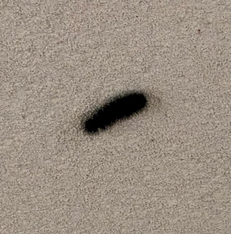
Some late summer weeds...

-
2
-
-
2 hours ago, LP08 said:
A storm like that would double our total from last year.....I need some more colors for 4 sleet pellets to 50 and rain.
No kidding! I think I barely measured 2" total last year, if I'm generously slant-sticking, hahaha! And I damn near slept through the "biggest" (1" or so) event, too!!
-
On 9/27/2020 at 10:53 AM, nw baltimore wx said:
We finished a backpacking trip in Dolly Sods yesterday, then settled in last night in Davis/Thomas. Stopped in to Stumptown Ales in the evening for some carry out but didn’t see JonJon. There’s a lot of nice color up this way. The first couple of photos are from the Sods.


After a good nights sleep in the motel, a couple of us got up early this morning to stretch our legs and walked out to the Blackwater Falls. The first pic is this morning, and the second one from last July. Easy to see how dry it has been up this way.


That's awesome, @nw baltimore wx! I bet in a couple of weeks that area will look amazing as the color really comes out!! You can definitely see the hints of it starting.
-
1
-
-
Couple of photos for you all! I experimented some with black and white here (with addition of red filter to increase contrast)...
Cirrus clouds:

And...not sure what this plant is called, but have seen it around. I liked how the light was hitting it:

-
11
-
-
3 hours ago, BristowWx said:
I would love to have a winter so severe and long I yearn for spring. I’ve yet to see that happen here. Maybe this year..
2 hours ago, Cobalt said:Correct me if I'm wrong, but weren't you here during 13-14? Seems like a rather prolific winter with little to no breaks.
Sucks that I have no recollection of that winter.. or 09/10.. or of 02/03..
2013-14 was incredible, perhaps the closest to anything "severe" we've had in recent memory outside 2009-10 and 2002-03 (though there wasn't any extreme cold...lots of snow though!). It was damn near gate-to-gate events, lots of solid moderate events, no big HECS-style ones. Even @Bob Chill said he was just about exhausted from tracking by the end of March that season!! I actually consider '13-14 to be pretty damn close to, or perhaps slightly exceeding, '02-03, even with no HECS events...nearly a toss-up in my opinion between those two seasons.
-
4
-
-
1 hour ago, H2O said:
A thousand monkeys at a thousand typewriters will write a masterpiece
or not
They certainly can write Shakespeare. I recently read a monkey random typewriter version of "Henry V". It was amazing, almost as if ol' Bill plagiarized it!!
Oh...and typewriters?? Really??
(Joking...I have fond memories of learning to type, on an actual old style typewriter, even before electronic typewriters became popular and well enough before word processors existed!!! That was only shortly after having to transcribe things by hand, in ink...and in Latin!)
-
On 9/19/2020 at 7:49 AM, osfan24 said:
Call me crazy, but I think it's too soon to be making declarations like that. 2013-2014 and 2014-2015 wasn't that long ago. 2015-2016 was a crappy winter but we still managed an epic storm. I'm more frustrated than anyone at the lack of snow, but sometimes we go through these stretches around here. It was just hard to remember brutal stretches like this because we were on such a heater there for awhile. Maybe climate change is really impacting our winters, but I think it's too soon to say our last several winters have been poor because of it.
I'll take a bit of issue stating categorically that 2015-16 was a "crappy winter." But that's all a matter of perspective and opinion of course, and others have expressed the same view, so it is what it is. I won't deny that Dec. 2015 was absolutely awful, the worst in the annals of craptacularity, with a +11 temperature departure for the month. More April than December. However, if you look at the temperatures for Jan. 2016, it was slightly colder than normal, and Feb. 2016 was near to a hair above normal. Though to be sure, the 2nd half of Feb. warmed up again. For snow...outside that one amazing event...you could argue it sucked, sure. But fact is we did get that one spectacular event. And in Feb., there was a small to moderate snow/ice event (that changed to rain very late) around President's Day weekend. Did we have other chances in that 2 month period? I don't remember. But to me, truly crappy would be last winter, where it was nearly wall-to-wall shutout with no chance. And a toaster bath most of the time. Or 2001-02, and 2011-12. Those are the worst kinds in terms of awful winters in my opinion...consistently lousy temperatures and almost no real snow opportunities. I'd argue that as bad as a lot of 2015-16 seemed (mostly thanks to that December), we still had a couple of realistic periods for something.
-
18 hours ago, yoda said:
Tiebreaker of 780 degrees?
")
Well...being the geek I am, I looked to see what 780 degrees Fahrenheit is in Celsius, thinking there was some inverse joke related to "Fahrenheit 451" in there. It's equivalent 415.6 deg C. So, it's not all that far from "Celsius 451"?
Either way, kinda toasty!
-
2
-
-
8 hours ago, JakkelWx said:
I suspect this winter will have twice as much snow if not more than last winter, despite an unfavorable ENSO. Last winter was a special one.
Well, to paraphrase Bilbo Baggins in LOTR, "We'll get half as much snow as we should like, and less than half as much as we deserve!!"

-
2 hours ago, CAPE said:
Probably shouldn't be drinking a high gravity monster a couple hours after donating blood, but wth.
Cheers!

Hey, gotta replace that blood with *something*!!!!
Looks really tasty, and I like the clever name too!
-
11 pages for a Winter 2020-21 thread, and we're barely into September...oy gevalt!! Either desperation or hope, I'm not sure which.
I didn't read the whole thing, but has Ji canceled this upcoming winter yet? And how many times?
Do we have Panic Room previews?? @WxWatcher007 promised so many new amenities this upcoming season for the wayward weenies!!
-
2
-


October Banter 2020
in Mid Atlantic
Posted
Yeah, heard about that...RIP, James Bond!! And of course he was iconic in so many other roles as well. I especially liked him as the doddering, semi-absent minded old professor/dad in the 3rd Indiana Jones (Last Crusade). He was perfect, with so many good lines in there, and actually could humble Indiana Jones with the stare and raised eyebrow. One of my other favorites was "The Man Who Would Be King", with Connery and Michael Caine.
Sad news...as if we haven't had enough in 2020.