-
Posts
7,803 -
Joined
-
Last visited
Content Type
Profiles
Blogs
Forums
American Weather
Media Demo
Store
Gallery
Posts posted by Scarlet Pimpernel
-
-
On 3/31/2026 at 7:08 PM, Ji said:
FOLKS!!!!!
FYP!!!
-
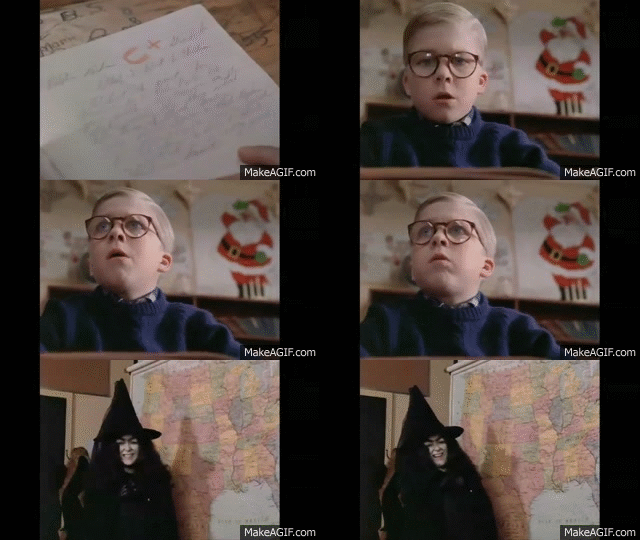
OK in all seriousness I'd have to give it a B or B+. Yeah, we missed out on more snow which was indeed frustrating, but it's hard to top the 2 straight weeks below freezing, deep winter. And "snowcrete" was pretty cool, 5-6" snow with 2" sleet on top that turned into a solid layer that went nowhere for a long time. I could literally walk on top of it without pushing into the snow. And though we missed the big snow for February, I still got 3-4" when it fell at a good clip for awhile in the evening. Not to mention, the amazing turnaround with 80 degrees one day followed by half an inch or so of snow the next day in early March.
-
 1
1
-
-
-
9 hours ago, MillvilleWx said:
Normal temps this time of year are fantastic with the late March into April sun. I’ll gladly take that right now. I’m ready for spring (NOT SUMMER). I have my limits

Amen!! I'm fine with 60s to 70s or so right now, but mid-upper 80s? Not yet, please!!! We'll have plenty of days (weeks!!) with oppressive heat in the 90s-plus and high humidity, that's a guarantee. Days where you feel like you'll just wilt or melt as soon as the sun hits you!
I remember all too well the late spring and summer days when I was at Florida State University for grad school. Now THAT is oppressive, day in and day out with no break! It was always a sad day when that last cold front would go through north Florida sometime in early May...you knew there wouldn't be another one to bring in more refreshing air until nearly October!!
-
 4
4
-
-
5 hours ago, PrinceFrederickWx said:
I need to change my screen name since I’m moving out of Prince Frederick, but it says I can only change it once every 30,000 days. Can anyone help me?
Not sure if you changed it once already, but yeah, there's some ridiculous amount of time to then change it yet again on one's own I believe (it's possible to do it once, basically, on your own). So I'm guessing that you had changed it sometime awhile back, thus got the "30,000 day" denial or something like that when you tried again more recently. I'm sure perhaps a mod would be able to go in there and change something to let you do it again.
ETA: I'm tempted to suggest that you change your name to "The User formerly known as Prince[FredericWx]"!!

-
 1
1
-
-
3 hours ago, TSSN+ said:
Try again in 82 years

-
 2
2
-
-
8 hours ago, Maestrobjwa said:
Why is it always the GFS starting crap, bruh lol
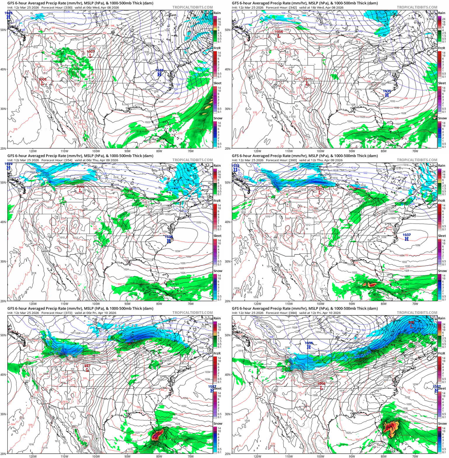
Just you wait until we see a tropical system near the Bay in late July that drops 24"+ snow on us for a cycle or two!!!

-
 1
1
-
-
-
12 hours ago, stormtracker said:
Gentelmen and Ladies,
It's been a pleasure to track with you guys. We've had good times, bad times and Houston times. I love this forum. We truly are the best subforum here. It's been an honor tracking our digital blue. But now has come to the time to admit defeat. It's over. We move to spring and I move to my hibernation until something big happens around here. It's been fun, but kind of lackluster outside of snowcrete. We'll get 'em next year. Peace out and RIP Roger Smith.
Driving the bus into the sunset. Until next time nerds.
And thank you for keeping the faith, for the fun PBP (guys, folks...jaws!!) and commentary, and of course for being a Beethoven music lover! Until next winter then!
-
 5
5
-
-
2 hours ago, stormtracker said:
Been busy all day. It’s happening. One more adventure guys. One more folks.
-
 1
1
-
-
March 32nd snow is the best!!!

-
 2
2
-
 1
1
-
-
2 hours ago, mitchnick said:
Thought I'dpost this off the 12z Gfs before @CAPE does. Lol
Dammit, you made me look!

-
 1
1
-
-
12 minutes ago, stormtracker said:
I just issued a Fail Watch.
The anti-FOLKS!!!
-
 1
1
-
-
3 hours ago, yoda said:
The 70 degree temperatures have captured me

Et tu, Yoda? Say it ain't so!
-
 1
1
-
-
1 hour ago, aldie 22 said:
That tracks I'll be in Charlotte on those days
LOL, by then you may be in the bullseye there! You can find an Irish Pub in Charlotte to toast the St. Pat's Day storm!!
-
10 minutes ago, Stormchaserchuck1 said:
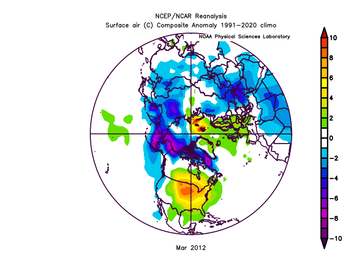
Interesting. Looks like most of the cold was on the other side of the hemisphere, as well as that strip of colder across northern Canada and AK. I would imagine given that distribution, a huge and persistent ridge over the eastern half to 2/3 of North America and another over much of Europe/Scandinavia (though not as warm there).
It's kind of reminiscent of how warm December 2015 was here (similar warm departure). I'm just grateful we got those large departures in December and March, and not a +9 in July!!!
-
 1
1
-
-
27 minutes ago, Stormchaserchuck1 said:
I feel like we've been tracking this warmup forever. NWS has DC hitting 83F on Wednesday! While it's still technically Winter!
Well, I recall March 2012 was insanely warm (+9 departure at DCA for the month), DCA hit 80+ degrees four times. Only two nighttime lows at or below freezing, the rest were well above. The cherry blossoms were essentially finished blooming by St. Patrick's Day since they came out very early. I believe that was an extremely warm month for much of the eastern third of the country.
(ETA: In fact, I remember seeing that some location in upper Michigan had a low temperature one day that was a few degrees warmer than the previous record HIGH for that particular date; it also of course broke a new record high).
-
 1
1
-
-
4 minutes ago, CAPE said:
I'm not opposed to it. There are some things to like about the LW pattern on the ens means. I posted about it yesterday. Op run snow maps tho..

I know, its what the kids like. (and Will)

-
 2
2
-
 4
4
-
-
5 hours ago, CAPE said:
Yeah I figured. NBD. Just odd. I'll post my grade here when Winter is actually over lol
You mean it isn't already?! But seriously, yeah, we've got through mid-March typically and some years even longer. Wouldn't be surprised if we get even something small before it's over.
-
3 hours ago, stormtracker said:
It’s happening.
Even if it does happen, I still wouldn't ever vote for Ron Paul or Rand Paul...However, RuPaul may be more entertaining!!!

-
Concerning any potential last snow event around mid-month/St. Pat's Day...


-
 3
3
-
-
35 minutes ago, BristowWx said:
I think you are suffering from weather related Tourette’s syndrome. I know what that is because I shouted fuck the NAM at church last Sunday.
Be sure to say three "Hail DGEXs" and douse yourself in sleet as penance!
-
 2
2
-
-
5 minutes ago, stormtracker said:
We truly might be out of gas and time. We’ve had miracles in less lead times tho. I’m arranging the deck trains and playing my violin. If we go down, might as well go down with glory. Let’s bring whatever this is home.

-
 2
2
-
 1
1
-
-
53 minutes ago, stormtracker said:
I was about to roast him, but I just let it go. It's like there are no examples of where it was 70 before a major snowstorm and the snow stuck just fine.
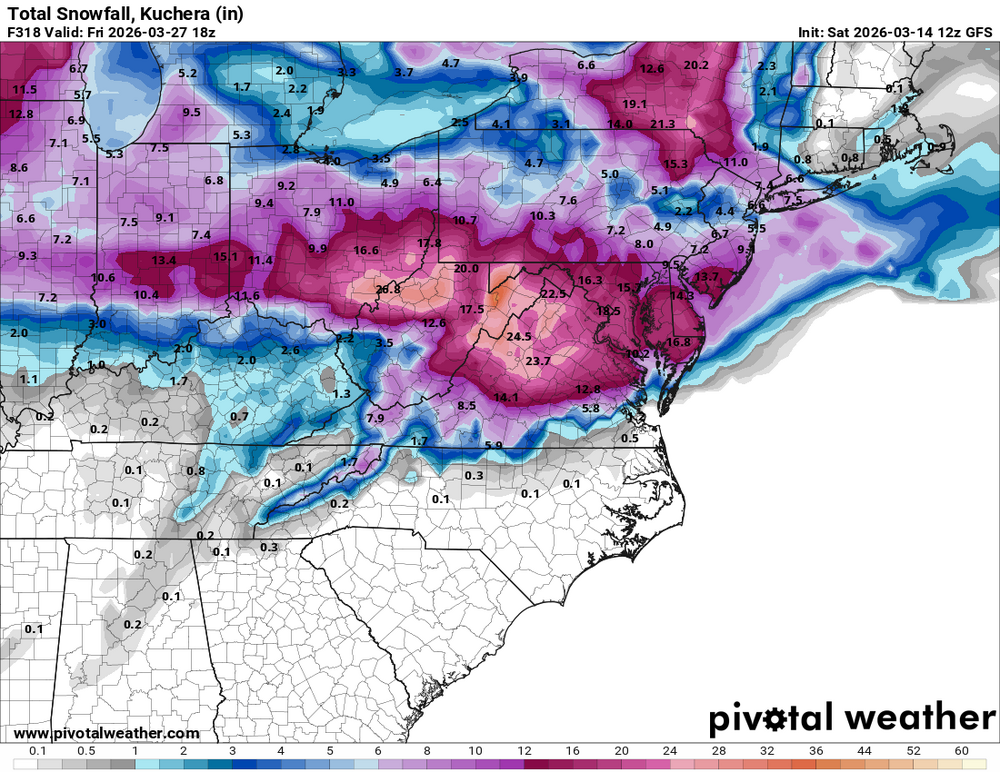
Yup. There were some pretty warm days the week leading into the St. Patrick's Day storm in 2014, and that was 2 weeks later too. Yeah a lot of that fell at night but it started in the afternoon and continued into early the next day. Plus, it was below freezing the entire following day. Not to mention the event on the 1st day of spring 2018, it was cool leading into it (below normal) but not extreme, it was the 3rd week of March, and that snow all fell during the daylight hours. And of course, March 2015 (same approximate time as this upcoming potential, 1st week of the month), where it rained the night before up to the morning of the event as a front went through, then a wave that went up the front dumped 6" snow on us...again, during the daylight hours as it turned colder.




April Banter 2026
in Mid Atlantic
Posted
Happy Easter, happy spring to all! And @mappy, here are some tulips for you!!