

MAG5035
-
Posts
5,884 -
Joined
-
Last visited
Content Type
Profiles
Blogs
Forums
American Weather
Media Demo
Store
Gallery
Posts posted by MAG5035
-
-
1 hour ago, AccuChris said:
CTP had an interesting take and write-up this morning about the ongoing disagreement within the models. They point to the more suppressed models focusing on a mid-level vort in northern New England enhancing drier advection from Canada versus the HRRR which cant even see that in its domain. Time will tell as always
“Still quite a bit of uncertainty with 18 hours or less until
first flakes. The ECMWF and Regional Canadian models are on the
lower end of the snowfall total spectrum. Part of the reason
for this might be that they both develop a stronger midlevel low
pressure system over northern New England late Monday from a
shortwave trough originating east of Hudson Bay at 00z Sunday.
This could act as a kicker to bring in drier air more quickly
and shorten the window for moisture advection early Monday
before the Mid Atl coastal system gets nudged offshore. This
shortwave trough is outside the domain of the hires models (HRRR
and 3km NAM) and will remain so until the 00z Monday runs.
Given that the HRRR and 3km NAM together make up about 1/3 of
the NBM weighting in this time period, IF this Hudson Bay
feature is indeed responsible for the lower snow totals in the
ECMWF and Canadian models, it`s certainly possible that we see a
shift south in snowfall totals over the next 24 hours. That
said, the HRRR does represent the worst case scenario, with
warning criteria (6+ inches) across much of central PA from I-80
southward, which can not completely be ruled out at this point.”
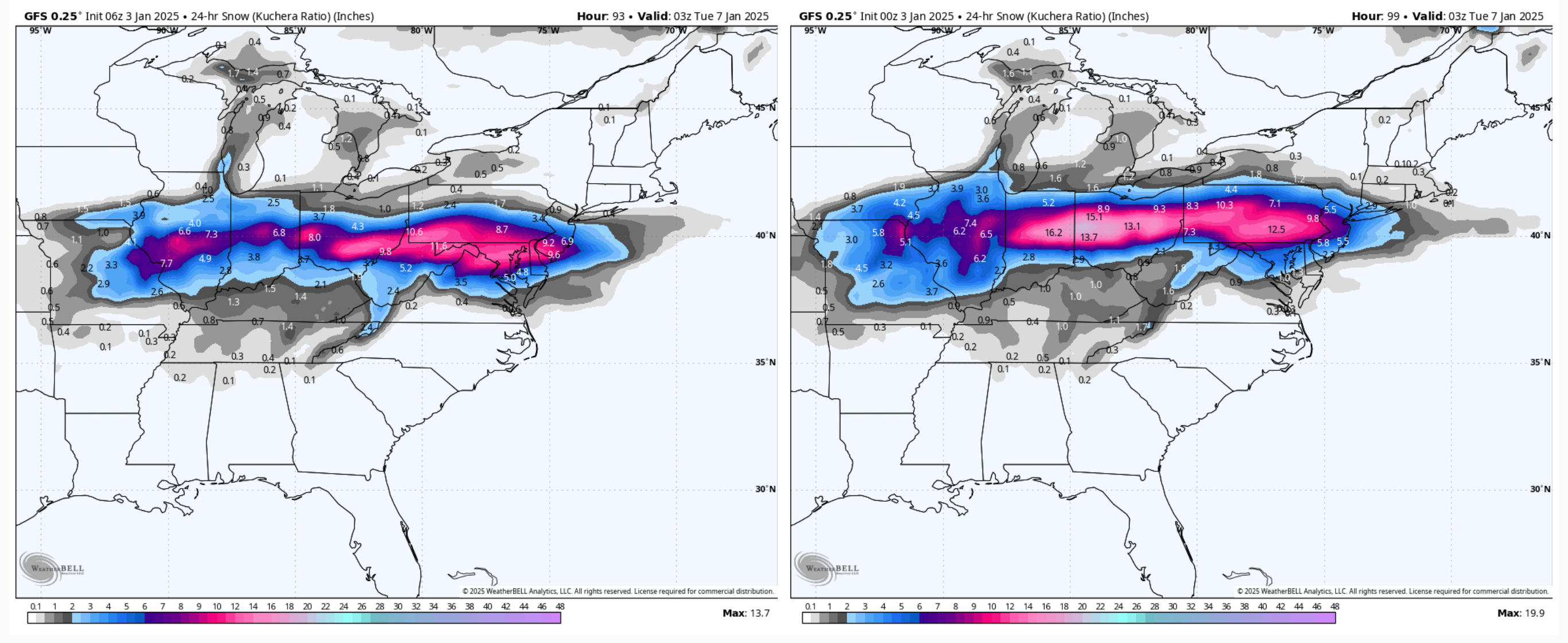
.Here’s what CTP is alluding to in their AFD on the 500mb prog with a GFS vs Euro comparison (using the 6z run). I x’ed the vort responsible for our storm and the one over northern New England. The arrows indicate the flow, and they converge (aka confluence).

I did notice this feature yesterday scrutinizing the 12z models. At that point track and precip expanse was similar on the Euro v GFS but the Euro wasn’t bringing the heavier precip up. That feature above New England was not nearly as prominent on the GFS as the Euro. And as you can see today, both models now have it (A Euro win).
I can only go back to 18z yesterday on the comparison, but here’s the 6z GFS (new 12z run is similar) vs yesterday’s 18z run. X’s again denote the shortwaves and arrows illustrating the confluence on the left. Now look at the right one in the circled area (yesterday’s 18z). No closed off low with that shortwave above New England.

The flow speeds up in a confluent pattern, and thus as CTP mentioned would limit the window for moisture advection. As I mentioned yesterday, the WAA precip phase was going to be the primary part of the event for most in here outside of the far southern tier (which could catch the back end of the shield with the upper feature passage). So it’s not really an issue of north or south with the actual storm, models have been similar with expanse of precip. It comes down to simply being a more progressive event here, which lessens QPF. Honestly, a good catch and call by CTP IMO by factoring that in their accum forecasts (since high res won’t account for it til 0z) . Now that doesn’t mean we can’t get some north trend back to a degree, but that’s their reasoning for their headline placement… which is solid at this juncture. I think there’s still room to expand advisories a bit, and maybe the LSV advisories to low end warnings. This affects the heavy swath to the south too, as I think we’re back to the ceiling of a general 6-10” event (maybe some 12s) in the axis of heaviest.
-
 6
6
-
-
1 minute ago, mahantango#1 said:
Relax, he will have 2 more maps(2nd call and final call)...and possibly more 8in.contours to confuse you more.
The start time spaghetti plot is where it’s at lol.
-
1
-
 4
4
-
 1
1
-
-
14 minutes ago, MAG5035 said:
And speaking of CTP, since there was great consternation here (and esp on social media lol) with the rather generous ranges that map product of theirs cranks out. If you select point instead of range you’ll see a much more straight forward map.
Actually to further on the NWS and one wanting to get into the reasoning of what they’re putting out product wise, when NWS Pittsburgh issued watches for their CWA last night and posted that to their social media (Facebook). I saw this in the comments.
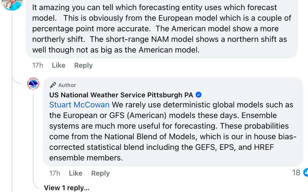
Definitely a candid response, whether CTP subscribes to that method precisely like PBZ does (rarely using deterministic) I’m not sure. But their map products are heavily derived from that NBM nonetheless.
-
3
-
 1
1
-
-
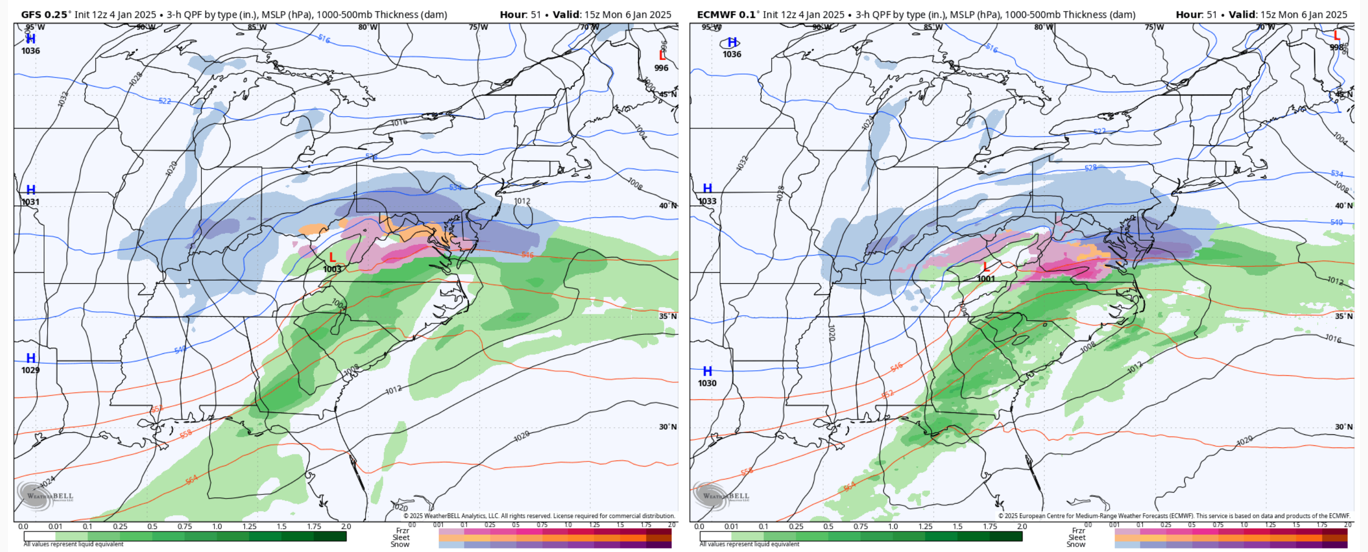
From a northern expanse standpoint, GFS and Euro are pretty close. Where they differ is in the intensity of the WAA precip.

It’s an important aspect for us because that’ll be the majority of the event up here in our subforum. Once that low transfers to the coast, it’ll pull the precip shield south and away and we’ll probably miss the back end of the shield that hangs back with the 500mb vort except for possibly the southern tier below the turnpike. That will further add to the DC/Mid-Atlantic folks’ totals. The short term/high res guidance has been coming in hot in the early going with regards to that surge of more intense WAA snowfall. So unless that changes wholesale as we get more into the nearer term, I’m more inclined to go with a more bullish outcome in the southern tier. I think CTP’s watch placement is fine right now.
And speaking of CTP, since there was great consternation here (and esp on social media lol) with the rather generous ranges that map product of theirs cranks out. If you select point instead of range you’ll see a much more straight forward map.

-
2
-
2
-
-
2 minutes ago, mahantango#1 said:
So with this model JB might be on to something.
Perhaps, NAM is putting out 0.6”-1.0”, with the 1.0” or so being near the DC area… which is probably about the limit given this system not really having a chance to wind up to any kind of full fledge coastal.
If this is going to actually crank out a swath of 10-15” amounts it’ll be due to ratios.. which may actually benefit the southern tier. In the NAM’s positioning, best mid level forcing would likely be in the southern tier which could enhance ratios thru more efficient snow growth further aloft. It’s already a pretty cold column as is, with the Kuchera method (which doesn’t account for actual snow growth processes) calculating 15-16:1 ratios for AOO/JST/MDT/THV/LNS. Could be a band(s) somewhere in there that may even best those ratios. Obviously a further south solution takes those dynamics south of the M/D line.
-
3
-
1
-
1
-
-
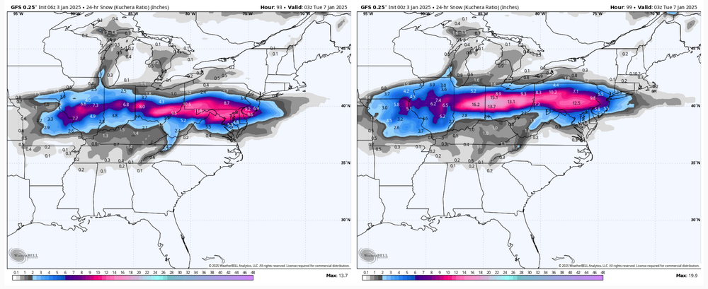
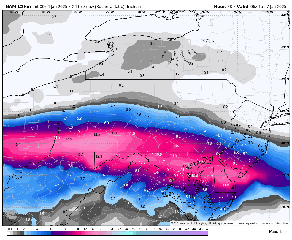
The NAM is indeed a winner for most, but it also has one heck of a cutoff near I-80 in central and I-78 in eastern.
-
5
-
1
-
-
5 minutes ago, WmsptWx said:
You're the only person I know of crazy enough to ski on that sheet of ice. They've gotta be having a banner start. Are they at 100%
4 trails open right now lol. Presuming they get a clean event Monday and a half decent amount of snow on top of the LES/upslope, it might actually be a good up there next week.
-
It can keep doing this up in Blue Knob, they’re under a nice band right now.


-
4
-
-
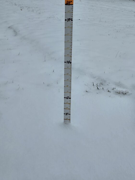
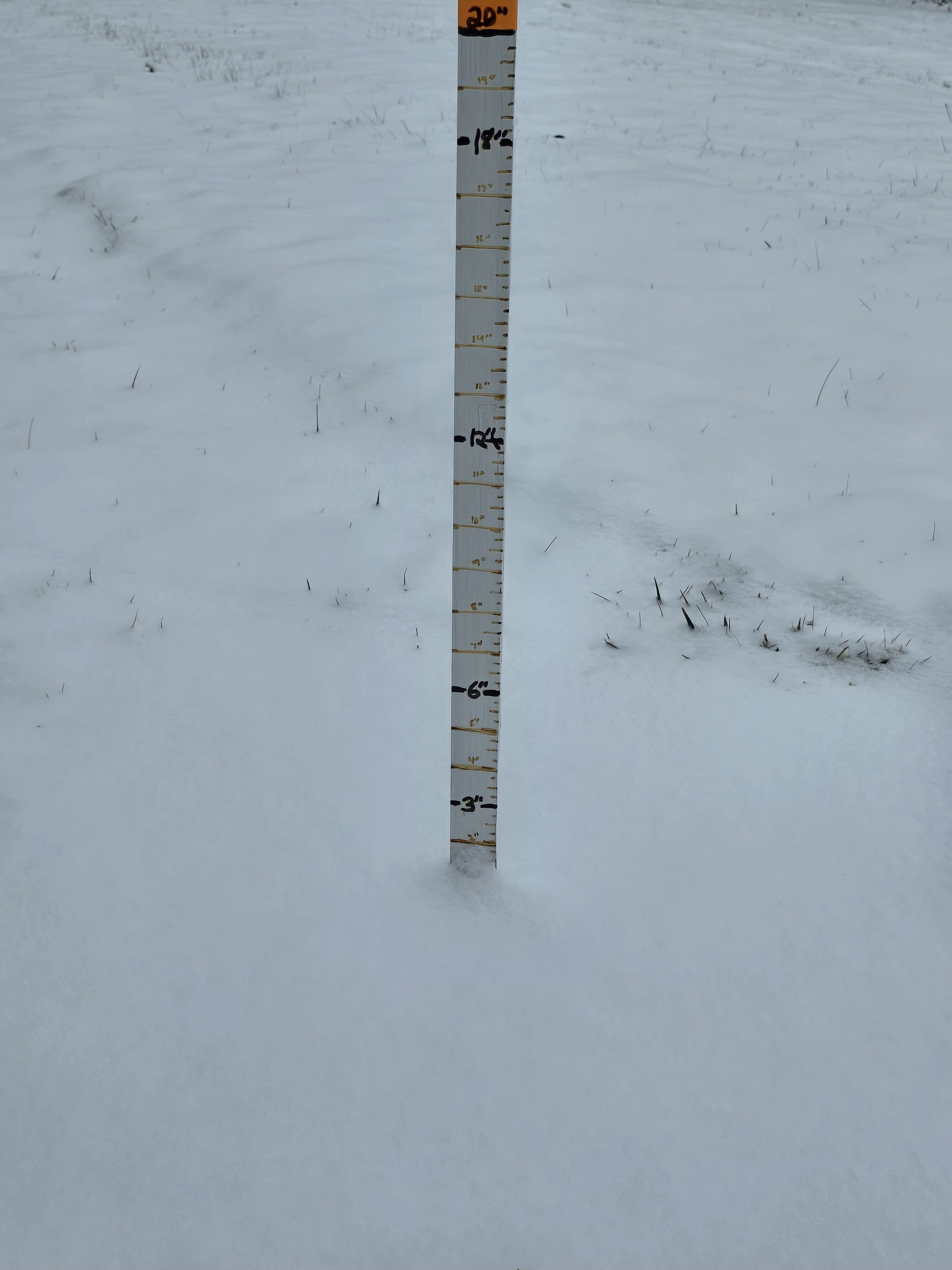
I’m not home today but here’s the situation there. Some of the snow on the ground is from the inch of wind driven squalls we got New Year’s night.
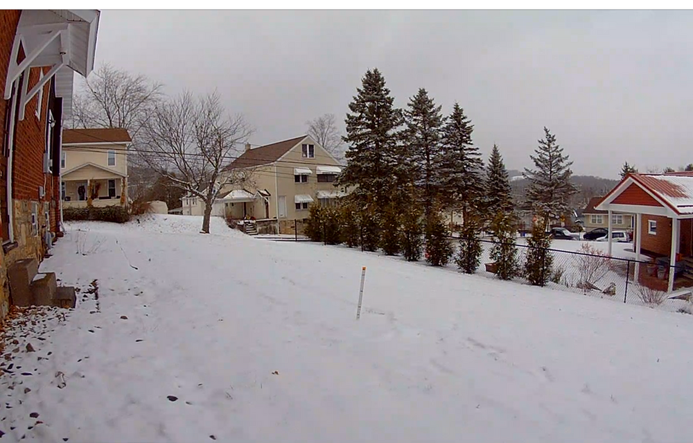
I called in for an official close up measurement of the snowboard haha, about an inch today so far with the snow squall warned stuff still incoming.
-
3
-
-
56 minutes ago, Itstrainingtime said:
Flurries and 33 in Maytown.
Most important thing I saw from the Euro is it didn't move further south.
I’m not budging from my original thinking quite yet of advisory snows I-80 south and warning snow potential in the bottom two tiers of counties across C-PA. I may eventually concede one or both of those tiers but I want to see the short range play out more, as we’re just barely into range of the NAM/RGEM and not even into the longer HRRR range. That stuff is going to see how the overall precip shield sets up better. I think we’ll still eventually see a more widespread snow shield into PA even if it’s lighter snows and we concede the whole swath of 6”+ to the DC folks. But if that happens the northern tier above 80 and especially NE PA might not see much.
Other thing to consider may be a secondary swath of higher snowfall due to better ratios. Lift would be further aloft (700mb level or a bit higher) in a further south solution and temps are plenty cold up there for good snow growth in that scenario with this storm and on down the column as well (less than -8ºC at 850mb on the Euro).
-
5
-
1
-
-
12z Euro is a little bit better than 6z for the southern tier, otherwise still adamant on heaviest swath all the way between DC and Richmond. We shall see how it’s ensembles look.

-
2
-
1
-
1
-
-
17 minutes ago, Blizzard of 93 said:
The Euro went south, but the NAM, ICON & GFS say otherwise.
Still a long way from consensus.
The GFS definitely shifted south from its 0z position, as did the GEFS (probably an even bigger shift in its snow axis). Might not make much of a difference for most currently, but it def does for our northern folks and Voyager. It was probably a bit too far north the last couple runs, but hopefully we can get the Euro to shift back to meet in the middle. Was just looking at the RGEM and that’s pretty low too with it’s heavy snow, but has more of a widespread lighter snow swath.
6z vs 0z GFS op
-
3
-
-
1 hour ago, Itstrainingtime said:
Both the Ukie and Euro are uhh...south.
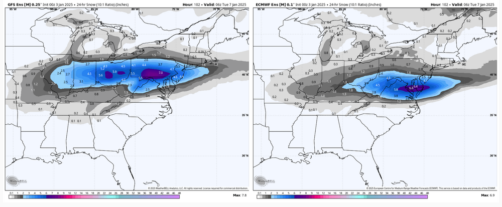
Euro ensembles are supporting the Euro op as well. Definitely a large difference between them and the rest of the suite this cycle for our region. But even the Canadian still had good snows across most of C-PA despite having the heaviest swath just south. WB never updated the UKMET to 0z for me but it sounded like that was even further south. Euro itself makes this nearly a non event north of the turnpike. In terms of the 0z cycle the Euro suite is a south outlier with the overall snow swath, and that’s including the NBM (National Model Blend). It’s not storm tracking without a model battle of course.
0z GEFS vs Euro Ens
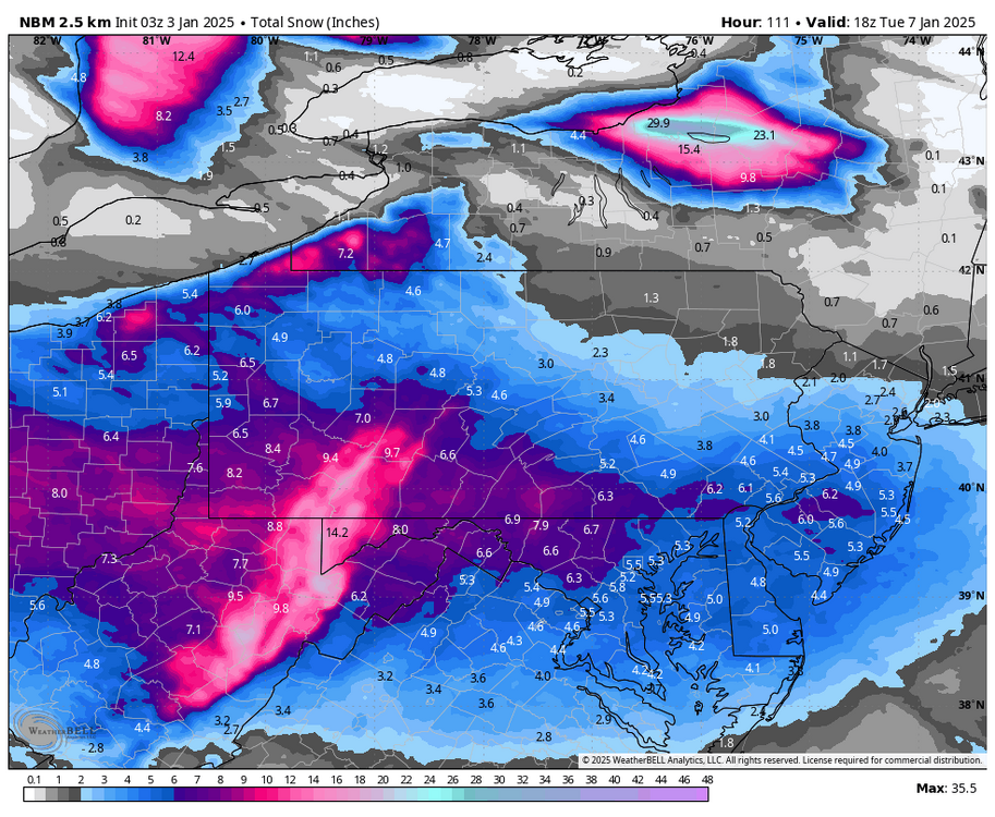
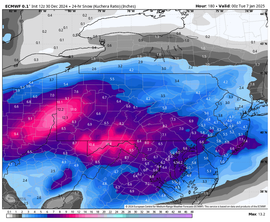
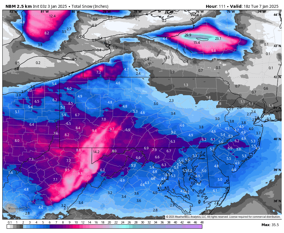
Here’s the 03z NBM (National model blend), and I don’t have 24 hr snowfall for that product so had to use the total snowfall. Outside of the Laurels, SW PA and the NW PA snow belt tomorrow’s event adds an inch or less east of the mountains to that total. Adds 2-3” in SW PA and probably 3-4” in the NW PA snow belt. Honestly, that looks like the best compromise at the moment and pretty much in line with my earlier post with my early thoughts on accums. We shall see how things trend.. we’re still at D4 out from this event.
-
4
-
-
11 minutes ago, WmsptWx said:
Goodbye, Georgia.
Ouch lol, completes the sweep of all four bye week teams.
-
I like where the majority of our subforum sits for this event. Given the setup downstream there’s really only so much more this thing can trend north IMO. Our wave tomorrow, which blows up off the coast and ends up being the deep 50/50 low that forces the trajectory of the main system flat, additionally brings in deep reinforcing cold air to be in place preceding. Even the GFS keeps surface temps about 25-26ºF at best during the storm in the LSV, with the Euro maybe a degree or two colder. It’s no blizzard of 96 or anything, but certainly not a marginal setup temp wise. Temps on up the column are plenty cold as well.
I’m not currently worried about any meaningful mixing in PA. DC perhaps, but not after they likely see their biggest snowfall of the last few years. Even there I think the column mostly holds. Worst case is if this trends towards an ICON type track is some mixed for a time along the M/D, but probably with sleet as the dominant mix type.
Rough thoughts on accums right now would be most of PA sees 1-2” with solid advisory I-80 south and the axis of 6”+ residing somewhere between the M/D line and the turnpike with the bottom two tiers of counties in good position for potential warning snows. I think the ceiling east of the mountains is a 6-10” type event for the most part, with bigger totals in the Laurels and/or western MD Alleghenies.
-
7
-
4
-
-
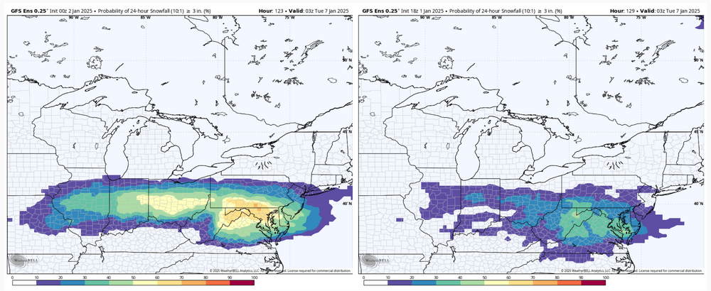
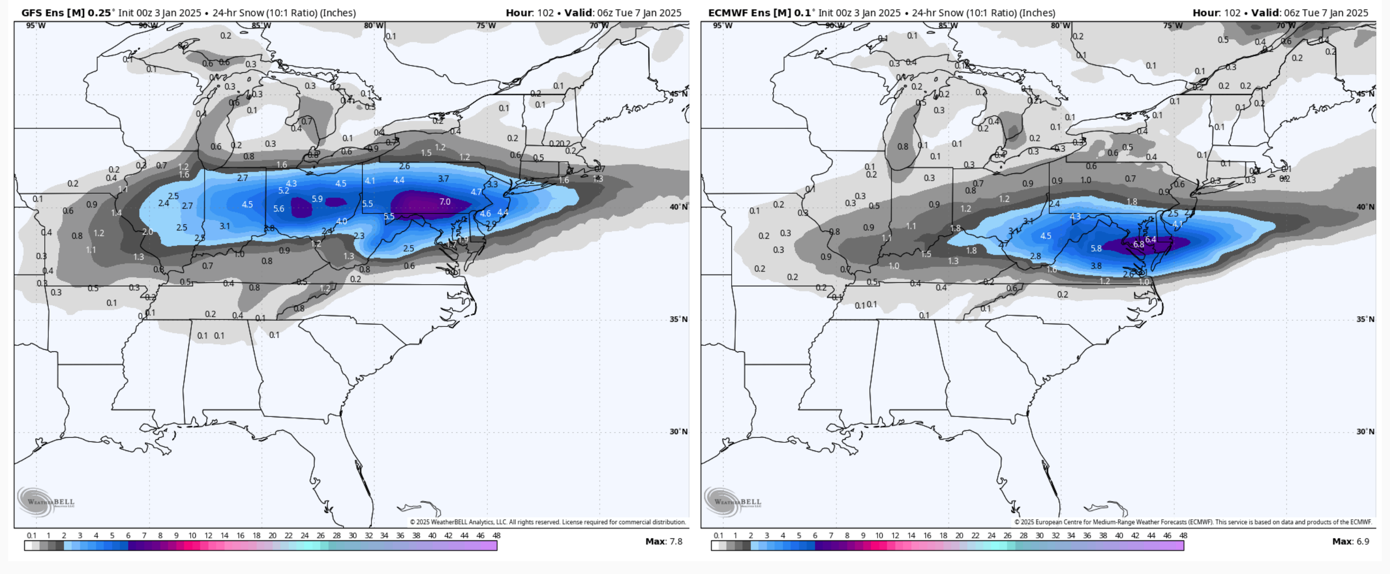
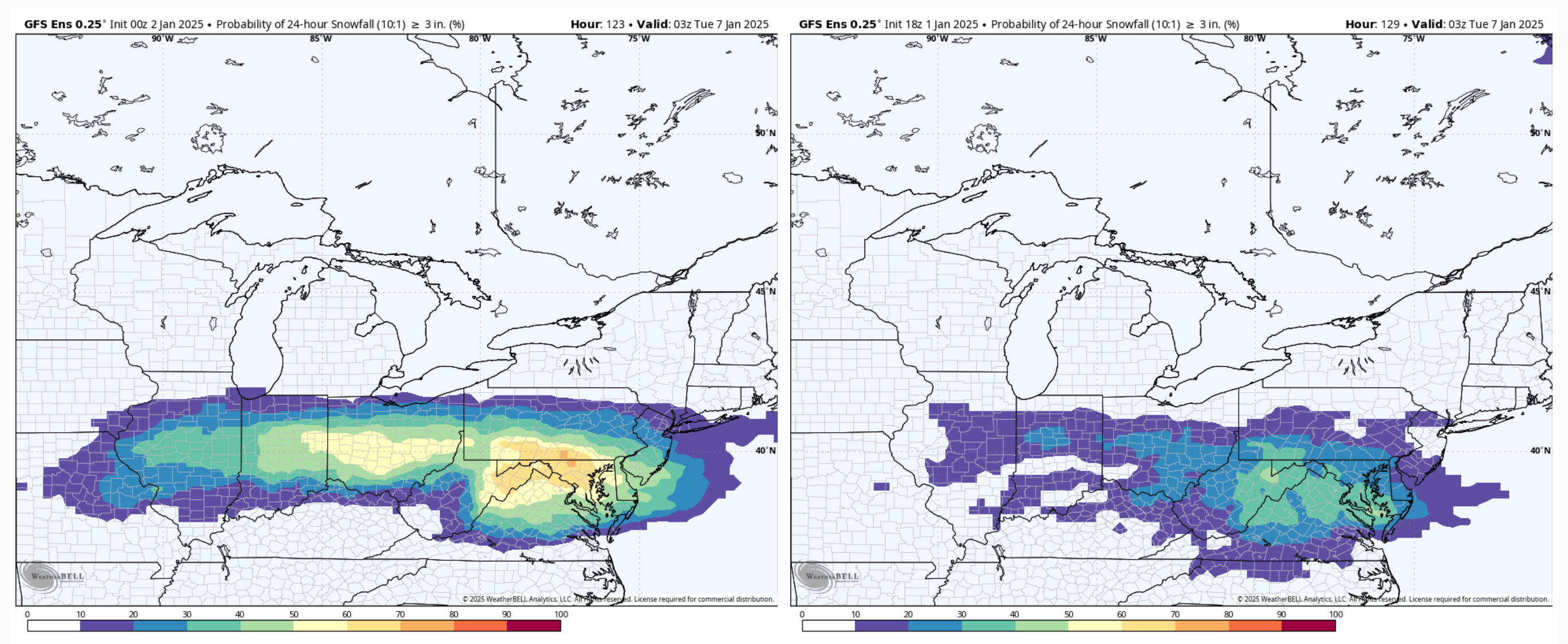
GEFS probs of 24 hr snowfall greater than 3”, 0z vs 18z. Big difference vs 18z although the 12z GEFS had similar swath placement to the current 0z run (but lesser probs). Stuff starting to dial in.
-
2
-
-
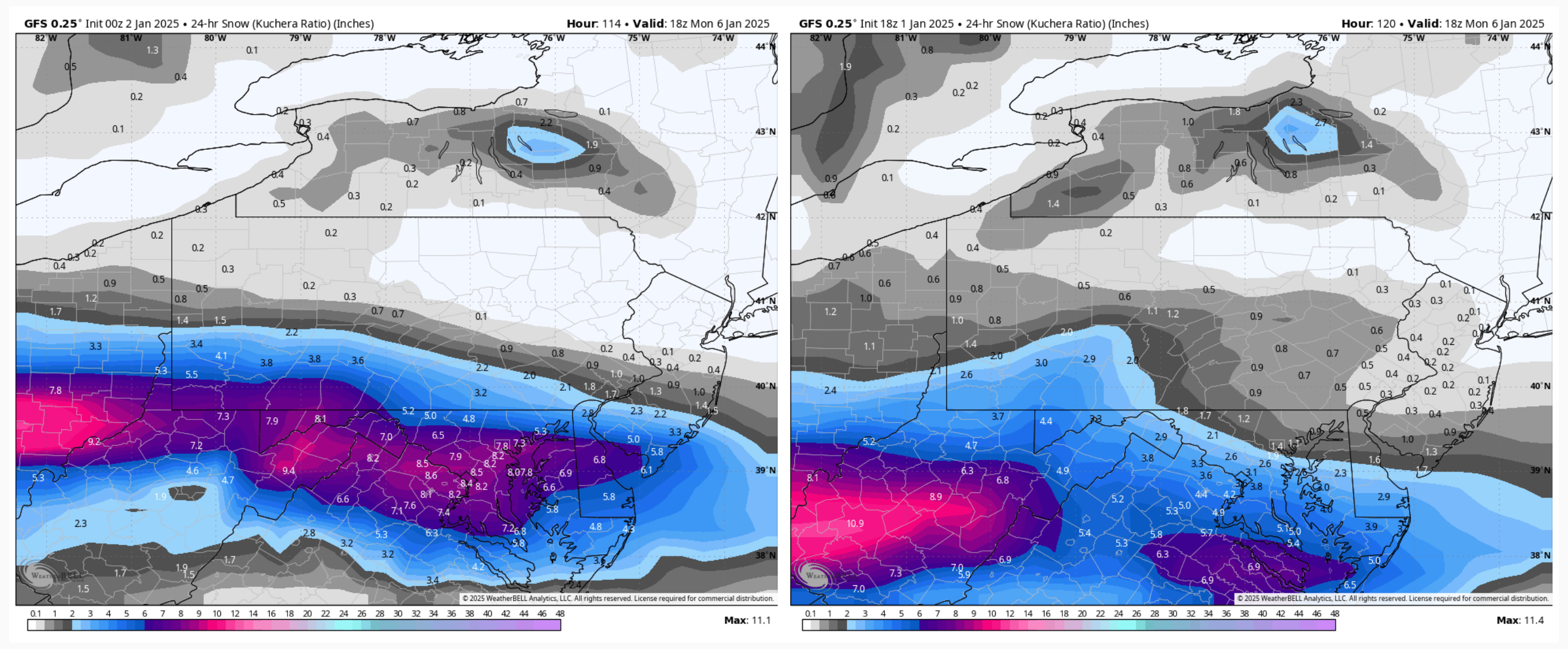
GFS definitely coming in more amped and north than 18z, which brought a more significant snow swath further north. At the same time really tightens the gradient of the snow swath.
0z left, 18z right

-
1
-
-
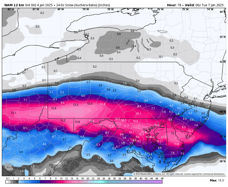
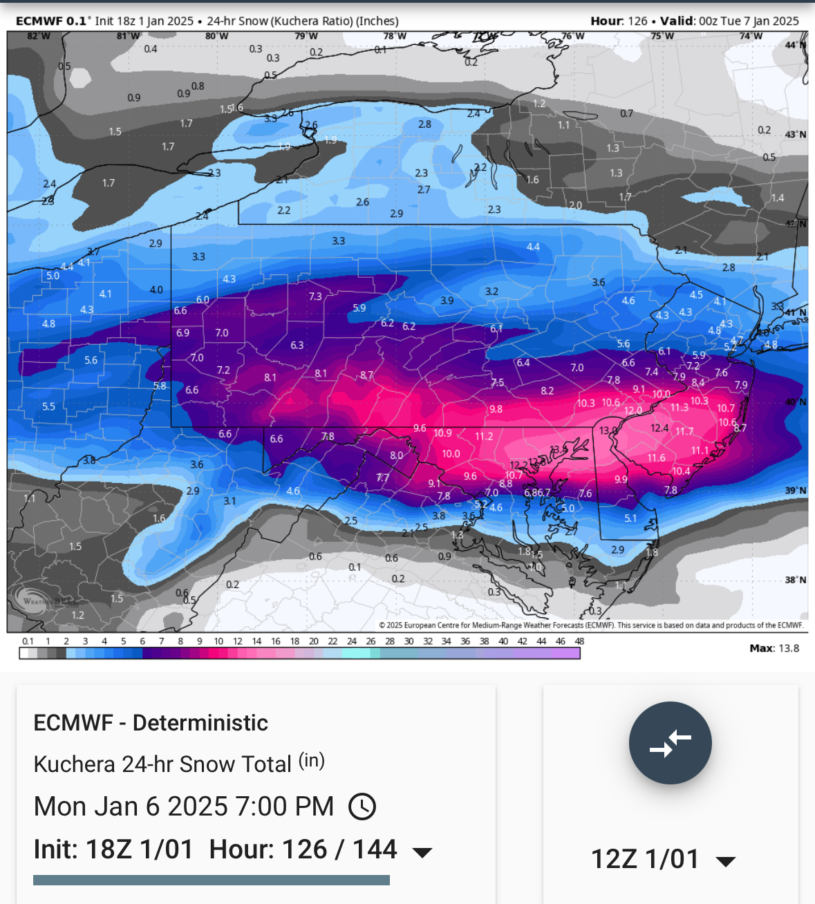
Here’s the snow map (24hr kuchera)
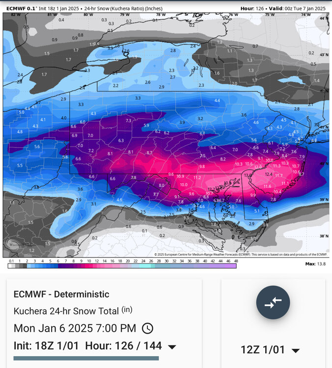
Solution looks similar to that further north solution the UKMET had been pushing the last few runs.
-
5
-
-
20 minutes ago, Itstrainingtime said:
Yeah - there is a lot of football left in this game, I felt like this was a classic retribution game. Oregon barely (barely) won on their home field. I think if they played 10 times Ohio wins at least 7-8 times.
Might end up being the biggest blowout of the quarterfinals at this rate.
-
1
-
-
Wagons back north on the 0z GFS for 1/6, decent snow swath I-80 south.
-
5
-
1
-
-
You guys are getting good practice in for storm mode model play by play lol.
-
3
-
-
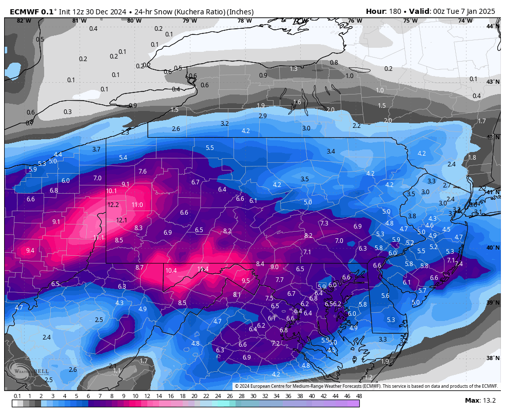
1 hour ago, Bubbler86 said:
Yea, I had edited my post that Kuch would be high. I saw a WB map but was not going to quote that. It was 2-4" higher than this map.
I’ll quote it, with 24 hour precip/snowfall
24hr Kuchera
24hr total QPF:

I’m not gonna go too crazy with mathing all the locations but MDT’s 8.2” at 0.5” is about a 16:1 ratio… which is somewhat better than January climo. The 12z Euro had a very cold column with this event, with the -8ºC 850 isotherm never getting above MDT and surface temps in the low to mid 20s area wide. Definitely cold enough for better than climo ratios. Just strictly interpreting what the model is outputting, I’m okay with those higher snowfall numbers.
Whether thats the actual solution is obviously debatable at this range. It seems that guidance wants to bring more of this energy out front to make the main system in the 1/5 to 1/6 timeframe. We don’t have the 500mb alignment the whole way in place yet (western ridge asis off the Pac coast).. a stronger system that phases more energy in would likely cut. The GFS actually does cut the low but it’s weakening into what will be a decent antecedent cold airmass so result would probably be a majority frozen event for most here but mixing would be on the table. The Euro managed to get the low just underneath PA to a coastal transfer. If this is going to be the main system to get us here in C-PA, that’s probably the ideal solution.
30 minutes ago, Bubbler86 said:From the 0Z EC to the 12Z, the temp on the morning of 1/11 went from -8 at Harrisburg to 17.
Euro has been a bit inconsistent, big difference between it and the GFS at 12z. Very little blocking in the NAO realm and also trying to hang troughing back into SW (Euro bias)
12z GFS v Euro

Euro ensembles are more in line with GFS/GEFS. Still weaker in the NAO realm like the Euro op but big difference in not really supporting the Euro op’s trough digging in the SW
12z GEFS v Euro EPS

Pretty far out in range yet, but I’m leaning cold given the general consensus right now. Models have been targeting that 1/10 to 1/11 timeframe for a major arctic shot more often than not so far.
-
6
-
-
Well GFS not a one hit wonder as the 0z has another run with a big storm near the 1/8 to 1/10 timeframe. Sort of redistributes energy away from any noteable in the 1/6-7 timeframe to make for the bigger storm a couple days later (but definitely faster than the 18z storm). Range is obviously way out there, but got to start somewhere for a storm signal. Definite potential in this timeframe. Now to see if other stuff starts seeing it (0z Canadian is a no for now)
-
1
-
-
Well if anything, that’s probably one of the best overall op runs of anything winter I’ve seen in a good while for at least another two hours.
-
1
-


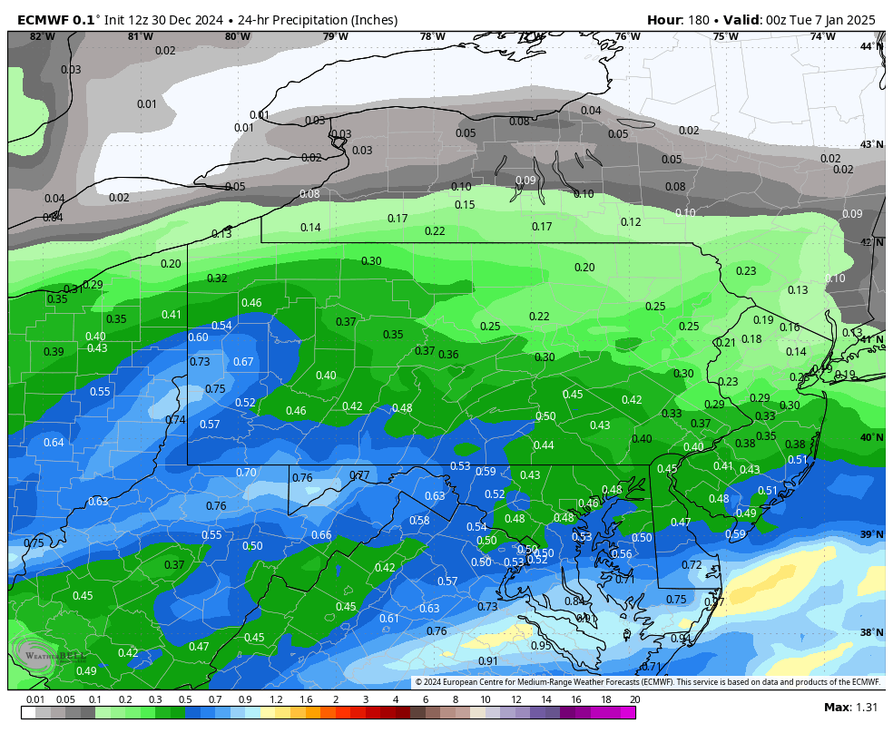


Central PA Winter 2024/2025
in Upstate New York/Pennsylvania
Posted
One thing at the mesoscale level I noticed on the 12z Euro is that despite it remaining on the lighter side with overall snowfall it managed to have a secondary band of enhanced QPF that extended from Pittsburgh to Clearfield to Williamsport, giving our northern folks in those spots approx 2-4”. Stuff like that will be need watched for on the meso models as we get close to start time.