

BlunderStorm
-
Posts
1,235 -
Joined
-
Last visited
Content Type
Profiles
Blogs
Forums
American Weather
Media Demo
Store
Gallery
Everything posted by BlunderStorm
-
Since 1 the snow has been falling up this way. Closing in on 3 inches thus far! At this rate it will be the biggest winter event so far for the season.
-

Jan 11-12 Mississippi Mauler: Will it or won't it?
BlunderStorm replied to John1122's topic in Tennessee Valley
Little over an inch and winding down. 36 and Mix. Very slippery haha.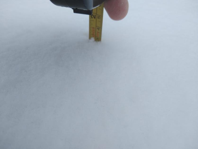
-
Jan 11-12 Mississippi Mauler: Will it or won't it?
BlunderStorm replied to John1122's topic in Tennessee Valley
Status Update: Directing Dad... -
Jan 11-12 Mississippi Mauler: Will it or won't it?
BlunderStorm replied to John1122's topic in Tennessee Valley
About 2/3 of an inch on the ground now with visibility down to a quarter mile. Fun surprise! -
Jan 11-12 Mississippi Mauler: Will it or won't it?
BlunderStorm replied to John1122's topic in Tennessee Valley
-
Jan 11-12 Mississippi Mauler: Will it or won't it?
BlunderStorm replied to John1122's topic in Tennessee Valley
Flurries up this way this morning interestingly. So far a trace has accumulated on the frozen ground. -
January 7 - 8 ULL obs and nowcast
BlunderStorm replied to Holston_River_Rambler's topic in Tennessee Valley
Roads are white, grass is getting blanketed with Nickels and Dimes falling. Nearing an inch on the ground with plenty more to go! Currently 32F. -
January 7 - 8 ULL obs and nowcast
BlunderStorm replied to Holston_River_Rambler's topic in Tennessee Valley
It has taken a while but flurries are finally reaching the ground here. The air column was relatively dry here. -
Christmas Eve/Christmas 2020 Arctic Express Snow Obs.
BlunderStorm replied to John1122's topic in Tennessee Valley
I took that measurement in NE Russell at 8:15 on Christmas Eve. A final total would more accurately be 4.2" haha. -
Christmas Eve/Christmas 2020 Arctic Express Snow Obs.
BlunderStorm replied to John1122's topic in Tennessee Valley
Final Snowfall Total for the synoptic snow and Christmas Eve as a whole is roughly 3.8". It's been a fun lead up and I'm glad I was able to participate and contribute to this storms forecast and obs threads. If significant NW flow snow happens I'll be sure to give yall an update. Until then Merry Christmas and Goodnight! -
Christmas Eve/Christmas 2020 Arctic Express Snow Obs.
BlunderStorm replied to John1122's topic in Tennessee Valley
End of the synoptic snow for here. Looks like some healthy NW Flow cooking in east KY headin this way. The Cumberland Mountains especially on the KY/VA line are notorious for wringing them dry by the time they reach the valley though. Fingers crossed for SWVA and TRI posters and lurkers. With a modified arctic air mass maybe we cash in. -
Christmas Eve/Christmas 2020 Arctic Express Snow Obs.
BlunderStorm replied to John1122's topic in Tennessee Valley
First Gallery of pictures! Measurements coming later tonight! 2.5" as of sending! -
Christmas Eve/Christmas 2020 Arctic Express Snow Obs.
BlunderStorm replied to John1122's topic in Tennessee Valley
A well earned one at that. It's been awhile haha! Been going in and out of the house like a pendulum. -
Christmas Eve/Christmas 2020 Arctic Express Snow Obs.
BlunderStorm replied to John1122's topic in Tennessee Valley
Snow's falling nice and steady like out of the scene of a Christmas card. 2 inches have accumulated on the ground with more to come! Including pictures! -
Christmas Eve/Christmas 2020 Arctic Express Snow Obs.
BlunderStorm replied to John1122's topic in Tennessee Valley
Just started here and man I'm hyped. Perfect day for a snowstorm! -
Christmas Eve/Christmas 2020 Arctic Express Snow Obs.
BlunderStorm replied to John1122's topic in Tennessee Valley
Currently 35 and moderate to heavy graupel/sleet! -
Christmas Eve/Christmas 2020 Arctic Express Snow Obs.
BlunderStorm replied to John1122's topic in Tennessee Valley
(Note: Ignore the time I recently reset it and yes I was standing outside with that xD) -
Christmas Eve/Christmas 2020 Arctic Express Snow Obs.
BlunderStorm replied to John1122's topic in Tennessee Valley
I'd say it will be. I for one am just glad the radar filled in and it wasn't a mirage! -
Christmas Eve/Christmas 2020 Arctic Express Snow Obs.
BlunderStorm replied to John1122's topic in Tennessee Valley
A mild 51 and drenched in Honaker. Can't wait for the fronts arrival to absolutely crash temps through the floor. -
Fall/Winter Banter - Football, Basketball, Snowball?
BlunderStorm replied to John1122's topic in Tennessee Valley
Alternate Version of my reaction to the 12-24-20 0z Euro Kuchera map.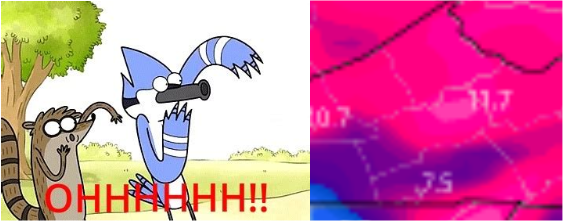
-
Fall/Winter Banter - Football, Basketball, Snowball?
BlunderStorm replied to John1122's topic in Tennessee Valley
Non-Rushed Dandridge +3KM Version. -
December 2020 Medium/Long Term Pattern Discussion.
BlunderStorm replied to John1122's topic in Tennessee Valley
I've often wondered if they or another modeling site could implement a map of median snowfall among all the ensemble members for a run. It would prevent distortion from weenie maps and eliminate a lot of wide expanses of sub-inch totals. A single member with snowfall using the average means that areas will be listed with snowfall despite the vast majority of members having it out of the equation. Granted, the mean is still valuable in it's own right showing low likelihood areas still in play. -
Fall/Winter Banter - Football, Basketball, Snowball?
BlunderStorm replied to John1122's topic in Tennessee Valley
I think we're all used to getting shafted at this point which makes the potential for a white Christmas all the more alluring yet bothering. In my case, I can only help but feel snubbed the past few years especially with my local climate. Last having recorded a single day snowfall above 3" in March of 2018. Of course, I don't mean to whine and remain optimistic for any potential winter events ahead. Echoing the sentiments of others I am glad we aren't dealing with what we had last year. -
December 2020 Medium/Long Term Pattern Discussion.
BlunderStorm replied to John1122's topic in Tennessee Valley
Probably the most coveted window for snow in any year. We still have a good amount of variation in timings with the GFS and UKIE hitting earlier. If I had to guess at least in the GFS's case it has to do with it's bias. -
December 2020 Medium/Long Term Pattern Discussion.
BlunderStorm replied to John1122's topic in Tennessee Valley
Shhh...


