

HKY1894
-
Posts
190 -
Joined
-
Last visited
Content Type
Profiles
Blogs
Forums
American Weather
Media Demo
Store
Gallery
Everything posted by HKY1894
-
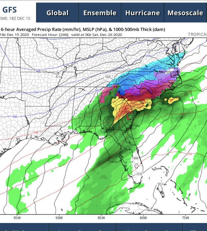
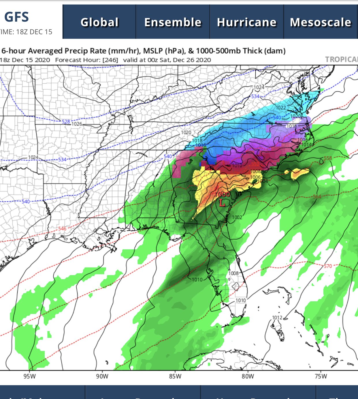
Interested in week leading into New Years. The -NAO means business
-
Christmas night snowstorm on happy hour gfs ...........we take
-
NAM is lights out along escarpment in NW NC
-
Opinions of chasing this to Winchester? I assume maybe Hancock or Hagerstown may be slightly better? Still don’t trust the mesoscale models yet for banding.
-
Looking good headed into first couple weeks of January. Think we will have chances to score big. Much improved from last winter
-
I want to chase this but it’s gonna be stressful trying to plan ahead to setup near best banding. Will have to make a decision by Tuesday.
-
Northern mountains looking good for midweek system. Gut feeling but this has consistently trended better today.
-
.........December 09 miller b style?
-
12z euro is interesting. Gfs is much different, if something like euro occurs I could see this trending better for climo favored areas in western part of NC. Blocking and hp to the north is classic cad setup
-
Thinking about chasing this up at beech, what times does it look to start? Trying to figure out when to get up there
-
Snowing lightly in boone starting to accumulate slowy 18z gfs is very interesting for this weekend, shows changeover to heavy snow as upper low moves over
-
All gonna come down to warm nose. Wouldn’t trust the globals fully. But the euro and FV3 consistency has been impressive .
-
FV3 snow map is unbelievable especially the consistency over this week .
-
If FV3 euro CMC and UK all blow the QPF forecast this badly I’ll be surprised this thing is juiced .
-
Slightly looks like CLT has 3 inch qpf probably 2.4+ everywhere else .
-
00z FV3 big again
-
Canadian is massive hit, especially for mountains and western piedmont
-
QPF seems to be on an upward trend since last nights 0z run on many models specfically on FV3 and euro
-
mother of god
.thumb.png.576ade5ac7e9c13613aa35371ceb167e.png)
-
http://mageval.ncep.noaa.gov/ It's just under gfs like normal its the eval page though so it's FV3
-
From the ncep maps for FV3 looks like the northern stream closed low drops decent snow on monday. QPF over 2 inches across most of state storm total
-
18z FV3 is another QPF bomb
-
QPF looks better on 18z gfs, One positive trend on both NAM and old GFS at 18z
-
NAM has been garbage in the Midwest at 60 hour leads for now I think it should be discounted. I believe the warm nose will affect clt but the way it drives it all the way to the escapement basically I’m not buying right now. .
-
He said we are taking there snow last night [emoji23] .


.png.ad6265351621ad3c0470fa594bf41465.png)