HKY1894
-
Posts
190 -
Joined
-
Last visited
About HKY1894

-
February 18-19 MAJOR Ice Storm Threat
HKY1894 replied to NorthHillsWx's topic in Southeastern States
18z HRRR is a crush job along the escarpment in northern mountains as well as big ice amounts from hickory to gso. Hope QPF is overdone as depicted is devastating . -
Nothing falling currently in hickory but evap cooling underway I’m sure.
-
The trend for this storm has been interesting. Wasn’t looking good yesterday but model trends for last 3 cycles have all been positive! I’m happy sitting in Lenoir for this one just hoping for 2-3 inches.
-
Euro QPF almost doubled from 6z run wow
-
Every model at 6z is big improvement from 0z cycle. Great trends The gfs looks great
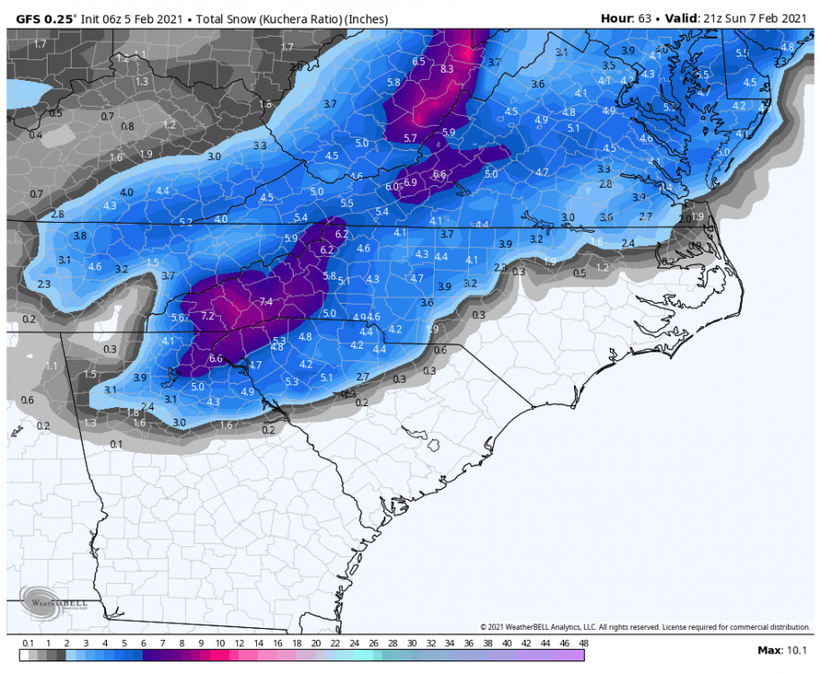
-
Most of this is due to evap cooling because of more expansive precipitation field but still great trend.
-
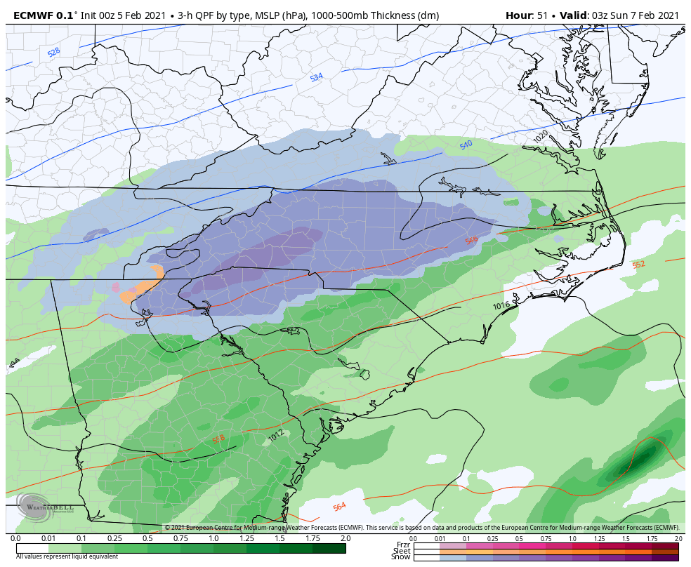
Thermals much better on euro! The QPF also increased markedly on NW side of storm. Couldn’t ask for a better euro run.
-
BOOM!
-
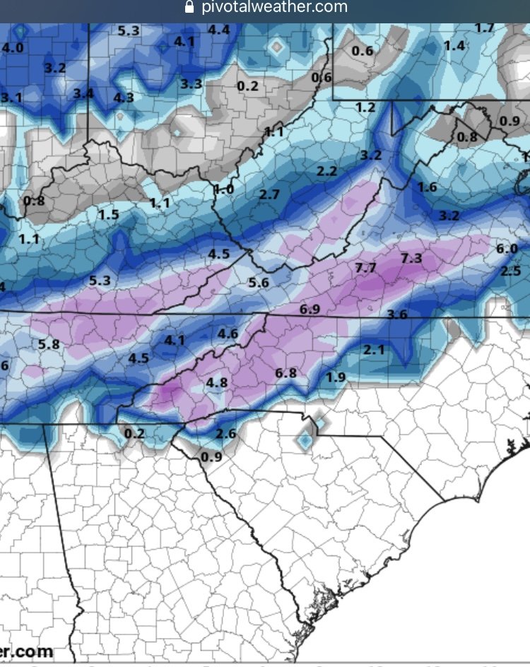
ICON is a crush job for western areas
-
Models are so erratic right now it’s best not to get emotionally invested. The trend for the upcoming weekend threat has been incredible. Still not confident in the outcome of that and it’s less than 72 hours out! At this rate won’t be surprised if it turns into an apps runner.
-
NAM was much closer to reality on the big storm last week, so we have that in our favor. NAM has actually preformed pretty well this winter overall. Was too aggressive on the early January storm but otherwise solid. The gfs also did well in final 72 hours leading into Eastern nc snow event so encouraging seeing that trend better.
-
6z gfs also trending that way. Hopefully we see euro start to fold in today’s cycles
-
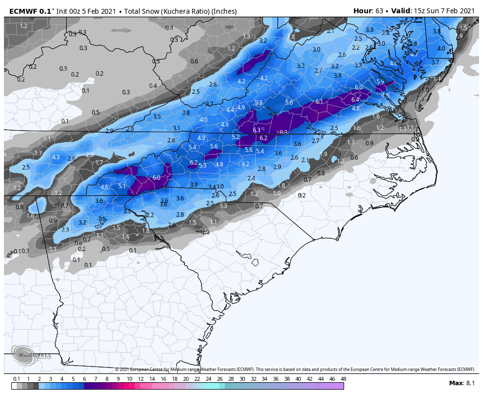
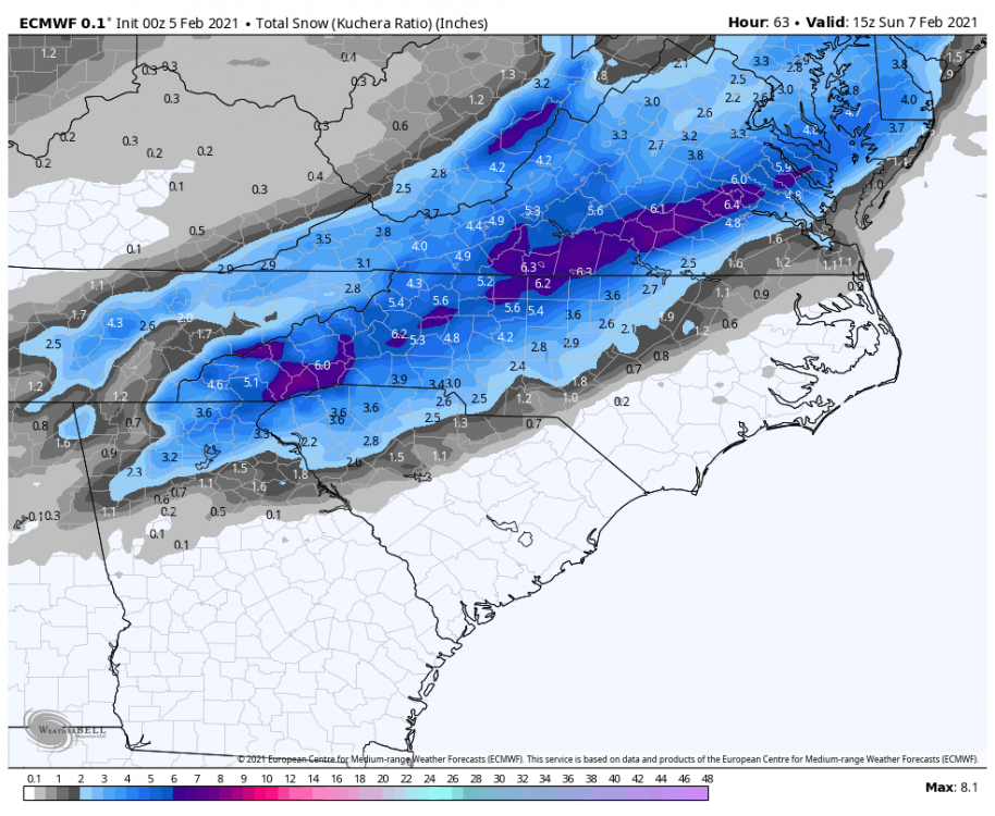
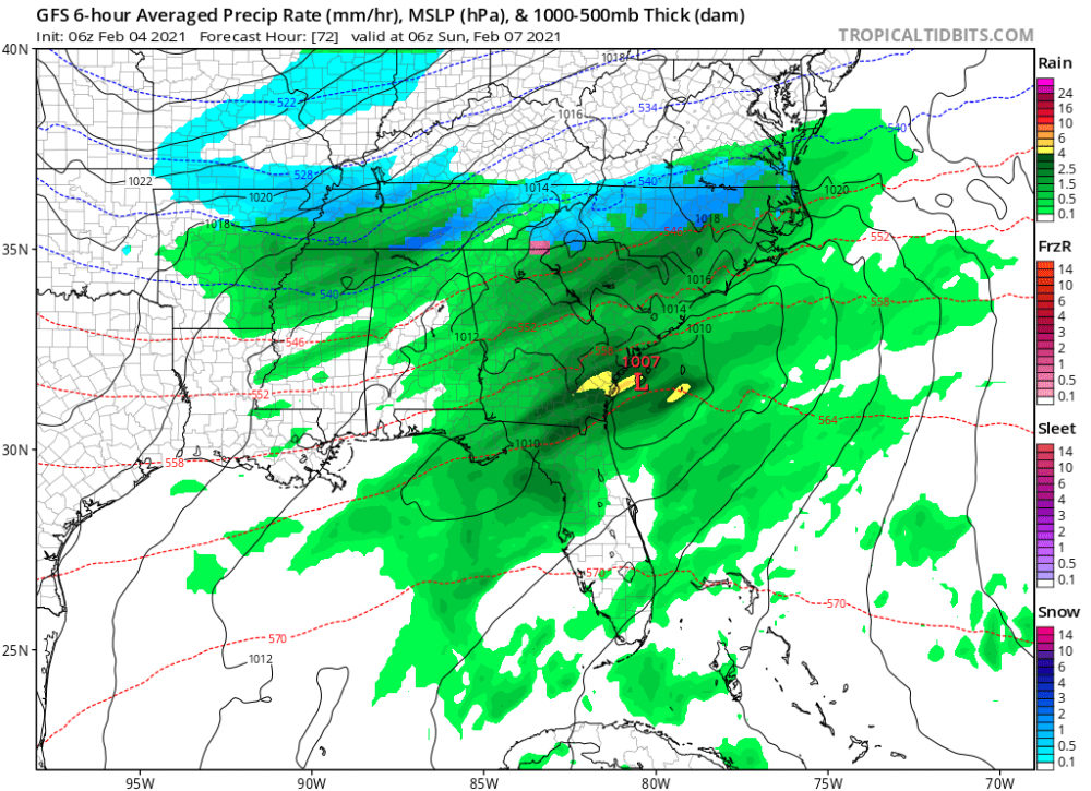
Para gfs at 6z is big hit for this Sunday

-
The whole western part of the state is not in his backyard.