HKY1894
-
Posts
190 -
Joined
-
Last visited
Content Type
Profiles
Blogs
Forums
American Weather
Media Demo
Store
Gallery
Everything posted by HKY1894
-
The deform band from the ull is gonna smack somebody in northern foothills and northwest Piedmont tomorrow morning
-
Steady snow in lenoir no mixing.
-
I hope the 0z hrrr is correct it sits deform band in northern foothills for hours
-
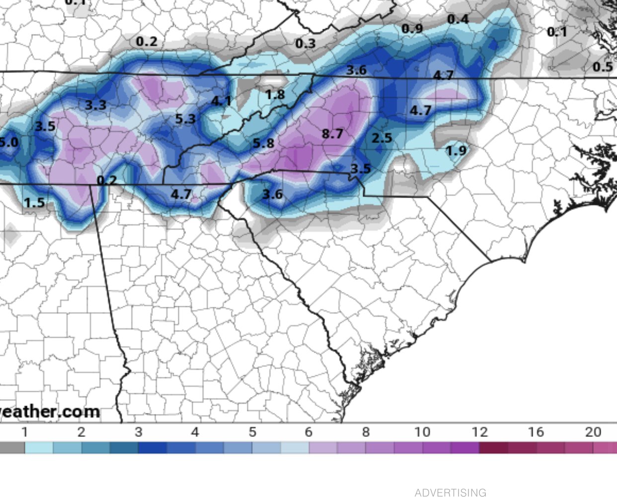
HiRes nam is concerning and is a big shift from prior runs. Went from 7 inches at my location at 6z to nearly nothing in the lee side dry slot. Hopefully it reverts at 18z
-
GFS v16 snow amounts differ greatly from current operational gfs. Will be interested to compare results.

-
18z gfs v16 snowfall amounts seems slightly east of NAM and euro consensus, doesn’t target mountains as much . We won’t see 10:1 ratios but map gives idea of QPF instead of actual ground truth accumulation.

-
18z GFSV16 continues to advertise snow event for mountains and foothills on Monday. Still tons of uncertainty with the system. The EPS doesn’t agree with the 12z euro op run. Definitely a legitimate threat.
-
Agreed QPF should be fine even with low ratios we should see heavy snow falling in the deform band for sure
-
Nam is a total crush job for wnc. Deform band seems to be focused in mountains western foothills.
-
Nam is an absolute crushjob wow
-
Hi Res Nam and euro combo I’ll take it to the bank every time
-
Hi res nam looks better!

-
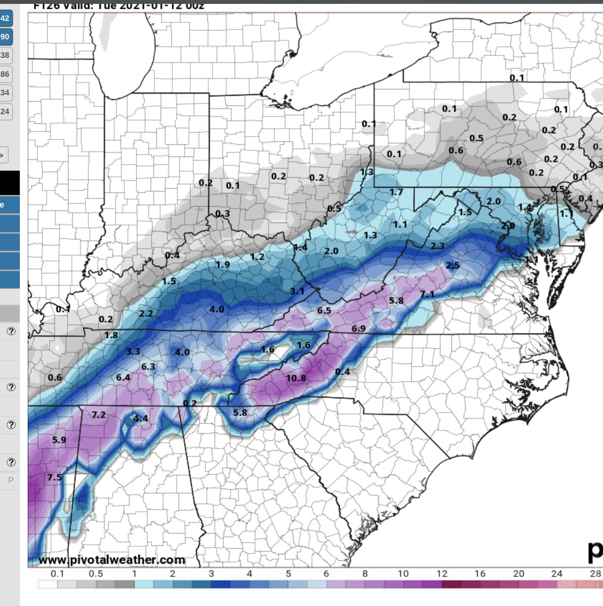
Massive winter storm on euro again on 0z run
-
At hour 60 at 500mb it’s south of 0z so far. And looks a bit more organized as well. Good changes imo
-
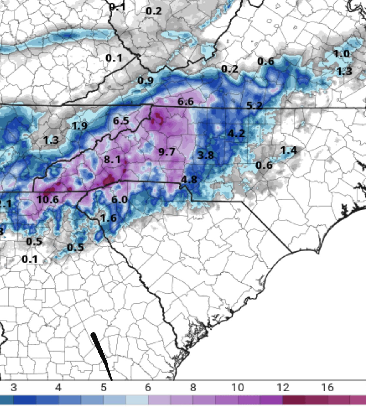
GfsV16 looks like a crush job
-
Para gfs is a huge hit for western NC wow!!
-
The EPS and GEFS look spectacular in extended and it is moving up in time. At the time stamp you posted it’s almost a textbook Miller A composite!
-
0z CMC

-
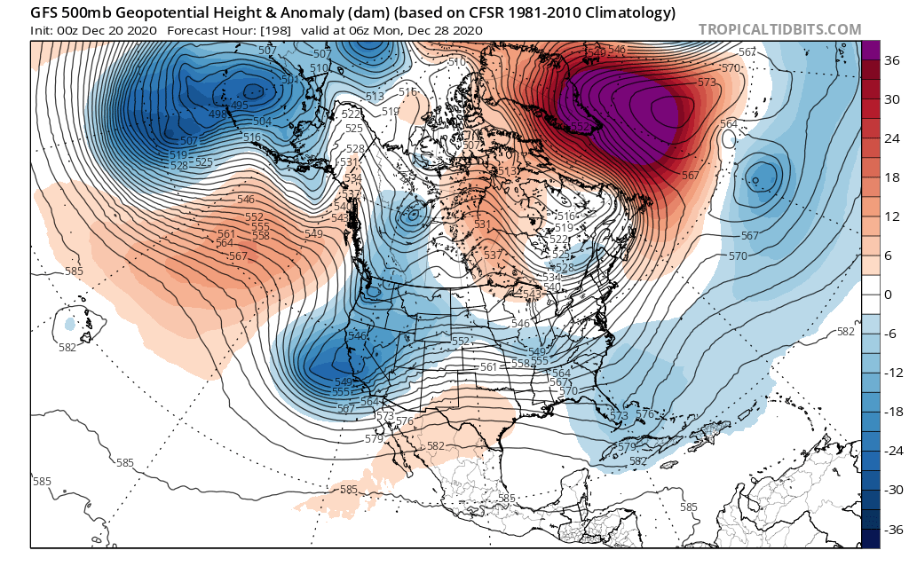
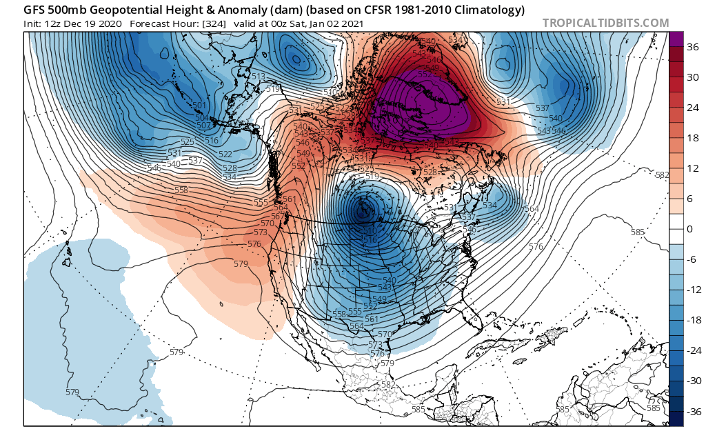
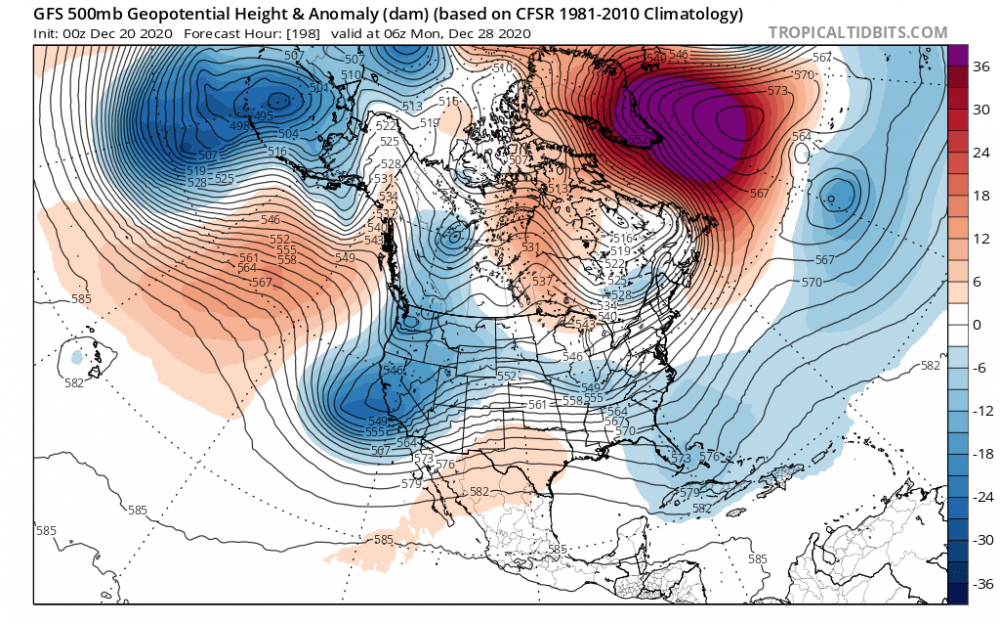
We will be looking at multiple winter storm chances coming up soon. One of best NAO blocks I’ve ever seen depicted
-
Long range getting more interesting. If blocking retrogrades back to where euro has it positioned it’s gonna get interesting. Euro and its ensembles also hinting a PNA spike near next weekend.
-
January 3rd-7th has potential no matter what any models verbatim output is at this range. I’m super optimistic for whole month of January. This is not the same as last few winters. NAM state most favorable we’ve seen in a decade.
-
Euro weekly looks excellent for blocking all the way thru week 4! It’s just a matter of time before we score something. PAC isn’t great but as always will be out timing wave with cold high. Miller B’s more likely right now though.
-
Main takeaway right now is how active it looks in long range. It may be all rain but it won’t be dry/boring. But we need to dry out some, very wet year. I feel like warm pacific sst’s causing this active pattern.
-
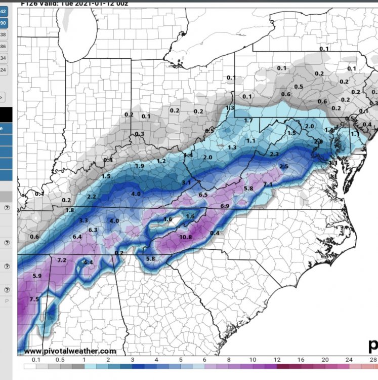
Op gfs long range looks interesting, strong disturbance in southwest that enters in southern Cali, with huge block overhead. This is the look that could lead to big east coast storm.
-
If we get this look with NAO first couple weeks of January should fun.