

hlcater
-
Posts
2,638 -
Joined
-
Last visited
Content Type
Profiles
Blogs
Forums
American Weather
Media Demo
Store
Gallery
Posts posted by hlcater
-
-
-
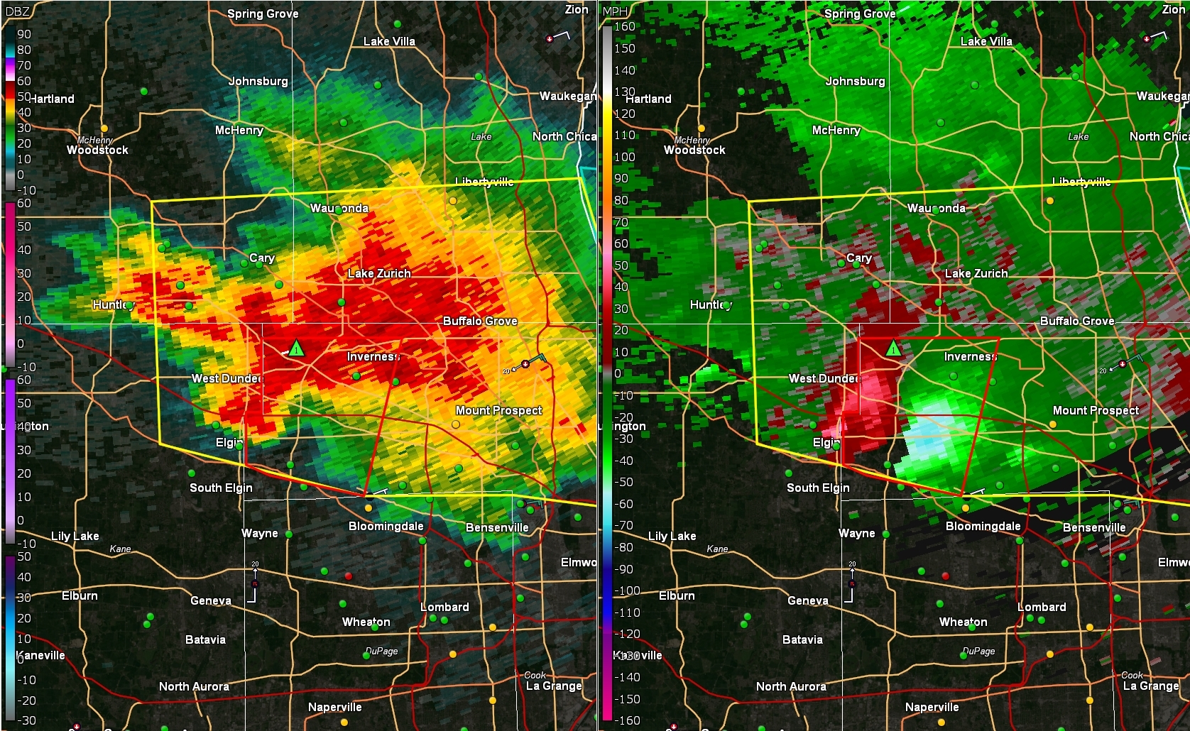
Got word that there's a tornado in progress with that storm now.
Now he's less sure that it was a tornado.
Radar appearance suggests that it may not be ready quite yet.
-
 1
1
-
-
Yea that storm has the lake breeze, whether or not it can turn right and ride it is probably the difference between nothing happening and a major tornado in the chicago metro.
-
8 minutes ago, HillsdaleMIWeather said:
It would be nice to actually get something further east for once, Minnesota has been slammed all spring
Gotta move west of the lakes hoss
-
 1
1
-
-
On 5/13/2022 at 8:20 PM, hawkeye_wx said:
Cedar Rapids may go the first three weeks of May without a rumble. May/June is a bad time of year to get stuck in an unfavorable t-storm pattern.
It's looking up for us over the next 10 days or so.
System traversing the country Wed-Fri should yield tstm and perhaps severe wx opportunities.
-
36 minutes ago, cyclone77 said:
I googled it. Now I'm gonna get constipation medication ads on fb for awhile lol.

-
 1
1
-
3
-
-
Someone needs to get the dulcolax

-
1
-
-
24 minutes ago, cyclone77 said:
Hopefully the trees will be fully leafed out by the 4th of July lol.
They haven’t even started here. One of the later years I can remember.
-
 2
2
-
-
Oh wow I just realized I posted in the wrong thread. Oh well
-
Y'all had to know it was coming, I just hadn't gotten time to type it up since I've been super busy and for all intents and purposes did not have time to go to NW IA tuesday but I did anyways because the setup was gas.
Targeted Sac City area primarily due to the presence of an area of enhanced moisture convergence giving me high confidence the area near Denison would convect. This strategy was spot on. For awhile, the storms really struggled with fast motions and being whisked away north of the front and it took multiple updrafts before one finally got established on the boundary.
I suspect there was still quite a bit of surface stability here, as inflow temps ranged from 66-70 depending on where I was, but inflow was impressively strong at 60+mph immediately prior to the tornado, and at multiple points afterward. I suspect the very strong (and more importantly spatially large) mesocyclone and impressive hodographs helped compensate for this surface stability and enabled the Palmer tornado to develop. Due to incredible fortuitous circumstances, the stage of the tornado which were brilliantly captured by Jim Tang (and others) occurred behind trees.
However, impressive views were still to be had of later stages of the tornado lifecycle.
The storm filled in with rain after this and I didn't see any of the subsequent tornadoes. Although I very nearly drove into one near Gilmore City and was caught in the rear inflow jet and, cognizant about what may lay ahead shrouded in rain, I pulled off the road and waited in winds which were likely exceeding 90mph and inflicted heavy damage to neighboring trees. Up ahead, a farmstead had a destroyed outbuilding and substantial tree damage, which was deemed to be caused by an EF1 tornado. The storm could never shake mergers from the rear either, and I called the chase at 7:30pm
-
12
-
-
Iowa's setup tomorrow looks primed. Moisture is currently overperforming HRRR progs, zero morning convection concerns, vectors off the boundary are 90 degrees, massive hodographs with large 0-3km curvature will support supercells, 2500-3000 MLCAPE will ensure updrafts are robust... There really isn't anything that's missing.
I was previously not super confident moisture would reach the triple point with sufficient quality, but obs tonight are suggesting that will not be an issue. Therefore, the only thing that remains that could disrupt or otherwise attenuate the setup is if the core of the lift is either slow and doesnt overspread the warm sector before dark or delivers a glancing blow such that storms that do initiate are too far NW and are elevated. Would probably be introducing a 15H at 06z for NW IA.
-
1
-
-
3 minutes ago, Powerball said:
Those storm are pretty far removed from the surface-based instability. For now, they should only pose a hail threat.
That said,they seem to be forming off the nose of the LLJ along the prefrontal trough.
College Station sounding does have about 1000 MLCAPE and a gigantic hodograph.

-
My total in IC was 4.7"
-
1
-
-
1 minute ago, Chicago Storm said:

.Strongest tornado I've seen so far. Bummed I wasn't in front of it while it was still visible near winterset but oh well.
-
1
-
-
1 minute ago, hawkeye_wx said:
I'm doing very well, up to 3.6".
2.9" in IC.
-
1
-
-
2 minutes ago, cyclone77 said:
lol thanks. I like that color palette.

stole it from pivotal
-
14 minutes ago, cyclone77 said:
In sort of a mini-screw zone (perfect for this winter) with snow streaking up northwest and east of us. Still waiting on the first flake. Thank god this pos winter is almost finished.
I figured I should immortalize it for you
-
1
-
-
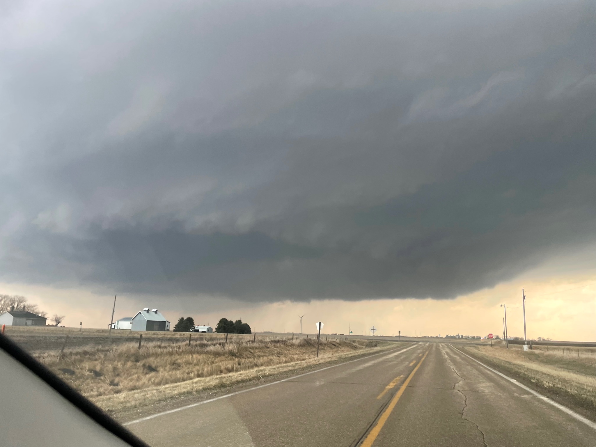
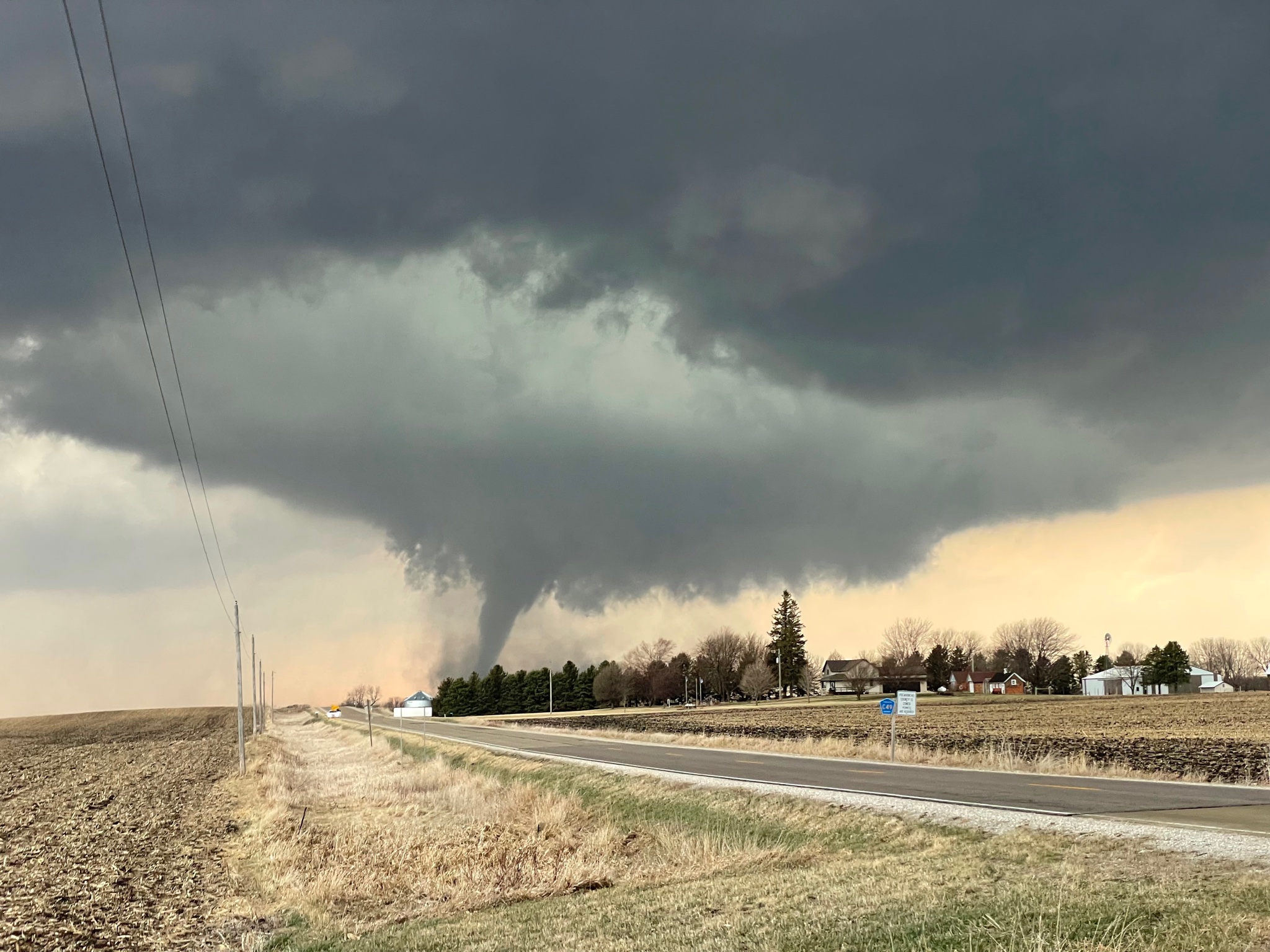
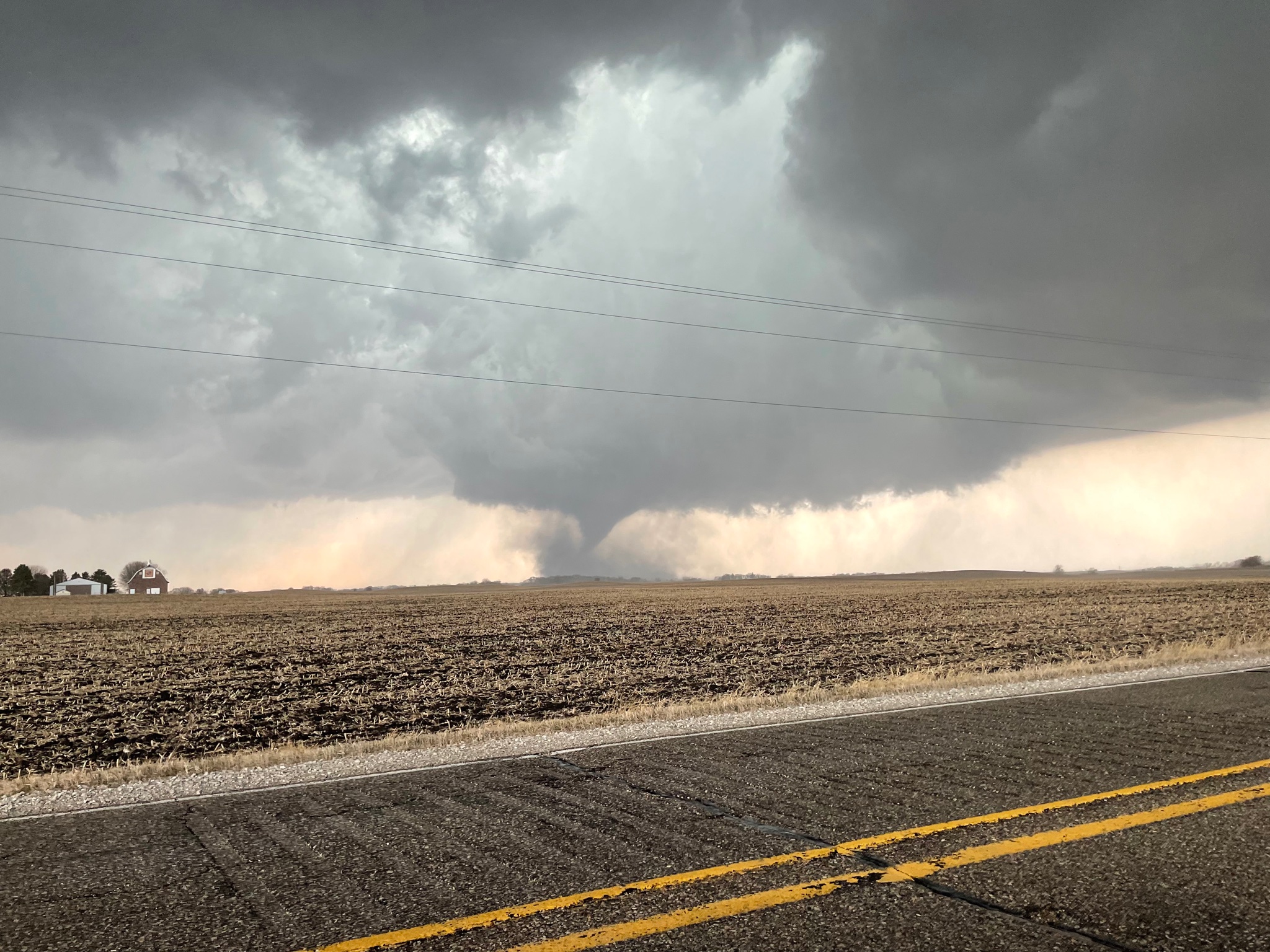
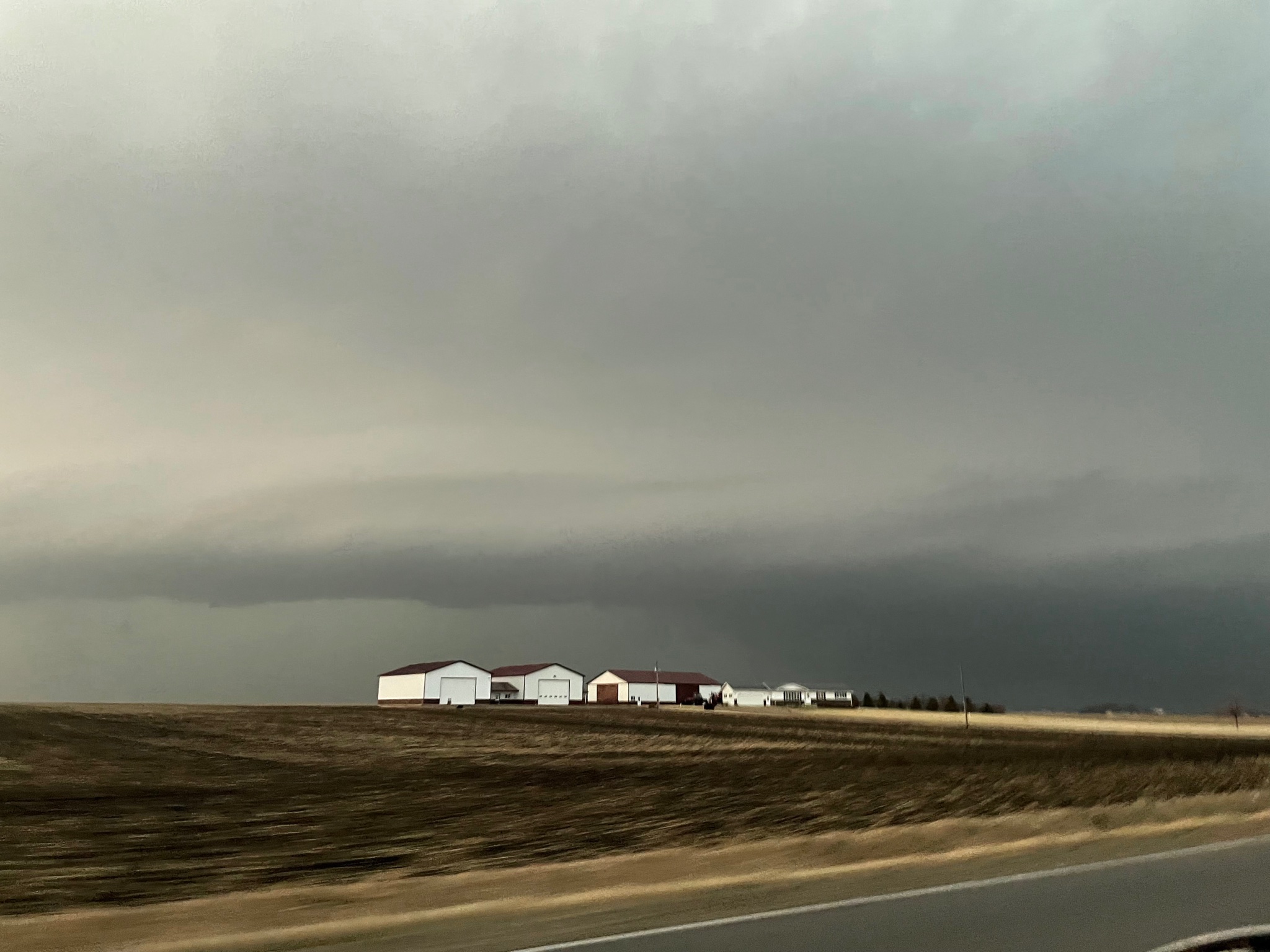
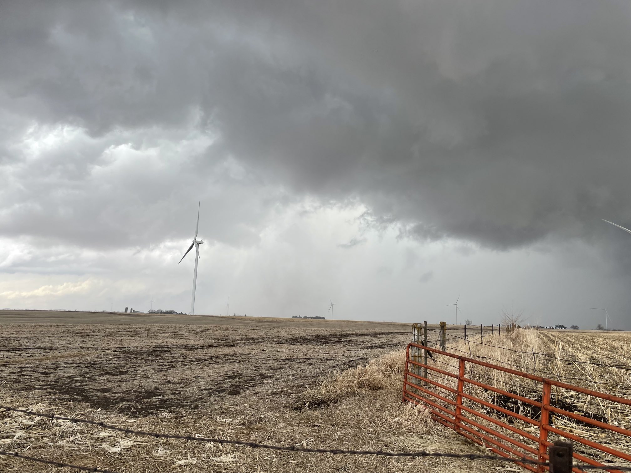
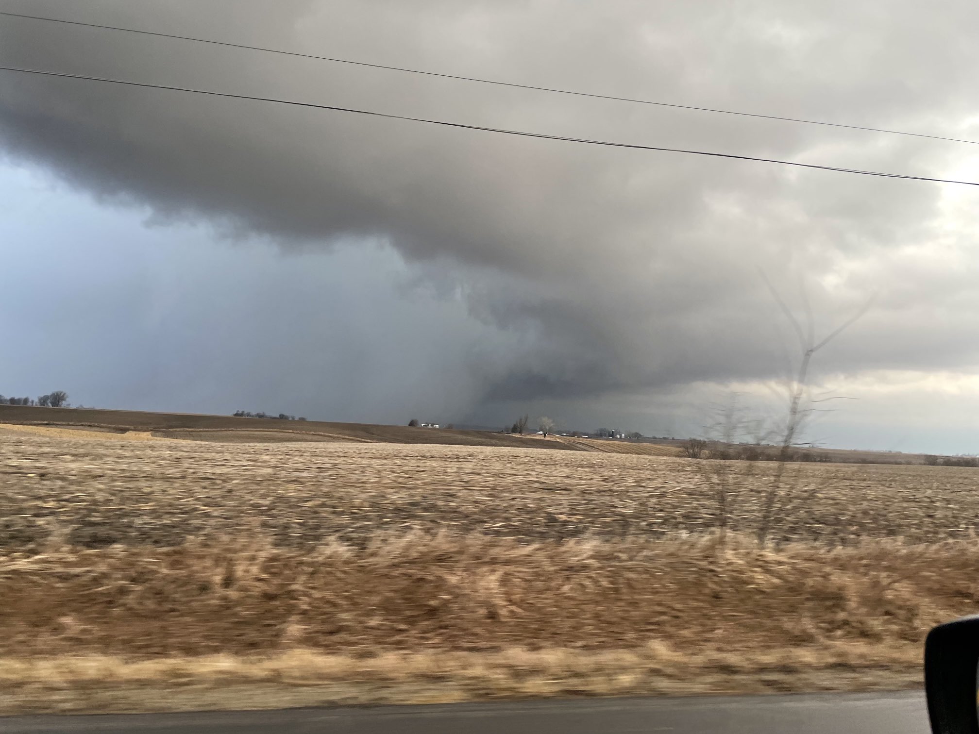
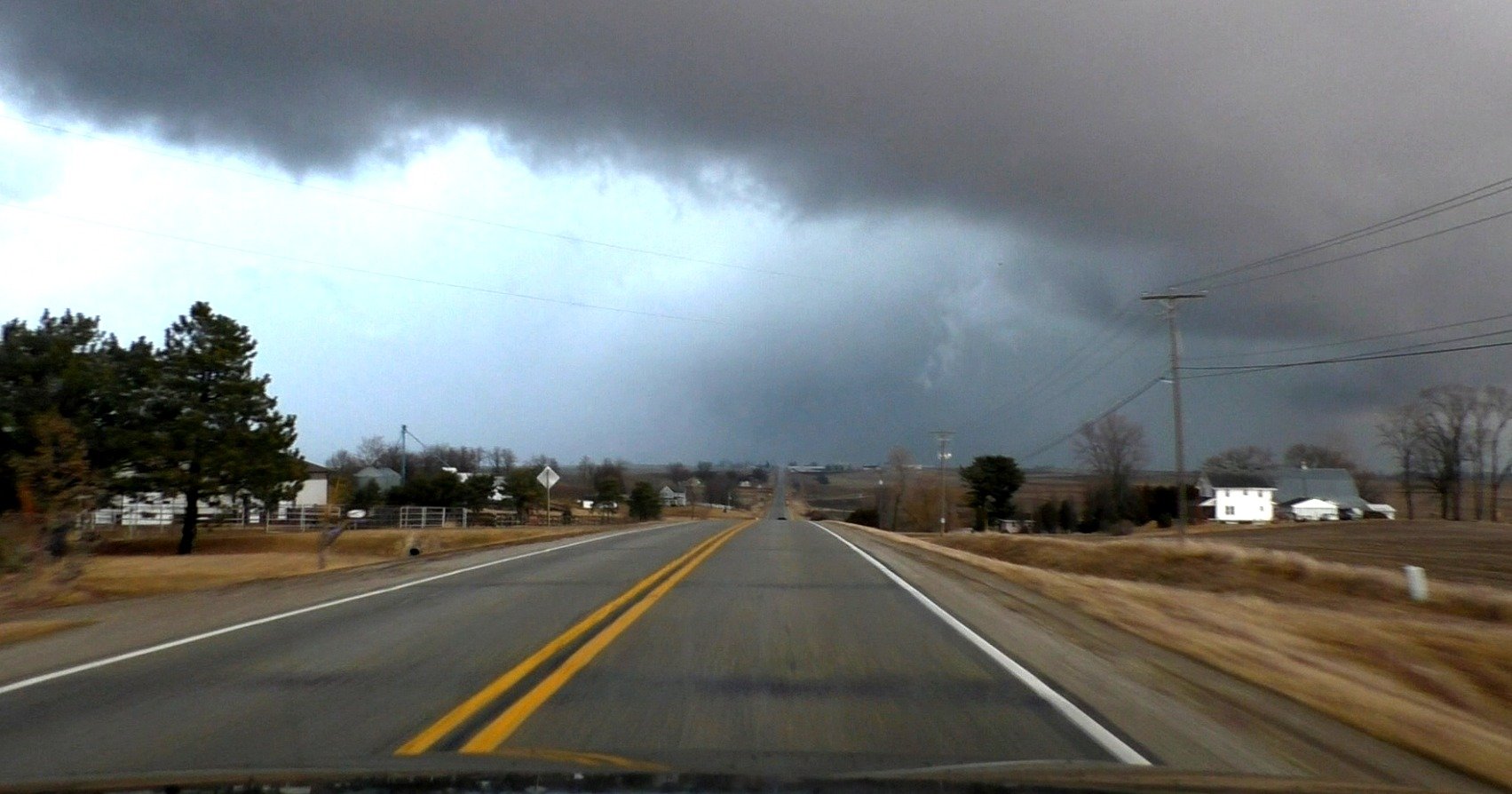
Yesterday was hard. Storms were moving 45-50mph at a 45 degree angle to the grid, so keeping up was exceptionally challenging. Needless to say, I didn't really have time to take many good pictures, and the tornadoes I saw weren't especially photogenic from my vantage points anyway. I traded pictures for keeping up and only stopped 2-3 times the entire chase. Despite the few good pictures, I absolutely cannot complain about seeing tornadoes and a great cyclic supercell on March 5th, in Iowa.
The first tornado was near corning which I have zero pictures of as it lasted 30-40 seconds and I was driving.
The second tornado lasted about 2 minutes and was near Creston. It had a much more pronounced debris cloud before I was able to get a picture.
The 3rd tornado was a rain wrapped wedge that tracked from Winterset to Newton and produced EF2-3 damage near winterset from what I could tell.
This was near colfax, and the tornado had shrunk markedly to a cone here.
And finally, the 4th tornado was an amorphous bowl near Kellogg. It had multiple subvortices beneath it and seemed pretty weak.
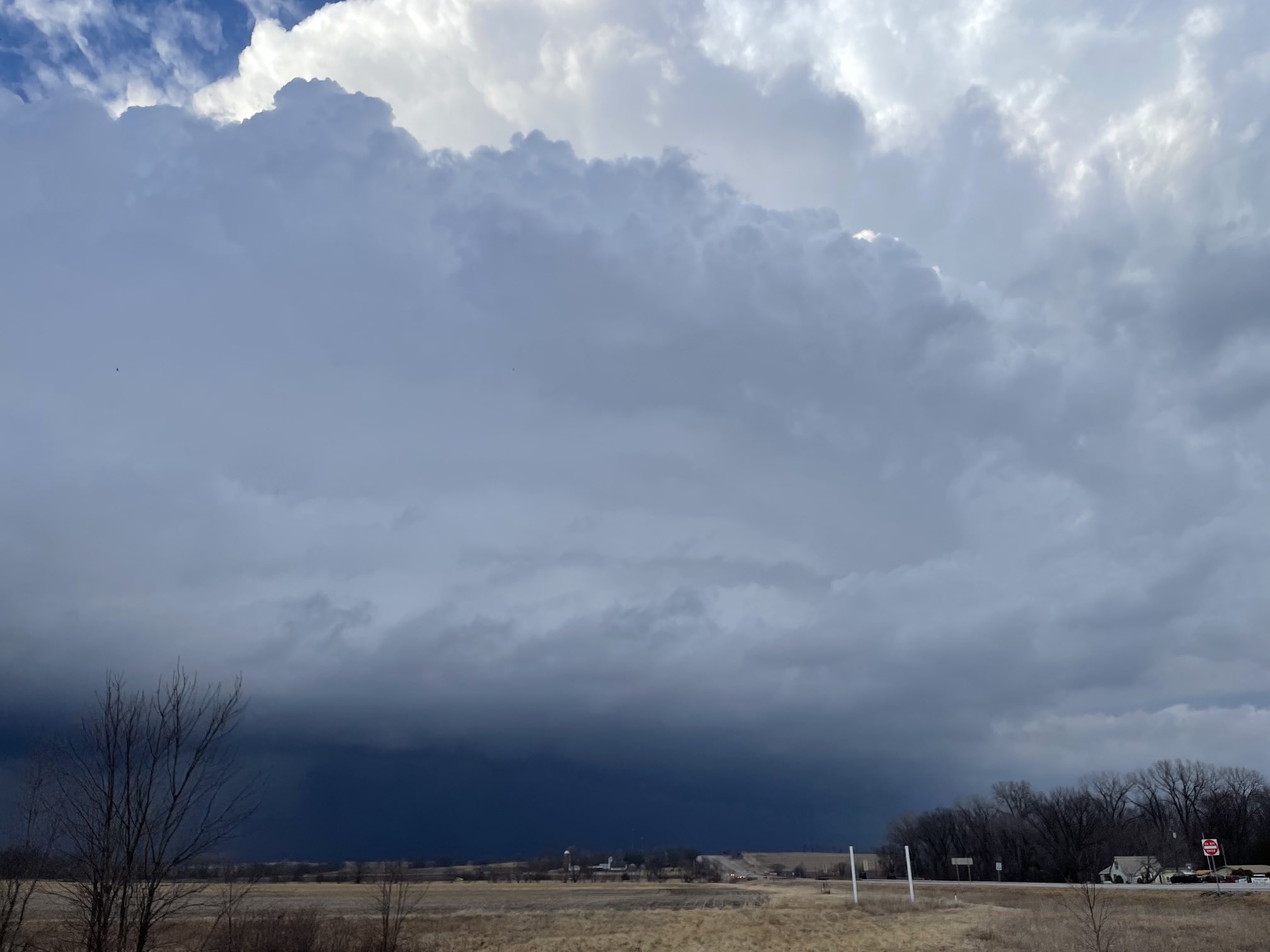
Immediately prior to the winterset tornado. Storm was a very high contrast sculpted beauty.
-
13
-
-
1 hour ago, Cary67 said:
Madwx, Cyclone77,and McHenrySnow have no idea what your talking about
yea I'm not aware of any snow bonanza
-
1
-
-
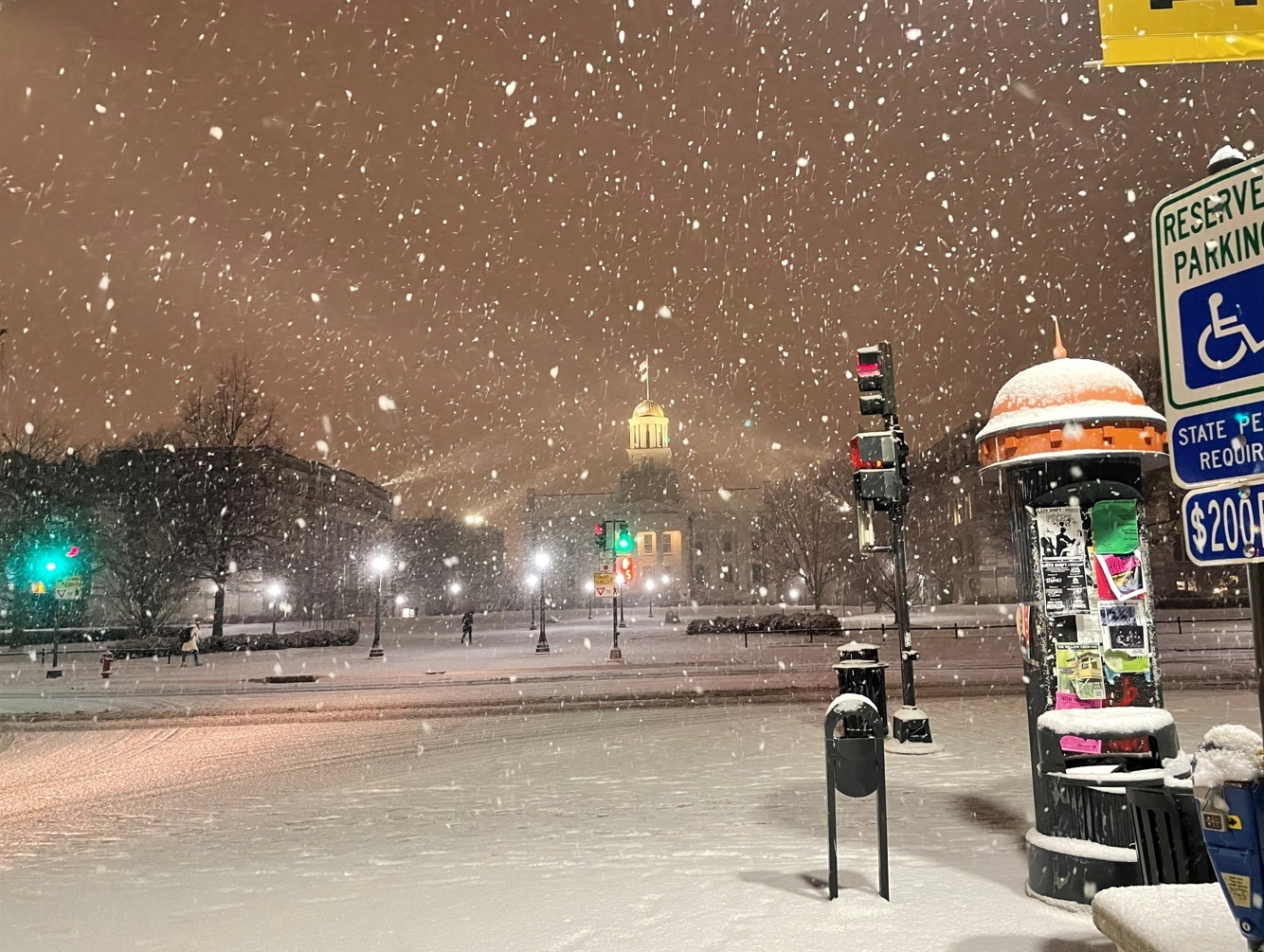
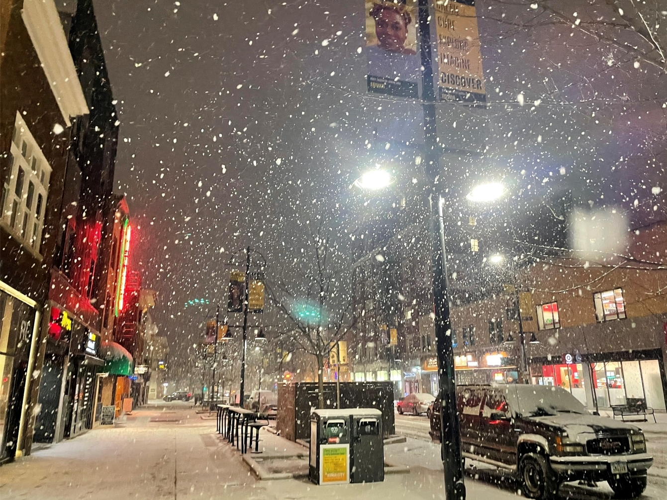
Much needed after this year's slow winter. Just shy of 3" in IC.
-
7
-
-
This must be what they call share the
wealthpoverty
-
3
-
-
Mother of god
-
2
-
-
beautiful image
-
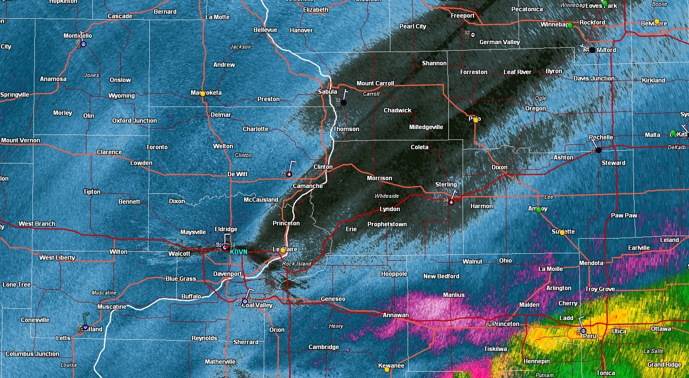
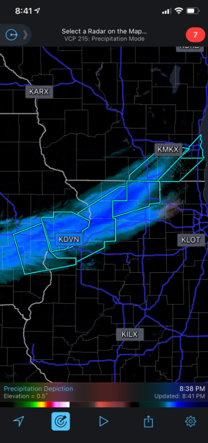
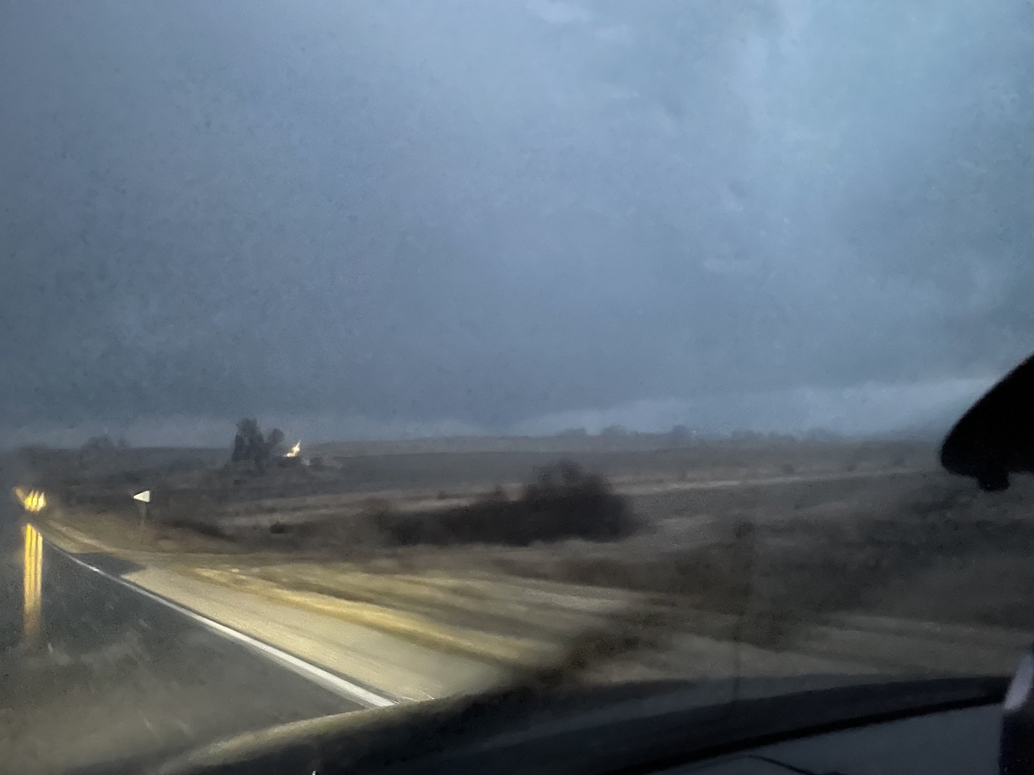
Pretty impressive squall. Vis dropped to a half mile at times and roads became snow covered rapidly. Some heavy gusts maybe to 50mph. This isn't the worst of the band either
June 13 Severe Event
in Lakes/Ohio Valley
Posted
I wouldn't say producing is a certainty just yet, seems to be paralleling just on the cool side of the boundary for now.