

hlcater
-
Posts
2,638 -
Joined
-
Last visited
Content Type
Profiles
Blogs
Forums
American Weather
Media Demo
Store
Gallery
Posts posted by hlcater
-
-
Gonna go out and say it snows at least one (1) time for most members of the sub.
-
 1
1
-
 7
7
-
-
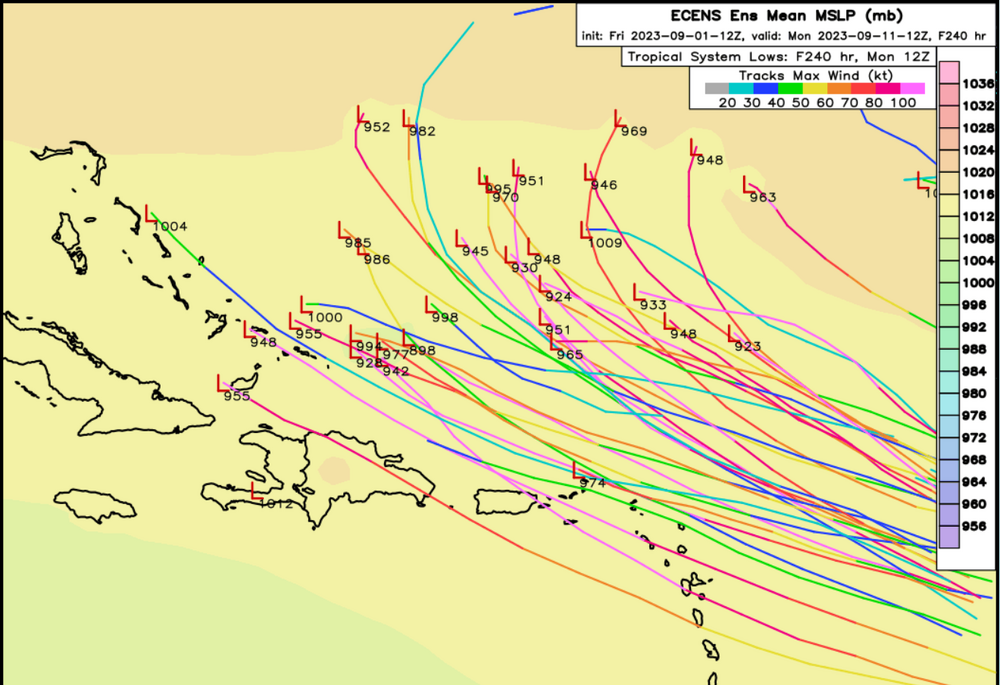
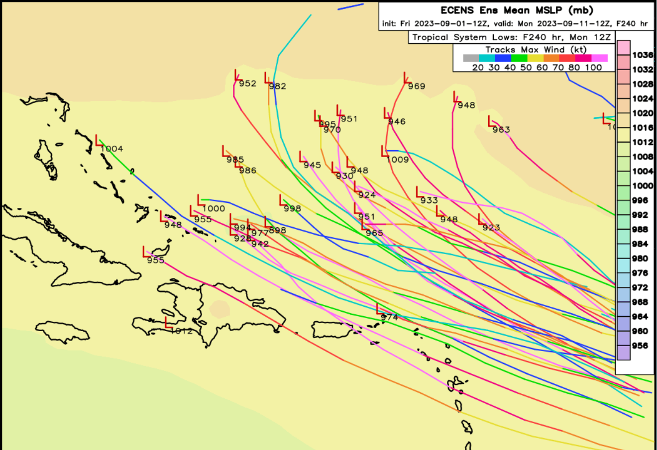
Kinda wonder if we start impinging on length records depending on eventual track. There is potential that Phillippe is still around in 10 days.
-
1
-
-
1 hour ago, WxWatcher007 said:
Love the tractor tire hurricanes. Probably keeps this below MH status too.
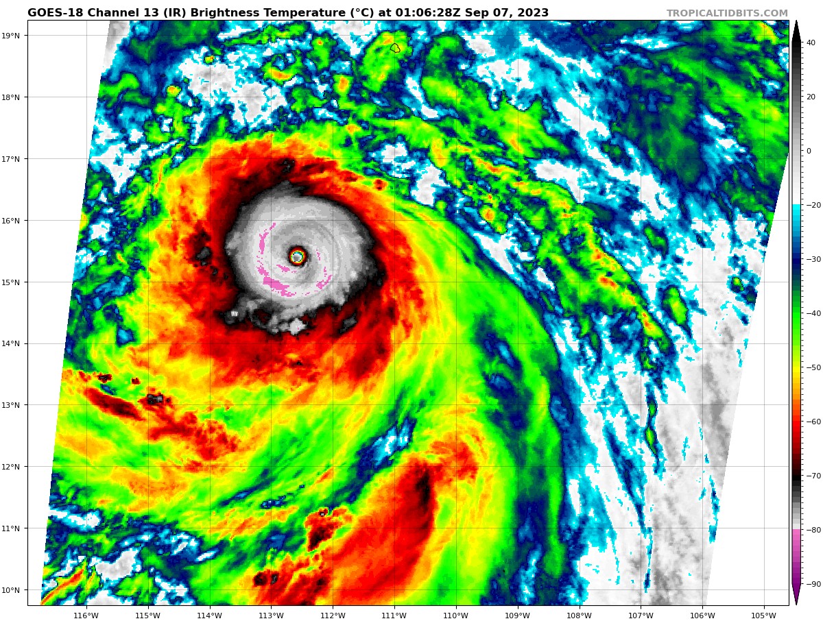
Idk that eye has cleared out considerably and cloud tops have continued to cool. Interested to see what the plane finds here shortly.
Has a shot at cat 3 over the next 24 hours or so imo.
-
The decay was pretty neat to watch actually. Cold water starved the cyclone from the inside out.
-
2 minutes ago, WxWatcher007 said:
Fixed. It’s always always bad

This is far from the worst offender (probably not even top 10) but there's a clear difference in threads that involve the northeast and those that do not
") .
.
-
1
-
-
Remarkable how the main thread becomes unusable whenever the storm *could* pass within 500 miles of the northeast
-
This is whole situation reminds me a lot of hurricane lane in the central pacific a few years ago
-
2
-
-
142SFMR and 147FL on the most recent pass.
-
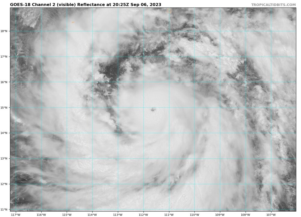
Absolute beauty of a cyclone out there today

-
5
-
-
Haha……..

-
1
-
4
-
-
So Jose might be a hurricane


-
5
-
 1
1
-
-
1 minute ago, WxWatcher007 said:
Where is recon? If there were ever a time for it..
2 hours out. It’ll be well timed I think
-
 1
1
-
-
The other thing that’s just crazy to me is that as soon as the eyewall went nuts the coherent band that had been forming disintegrated completely and is now multiple bands all spiraling into the eyewall. That seems like more than just a coincidence.
-
Just now, Tezeta said:
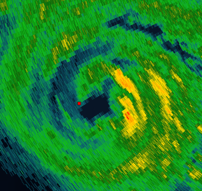
I’m 50/50 on it. Recon hasn’t really found a double wind maxima. But man radar looks moaty.
It did for a few scans but it has since filled in and the outer band continues to spiral inwards, for now.
-
14 minutes ago, MattPetrulli said:
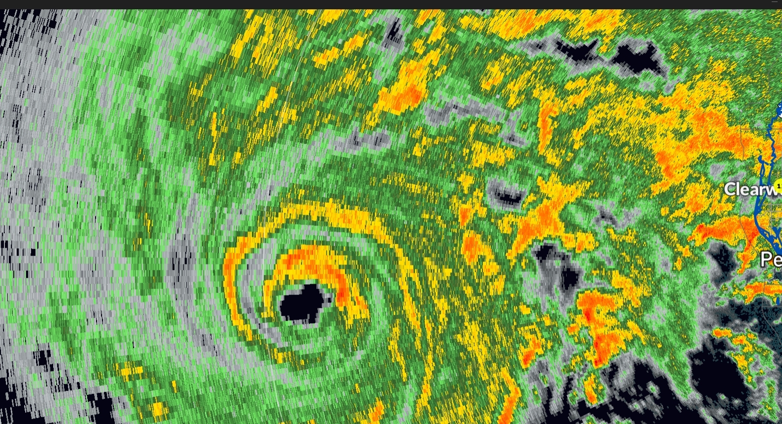
Thinking we got an EWRC going on
Don't think you can call it that yet. Still clear evidence that the band is spiraling inward and some of the "moat" is probably from very strong convection in the northern semicircle of the eyewall. I've noticed this a few other times tonight. If that outer band continues to gain substance then maybe though I think we're probably a few hours from that minimum.
-
1
-
-
6 minutes ago, WxSynopsisDavid said:
Not actually, as been mentioned earlier there’s been mesovortices rotating around the eye at times. When that happens the eye will appear ragged/rugged but it’s actually not a deterioration.
I disagree. While mesovorts are likely present and can warp the edge of the eye to a degree, think there really is an ellipse. My best guess is due to asymmetry in the convective bursts that we've seen tonight. There's typically only 1 burst ongoing at a time while the other side of the hurricane is "quiet".
Not 100% on that one tho and curious to other input if people have it.
-
1
-
-
Eye is also kind of a bizarre ellipse. Not sure what to make of that
-
2 minutes ago, WxWatcher007 said:
Latest VDM with interesting characterization of the eye
Can see that on radar. Though it doesn't look like an EWRC to me. Looks like growing pains of inner core organization.
Also supported by the fact that there is no outer wind maxima visible on the aircraft data.
-
Eye diameter on radar is about 10nm at 20,000ft so it is likely ~9.5nm at flight level and we had a drop of probably 3-4mb between passes. From 972 to probably 968ish. Looks like its go time.
Update: 968 confirmed. That's a big pressure drop.

-
12
-
-
91kts FL is what they based it on, along with the pretense that the NE quad has not been sampled yet. Decent strengthening from the last pass, but perhaps not as rapid as models had indicated. However, the storm is in good shape for more robust strengthening tonight. Still think an intensity of 110-115kts is a pretty reasonable guess for landfall.
-
4
-
-
7 minutes ago, Boston Bulldog said:
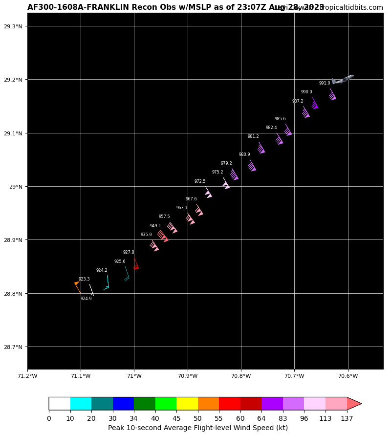
923.3mb per recon
EDIT: 140kts it appears. That's a category 5
230030 2855N 07057W 6982 02635 9491 +100 +059 141136 140 128 028 0

At flight level. Surface data suggests 125-130kts.
-
2
-
-
recon is in the air.
-
1 minute ago, Boston Bulldog said:
Now we are seeing signs of one, though the inner eyewall is very thick

No fix until 23:30z. Probably will be past peak by then.
-
1
-
-
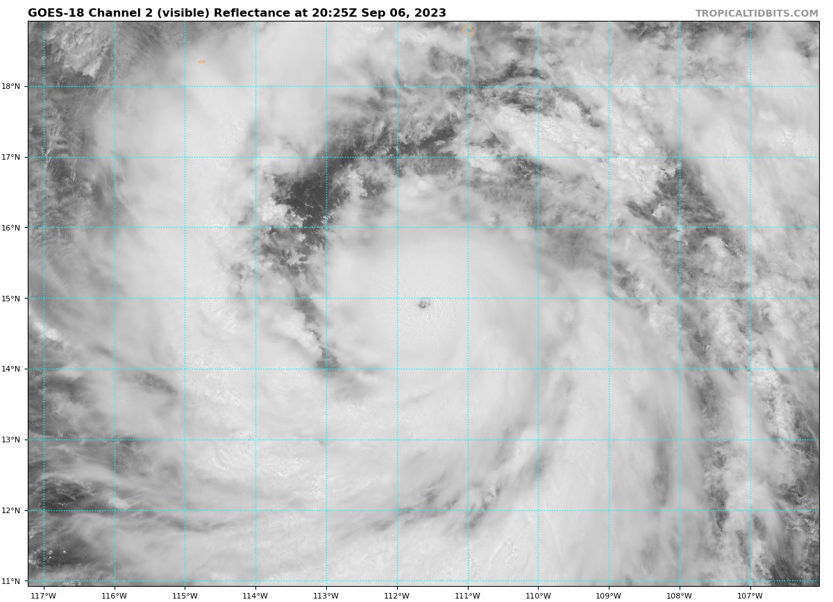
One thing to notice over the past several hours is the transition from spotty and isolated thunderstorm activity to a coherent and organized curved band that is now wrapping around to the south side and over the center. The purple X is roughly where the center is on visible and on radar data. There is some moderate northly shear being imparted on the system today but the improvement in convective pattern suggests that Idalia has continued steady intensification.

-
4
-
1
-
Winter 2023-24 Longrange Discussion
in Lakes/Ohio Valley
Posted
Gut saying WAD this year. We'll see.