hlcater
-
Posts
2,686 -
Joined
-
Last visited
Content Type
Profiles
Blogs
Forums
American Weather
Media Demo
Store
Gallery
Everything posted by hlcater
-
dont count your chickens lol. This could be the 5/20 of hurricanes. But realistically, real good chance this is sub 910, and a not-so-outside shot at sub 900.
-
It's already wobbling and a concentric band is becoming evident on San Andres radar. If it's not at peak now, peak is not far away. I'll go 911mb/145kt.
-
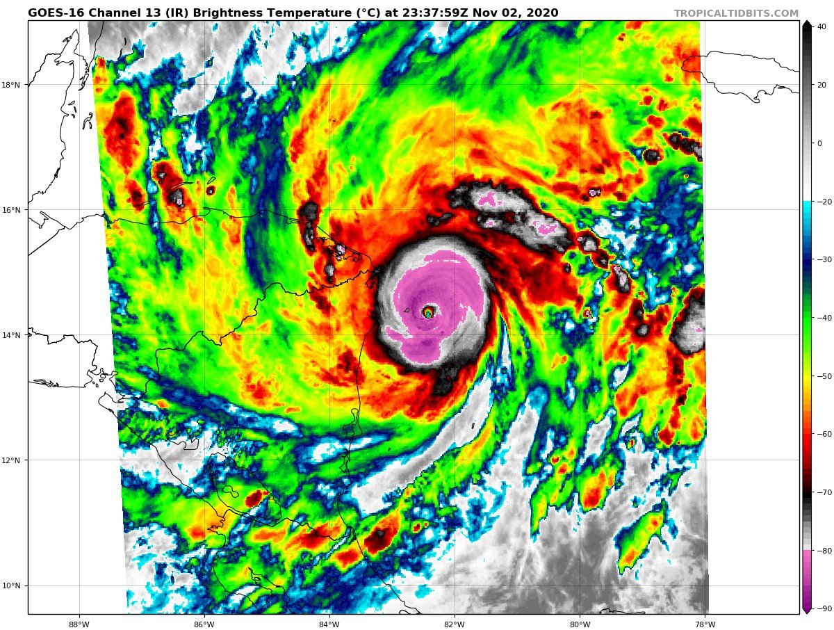
Eye temp of +0.9C.
-
Eta's eye is warming multiple degrees every satellite scan. Now up to -16. (I promise I wont play by play it )
-
-18c core temp with a -84c convective ring. Almost certainly a high end cat 4, and if this continues, recon may very well find a cat 5. (there's one whole pixel of -18c in the core). Checked it on RealEarth.

-
A 1 out of 4 recon success rate over the past 24 hours is pretty inexcusable. Especially when these flights cost pennies on the dollar for the government to run.
-
Now closed -80c ring with pockets of -90c with the strongest updrafts. Definitely acting like it's feeling some of that SSWly shear I was talking about earlier. Holds 10-15kts through landfall by the looks.
-
woooooooaaaaaaaaaahhhhhhh about as healthy as a pinhole can possibly be.
-
Shear is currently reaching a relative maximum prior to landfall and should hold steady or gradually weaken later today. Currently analyzed between 10-15kts, so ever so slightly stronger than the RAMMB would have it.
-
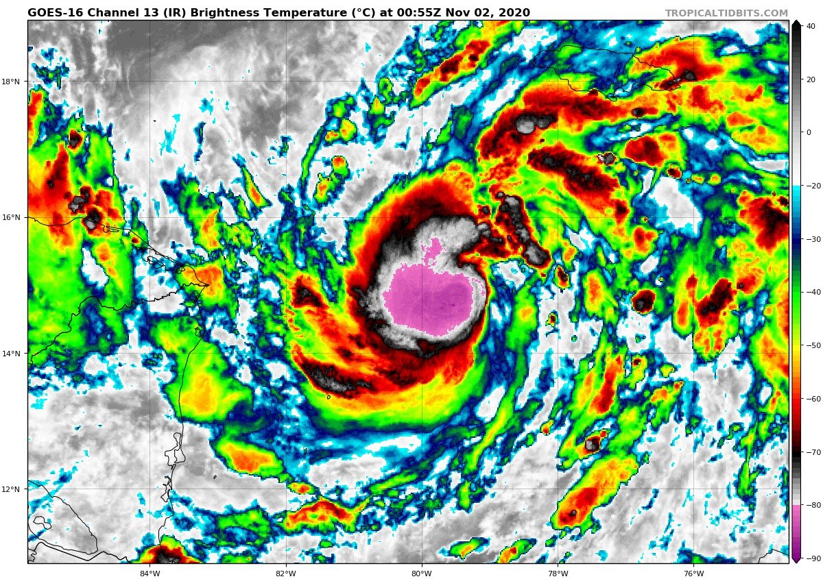
Cat 4 is probably a good bet right now. Would like recon to get in there sooner rather than later, as eye is probably no wider than 6nm or so. An eye that small is not stable and I'm not confident that it maintains itself long enough should the 1730z recon plane end up getting canceled. Think it peaks sometime later today/this evening and kinda just holds steady into landfall. Whether or not this attains cat 5 to me is solely a function of how long can the pinhole remain stable?
-
We have Hurricane Eta on ATCF 65kt/987
-
530z
-
Looking like it’s getting ready to undergo RI. Multiple impressive bursts rotating tightly around the center. In contrast to Delta and Zeta which could seemingly only fire one burst at a time.

-
 Absolute beast of a storm. Wish we had recon in a storm like that.
 -
Big if true
-
Hope brandon clement is actually getting some wind/pressure data right there. In a spot such that if there were cat 3 winds in this thing, he probably would've seen them.
-
Most north moving gulf storms have weak/non-existent south sides. I remember when people thought Michael was remarkable because it was the exception to the rule. Not only that, take a look at environment/synoptics and a half-a-cane absolutely makes sense.
-
Could see this one going either way in post analysis. Lot of indicators suggestive that this may have briefly been a marginal cat 3, but nothing was overtly definitive. Pressure kept falling into landfall and bottomed out at 966. If any of this years storms were to be bumped in post, it'd be this one, pending onshore obs.
-
Huge fetch too on the eastern side. This is gonna be a surge problem.
-
Never seen asymmetry quite like this. Fascinating.
-
What it really needs to do is contract. A rough eye diameter is somehwhere in the ballpark of 40 miles. Pretty big...
-
I like the look of this one. Could make a run well into C2 status if things go well for it overnight. Actually like the vortex structure more now than I did yesterday. Seems reasonably tight and compact.