

janetjanet998
-
Posts
6,027 -
Joined
-
Last visited
Content Type
Profiles
Blogs
Forums
American Weather
Media Demo
Store
Gallery
Posts posted by janetjanet998
-
-
Lake cumberland rise lake increasing....steadty moderate rains...no change to outflow
up 1.37 feet or .057/hr last 24 hours ending at 4am 2.4 feet from record...should break late this evening
2/23/2019 3 AM 749.00 34,360 +.05
2/23/2019 4 AM 749.08 34,460 +.08
2/23/2019 5 AM 749.21 34,520 +.13
2/23/2019 6 AM 749.32 34,540 +.11 -
14 minutes ago, Holston_River_Rambler said:
Urban flooding in N Knoxville now. Just saw video of a section of road completely submerged and a fire truck half covered in water and tipping over
Heavy steady (not not excessive rates yet) rains the past 6 hours. 2.17 inches
time and per hr rainfall
23 07:53 0.42
23 06:53 0.38
23 05:53 0.40
23 04:53 0.27
23 03:53 0.33
23 02:53 0.26
23 01:53 0.11 -
The little Tallahachie river at Elta MS ( out of TVA area), is now above record stage... 30.54 and still climbing..records go back to at least 1973
29 The post office and businesses and homes in the low lying area near the river in New Albany are flooded. Several homes along County Highway 46 are flooded. Flood water is covering County Highways 46 and 47. flood waters are approaching the level of Highway 355 near Etta
-
23Z HRRR very is scary for central and SW TN including nashville....the current training band of light-moderate rain turns into training storms
-
 1
1
-
-
TN River at Savannah forecast crest now 393.81. which would be 3rd all time
1) 401.20 ft on 03/21/1897
(2) 396.11 ft on 03/20/1973
(3) 392.70 ft on 01/02/1927
(4) 392.42 ft on 02/06/1957
(5) 392.29 ft on 02/16/1948
(6) 391.61 ft on 01/13/1946
(7) 390.70 ft on 05/12/2003
(8) 390.42 ft on 12/12/2004
(9) 389.05 ft on 04/10/1936
(10) 389.00 ft on 01/14/1974392 Second floor of houses on stilts is flooding all along the river. North end of Dorthy Lane at Campsite is beginning to flood. Many houses are flooded at Campsite.
-
Top 5 crest now expected at Cairo and Paducah on the OHIO
56.5 cario and 53.5 at Paducah
this is all depended if the heavy rain one make it more north I think...if not they will be lower
they are dumping huge amounts out of the Kentucky Lake and Barkley but they have no choice...
420,000 cfs!!
----------------------------------------
Lake Cumberland
2/22/2019 2 PM 748.20 36,200. +.06
2/22/2019 3 PM 748.26 36,200. +.06
2/22/2019 4 PM 748.30 36,220. +.04 -
REA FORECAST DISCUSSION
NATIONAL WEATHER SERVICE NASHVILLE TN
212 PM CST FRI FEB 22 2019
...POTENTIALLY LIFE-THREATENING FLASH FLOODING POSSIBLE TONIGHT
AND TOMORROW MORNING...
DISCUSSION
LIGHT TO MODERATE RAIN CONTINUES TO STREAM INTO MIDDLE TN AT
FORECAST TIME. LATEST SURFACE ANALYSIS WOULD SUGGEST THAT THE WARM
FRONT, CURRENTLY DRAPED FROM WEST TO EAST OVER CENTRAL MS AND AL, IS
STARTING TO LIFT NORTHWARD TOWARDS THE MID-STATE AT THIS HOUR. AS
IT APPROACHES THE AL-TN STATE LINE THIS EVENING, ELEVATED
INSTABILITY AND PLENTY OF CONVERGENT LOW-LEVEL WIND FIELDS WILL SPUR
HEAVY RAINFALL ONCE AGAIN. PW VALUES THAT ARE UNHEARD OF THIS TIME
OF YEAR WILL PROVIDE THE NECESSARY MOISTURE AND IT'S DURING THIS
TIME, WHEN WE START TO SEE SOME WARM FRONT-INDUCED CONVECTION BEGIN,
THAT IS OUR MAIN CONCERN FOR ADDITIONAL FLASH FLOODING. THE PROBLEM
IS, IT'S GOING TO BE DURING HOURS OF DARKNESS. THIS PRESENTS ADDED
ISSUES WHEN DEALING WITH FLASH FLOODING: YOU CAN'T SEE IT COMING.
THE AREA(S) OF CONCERN HAVE NOT CHANGED. THOSE SOUTH OF I-40 AND
WEST OF I-24 HAVE THE GREATEST THREAT DUE TO THE HIGHEST RAINFALL
TOTALS OVER THE LAST COUPLE OF DAYS. I CAN'T STRESS THIS ENOUGH: IF
YOU DON'T HAVE A PLAN IN PLACE ALREADY, NOW IS THE TIME TO DO IT. IF
YOU LIVE IN AN AREA THAT IS ALREADY FLOODED OR YOU KNOW IT CAN FLOOD
QUICKLY, HAVE A PLACE OF HIGHER GROUND WHERE YOU CAN GO IN A HURRY
TO ESCAPE RISING FLOOD WATERS. PLAN, THEN ACT. DON'T REACT.
THE HEAVIEST OF THE RAINFALL SHOULD MOVE NORTH OF THE MID-STATE
BEFORE THE NOON HOUR TOMORROW. WHILE SOME LIGHT RAIN IS POSSIBLE
DURING THE EARLY AFTERNOON HOURS, IT'S MORE LIKELY THAT WE'LL SEE
SOMEWHAT OF A BREAK FROM THE RAIN FOR SEVERAL HOURS BEFORE ANY
THREAT OF SEVERE WEATHER SATURDAY EVENING. THIS WILL BE THE BIG
QUESTION OF THE FORECAST: HOW MUCH OF A BREAK CAN WE GET? IS THERE
ANY CHANCE WE SEE BREAKS IN THE CLOUDS? AND EVEN IF WE DON'T SEE ANY
BREAKS IN THE CLOUDS, WILL THE WARM AIR ADVECTION START EARLY ENOUGH
AND BE STRONG ENOUGH TO PROVIDE THE NECESSARY INSTABILITY FOR
WIDESPREAD SEVERE WEATHER TOMORROW EVENING? BOTH THE GFS AND NAM
SUGGEST THE WAA WILL BE STRONG ENOUGH TO BRING 500-800 J/KG INTO
AREAS OF MIDDLE TN SOUTH OF I-40 AND WEST OF I-65. THIS IS
TROUBLESOME BECAUSE OF THE AMOUNT OF LOW-LEVEL SHEAR THAT WILL BE
AROUND. FORECAST HODOGRAPHS HAVE QUITE THE CURVE IN THEM IN THE
LOWEST LEVELS OF THE ATMOSPHERE, BUT IF WE DON'T REALIZE THE
INSTABILITY, WE'RE MOST LIKELY GOING TO BE DEALING WITH A BROKEN
QLCS THAT WILL HAVE EMBEDDED ROTATION. ALL OF THAT SAID, HERE'S THE
KICKER: WE DON'T NEED WINDS OF 60-70 MPH TO HAVE PROBLEMS TOMORROW
EVENING. AS WET AS THE GROUND IS AND WILL BE, WINDS OF 40-50 MPH
ARE LIKELY TO TOPPLE TREES JUST AS EASY. SO, NO MATTER THE
EVOLUTION OF THIS SYSTEM, IF WE DO SEE ANY WINDS TOMORROW EVENING,
IT'LL LIKELY BE A LONG NIGHT. PAY CLOSE ATTENTION TO DEW POINTS IN
THE MORNING ACROSS NORTHEASTERN MS AND NORTHERN AL. IF THEY START
CREEPING TOWARDS 55-60 DEGREES, THE LIKELIHOOD OF SEVERE WEATHER
WILL BE THAT MUCH GREATER HERE IN MIDDLE TN.
HERE'S THE GOOD NEWS IN ALL OF THIS: MODELS ARE STILL SHOWING AT
LEAST 3 DRY DAYS AFTER THIS IS ALL OVER. I'M GOING TO CARRY VERY
SMALL POPS FROM WEDNESDAY ON AS THE GFS AND EURO CONTINUE TO HOLD
THEIR GROUND WITH VERY DIFFERENT SOLUTIONS. IF THE EURO VERIFIES,
WE COULD BE LOOKING AT 5+ DAYS OF DRY WEATHER. FINGERS CROSSED...
-
1
-
-
22 minutes ago, PowellVolz said:
Just mostly drizzle to light rain in Knoxville for the most part. Knock on wood but we have escaped the major flooding to this point.
.HRRR, RAP and 18z NAM products lift the WF north of you without much rain really...everything NW,,,likely too far NW
18z NAMnest destroys the TN/KY state line..NAM central KY
18z RAP clueless
-
1
-
-
BNA
MODERATE TO OCCASIONALLY HEAVY RAINS CONTINUE TO STREAM INTO
MIDDLE TN THIS MORNING. BIGGEST AREA OF CONCERN IS STILL SOUTH OF
I-40 AND WEST OF I-24 WHERE THE BULK OF THE RAIN IS FALLING THIS
MORNING. TO THIS POINT, WE'VE BEEN SPARED ANY EXTREMELY HEAVY RAIN
BY THE FACT THAT WE REMAIN NORTH OF THE WARM FRONT, WHICH IS STILL
WAY DOWN IN CENTRAL ALABAMA. THIS IS KEEPING THE INSTABILITY SOUTH
OF US ALONG WITH THE CONVECTION. HOWEVER, THIS IS GOING TO BE THE
BIGGEST CONCERN THIS EVENING AS THE WARM FRONT SLOWLY LIFTS
NORTHWARD. CONVECTION WILL BE OUR BIGGEST ENEMY IN THIS SITUATION
BECAUSE IT MEANS RAIN RATES WILL QUICKLY INCREASE FROM WHAT IS
0.5-1.0 IN/HR (WHICH IS CLOSE TO MANAGEABLE) TO 1.0-2.0 IN/HR OR
MORE.
NOT MUCH HAS CHANGED IN THE OVERALL BIG PICTURE. THIS MORNING'S
RAINFALL IN THE SOUTHWEST IS ONLY GOING TO SERVE TO EXACERBATE THE
FLASH FLOOD POTENTIAL LATER THIS AFTERNOON AND TONIGHT WHEN THE
WARM FRONT LIFTS NORTHWARD. IN THE MEANTIME, IF ANY CONVECTION
STARTS, FLASH FLOOD WARNINGS ARE LIKELY TO COME OUT QUICKER.
THIS REMAINS A VERY DANGEROUS SITUATION. IF YOU HAVEN'T DONE IT
ALREADY, PLEASE DEVELOP A PLAN SO THAT YOU AND YOUR LOVED ONES
HAVE HIGHER GROUND TO RETREAT TO IF FLASH FLOODING BEGINS IN YOUR
AREA.
-
lake Cumberland getting a train of Moderate rain now...models increase the rates overnight in this band (or reform it),,location is the only question...flood warnings for the eastern part of the watershed from rainfall this morning.. (up to an inch)
2/22/2019 8 AM 747.88 35,960 +.04
2/22/2019 9 AM 747.98 35,960 +.10
2/22/2019 10 AM 748.00 35,960 +.02
2/22/2019 11 AM 748.05 35,960 +.05
2/22/2019 noon 748.10 35,960 +.05 -
so far no heavy rain
Current State of Lake Cumberland
FEBRUARY 22, 2019 LEAVE A COMMENT
The U.S. Army Corps of Engineers continues to monitor stream conditions throughout the Cumberland River Basin and to manage the release of water from its 10 dams, including Wolf Creek Dam on Lake Cumberland, as heavy rain continues to impact the region this week.The basin has received two to five inches of rain over the past four days, four to seven inches of rain over the past seven days, and seven to 12 inches of rain over the past month. The latest forecast from the National Weather Service calls for three to four inches of rainfall in the next 72 hours. At this time, long-term forecasts are more positive with little precipitation expected beyond the next 72 hours.
Lake Cumberland’s elevation is was over 746 at the last Corps report late Thursday afternoon. The flood control pool extends from elevation 723 to 760 and is currently 60 percent full. The Corps says the lake will continue to rise for the next several days ahead of the rainfall as inflows currently exceed outflows. Current discharge at the dam is now 35,000 cfs.The pool of record is 751.69 back in 1984. Many of the roadways leading to the lake have been closed off and the public is urged to be cautious when approaching these areas.
----------------------------
Lake Cumberland hits second-highest elevation in history and is expected to keep rising
The water elevation at Lake Cumberland has hit a level seen only three times since Wolf Creek Dam was finished nearly 70 years ago, and is approaching a record with continued rain expected.
The level as of 8 a.m. Friday was 747.84 feet above sea level, according to the U.S Army Corps of Engineers.
The only other times the lake level has topped 745 feet were in April 1962, when it hit 747.12, and in May 1984, when it was 751.69, the record.
Under typical conditions, the lake fills to a level of 700 feet to 723 feet by mid-May.
-
seems hr focus is a little more west for now
EXCESSIVE RAINFALL DISCUSSION
NWS WEATHER PREDICTION CENTER COLLEGE PARK MD
957 AM EST FRI FEB 22 2019
DAY 1
VALID 15Z FRI FEB 22 2019 - 12Z SAT FEB 23 2019
...A HIGH RISK OF EXCESSIVE RAINFALL OVER PORTIONS OF MS, AR, AL
AND TN...
15Z UPDATE: LITTLE CHANGE IN THE OVERALL AXIS AND METEOROLOGICAL
SETUP WITH RESPECT TO CURRENT HIGH RISK. HOWEVER, RECENT TRENDS
IN GOES-16, REGIONAL RADAR MOSAIC, AND SURFACE/VWP OBSERVATIONS
SUGGEST GREATER MOISTURE FLUX/CONVERGENCE UPSTREAM AS FAR WEST AS
EXTREME EASTERN TX. HI-RES CAMS PARTICULARLY THE HRRR AND
ARW/ARW2/NMMB ALSO INDICATE THIS INCREASE IN CONVECTIVE ACTIVITY
THIS AFTERNOON WITH TRAINING ALONG THE 850MB BOUNDARY, EVENTUALLY
TRAINING INTO AREAS ALREADY AFFECTED OVERNIGHT IN SE AR AND N MS.
WHILE, ANTECEDENT CONDITIONS ARE A BIT DRIER OVER E TX, N LA, SW
AR, THIS GROWING QPF SIGNAL AND DEEP MOISTURE FLUX (AND MULTIPLE
ROUNDS THIS MORNING AND OVERNIGHT TONIGHT) SUPPORT A WESTWARD
EXPANSION OF THE SLIGHT RISK TO THE TX/LA BORDER. ADDITIONALLY,
THE HIGH RISK WAS PULLED WESTWARD, AS WELL, CLIPPING SE AR, WHERE
THERE HAVE ALREADY BEEN ACTIVE FLASH FLOODING CONDITIONS. THE
MODERATE RISK WAS PULLED BACK TO THE-
1
-
-
they have increased outflow at Wolf Creek up to 39,000 at one point. (all time record 40K)...this has slowed the rise and so far no heavy rain is helping too
lake up another 2.71 feet the past 24 hours an average of .0112 per hour..at 4am the lake is .67 feet behind my "overflow post" and not rising the .12 per hour for today....so things looking better...I think they got more aggressive with the outflows when crunching numbers...they implied a week ago ago they had plenty of flood storage and wouldn't increase to 35.000 until it stopped raining...so something changed
2/22/2019 1 AM 747.52 35,860
2/22/2019 2 AM 747.58 35,860 +.06
2/22/2019 3 AM 747.65 39,860 +.07
2/22/2019 4 AM 747.71 35,860 +.06
2/22/2019 5 AM 747.76 35,960 +.05
2/22/2019 6 AM 747.81 35,960 +.05 -
19 minutes ago, TellicoWx said:
00z 3k is prob worst case scenario for SE TN. Models all day have underperformed here... .6" so far. 3k spits out close to 3" by noon tomorrow and front still stalled south of the area, overrunning precip.
12z and 18z NAM products= bad
00z = "hold my beer"
all depends on placement ..and nowcasting.....NAM with a stripe of 6- 7 inches from Northern MS into TN ..the odd part is it has very little precip in that area thru 06z ..yet heavy rain there now
Namnest actually keeps a lot of the max precip south and west of the TVA watershed (west Tn and N MS)
no update from TVA about Cumberland since 2..but NWS river data suggest rate of rise slowing to perhaps .1 an hour?
-
it looks like Corps is finally seeing what I was pointing out and have increased outflows from the Lake Cumberland to 33K..will they keep it up as the system moves in though? On the Friday media report they said they will only increase to 35,000 cfs when "conditions allow" to help downstream flooding....that means they wouldn't do it with heavy rains in the forecast
I wonder what changed..mmmmmmm..believe me that they don't want this water going down the river at this point unless they have too for a reason
2/21/2019 noon 746.35 29,380 +.15
2/21/2019 1 PM 746.50 30,700. +.15
2/21/2019 2 PM 746.65 33,060. +.15this should have been done earlier IMO..Friday they said it would take 48 hours to build a flood wall....so Monday or Tuesday they should have been ready to increase but they dropped it to 25K instead
-
4 hours ago, Holston_River_Rambler said:
Looks like Cumberland Falls flow has increased dramatically since I was there last week
Much higher and there won't be a waterfall anymore. If you've never been there it's hard to express how high the water would hav to be.
-
1
-
 2
2
-
-
18z NAM best case for Cumberland as it keep the train south(current obs and short range models agree) and north with the last part
18 minutes ago, nrgjeff said:Friday Excessive Rainfall Outlook is upgraded to High for parts of North Alabama, southern Middle Tennessee, northeast Mississippi and other adjacent areas of Tenn.
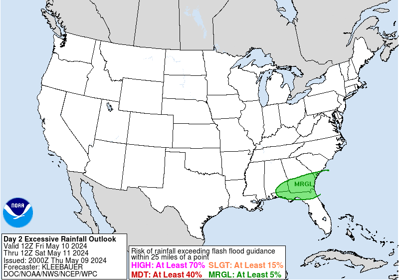
...THERE IS A HIGH RISK OF FLASH FLOODING OVER PORTIONS OF SOUTH
CENTRAL TN...NORTHEAST MISSISSIPPI AND FAR NORTHERN ALABAMA......THERE IS A MODERATE RISK OF EXCESSIVE RAINFALL OVER PARTS OF
THE LOWER MISSISSIPPI VALLEY TO THE TENNESSEE VALLEY DUE TO
ANTECEDENT CONDITIONS PLUS ADDITIONAL RAINFALL...21z update...
After collaborating with WFOs JAN/MEG/OHX/HUN, a High Risk was
assigned to portions of south central TN, northeast MS and far
northern Alabama for Day 2. The main reason for the upgrade is the
saturated antecedent conditions across these areas. In many spots,
rivers are in flood, and the most recent National Water Model
showed a large area of very high streamflows from previous
activity. The aforementioned offices indicated that as little as
1.00 inches of rainfall in three hours could have significant
impacts.As surface low pressure tracks from the TX Panhandle into the Mid
MS Valley, a 35/45 knot low level southwest flow transports 1.50
inch precipitable water air (which is between two and three
standard deviations above the mean) and 500 J/KG of MUCAPE along a
frontal boundary moving north across the Lower MS and TN Valleys.
The combination of moisture and instability could result in
convection with hourly rainfall rates in excess of 1.00 (as seen
in the 12z NAM CONUS Nest and the 12z WRF ARW) over the
aforementioned areas. This would be sufficient to cause
significant flooding issues where storms training (which is
possible, given that the 850-300 mb mean wind becomes better
aligned with the propagation vectors).Hayes
-
8 minutes ago, jaxjagman said:
ECMWF Deterministic FORECAST FOR: BNA    LAT=  36.12 LON=  -86.68 ELE=   591

                                            12Z FEB21
                6 HR    6 HR    FROZN   TOTAL    SFC     2 M    1000    1000
                 QPF     CVP     PCP     QPF     PCP     TMP     500     850
                (IN)    (IN)    (IN)    (IN)    TYPES    (C)     THK     THK
THU 12Z 21-FEB                                           4.4     555     132
THU 18Z 21-FEB  0.00    0.00    0.00    0.00            12.1     556     134
FRI 00Z 22-FEB  0.04    0.00    0.00    0.04             8.8     557     134
FRI 06Z 22-FEB  0.21    0.04    0.00    0.25             6.3     558     134
FRI 12Z 22-FEB  0.56    0.12    0.00    0.82             6.3     558     134
FRI 18Z 22-FEB  0.52    0.03    0.00    1.34             8.2     559     135
SAT 00Z 23-FEB  0.21    0.03    0.00    1.54             8.0     559     136
SAT 06Z 23-FEB  0.40    0.07    0.00    1.94            11.1     562     138
SAT 12Z 23-FEB  0.91    0.47    0.00    2.85            14.5     563     138
SAT 18Z 23-FEB  0.32    0.21    0.00    3.17            18.4     563     138
SUN 00Z 24-FEB  0.11    0.04    0.00    3.28            17.3     565     138
SUN 06Z 24-FEB  1.30    0.23    0.00    4.58            14.7     562     136
if that train sets up the typical WSW to ENE fashion then I assume the cumberland watershed above(SE of the lake) the lake gets that too..or at least a toned down version
-
54 minutes ago, Wmsptwx said:
That picture is incredible...having been there once it's astounding to see it like that.
well I assumed the rate of rise would level off by now and it looked like that was happening. as the rate fell to .14 feet per hr this morning for a few hours..but the last few hours rate is increasing again( not on TVA site yet but will be soon)
It could be the crest wave off the main stem is hitting the lake and this is more then the decline in other inflows..
another wild card is Laruel River lake...this is a dammed up area for Flood control with no spillway in the watershed ..I have seen You-tube videos of it overflowing in the past but can't find any info on its current status...did it just start to overflow? has it been all along? not yet?
I'm not sure if TVA is legally bind to keep the combined runoff flows from Wolf Creek, Dale Hollow and the 500 sq miles of local runoff maxed 40.000 cfs..the articles I found just implies that is procedure
but as I pointed out they are wasting time and water but not moving outflow up to 35,000 now...as they planned last friday
-
1 hour ago, Holston_River_Rambler said:
Looks like Cumberland Falls flow has increased dramatically since I was there last week.
Much higher and there won't be a waterfall anymore. If you've never been there it's hard to express how high the water would hav to be.
all going into the lake of course...looks like the river at williamaburg just upstream from that has peaked for now..but a second peak similar to the one today is in the forecast plots...it will go even higher if training happens again
.lots of replies on facebook on that post...I think as time goes on more and more people may question if the lake will over flow...amd there will be hype and panic on social media
even it is does all that MAY happen is it will spill over a little and really have no more outflow(since by then inflow should be much lower then now) then it does now assuming the shut the gates and just let it go? but it is going to be a battle all spring to get the flood control storage back in the upper Cumberland basin for any huge spring events
2/21/2019 9 AM 745.92 26,040 +.25
2/21/2019 10 AM 746.05 26,130 +.13A slight uptick in outflow,(about 500 since this morning),this is what happened when it increased to 29K before
but just a drop i the bucket to what is needed
edit: outflow increased again
2/21/2019 11 AM 746.20 +.15 28,420
-
Time for for some math ( in a hurry I made have made errors)
2/21/2019 4 AM CST 745.00 25,850
2/21/2019 5 AM CST 745.18 25,940 +.18
2/21/2019 6 AM CST 745.36 25,940 +.18the lake has risen an average of .18 feet per hour ending at 4am and amazing 4.32 feet..the max rolling 24 period will be higher then that even
The corps has a major problem..Dale Hollow 655.25. just downstream, has zero outflow right now...and rising fast too.. up almost 2.95 feet on 24 hours..it overflows at 661 feet..came within inches in a few times in the past..outflow of 5,000 keeps the lake steady it seems,,,but that is 5000 that takes away from Wolf Creek outflow
If the Cumberland lake averages .14 an hr rise the next 24 hrs 4 am-4am from that 745 level
.14 rise per hour ending 10z Friday that's 748.36 no more rain
.12 average rise the next 24 hours 751.24 mod-heavy rains widepread training?
.16 the next 24 hours 755.08 record smashed light rain to scattered heavy stuff with the line of storms
.14 next 24 hours 758.04 no more rain but still rising fast from old rain
.04 per hour the next 24 hours 759.4 no rain
.02 per hour the next 24 hours 759.88 no rain
.01 per hour the next 24 hours 760.12 lake overspills here 10z thursday Feb 28th no rain
now some days like tommrow I may have over estimated rises, and some days underestimated ..but you can take away some one day but add it to the next set of numbets. etc etc
...the lake may still be rising at .08 inch per hour or so before the next batch of rain starts adding to it too
The above assumes the basin gets trained again..12z NAM (usually NW) keeps that just SE of the basin
2/21/2019 7 AM 745.50 25,940 +.14
2/21/2019 8 AM 745.65 25,940 +.15-
2
-
-
6 hours ago, janetjanet998 said:
following Oroville , DWR said that the peak inflows, or lake level rises, into a lake occur a few hours after peak rainfall rates...then the rate of rise starts to decline without any more rain
but .22 feet per hour for a lake the size of Cumberland is crazy, especially at these high levels since it takes more volume of water to raise it per foot the higher it is since the lake is shaped like the letter V
the 6pm TVA data is flawed but the NWS river graph hints that may be even higher then a .22 rise between 5 and 6
2/20/2019 3 PM 742.18 25,420. +.18
2/20/2019 4 PM 742.38 25,510 +.20
2/20/2019 5 PM 742.60. 25,470. +.22
WOW...only 8 feet from the record....still climbing fast....hopefully the train will stay south and the last part north....the GFS is disturbing with 2-3+ inches
at 760 it spills over the top of the spillway...(again may not get there this time but later in the spring?) .this isn't Oroville where it spills on to a hillside and erodes it away but still.....there will be no flood control at that point..
if it is like any other situation there is a control plan that you do X, Y, and Z when A, B and C happens
the control plan likely says no more then X amount of outflow when there is so many inches of future predicted rains for downstream flood control...
that is likely why they dropped outflows to 25K from 29K and have delayed the increase to 35K they mentioned last Friday...
but every hour of these lower outflows means an extra hour of 5-10 or even 15K cfs(if they eventually increase to the record 40K) that they will have to make up in the future
2/20/2019 6 PM 742.86 25,560. +.26
2/20/2019 7 PM 743.07 25,560. +.21
2/20/2019 8 PM 743.29 25,650. +.22
2/20/2019 9 PM 743.49 25,740 +.2
2/20/2019 10 PM 743.73 25,660. +.24-
1
-
-
following Oroville , DWR said that the peak inflows, or lake level rises, into a lake occur a few hours after peak rainfall rates...then the rate of rise starts to decline without any more rain
but .22 feet per hour for a lake the size of Cumberland is crazy, especially at these high levels since it takes more volume of water to raise it per foot the higher it is since the lake is shaped like the letter V
the 6pm TVA data is flawed but the NWS river graph hints that may be even higher then a .22 rise between 5 and 6
2/20/2019 3 PM 742.18 25,420. +.18
2/20/2019 4 PM 742.38 25,510 +.20
2/20/2019 5 PM 742.60. 25,470. +.22
-
1
-
-
20 minutes ago, Holston_River_Rambler said:
I'm not saying it looks great in any way, but having 5 - 6" inches fall over half the watershed instead of all the watershed has to be better in some small way. Getting emails from the Euro people so I'm being a little more descriptive with their non-free maps for a bit.
I think Corps and river forecast center uses the WPC rainfall maps....if you get training like happened this morning it throws it into chaos, any press releases or forecast released that day are based on the lower general WPC numbers released at 3am...that is why sometimes these people are behind the curve... for example ...look at the Cumberland river level forecast upstream of the lake...even though they were updated this afternoon...they are getting blown away....
Wolf creek Dam was repaired...by putting in a very deep cut off wall to stop seepage and leaking out of the earth part....but at least those leaks and seepage relieved pressure...so it will be interesting to see what happens since the pressure has to go somewhere else...
Lewisville Dam near Dallas( big trouble there a few years ago). I know they actually dig pressure release wells...but thats a different set up...(no bedrock there just dirt)
I have no idea what will happen if the entire watershed get 5 inches....it will be a nowcast thing to see where training sets up ..again most of the water shed is SE of the lake ..even a few miles north of the actual lake is out of the water shed
TN valley heavy rain/flooding week of whenever
in Tennessee Valley
Posted
Knoxville
Highest rainfall total in one day
6.14"July 16, 1917
as luck would have it timing wise........ it started raining hard at midnight..and the ending frontal storms should hit about midnight
2.60 as of 9am (.42 last hr)