

eyewall
-
Posts
11,675 -
Joined
-
Last visited
Content Type
Profiles
Blogs
Forums
American Weather
Media Demo
Store
Gallery
Posts posted by eyewall
-
-
18 minutes ago, NorthHillsWx said:
This weekends storm has trended way east. Probably saves inland areas from worst winds and severe threat
yeah should be a run of the mill rainy day for the most part.
-
9 minutes ago, buckeyefan1 said:
There’s a shit ton of energy associated and just a slight change from any of the 3-4 pieces flying around will give various solutions. I hope the same thing happens when there’s cooler air around. The hourly meltdowns would be epic

present company included. We're all jaded after last year.
-
 2
2
-
 2
2
-
-
6 minutes ago, CaryWx said:
Kind of a wonky shift to me. Still not resolved imho
Yeah it was all about the northern stream energy in that run. Not sure why such a large change.
-
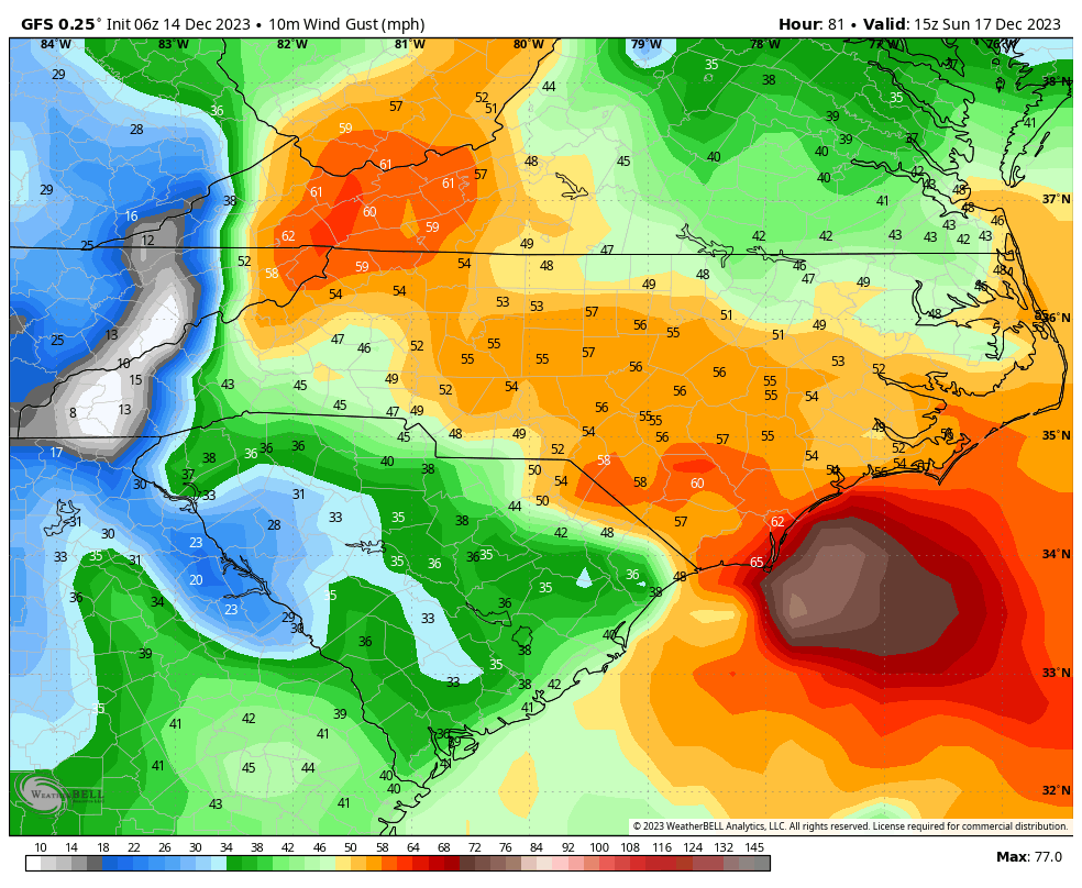
54 minutes ago, buckeyefan1 said:
It looks overdone. There’s a stable layer, thanks to the rain, that should prevent the higher winds from mixing to the surface. Still plenty of time for that to change of course. The mountains are a different story. I do expect the winds to be kicking at higher elevations

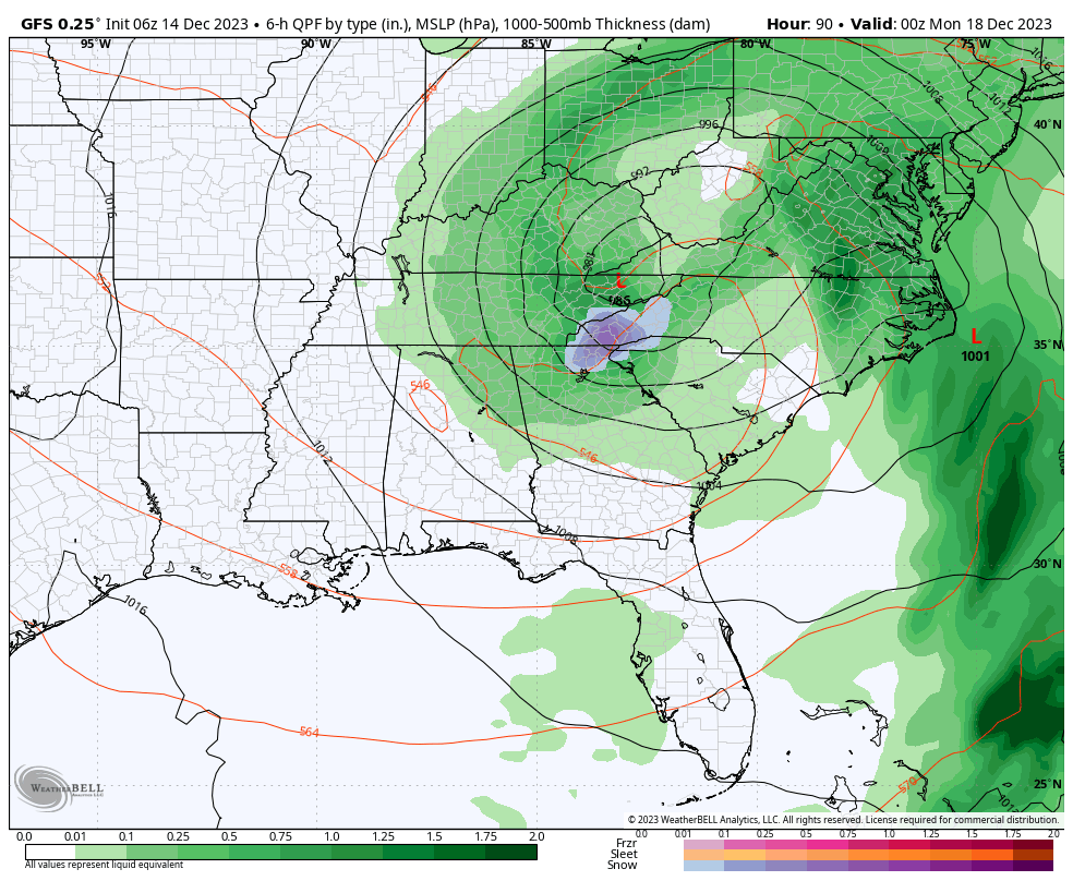
yeah for sure. The 12z GFS is significantly farther east with the surface low but the main ULL is definitely much farther north.
12z:
6z: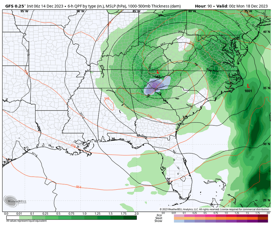
-
 1
1
-
-
15 minutes ago, CaryWx said:
oy
It is likely overdone to some degree but I would think more gusts to around 40-45.
-
1
-
-
-
34 minutes ago, NorthHillsWx said:
At least we don’t have to worry about “what if there was cold air”
We may end up with another tor day.
-
1
-
-
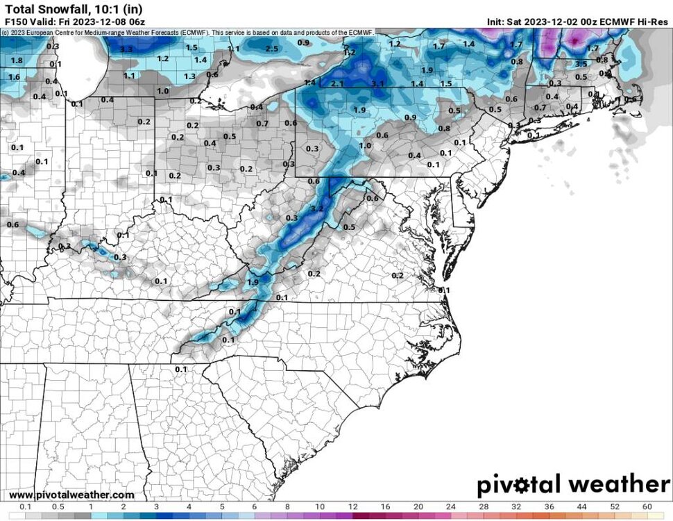
2 hours ago, J.Spin said:
Yeah, B&W is especially fantastic for snow photography – if there’s any weird color cast from poor white balance, strange natural lighting, or whatever, you immediately ditch that and it nails the perfect white once you’re done with level adjustments. The auto balancing in Photoshop is pretty fantastic at nailing the white balance in color photos almost all the time anyway, but going to B&W is basically fool proof in that regard.
Beyond the technical side though, B&W is just perfect for contrasting light and dark, and that’s such a huge part of so many snow photos. Storm days, late days, low light days, and certain parts of the mountain are basically B&W to begin with, so going that route is a natural fit. B&W really just fits so well with the typical snowy, winter vibe of the mountains around here.

Yeah Lightroom is pretty solid for handling those casts etc. I used that for the recent snow in the NC Mountains:
-
5
-
-
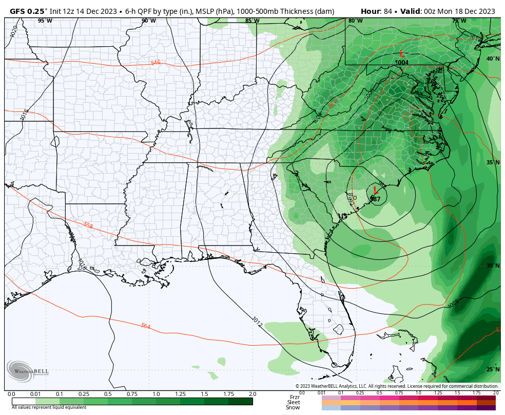
21 minutes ago, MotoWeatherman said:
This weekend's potential upper level low needs to be watched closely. Typically in years past the ULL would trend stronger as the model runs get closer and closer. This is not that far off from being a major whopper for the mountains come Sunday night into Monday.
Don't look at the 18z GFS
-
2
-
-
Happy Hour GFS is way west
-
1
-
-
22 minutes ago, olafminesaw said:
Let's not forget, last year around this storm we were hoping for a massive Christmas blizzard and a solid pattern afterwards. We know how that turned out. All that to say, I'd rather be hoping for a pattern change now, considering El Ninos are typically more back-loaded.
Yeah I am trying to hold on to hope for Jan/Feb which is when we see are biggest snowfalls. I know we're all beyond jaded given the past few years.
-
3
-
-
A timelapse of the afternoon round rolling in:
-
1
-
-
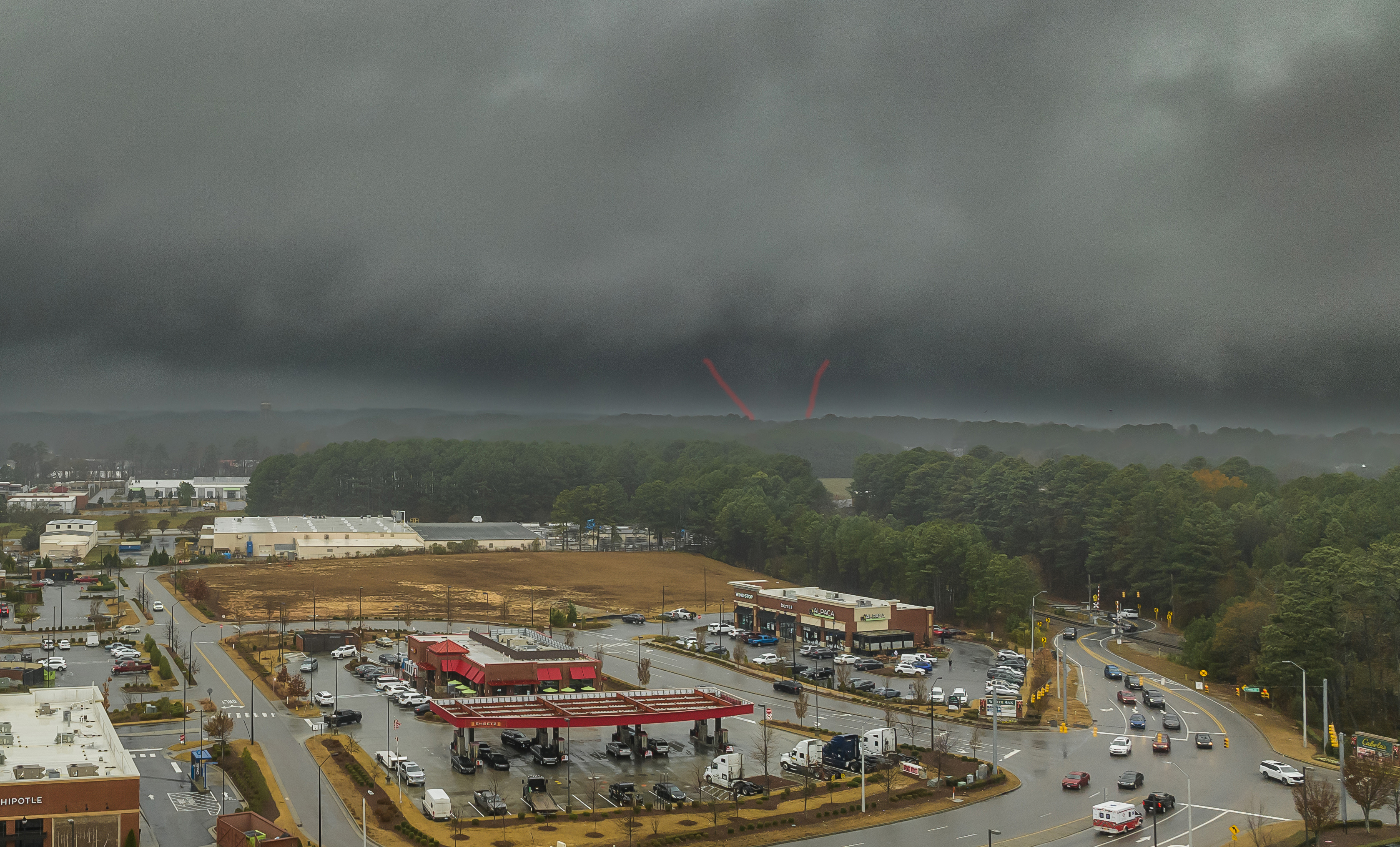
The best look I got at the Garner storm (rain wrapped):
The red highlights where I think the tor was when this was taken.-
3
-
-
54 minutes ago, BooneWX said:
Is there a better location outside of the mountains to live than Roxboro for snow?
Probably not in NC considering it is just under 1000ft in elevation.
-
1
-
-
I wouldn't mind a local chase to Roxboro lol.
-
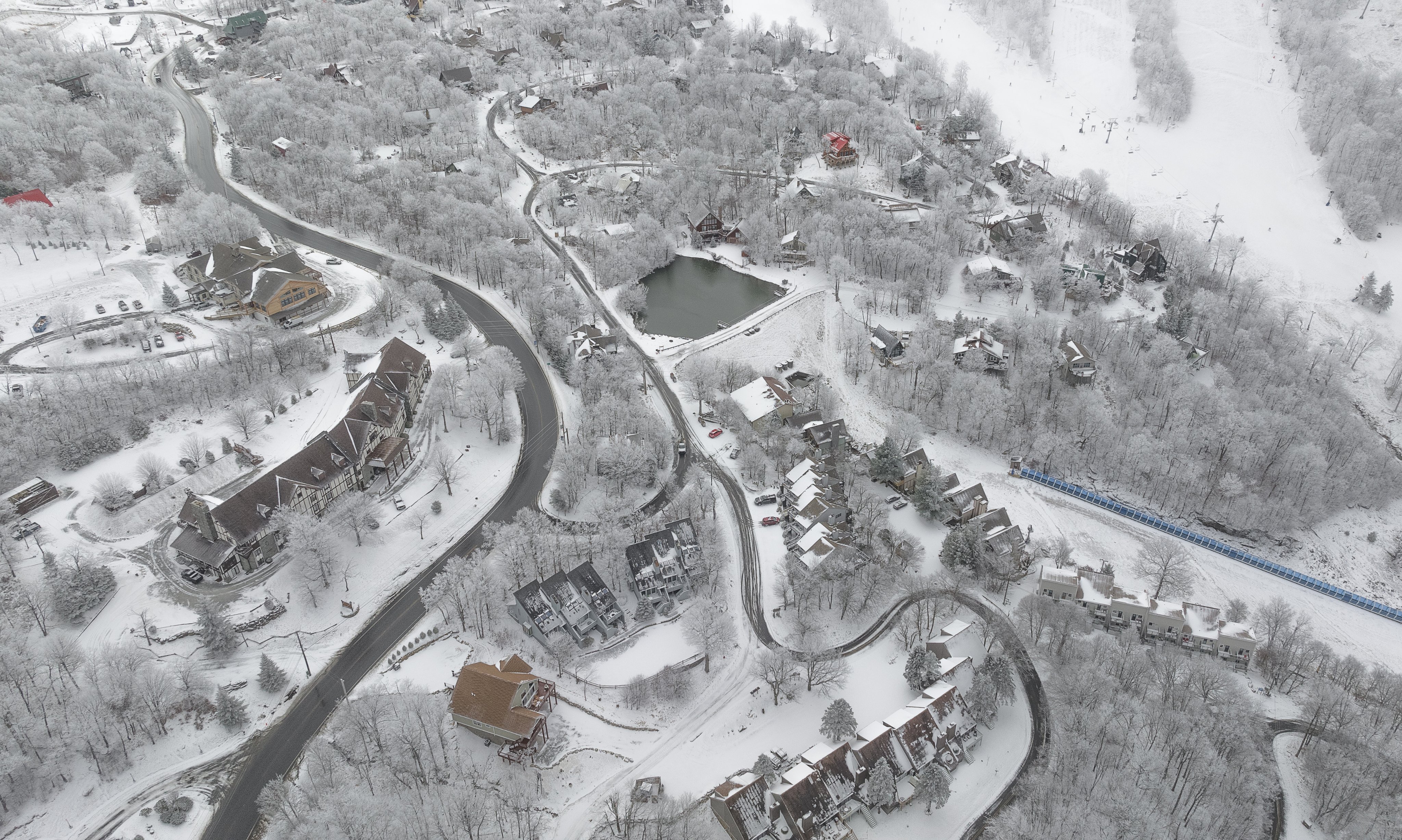
8 hours ago, Boston Bulldog said:
A beauty of a day up high at Sugarbush with immaculate views north towards Camels Hump and Mansfield. Getting a bit skied off in most spots, but taking the hike along of the Long Trail to Castlerock was well worth the effort for some softer turns. For December 8th, hard to do better than this

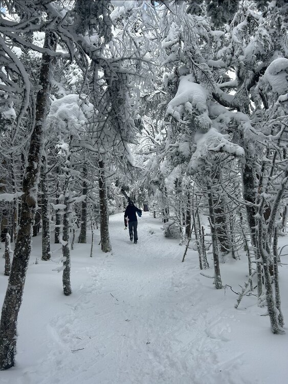
I miss those scenes! My favorite view is from the top of Madonna Mountain at Smuggs. I am hoping to get there this winter.
-
14 hours ago, Layman said:
Looks like a really nice area.
Ironically, I need to secure a "home base" for about 6-10 months in NC during 2024 about an hour outside of Greensboro for my company next year. Any direction and within an hour or so from that area. I was thinking Lake Norman however, do you have any recommendations for places to avoid or areas that are nice? I'm going in blind and am trying to find a nice area to pop into for a few days at a time each month to check on things while we get operations going.
Well that is the Triad which puts you about 2 hours and change from the mountains. Definitely check out Grandfather mountain and that area. Lake Norman is cool for sure as well. I am in Raleigh about an hour east of Greensboro which can be a fun place to visit. You will be about 3-4 hours away from the closest beaches (which are actually at the end of I-40). I would avoid Myrtle Beach in SC though. If you can invest the extra time (5 hours or so) drive to the Outer Banks. Finally in NC, Fayetteville and much of the coastal plain region (inland) is kind of the armpit region of the state.
-
1
-
-
5 hours ago, Layman said:
Nice pics! Where in NC is that?
EDIT: Pardon my reading comprehension....I just saw you said Beech and looked it up.
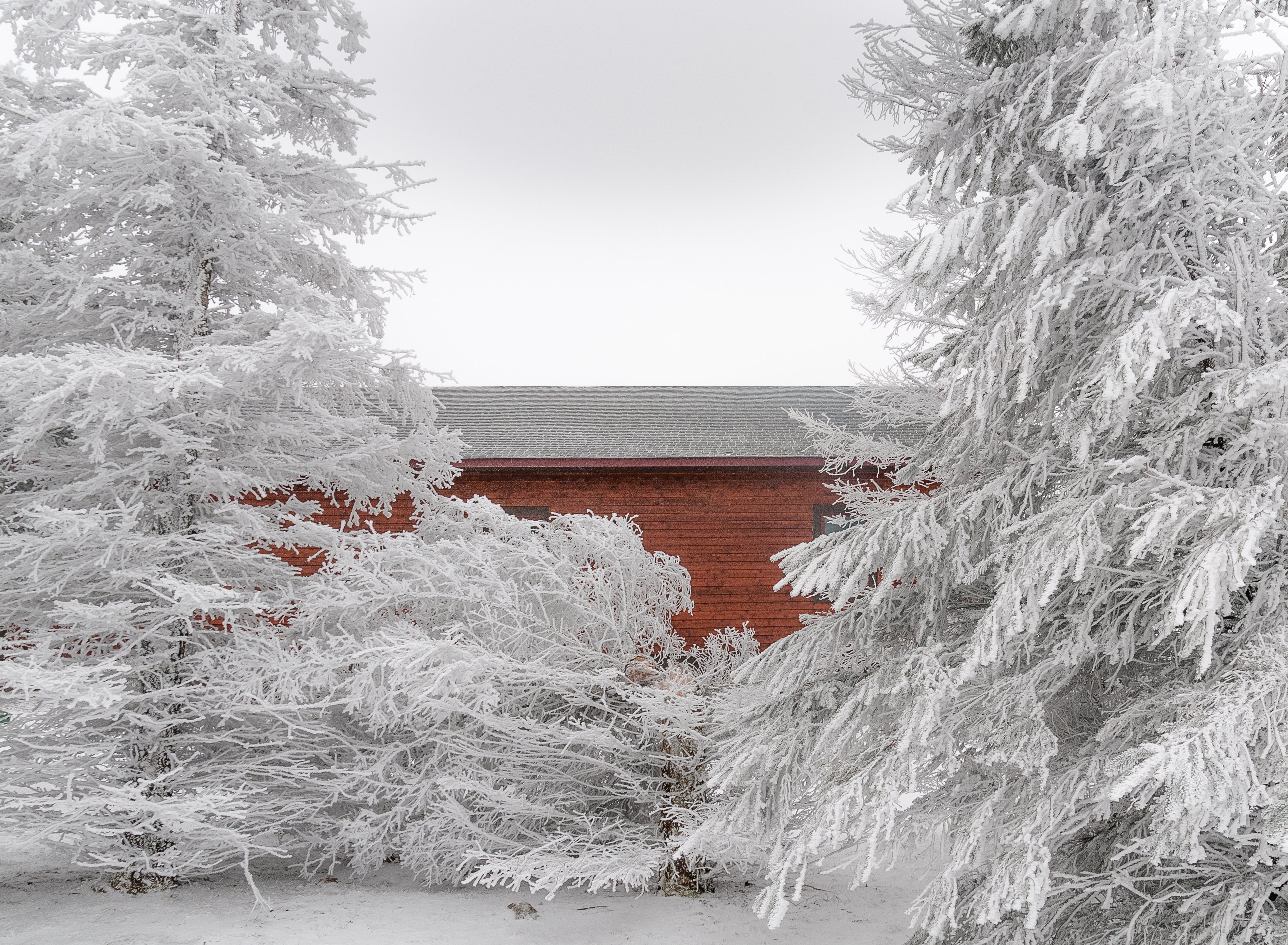
Yes just outside Banner Elk, NC
-
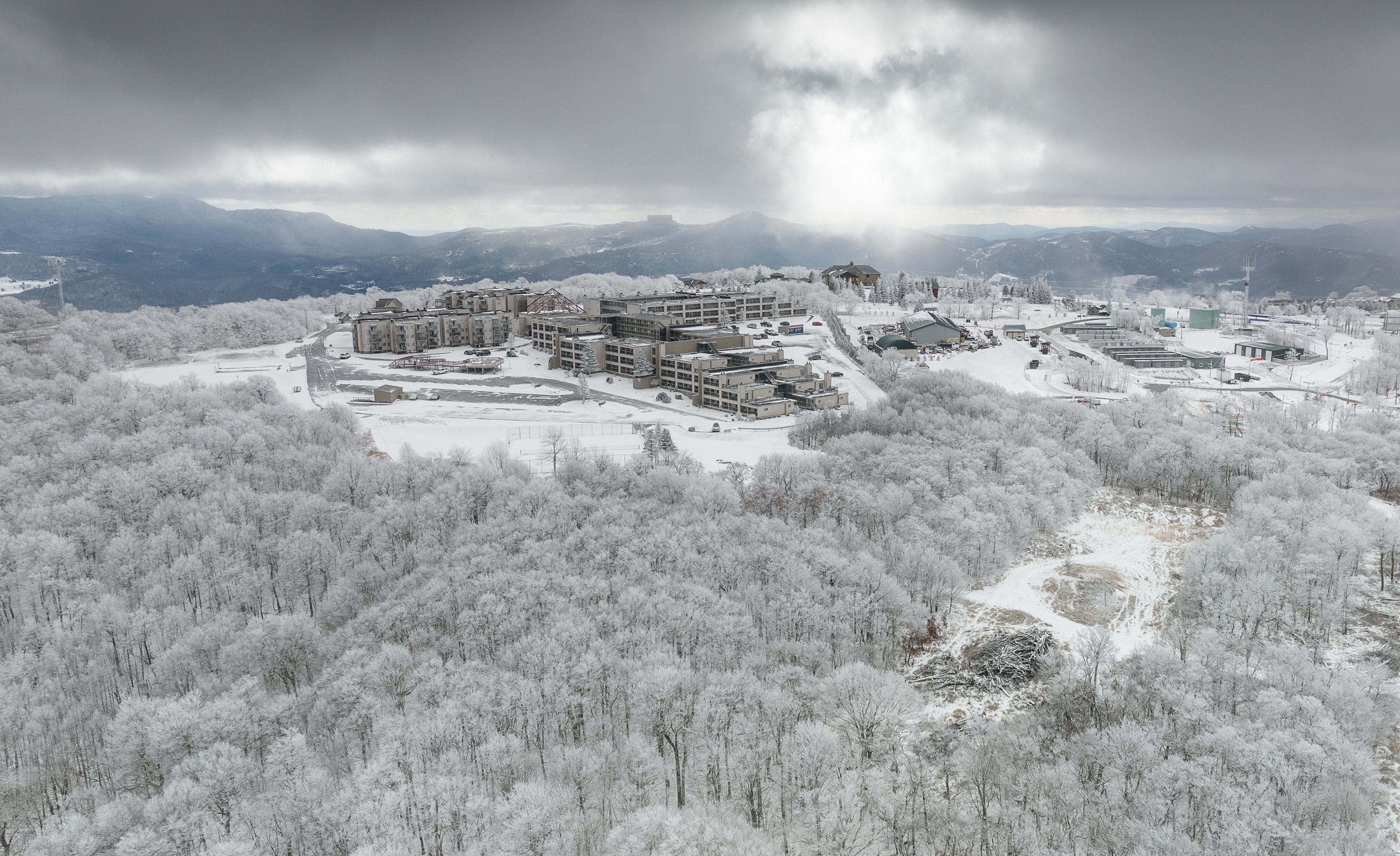
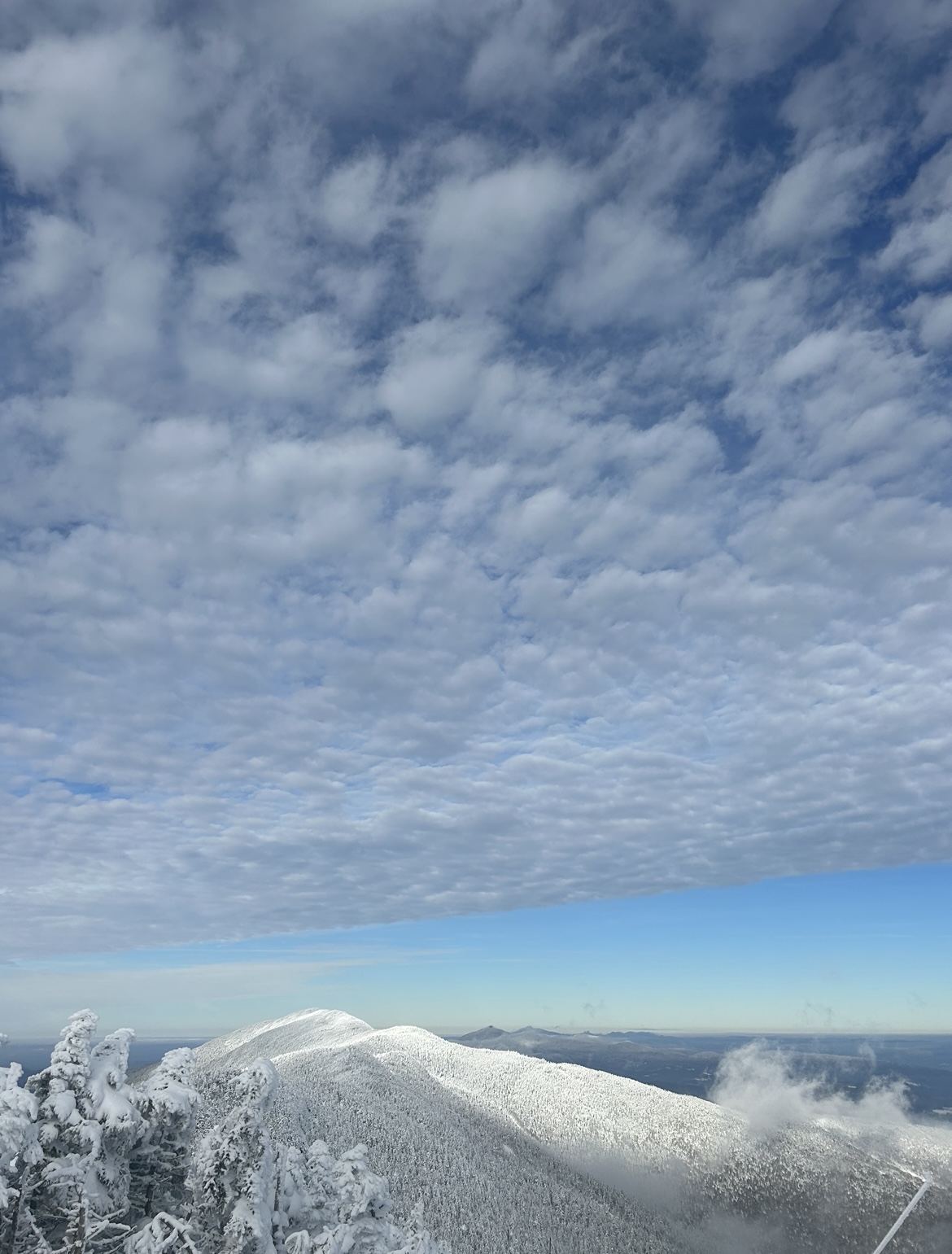
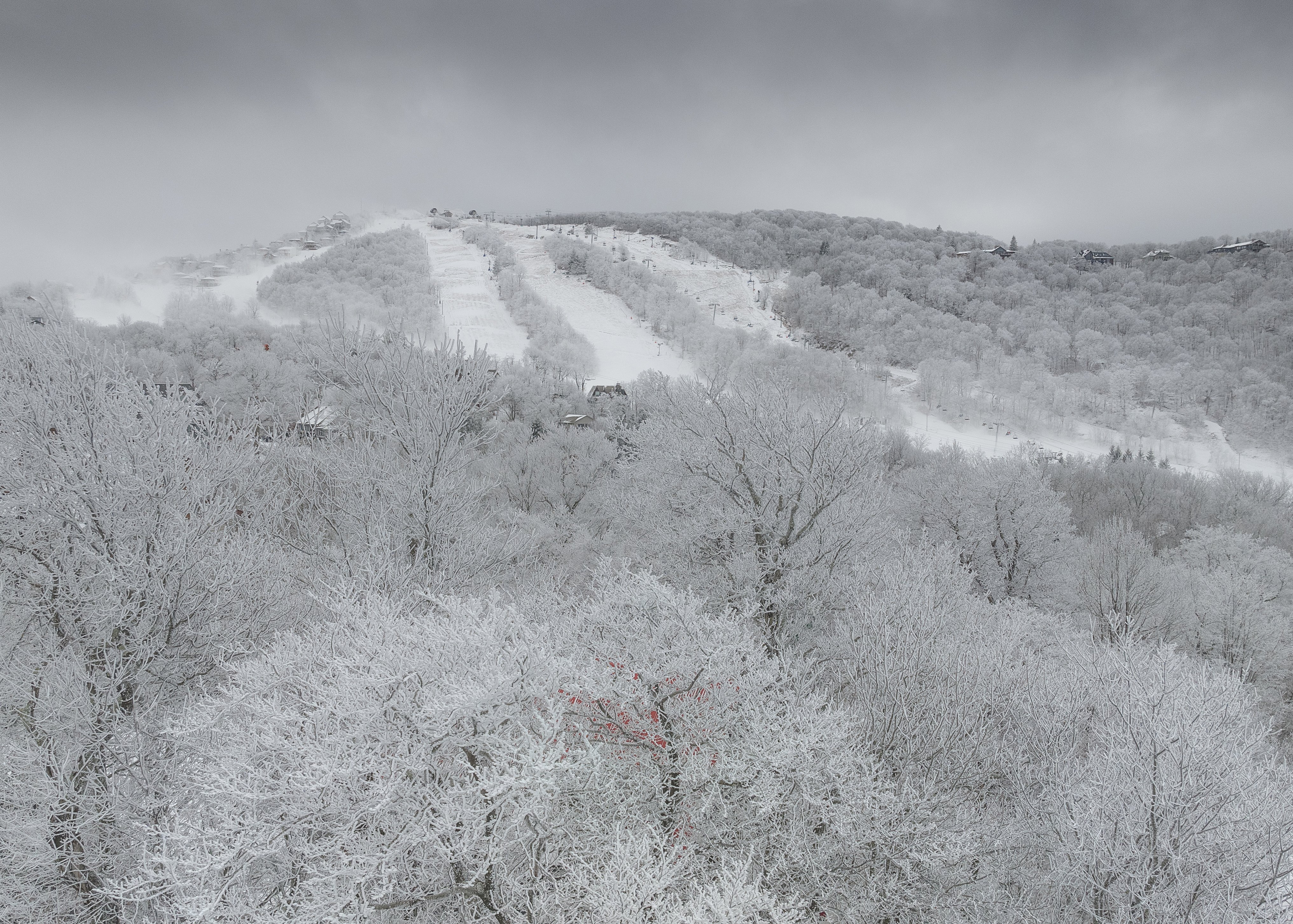
Wow looking great up there! Down here in North Carolina we are seeing winter arrive in the mountains and Beech opened up:
-
4
-
-
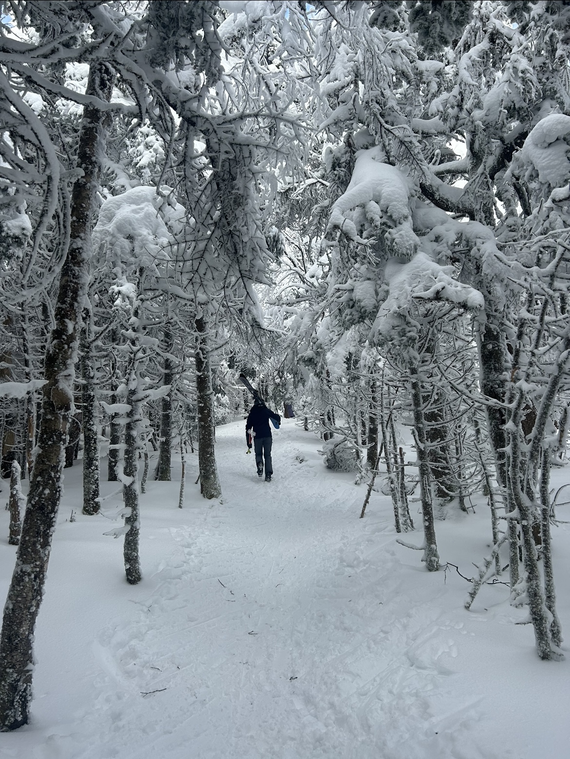
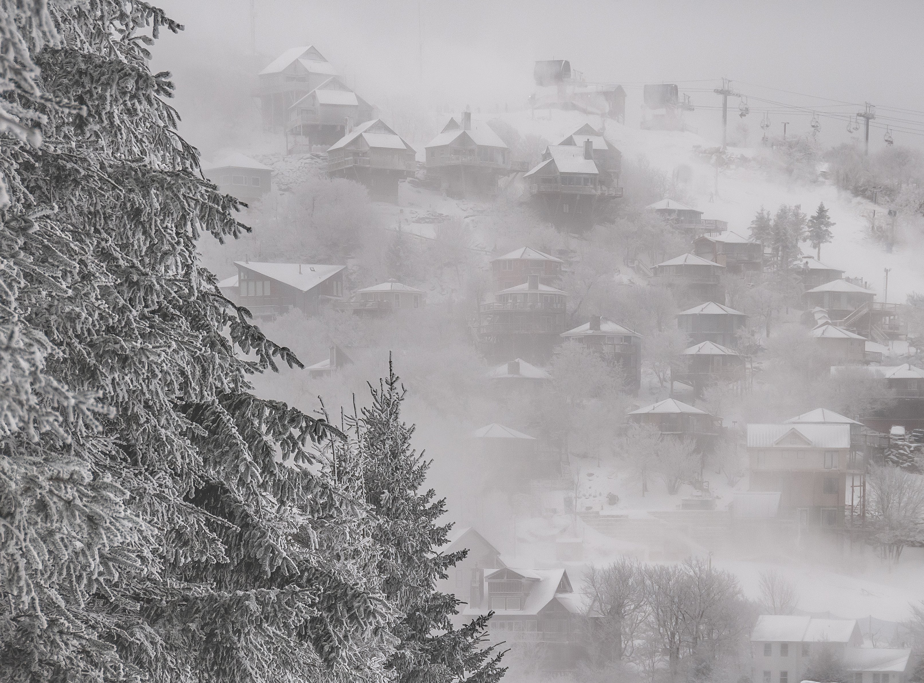
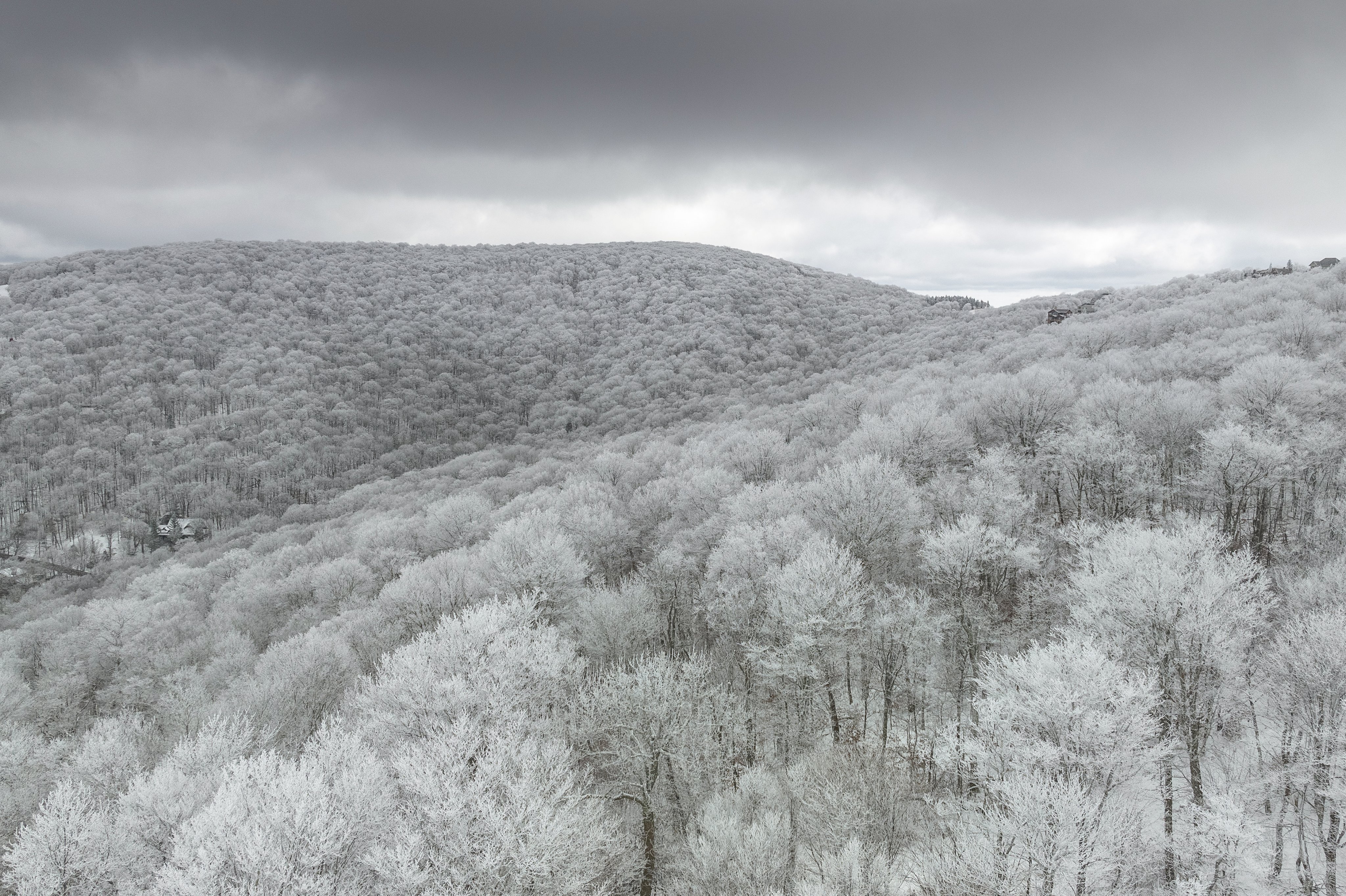
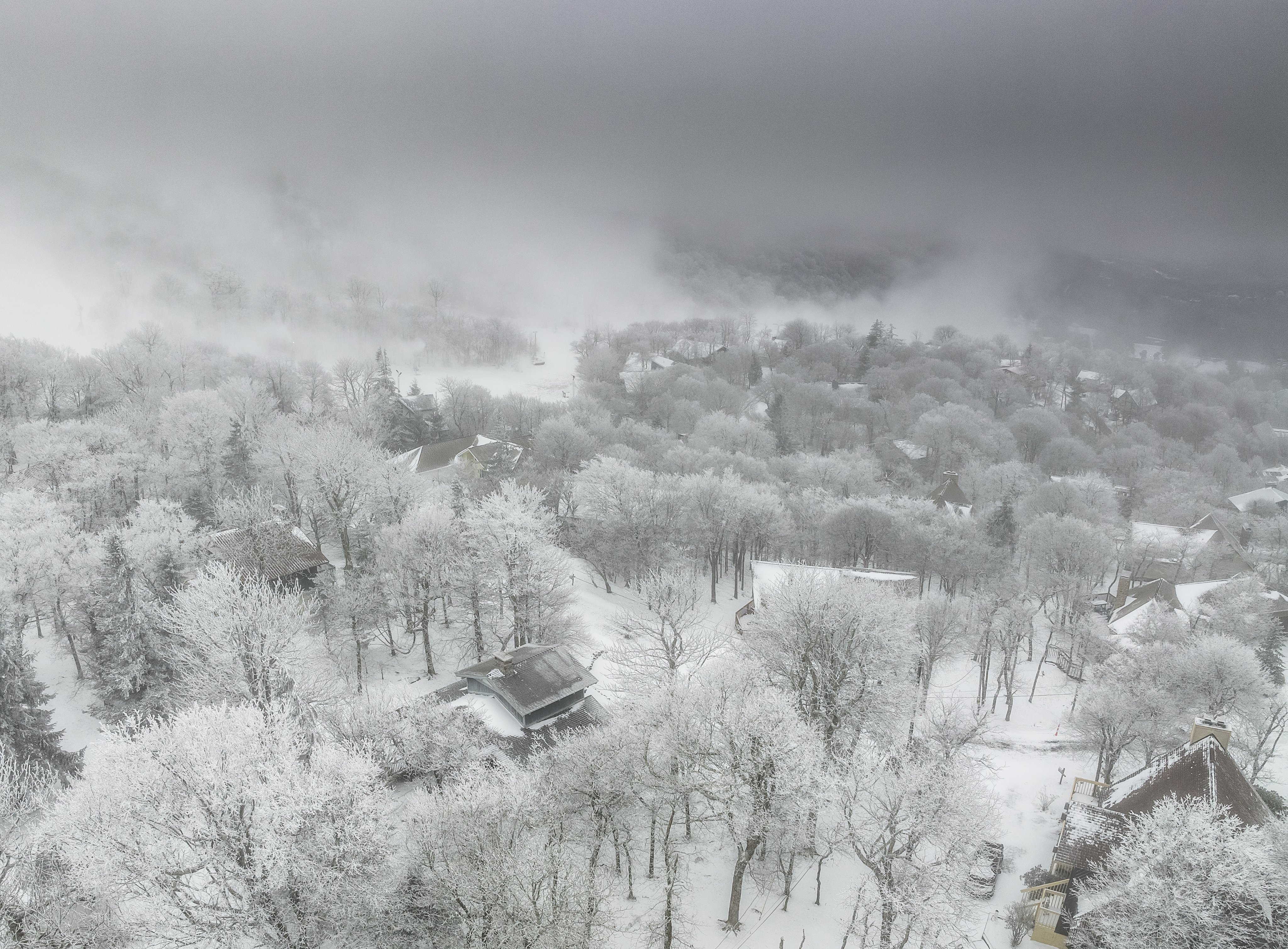
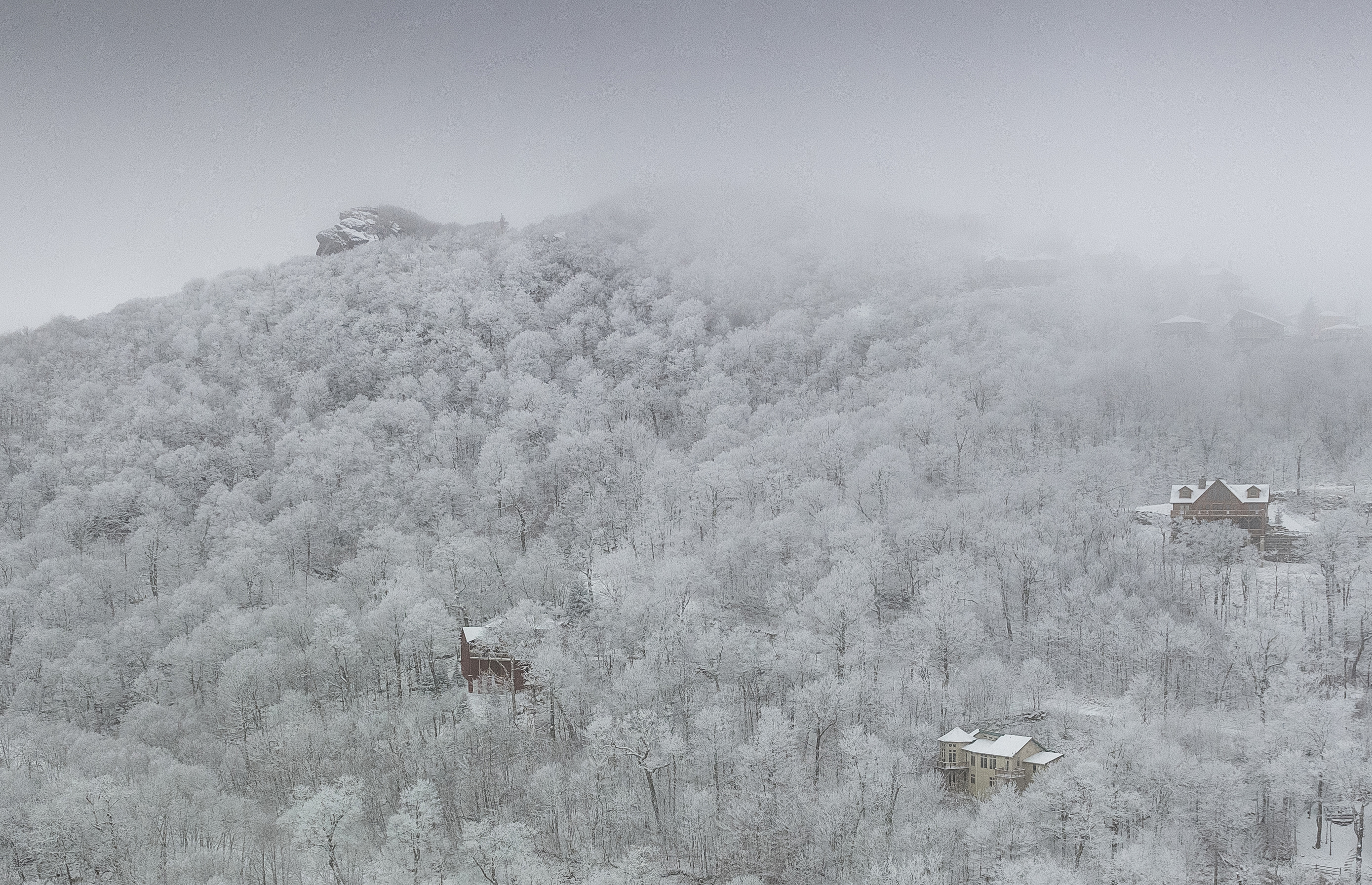
A few more from yesterday:
-
13
-
1
-
-
It wasn't the biggest snowfall but very enjoyable today on Beech. Glad I went up!
-
13
-
-
8 hours ago, Met1985 said:
Euro a lot more robust with some snow this next week.
Sent from my SM-G998U using Tapatalk
Yeah I am watching trends to see if it is worth a trip up that way.
-
10 minutes ago, dendrite said:
Kp just shot up to 7 with a strong south Bz…sure enough right after sunrise.
Isn't that always the way lol.
-
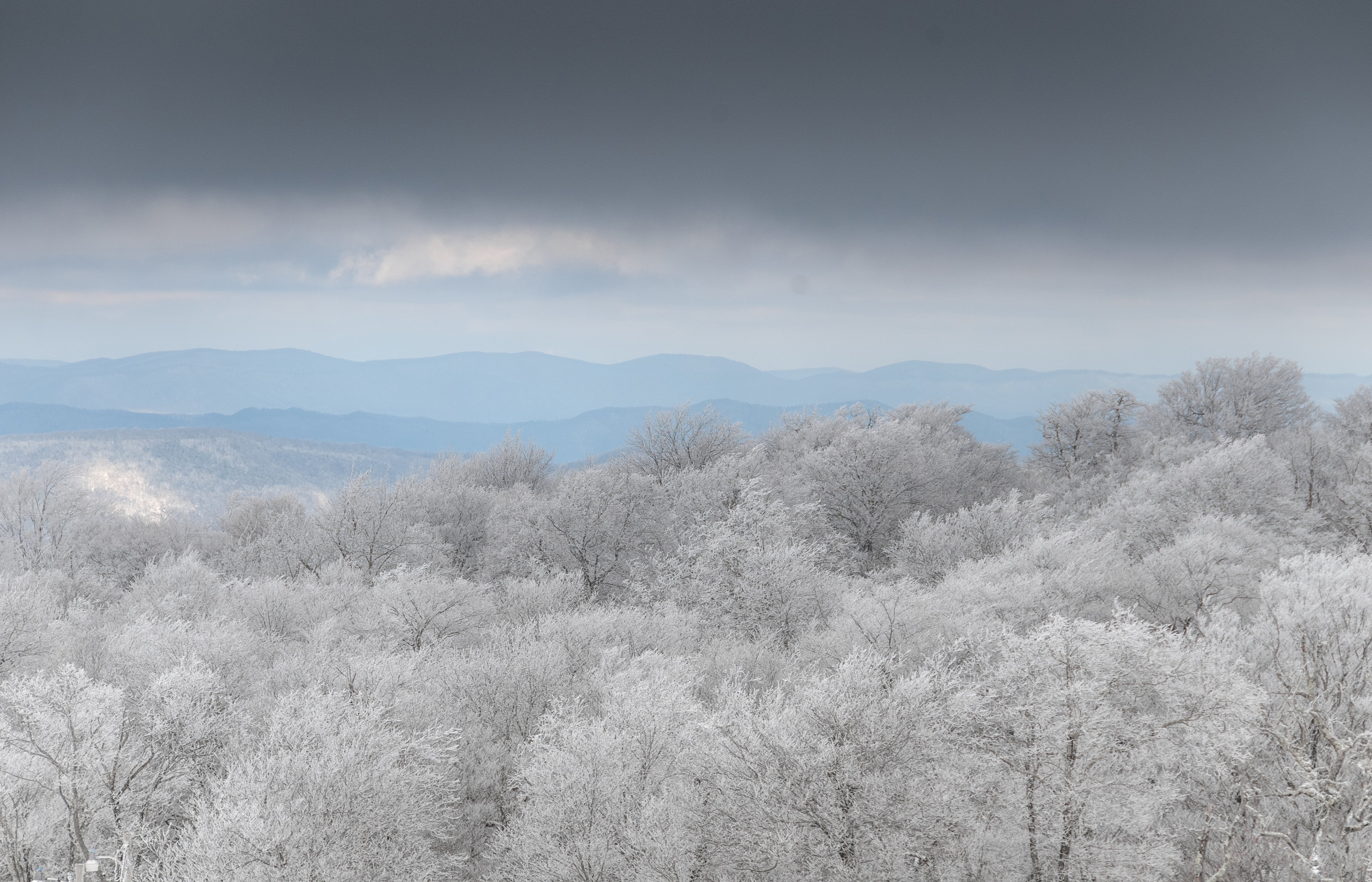
Things looking interesting for Wednesday in the mountains. I may have to venture up.

-
6
-


Mid to Long Range Discussion ~ 2023
in Southeastern States
Posted
There should have been measurable there once in the winter of 2021-2022 and 2020-2021.