

eyewall
-
Posts
13,269 -
Joined
-
Last visited
Content Type
Profiles
Blogs
Forums
American Weather
Media Demo
Store
Gallery
Posts posted by eyewall
-
-
8 hours ago, NorthHillsWx said:
Tomorrow many areas have a chance to go for the all time records. Let’s see them fall screw it at least make this pain historic
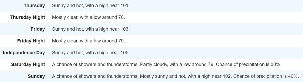
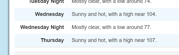
NWS lowered my point and click to 102F for today.
-
101F looks to be the RDU high. That is slightly below the forecast.
-
8 minutes ago, yotaman said:
Currently 95/81 for a feels like of 116. Highest temp so far today.
coastal dewpoints can be brutal.
-
 1
1
-
-
RDU is now officially at 100 F
-
29 minutes ago, NorthHillsWx said:
Blew by 100, 101.4 right now
3 minutes ago, NorthHillsWx said:We’re surging temps now, just crossed 103. My goodness this weather sucks
RDU stalled around 97 F for a bit but wondering what is going on there between hours.
-
RDU Is running 6 degrees warmer than this time yesterday.
-
1 hour ago, GaWx said:
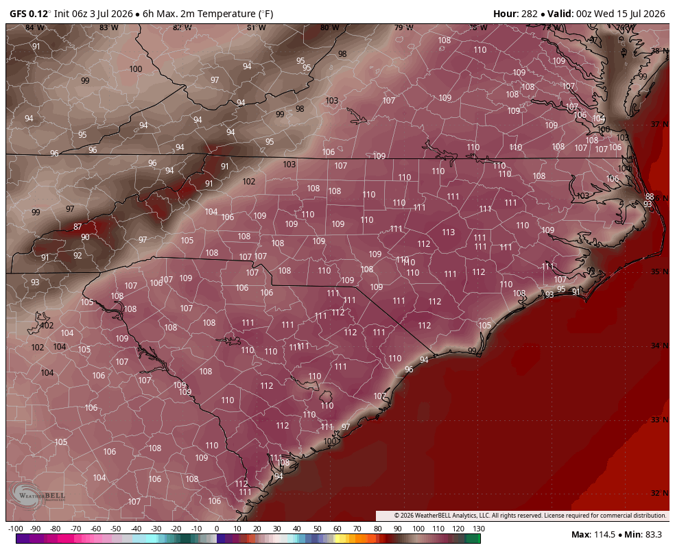
Once again the GFS (6Z) is way too hot in the extended. Even if H5 reaches the near record high upper 590s as it has, highs on July 14-15th will not reach anywhere near as hot as this shows even with the drought:
6Z GFS July 14th highs: for example 112 at SAV is loltastic as that’s compared to the 105 all-time hottest on record there back 155 years!
6Z GFS July 15th highs: also not going to happen

Either way this is horrible that the heat will continue to plague us for this long.
-
1
-
 1
1
-
-
13 minutes ago, NorthHillsWx said:
My point click is now showing a high of 106 tomorrow. I’m. Little skeptical of that
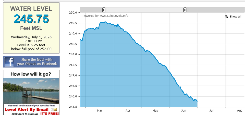
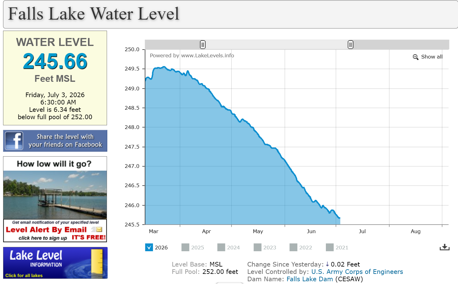
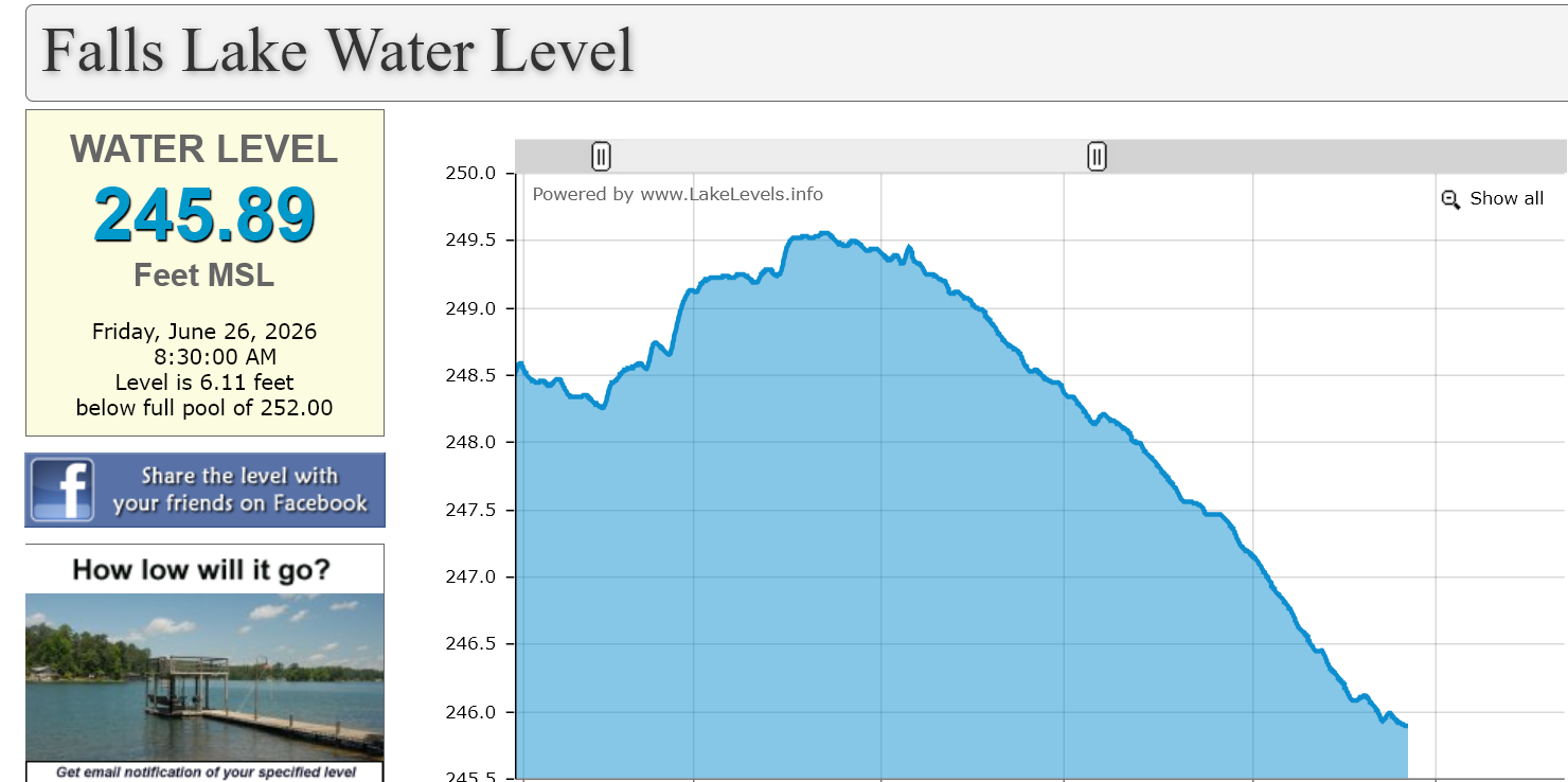
I noticed the bump up as well this morning. I am a bit surprised by that. Also Falls Lake as expected is in free fall again. It has about 3 feet to drop before reaching the all time record low level.

-
46 minutes ago, NorthHillsWx said:
We are running significantly above RDU right now, 97.4 vs 93. Don’t see that ever
Yeah that is very odd!
-
30 minutes ago, NorthHillsWx said:
Y’all have it worse than we do I guess, our DP is 65 right now
Yeah really the worst of this will be up in the DC region. Not that it won't suck here as well but the dp's up there are horrendous.
-
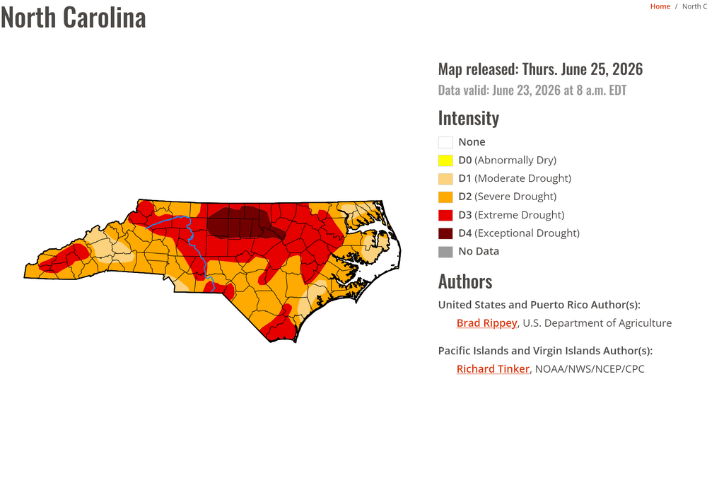
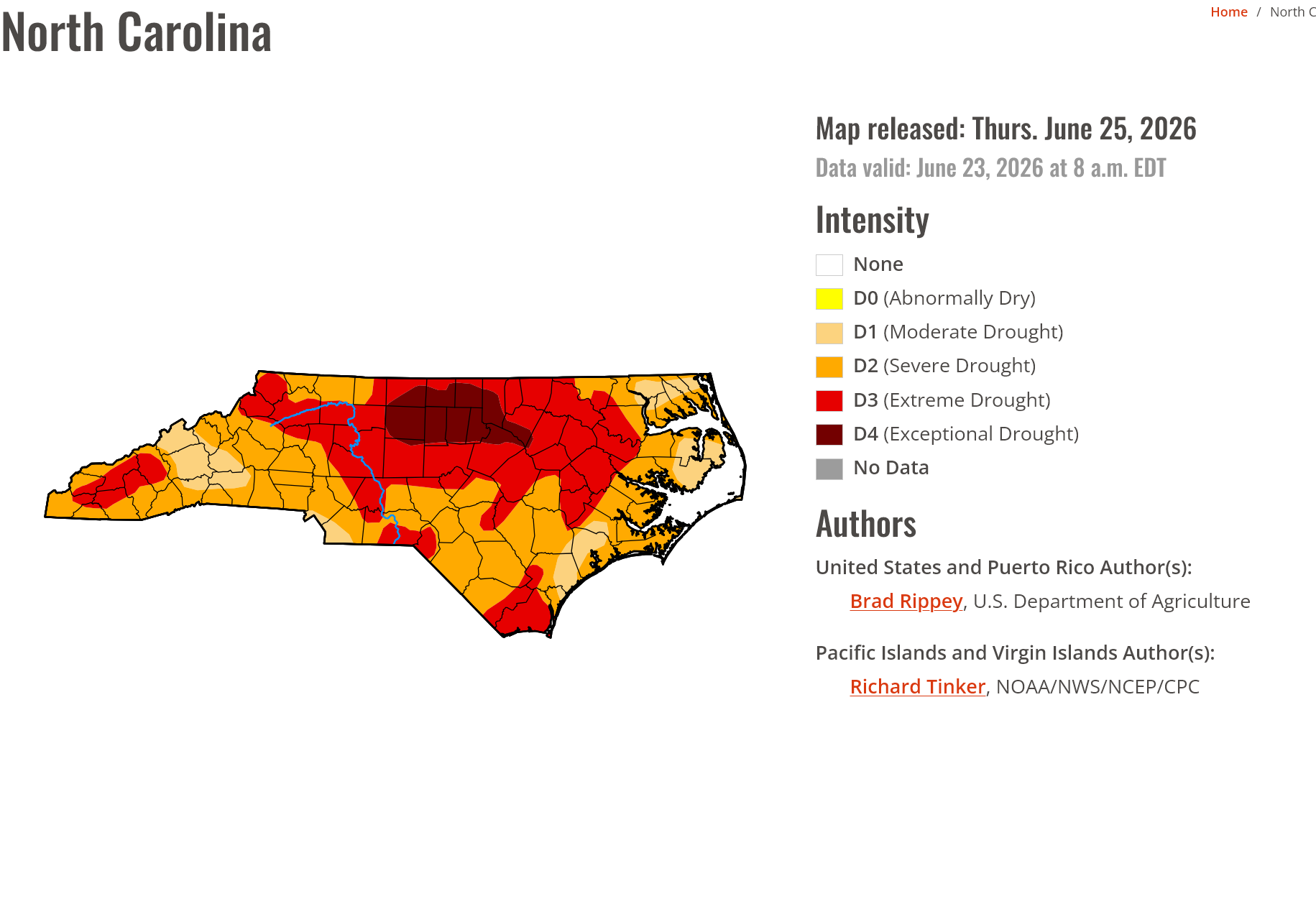
The latest drought update does not look much different:
-
 1
1
-
 1
1
-
-
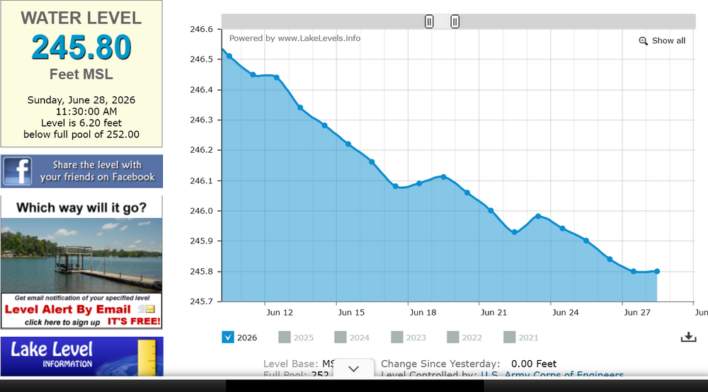
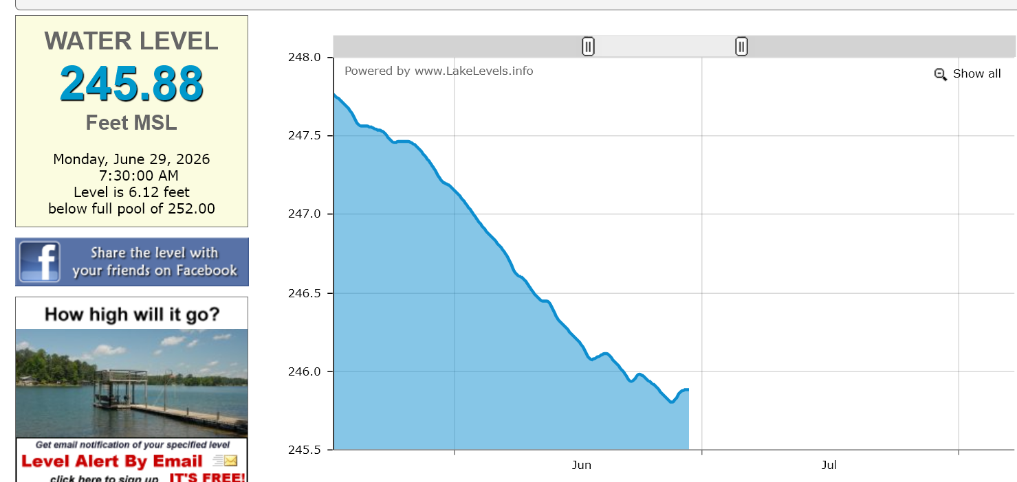
Falls Lake as of late this afternoon as the steady fall resumes:
-
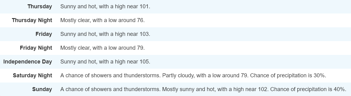
Our latest point and click in Raleigh:
-
1
-
-
Falls Lake after yesterday's rain saw a little bump. I assume it will drop again during the heatwave but the bleeding has stopped temporarily:

-
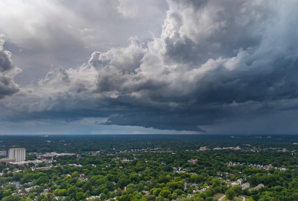
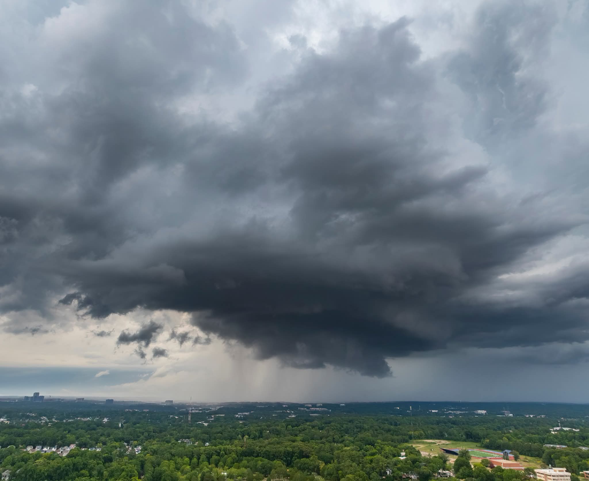
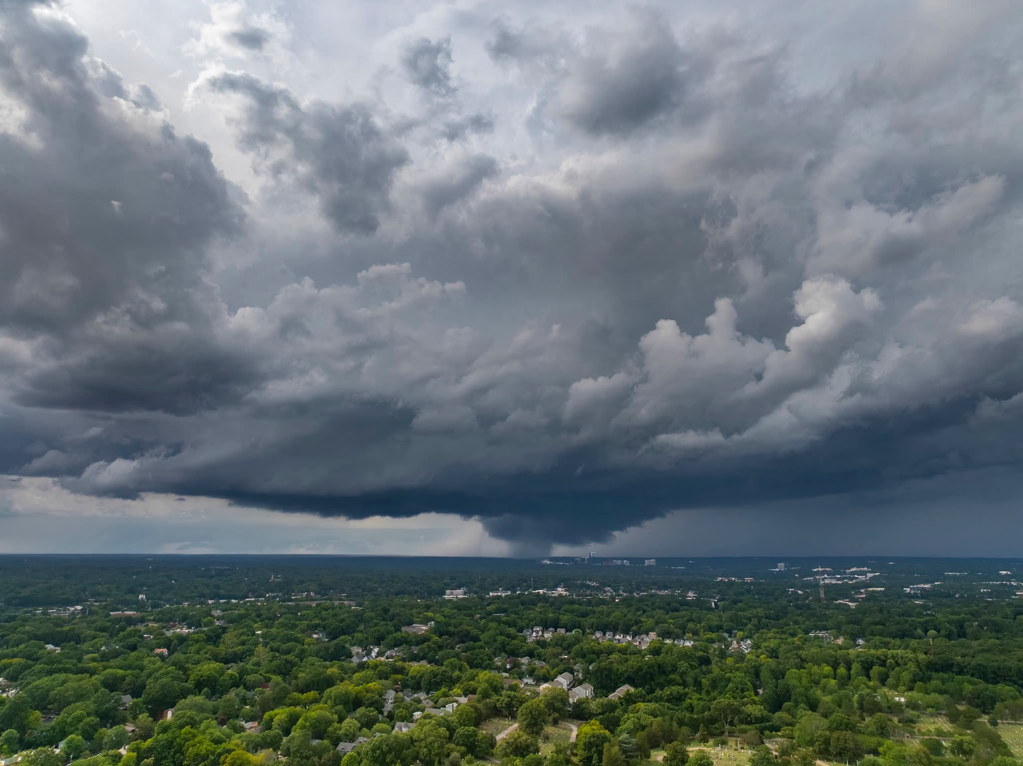
Some more shots from yesterday's brief supercell:


-
2
-
-
A wall cloud after a storm in North Raleigh interacted with a boundary to become a transient supercell.


-
6
-
 1
1
-
-
There are some storms over Falls Lake now so hopefully that can help a little.
-
Definitely still a brutal GFS run through next weekend and perhaps even drier than the previous one. It is not doing anything with the lemon offshore. Falls Lake after yesterday's rainfall. Each tenth would represent 1.2 inches.
-
1
-
-
There wasn't any improvement worth mentioning for Falls Lake from yesterday. Looks like today is the last chance for about a week for any real rainfall there. We will see how much it drops off during the net heatwave. At least they lowered my forecast high to 105F for Friday lol.
-
No rain in downtown Raleigh. Just some strong gusts from thunderstorm outflow. Looks like the eastern side of Falls Lake got a bit of rain.
-
5 minutes ago, SUNYGRAD said:
"The combination of strong subsidence, lack of clouds, dry ground,
and a downslope low and mid level flow - could potentially yield a
near historical heat event bringing very dangerous conditions. Some
guidance is now forecasting a few disturbances in the NW-N flow
aloft riding into the region by Friday and Saturday the 4th. This
may be enough to trigger either widely scattered or scattered (20-30
percent chance) of afternoon or early nighttime thunderstorms
perhaps bringing some temporary cooling."
Doughts can create that kind of a feedback loop for sure.
-
1
-
-
Falls Lake has resumed the steady drop after the rain event we had a few days ago.

-
This is the highest I have ever seen in my point and click:
-
1
-
 1
1
-
 1
1
-
-
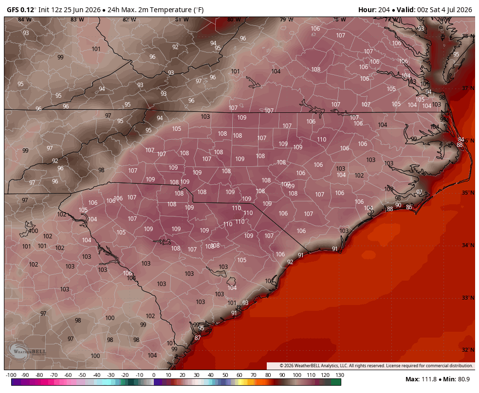
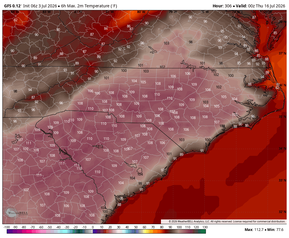
The 12z GFS for Juy 4th:


July ‘26 obs
in Southeastern States
Posted
We have high clouds which may prevent all time records from being set.