

eyewall
-
Posts
11,675 -
Joined
-
Last visited
Content Type
Profiles
Blogs
Forums
American Weather
Media Demo
Store
Gallery
Posts posted by eyewall
-
-
Love the snowliage! Wish I was up there for that!
-
 2
2
-
-
1 hour ago, WinterWolf said:
Ya, only this year. Last years foliage was absolutely stunning. It happens…to much rain this year messed up the leaves.
Yeah last year was amazing! I was up for that as well.
-
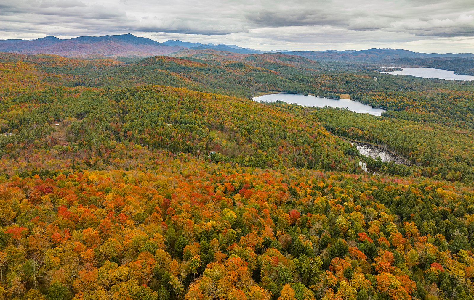
It is definitely a very dull/uneven year foliage wise in VT but I did manage this in Smugglers Notch with a little color enhancement in post (Taken 10/11):

-
6
-
-
One more shot
-
11
-
-
On my way up I caught this yesterday in the Adirondacks (close to I87)
-
2
-
-
9 minutes ago, powderfreak said:
It was hot inside yesterday evening after 87F and dews into the 60s. Temp was higher in many spots up north than they were in August. But if I was dealing with window units then they’d be out and I’d be fine. But flip the switch, cool and dry it out while eating dinner and the evening.
Looks like I am coming up just in time for the rain and cool down lol. Anyway what happened to the NNE threads?
-
48 minutes ago, MarkO said:
Got in September, but with an asterisk. Terrible drive down and back on Friday. Record daily rainfall, and I took the vette which is terrible in rain. Worst mistake was renting skis. They were junk and used the wrong wax. Just a terrible experience overall.
.thumb.jpg.b4eac6d13715c568c935f278bf3a1f90.jpg)
Where was this?
-
It will be fun tomorrow at the Mt. Washington Observatory. Forecast gusts of 130 mph.
-
3
-
-
52 minutes ago, NorthHillsWx said:
Other than FL winds, nothing else points to this being a cat 2 anymore. Max SFMR values of 70-75 kts two flights in a row
Yeah it will basically be a gale center soon enough.
-
2
-
-
Sorry there is more:
-
1
-
-
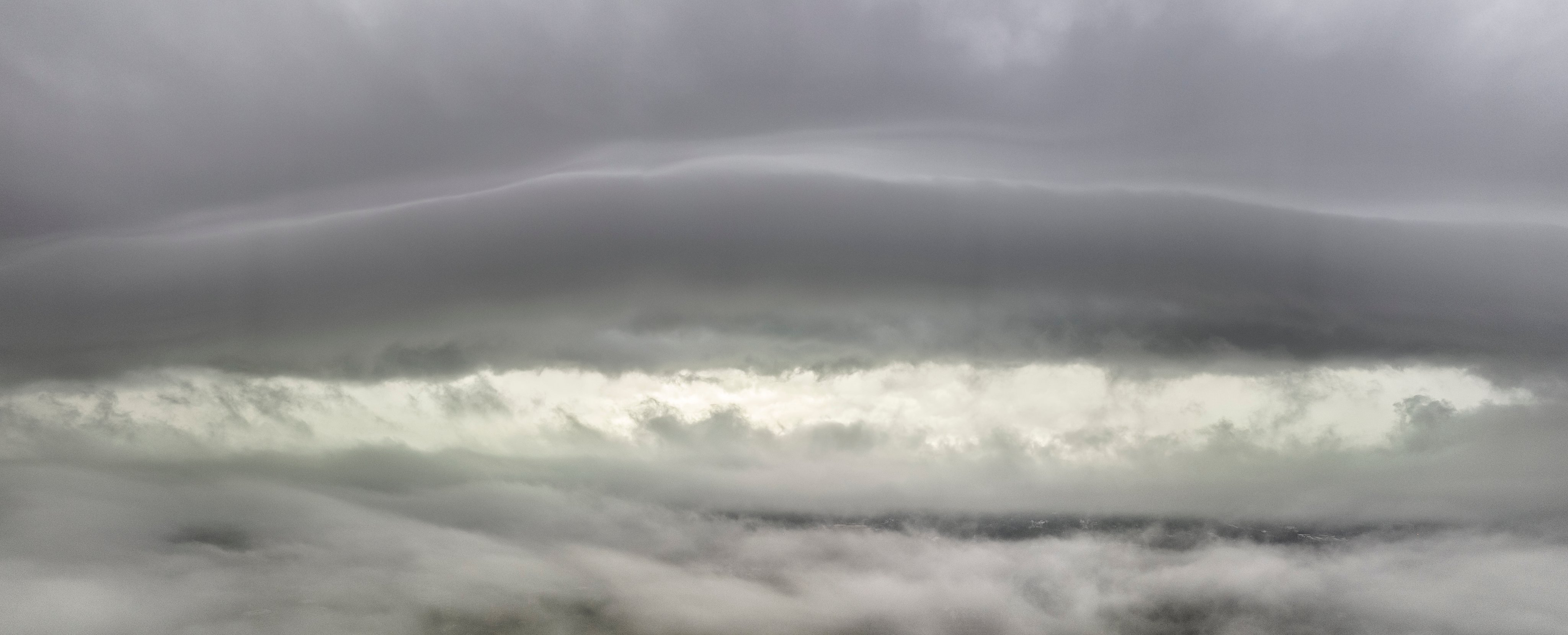
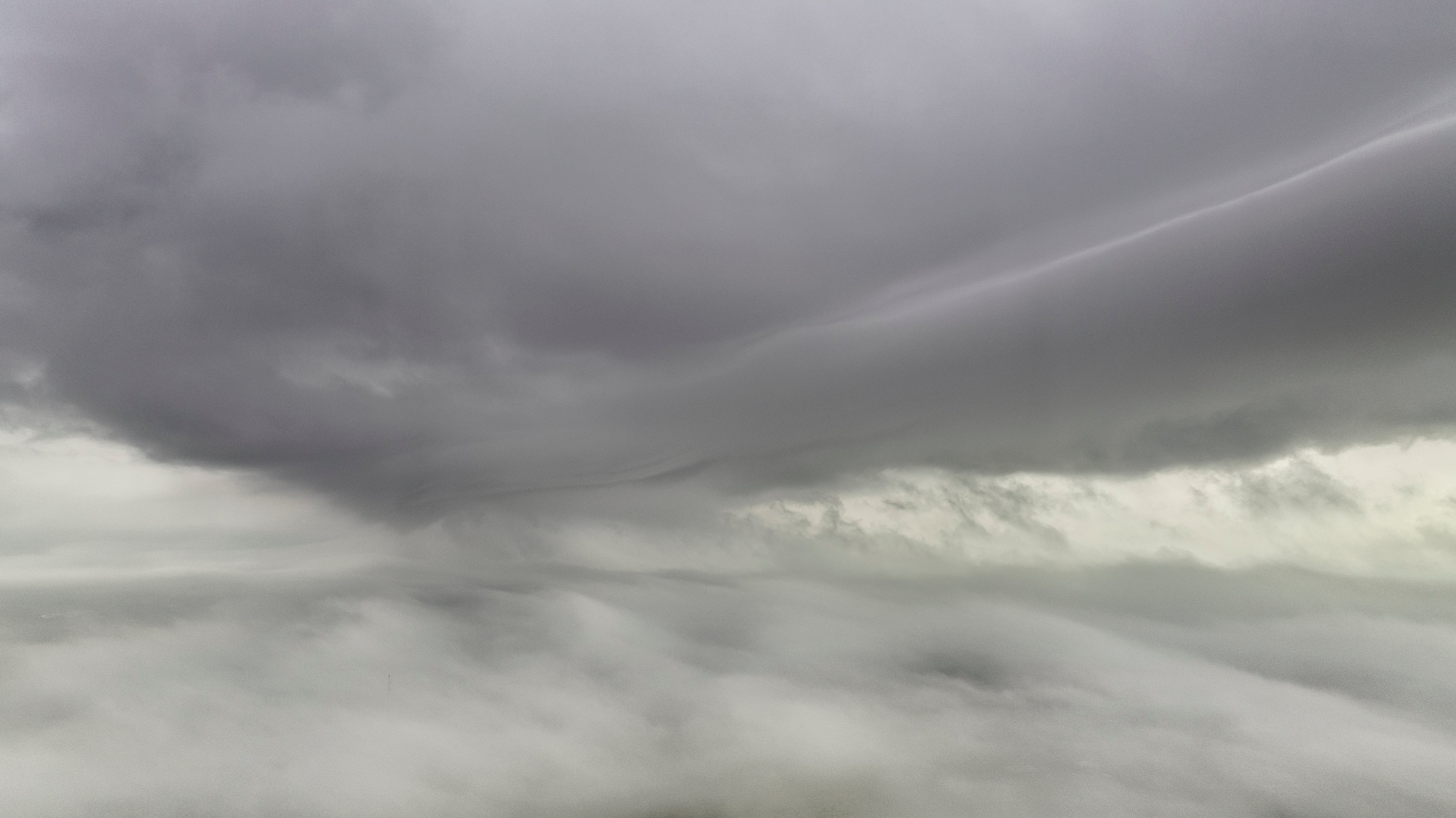
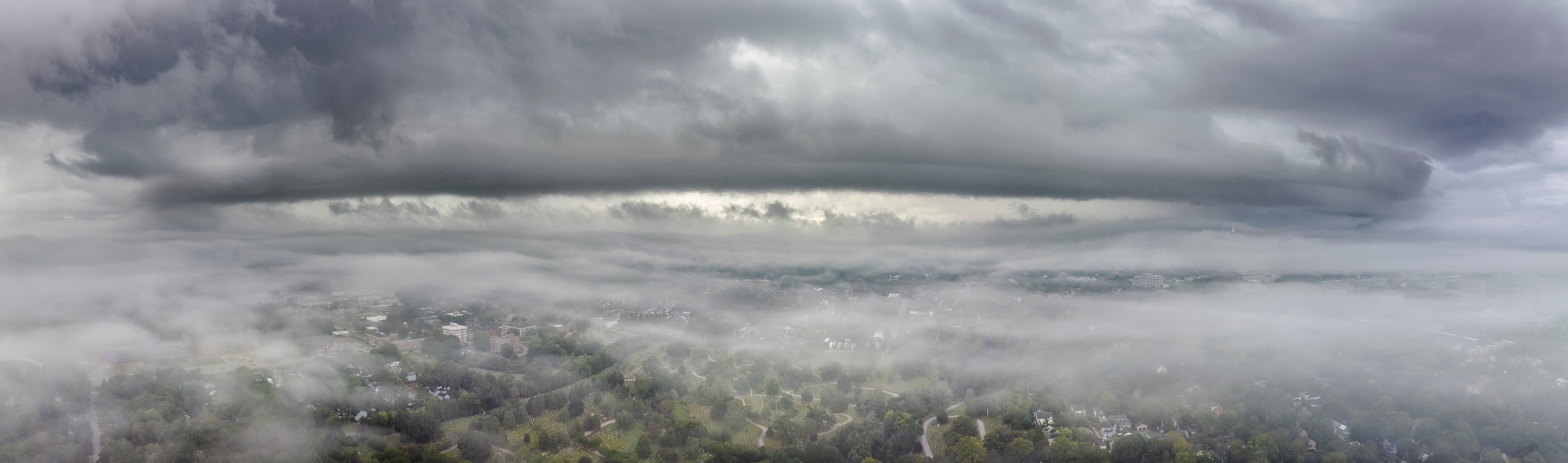
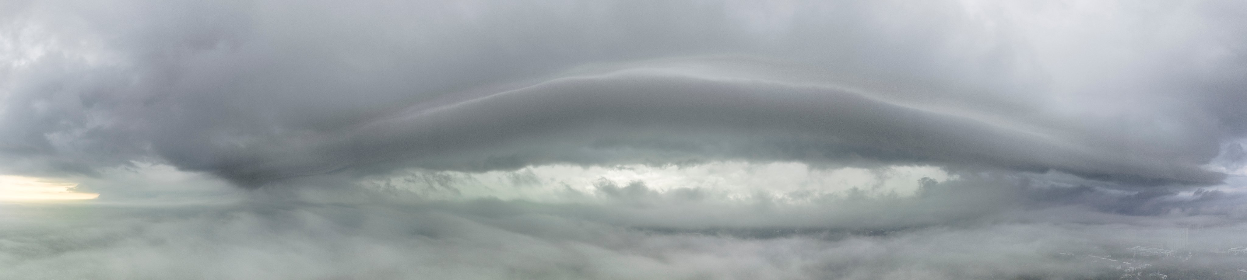
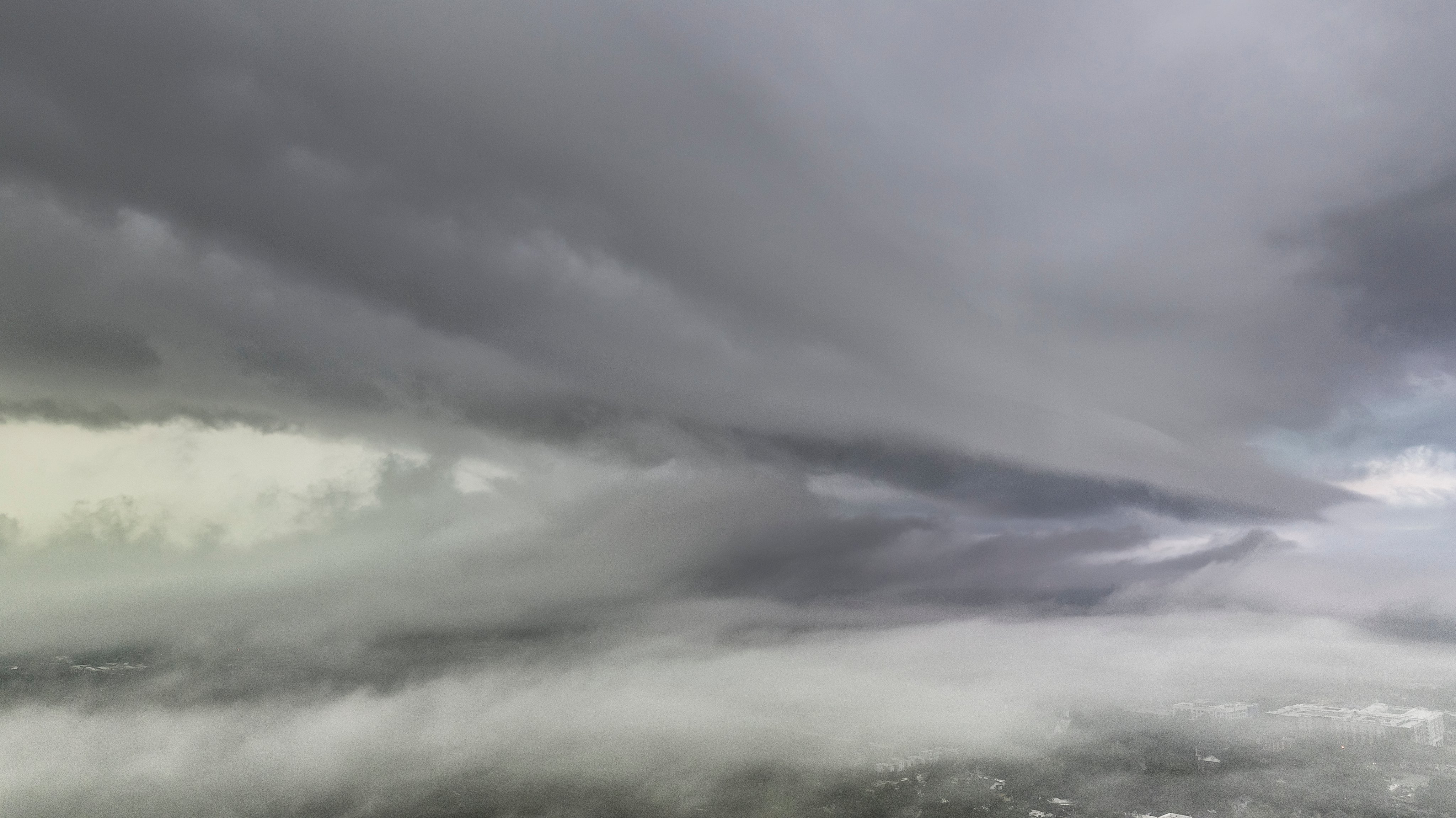
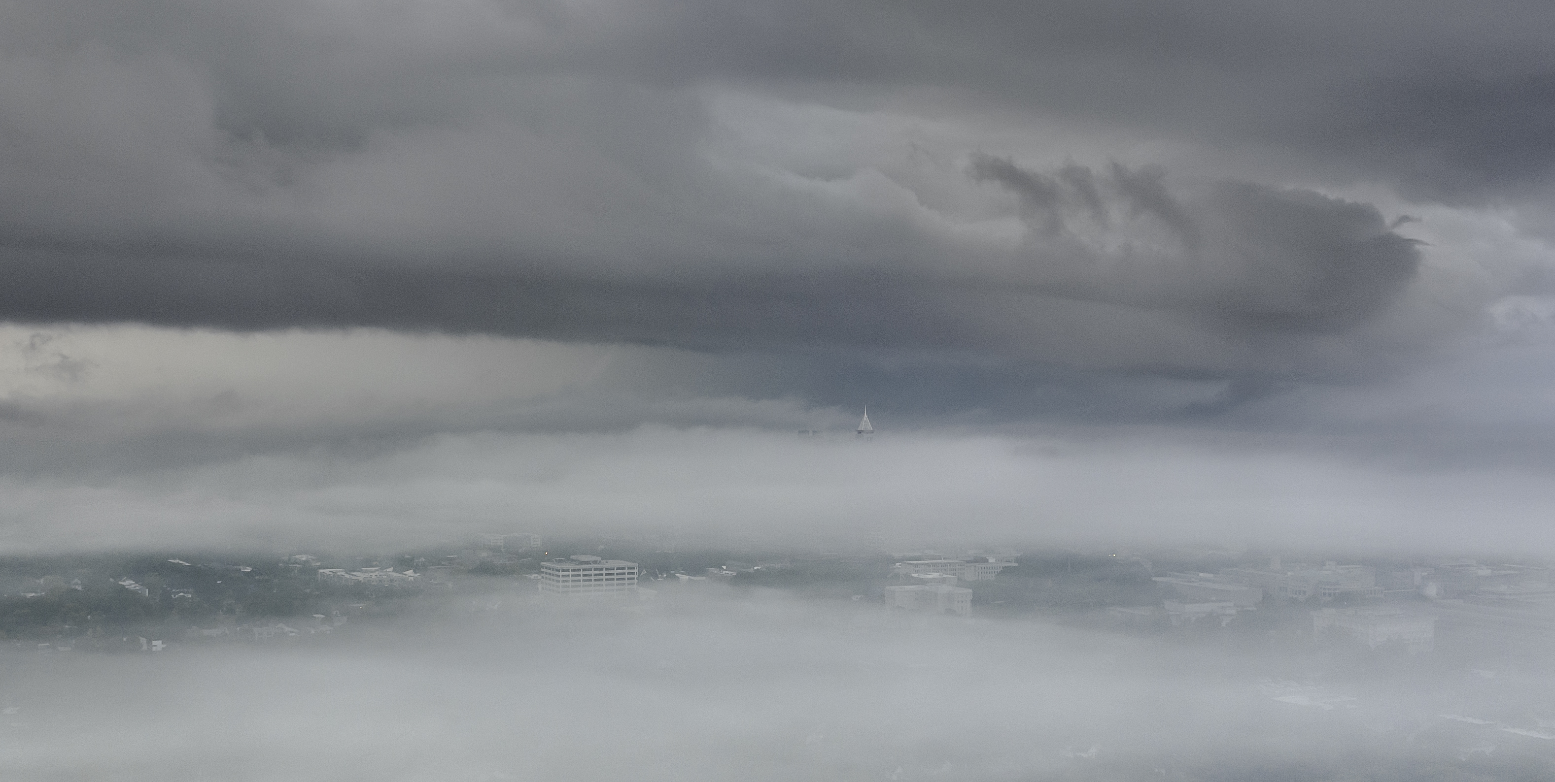
Some more of this morning's surreal scene:
-
5
-
-
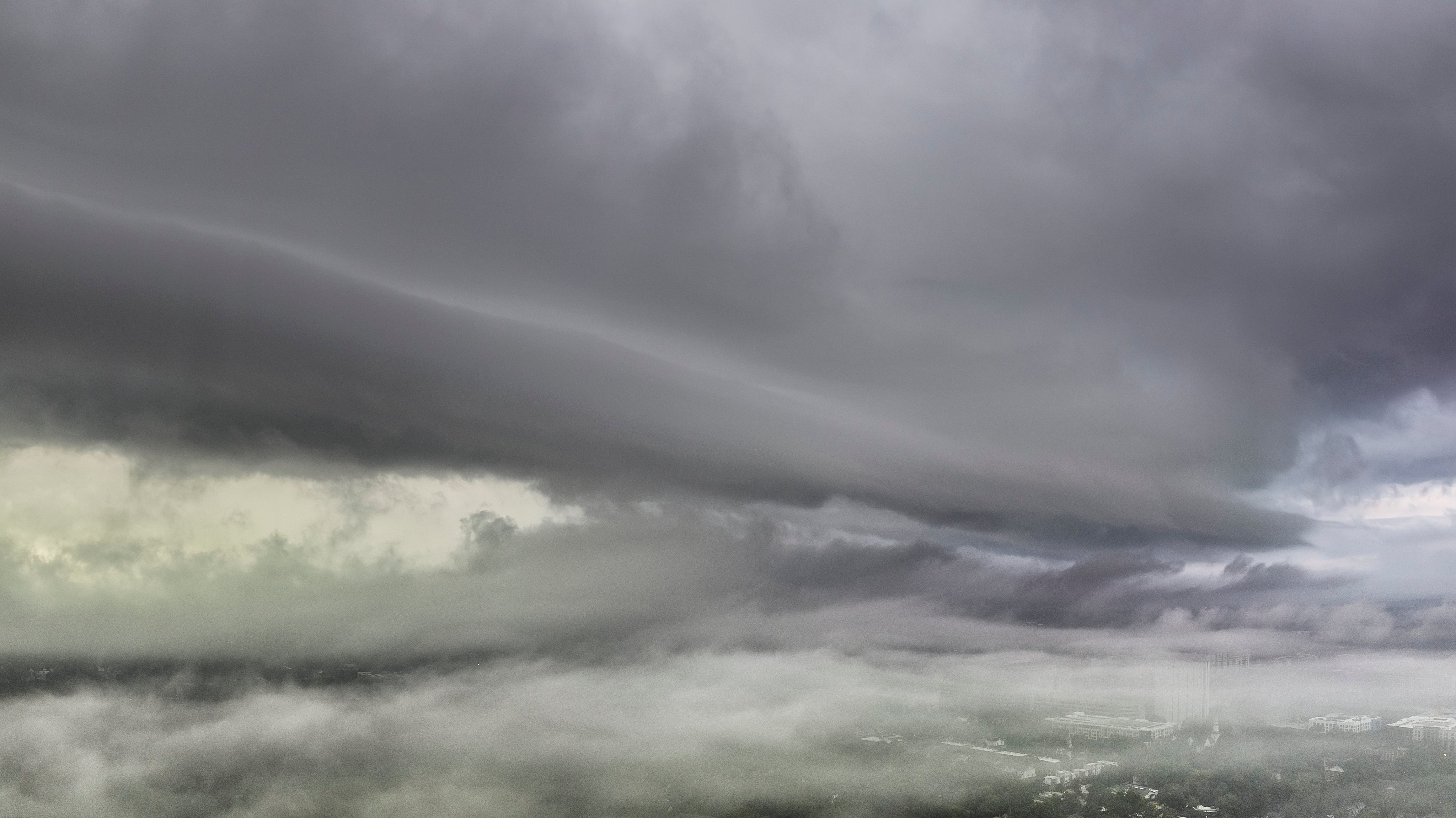
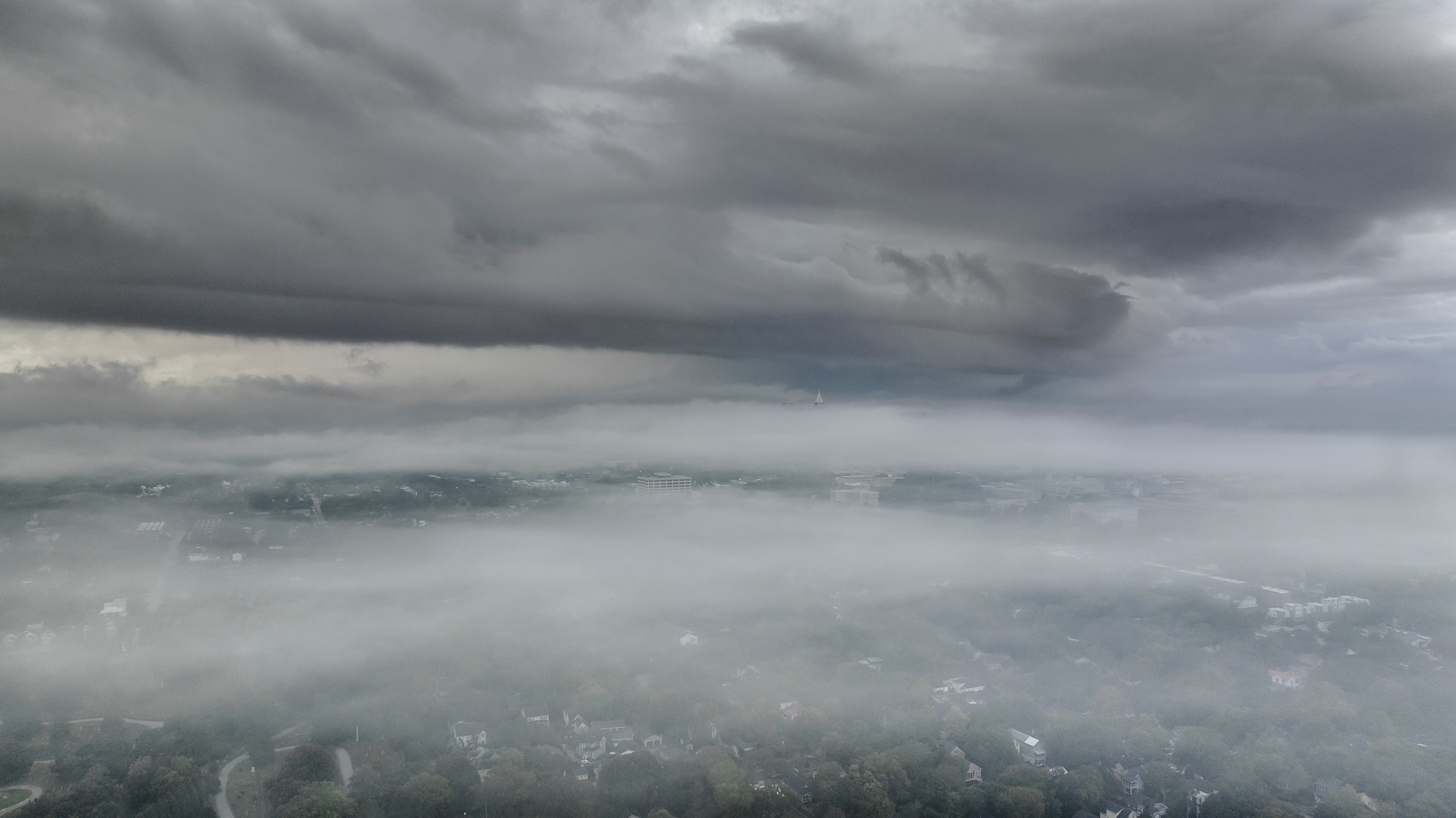
Not often you get a shelf cloud above a fog bank:
-
5
-
 1
1
-
-
23 minutes ago, Wannabehippie said:
Latest satellite photos appear to show the eye completely obscured, and that shear hitting Lee hard at the moment. Is the consensus that Lee will see a bit more weakening on the next NHC report?
Overall yes. Lee definitely peaked last night.
INIT  08/2100Z 18.9N  55.5W  130 KT 150 MPH
 12H  09/0600Z 19.7N  56.9W  125 KT 145 MPH
 24H  09/1800Z 20.6N  58.6W  120 KT 140 MPH
 36H  10/0600Z 21.3N  60.0W  120 KT 140 MPH
 48H  10/1800Z 21.9N  61.3W  125 KT 145 MPH
 60H  11/0600Z 22.5N  62.5W  125 KT 145 MPH
 72H  11/1800Z 23.0N  63.7W  125 KT 145 MPH
 96H  12/1800Z 23.7N  66.0W  120 KT 140 MPH
120H  13/1800Z 25.1N  67.6W  110 KT 125 MPH
-
2
-
 1
1
-
-
Lee isn't looking nearly as good this morning. A little shear on the western side?
-
All depends on when the ERC starts but I think 165 is a good bet.
-
1
-
-
Raleigh only got around a half inch of rain and gusts in the 30's. It is kind of funny that Wake cancelled schools today.
-
 3
3
-
-
I think for Raleigh we may be too far NW to see much out of this. I am just hoping one solid outerband makes it up for drone shots.
-
2
-
-
5 minutes ago, NorthHillsWx said:
Entirely due to a tiny core of winds (roughly 15 miles diameter of maximum winds with the eroding inner eyewall) and it hitting a WMA instead of a town. Inland gusts rarely reach MH strength even in the worst storms. IDA in particular was able to generate gusts to MH strength well inland but that’s bc the topography of that area is basically an inland sea especially with surge. I have no doubt MH+ winds occurred in a small area near the coast where this thing came ashore. I think we’ll see gusts to 100+ as it starts impacting a few more populated areas and the wind field expands
That and the strongest winds were probably missed by any real obs on the right side of the eye which is going with the motion of the storm. When a storm is moving this fast that makes a big difference. Perry actually ended up barely to the west of it.
-
LIghtning in the northern eyewall
-
While the EWRC is good for the Big Bend it can extend the overall windfield which may not be so great for southern Georgia.
-
1
-
-
Any one of these in the outer bands could become tornadic:

-
17
-
-
I just want to get a solid outer band like I did in Isiais in 2020.
-
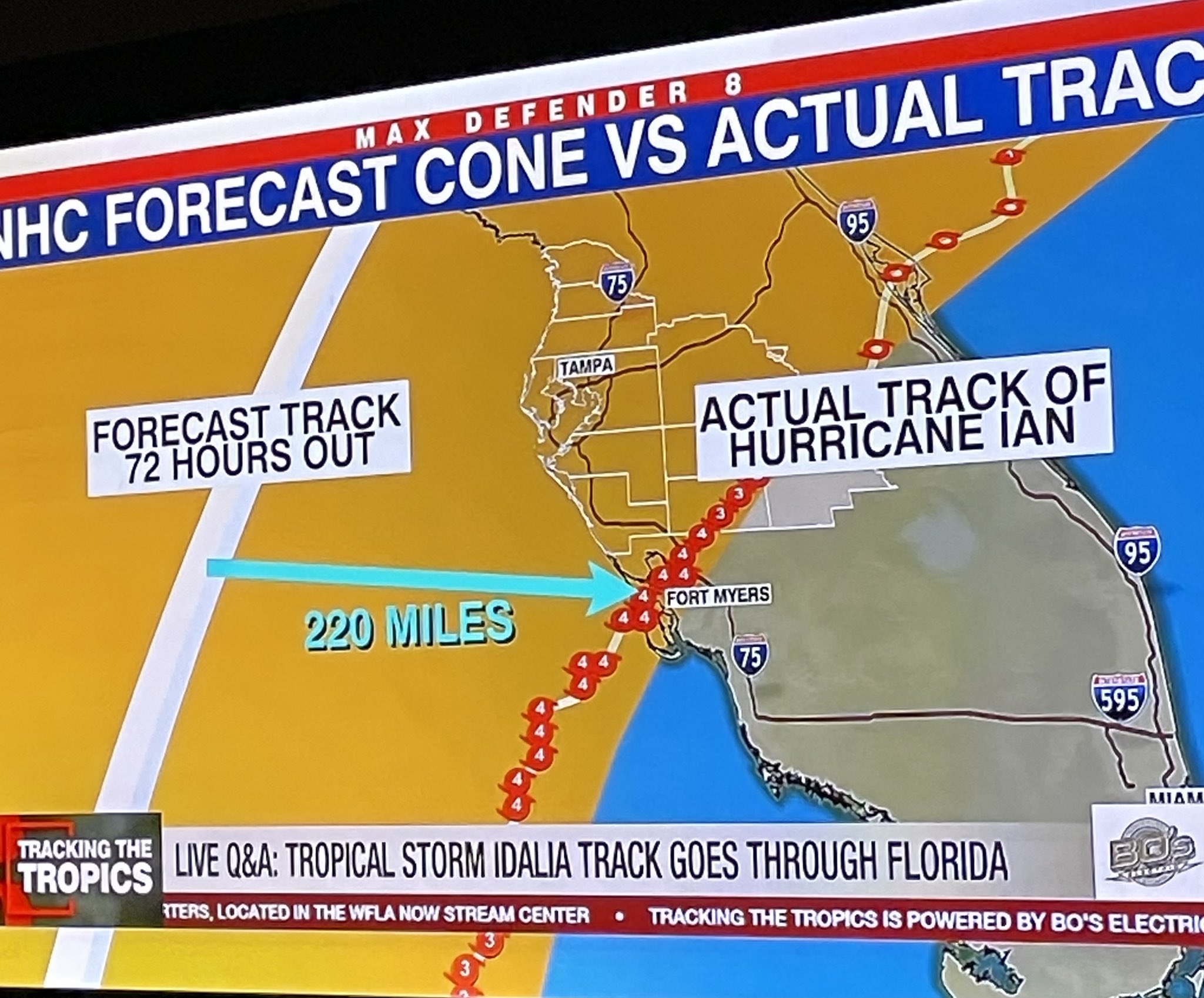
5 minutes ago, Hotair said:
TV reminding folks how far Ian track was from actual LF 72 hours out. I do believe the steering patterns are a little better behaved this time given the multi model consensus, but no one inside the cone should let their guard down

Yeah Charlie ended up farther down the coast too like that.
-
38 minutes ago, PackGrad05 said:
6Z EPS model consensus is tight around a big bend landfall and then riding the GA/SC/NC coast up to Cape Fear. ECMWF, UKMET, and ICON largely agree.
6Z GEFS model consensus slightly west of this.
Yeah I am hoping for some outer bands like I saw in Isiais in 2020.
.jpg.5a4542f3923cee8084b3da49b3c84898.jpg)

2023-2024 Ski Season Thead
in New England
Posted
First snow in the North Carolina mountains! Hopefully it bodes well for the entire East skiing wise..