

eyewall
-
Posts
11,675 -
Joined
-
Last visited
Content Type
Profiles
Blogs
Forums
American Weather
Media Demo
Store
Gallery
Posts posted by eyewall
-
-
5 minutes ago, WxWatcher007 said:
The waters there are rocket fuel right now
-
 2
2
-
-
8 minutes ago, WxWatcher007 said:
Pretty potent look rolling up on the coastline. Good job by the models to show this evolution without overdoing it.

Yep just running out of water before it could take off.
-
1
-
-
2 minutes ago, Normandy said:
here in so cal there have been essentially zero winds. The gradient of the storm is such that the SW US gets the TS winds as stated above
Yeah Imperial (El Centro), CA also verified TS Winds
-
Not every day you see TS Conditions reported in Yuma, AZ:
 A sustained wind of 45 mph (72 km/h) with a gust
to 69 mph (111 km/h) was reported in Yuma, Arizona
-
7
-
 2
2
-
-
Hurrevac has the storm at 100 mph near San Diego! I have a hard time buying that right now.
-
Durham got hammered with a microburst. Anyway I caught these in Raleigh:
-
5
-
1
-
-
17 hours ago, olafminesaw said:
Current CAMs seem to suggest the morning MCS will be the main event (strong to borderline severe storms), with some scattered strong storms behind it. Usually these large MCS systems do put a damper on several storms later in the day, even if they clear out by mid morning.
Yeah it is looking like shite after all.
-
58 minutes ago, olafminesaw said:
Seems like timing is the big question. May move through too early in the day. Parameters aren't as impressive either way, but a nice line of storms regardless.
There could be the MCS in the morning and then the main round of severe in the afternoon/evening. MHX discussion is quite bullish.
-
Don't sleep on tomorrow either. Could be another unusually strong severe event for this time of year.
-
2
-
-
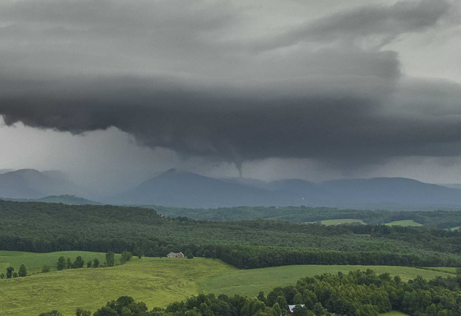
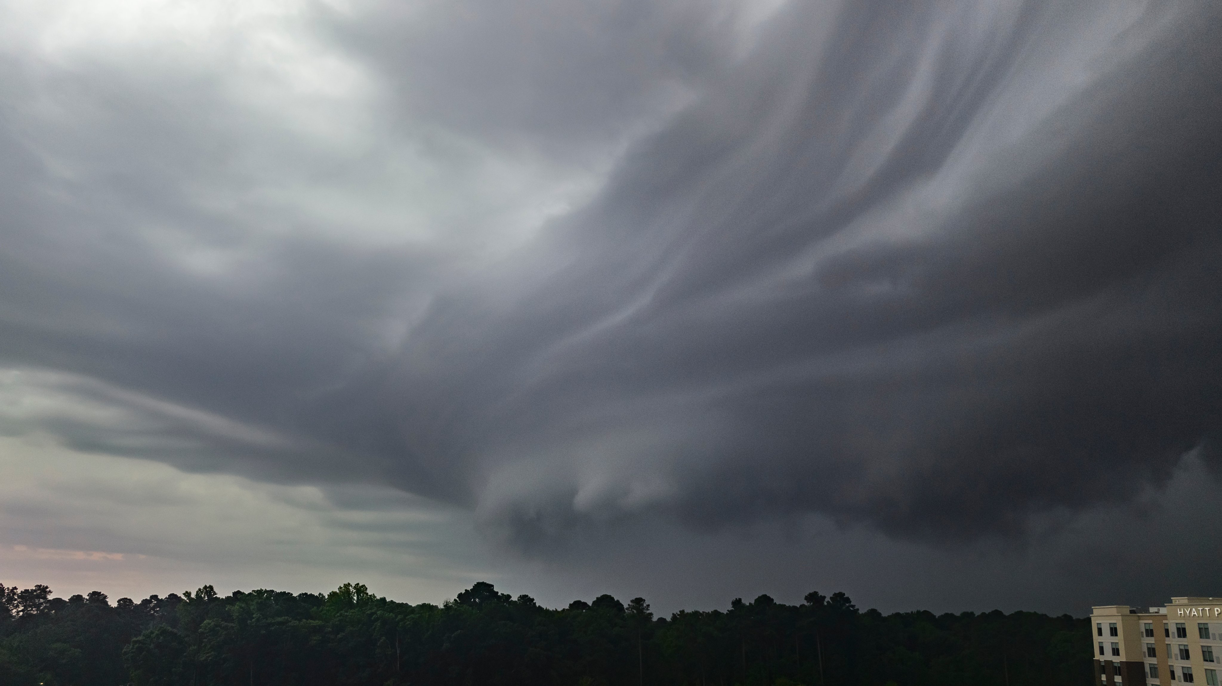
Sorry I'm late in posting. I chased yesterday and tried for a discrete near the NC/VA line. When coming back to Raleigh it was very hard to get ahead of the line because of its fast forward motion. I did see a funnel looking north from Round Peak, NC into southern VA. Here are some shots:
Meso:
Elephant Trunk Funnel:
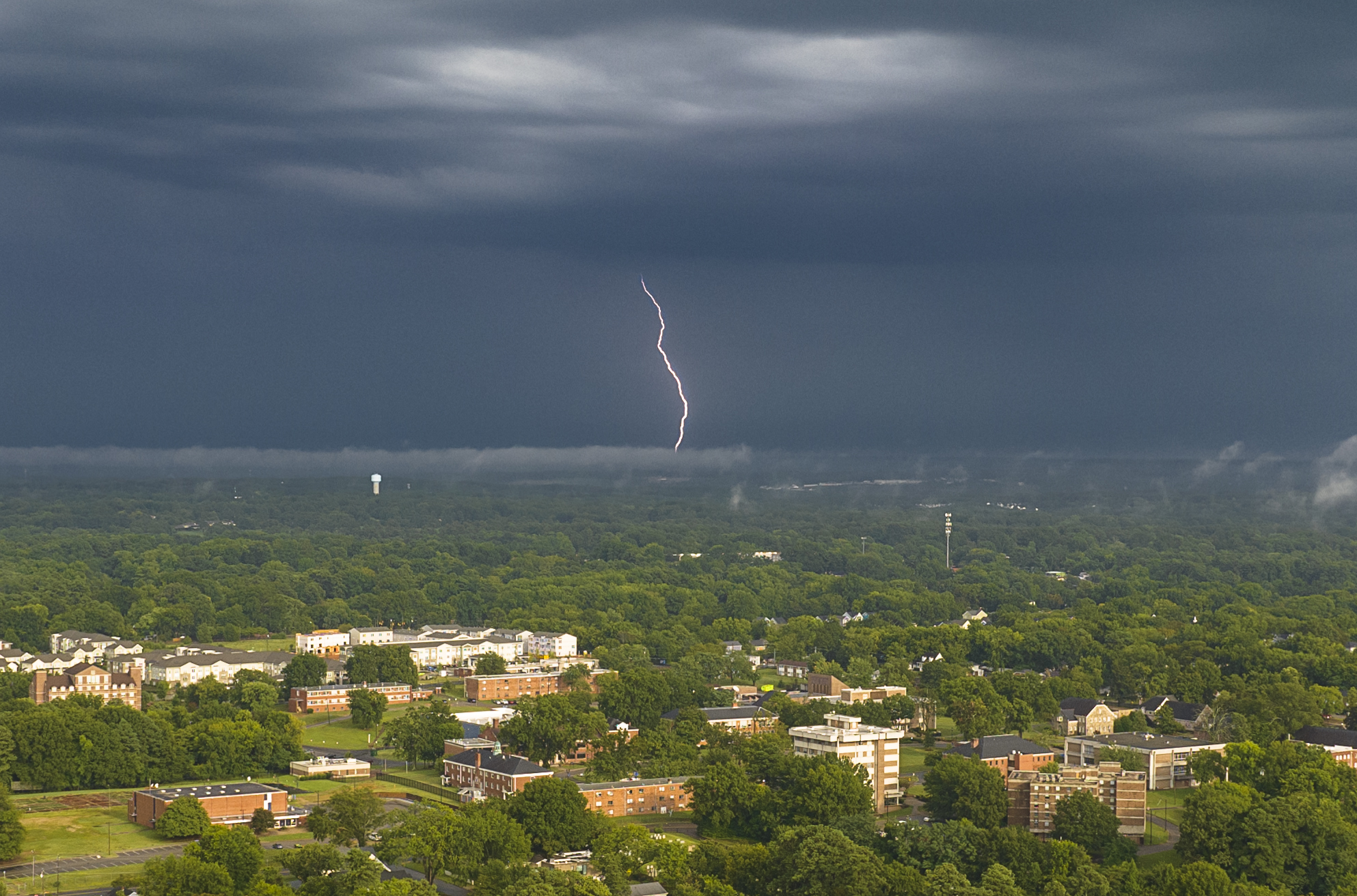
Shelf in South Durham (couldn't get any farther ahead of the line)Lightning in Raleigh:
-
4
-
1
-
-
Caught these before the line fizzled at Southpoint in Durham this morning:

-
1
-
-
41 minutes ago, NorthHillsWx said:
Officially the hottest day of the year at my house, for the third day in a row
what is your temp?
-
2 hours ago, GaWx said:
I just put this in the main tropical wx thread (this will lead to plentiful rainfall over a portion of the SE US):
There is a tight little circulation center (easily seen on radar) just offshore from Amelia Island where SSTs are ~85F moving NNW toward the lower GA coast, but it is more mid level than low level from what I've read. One NWS discussion mentioned that this is in association with the TUTT (see below). Surface pressures are still pretty high (1017 mb+) and surface winds are light. The highest wind I could find in gusts is 16 knots and that is at an offshore buoy.
From Jacksonville NWS office earlier this morning:
AT THE SURFACE, AN INVERTED TROUGH ACROSS NORTH CENTRAL FL
WILL LIFT NORTH-NORTHWESTWARD UP THE NE FL COAST AND INTO THE
ALTAMAHA RIVER BASIN BY THIS EVENING. MEANWHILE, A TROPICAL UPPER
TROPOSPHERIC TROUGH (TUTT) AND ASSOCIATED VORTICITY MAX WILL
ROTATE ACROSS THE AREA.--------------
From Melbourne ~40 minutes ago:
ISSUED AT 924 AM EDT FRI JUL 28 2023
IN THE WAKE OF THE DISTURBANCE THAT MOVED OVERHEAD YESTERDAY, DEEP
S/SE FLOW IS IN PLACE ACROSS MUCH OF THE FL PENINSULA THIS MORNING.
IN FACT, THAT FEATURE HAS ACTUALLY CLOSED OFF INTO A WEAK
SURFACE LOW NEAR JACKSONVILLE.I wish we would get in on that instead of just a scorching day.
-
1 hour ago, NorthHillsWx said:
Already flirting with 91 at 10:45
Yeah this is the time of year I hate most.
-
3 hours ago, NorthHillsWx said:
Topped out at 96.7 yesterday. That was our hottest reading of the year imby
until the next couple of days lol.
-
5 hours ago, NorthHillsWx said:
0.35” last night. Can’t remember what time exactly but I woke up to some loud thunder very early this morning
It was around 2am
-
1
-
-
44 minutes ago, yotaman said:
To be fair, there was no indication that something like this could even have happened yesterday.
That is true although it was mainly work that prevented me from going. I was going to get ahead of the mini supercell when it was coming through southern Wake County but overall you are right.
-
The sting of this one is still with me today as I missed a once in a decade chase.
-
24 minutes ago, NorthHillsWx said:
NWS preliminary rating of a high-end EF2. We’ll see what the damage survey reveals but there’s definitely the chance this was a EF3 tornado based on some of the pictures and video floating around
yeah depends on the construction of some of these homes.
-
5 minutes ago, NorthHillsWx said:
Several multi-storied houses leveled
It is going to be an EF-2 or 3 for sure. NWS sure waiting a long time to pull the tor when a CC drop was present for multiple frames.
-
1
-
-
6 minutes ago, NorthHillsWx said:
A clean, long track, low precipitation supercell tornado. That happens so rarely here I cannot remember the last one. This was a significant tornado too.
Exactly why I feel so deflated right now when it comes to chasing. I know this was a rare chance.
-
 1
1
-
-
And of course I missed it. I wasn't out there. I don't feel any motivation to chase anymore after that.
-
1
-
-
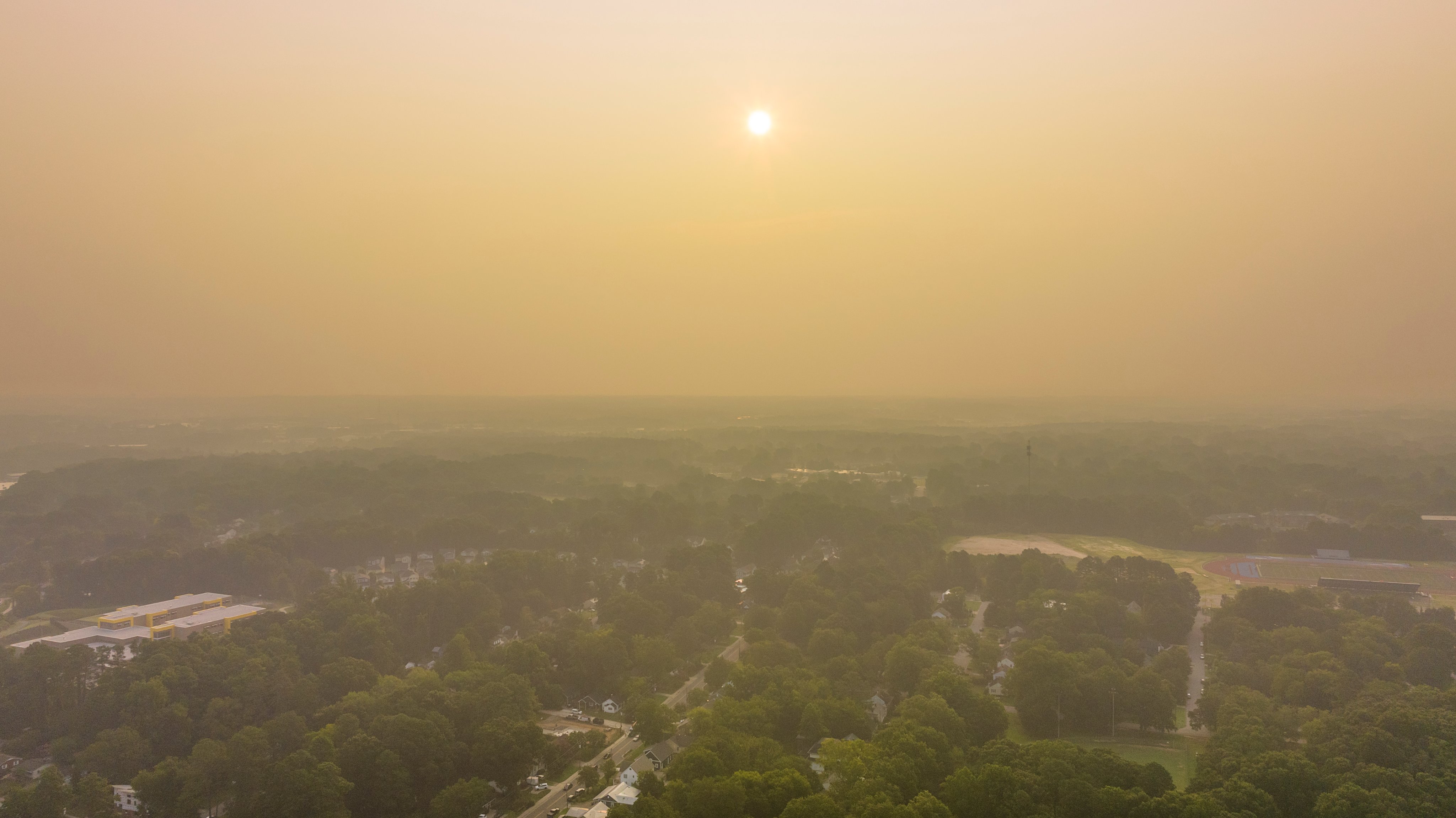
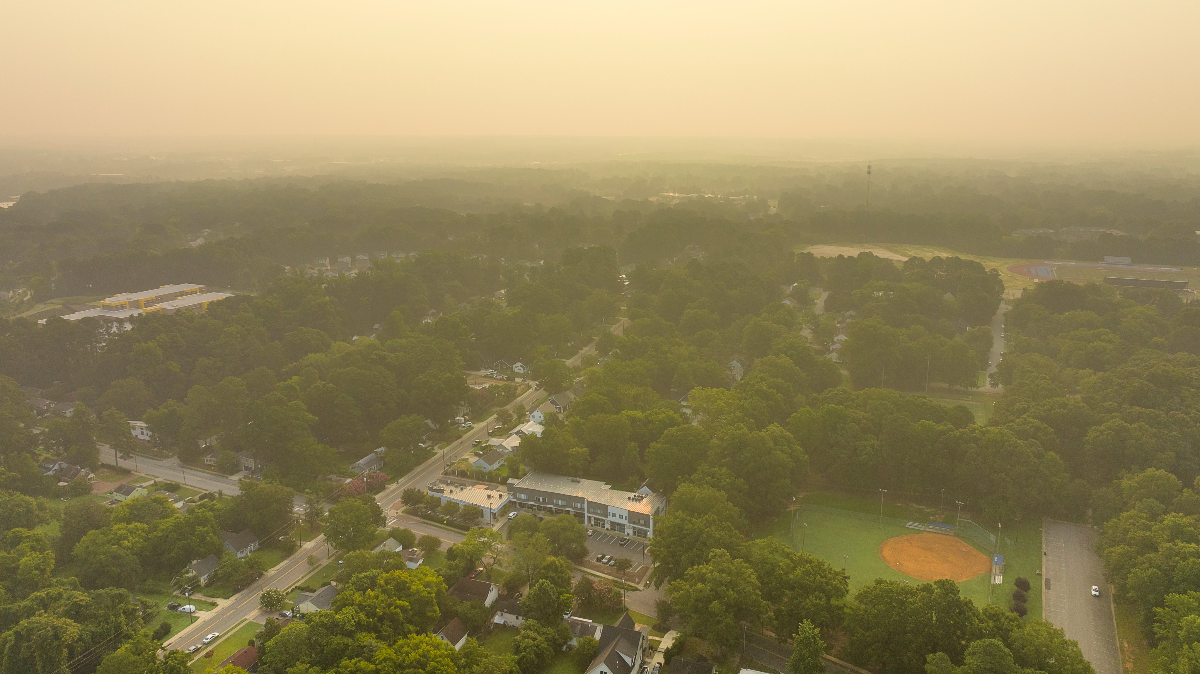
22 minutes ago, NorthHillsWx said:
You can smell the smoke today. Disgusting
Yep it is pretty bad this go around.
-
This morning in Raleigh
-
1
-
1
-


Mid to Long Range Discussion ~ 2023
in Southeastern States
Posted
Oh I can't wait!