eyewall
-
Posts
12,551 -
Joined
-
Last visited
Content Type
Profiles
Blogs
Forums
American Weather
Media Demo
Store
Gallery
Everything posted by eyewall
-
I am pretty sure we should shut down the Southeast region forum if we zero out again.
-
Gaithersburg is about to get smoked.
-
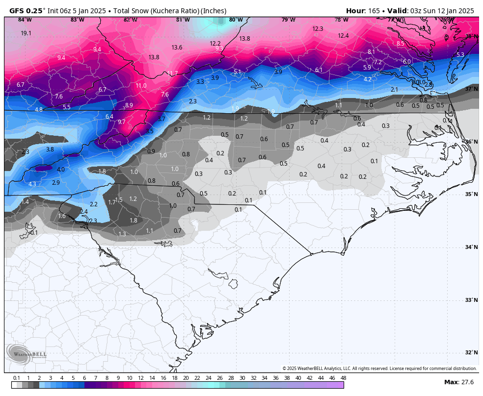
Congrats all from RDU where the futility streak is up to 1072 days. It looks like this band in NOVA is going to really up things for a lucky few. Would not be surprised if there is some thunder in that band.
-
Very accurate though with the nose of rain into Wake County JK
-
The CMC does have a cold bias I believe.
-
Lights out Columbia
-
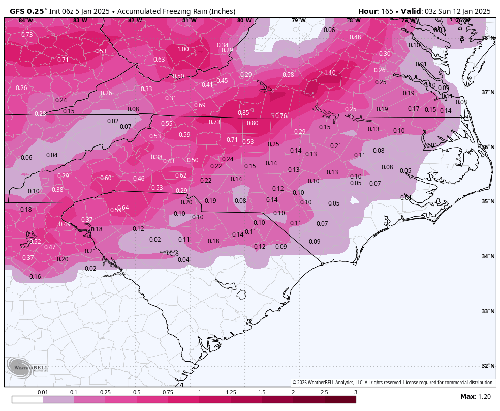
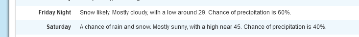
1/2 inch of snow with around 0.2 ice for Raleigh verbatim. The bare minimum to break the streak.
-
At this point an hour of snow-covered grass will do it for me. I have significantly lowered my standards just like on Tinder.
-
and it is already probably above freezing there.
-
35F and rain. Pure misery.
-
It is broken
-
Yep they got half the forecast in some spots.
-
Yeah that was definitely awful overnight. Time to draw the shades if this doesn't work out.
-
Not a good result on the 18z GFS op run.
-
Never thought I would see this in the Raleigh zones:
-
Sleet in downtown Raleigh
-
Sleet/snow mix in North Raleigh
-
I drove up to Gorman where it is sleet and snow pellets
-
Still no clear answer but I would take the 12z run
-
It is not unusual for models to underestimate start times for precip with overrunning events.
-
I used to wish for 1 winter storm warning event a year but now I just want to see the grass covered.
-
Everyone is showing trauma responses to the last several winters I think.
-
The 6z GFS shows more of a Miller B with the storm. The first low weakens in Ohio and the eastern low takes over and rolls right through central NC (another move inland). This new low then bombs out as an inland runner through NJ/NYC before cutting ENE south of the Maritimes.


-
The one on the 17th will verify because I have to leave town then.
-
Sleet is typically around a 4:1 ratio. Most I have seen in one event is around 3 inches back on Long Island in the 90's