

sbnwx85
-
Posts
1,938 -
Joined
-
Last visited
1 Follower

About sbnwx85

- Birthday 10/04/1985
Recent Profile Visitors
8,819 profile views


-
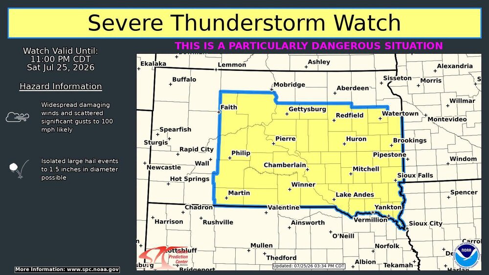
The rare PDS Severe Thunderstorm Watch up in SD.
-
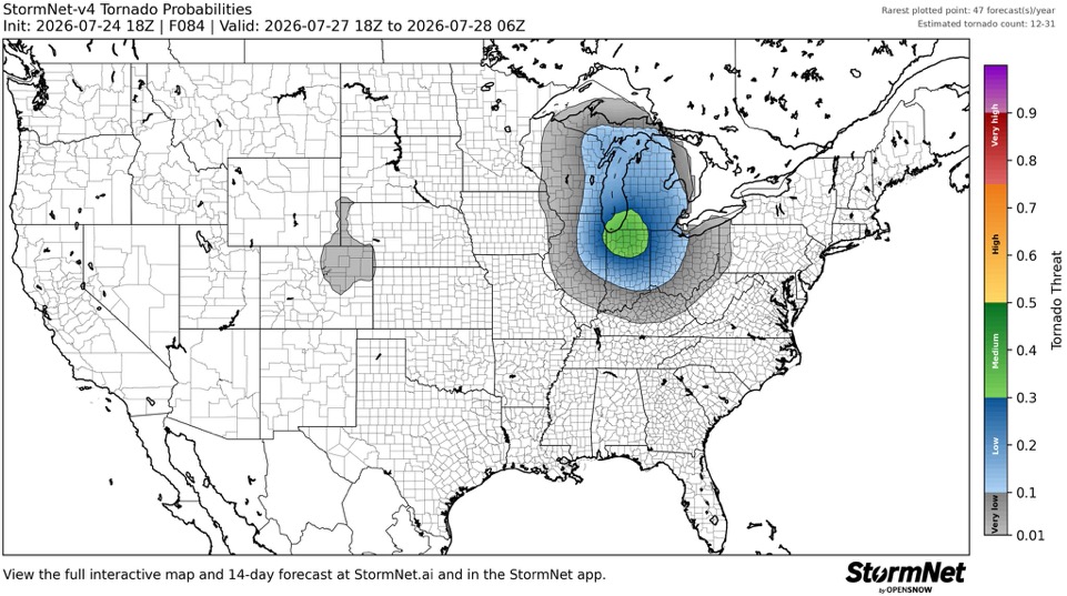
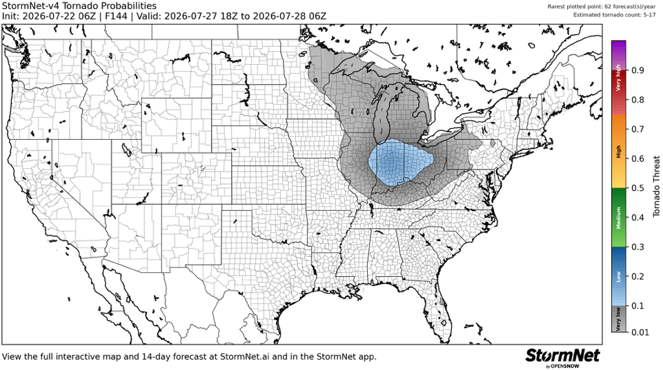
Getting intrigued for Monday.
-

If you could re-experience ONE winter event....
sbnwx85 replied to cyclone77's topic in Lakes/Ohio Valley
I remember my mom telling me about water skiing and barbecuing at the lake on Christmas of ‘82. -
Was skeptical of StormNet at first because it’s very AI driven but it’s done a damn good job. Something to watch for Monday.
-
71/48 winds gusting to 20. Brilliant day. Might the best of the summer.
-
Not quite yearning for winter yet (who yearns?) but this pleases me.
-
Saw a post on FB about three Tornado Warnings in the UP at the same time. A rarity for sure
-
GFS and NAM keep me in the 60's on Wednesday. Would be v refreshing
-
-
Wow, even if it does happen, my area gets split like a pair of cheap khakis on Chris Farley.
-
After striking out with the storms yesterday we got a good storm today. Nothing severe but it was nice to get some heavy rain and thunder.
-
After avoiding the worst yesterday, we are in the thick of the smoke here. AQI over 400. Smells nasty.
-
Smoke got worse. AQI now in the 200's here. I can't imagine how much worse it is to the north and west. Woof.
-
This sunset is gonna be bonkers
-
We're right on the southern edge of the smoke. AQI has been in the 100's all day. Slowly getting worse. I wasn't able to smell anything in the smoke this morning, but getting a faint hint of something this afternoon.


