Eskimo Joe
-
Posts
24,711 -
Joined
-
Last visited
Content Type
Profiles
Blogs
Forums
American Weather
Media Demo
Store
Gallery
Everything posted by Eskimo Joe
-
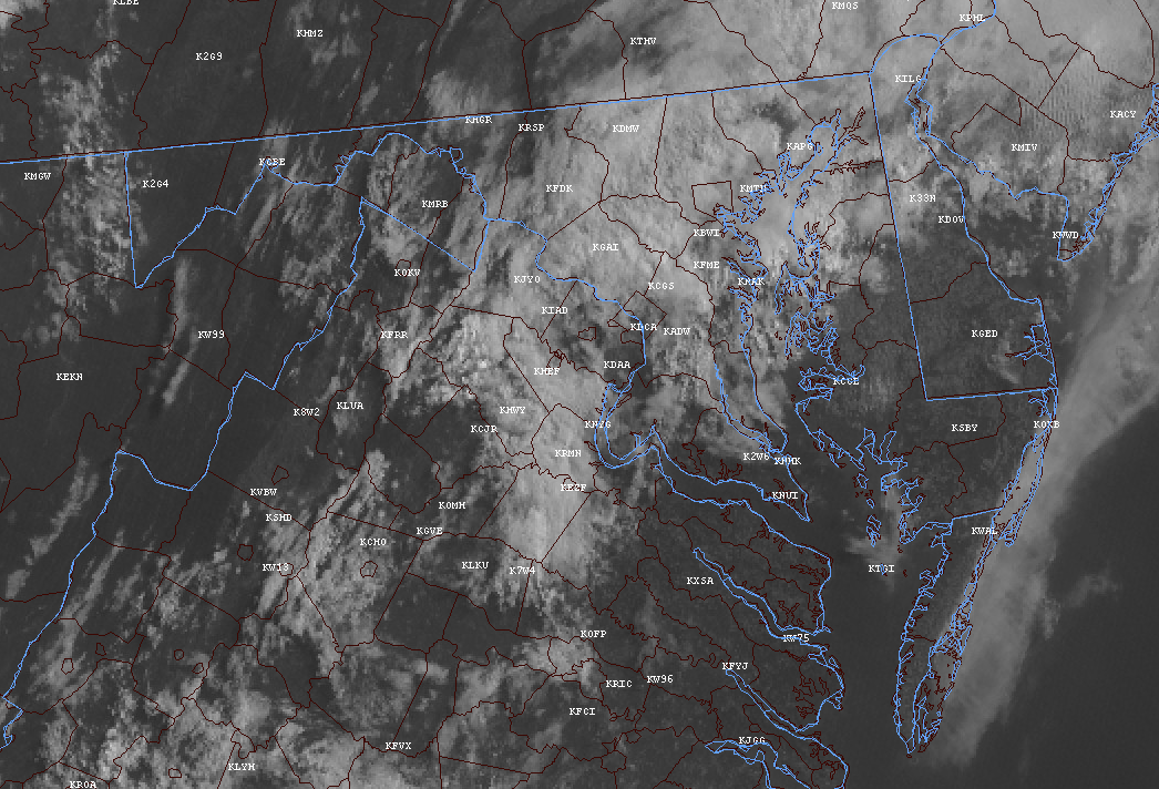
Just wanted to stop by and say good luck to everyone today. I think anyone in the CTP CWA and north of the turnpike in PHI's area looks good so far. Early clouds seem to be burning off or almost gone. The cell near Greensburg, PA already is dropping CG in an environment that is pretty meh...a good sign for central and eastern PA.
-

2021 Mid-Atlantic Severe Weather - General Discussion
Eskimo Joe replied to Kmlwx's topic in Mid Atlantic

-
2021 Mid-Atlantic Severe Weather - General Discussion
Eskimo Joe replied to Kmlwx's topic in Mid Atlantic
CU field already popping on the up-slope of the Allegheny Plateau in West Virginia. Some CG on cells in western PA. -
Probably the worst start to fishing in a decade for my wife and I. Wish it would just get warm and stay that way.
-
2021 Mid-Atlantic Severe Weather - General Discussion
Eskimo Joe replied to Kmlwx's topic in Mid Atlantic
My target today would be Washington / Frederick / Carroll / Baltimore / Adams / York County -
2021 Mid-Atlantic Severe Weather - General Discussion
Eskimo Joe replied to Kmlwx's topic in Mid Atlantic
Eternal pain.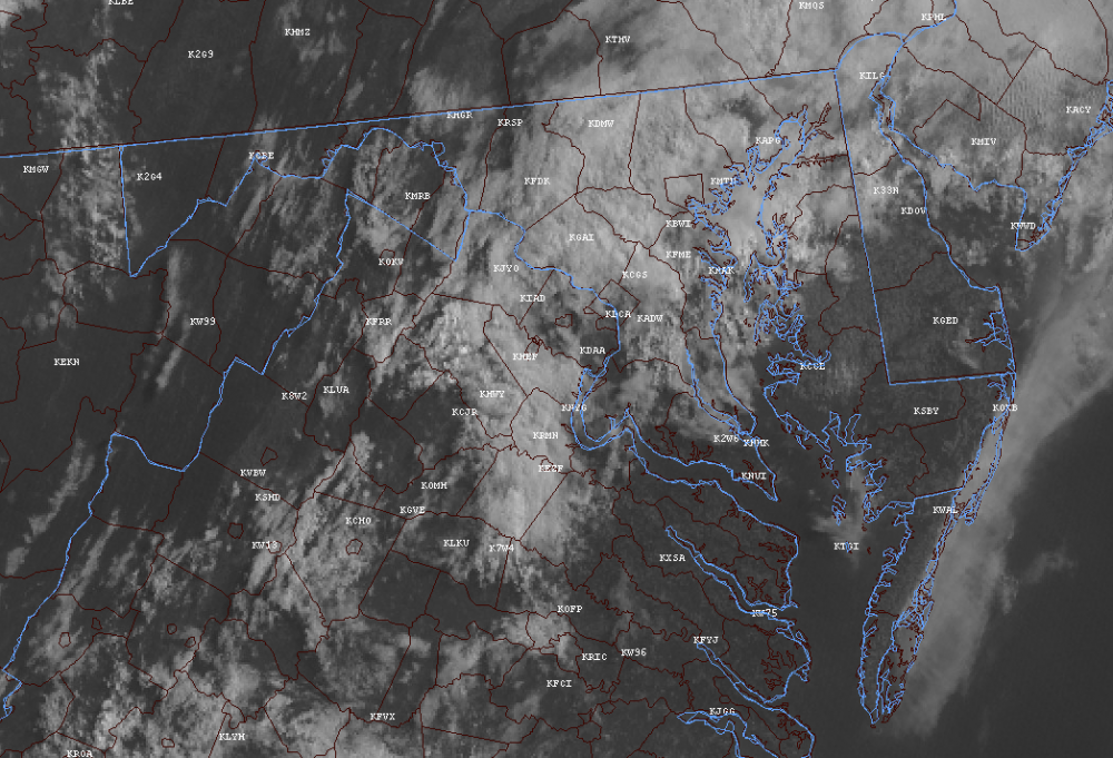
-
2021 Mid-Atlantic Severe Weather - General Discussion
Eskimo Joe replied to Kmlwx's topic in Mid Atlantic
I like the Mason-Dixon counties up into the Harrisburg / Reading area for a few cells tomorrow. I could see a DY1 Slight getting put up for places north of I-70 if things break right. -
The wedge is definitely losing. Sun trying to poke out here in Reisterstown.
-
Past couple of frames on the visible are promising for NOVA and up into Charles Town. Wedge might not be able to hold today.
-
I think it's sarcasm.
-
Visible satellite shows this is mostly low level stuff. I don't see a lot of mid or high level clouds to prevent us scouring this out after lunch. Probably going to be a very nice mid to late afternoon.
-
58 and overcast...terrible.
-
Kinda weird...looking like a bit of a divergence between the ensembles and OP.
-
@Rainshadow posted on Facebook about the summer...not too bad temp wise for June, but July is setting up to be a scorcher, maybe some good storm in August. Sounds like typical DC weather.
-
Euro/GFS continuing the trend of diminishing rainfall for Memorial Day weekend. Looking more and more spotty.
-
Cicadas everywhere. Love this. Next time this happens, I'll be as old as @H2O
-
Finally got a mass emergence at my house. Easily better than 500 casings in my lawn. Having grown up in the city, I'm quite excited to have this.
-
Getting a decent number of emergers in my cul de sac. It's kinda cool. Everyone comparing these to locusts and trying to kill them are dumb.
-
Euro and several of the GFS members really pumping the heat during the middle of next week. Could endanger the record highs for IAD. From this morning's LWX AFD: Record highs and record warm lows late this week into early next week. DCA, BWI and MRB records are probably out of reach, but the IAD records could be matched. DateSite DCA BWI IAD MRB Fri 5/21 95 71 96 71 92 67 100 65 1934 1996 1934 1934 1996 2013 1934 1996 Sat 5/22 96 71 98 71 88 67 98 68 1941 1959 1941 1903 2004 1975 1934 1959 Sun 5/23 97 74 98 69 92 70 100 68 1925 2004 1925 2004 1964 2004 1925 2004 Mon 5/24 92 72 93 72 90 69 96 67 1964 2004 1933 2004 1964 2004 1941 2011 Tue 5/25 94 71 94 70 92 67 94 67 1880 2012 1991 1936 1991 2004 1933 1991 Wed 5/26 96 74 94 74 92 71 96 69 1880 1991 1914 1880 2007 2018 1914 2018
-
Euro torches us next week...mid to upper 90s for just about everyone. Things going for it: it's been dry so things can heat up fast. Things going against it: the Euro seems to have a bias of late towards high temps beyond D6.
-
2021 Mid-Atlantic Severe Weather - General Discussion
Eskimo Joe replied to Kmlwx's topic in Mid Atlantic
CC: @mappy and @Ian -
Unfortunately, we are seeing air quality go the wrong way as more vehicles hit the road. If you have Twitter, I recommend following Ryan as he's the regional expert on Air Quality: https://twitter.com/ryans_wx
-
2021 Mid-Atlantic Severe Weather - General Discussion
Eskimo Joe replied to Kmlwx's topic in Mid Atlantic
Eternal pain -
I'd just be happy with some real heat this year. None of this perpetual low 90s with a low Td. Something where we bake for a week in July and the big three terminals hit 100 for a couple of days. I love evenings after a day like that. The sun set and it's a big deep orange ball sinking into the cornfields.