AlexD1990
-
Posts
1,404 -
Joined
-
Last visited
Content Type
Profiles
Blogs
Forums
American Weather
Media Demo
Store
Gallery
Everything posted by AlexD1990
-
If you want to kayak, I would recommend trap pond or killens pond, both state parks. Killens also has a small water park that is actually very nice with a just redone pool. Admission is like $12
-
The ferry is a great experience! And cape May is a fun little town, almost like a mirror to Lewes. Lots of beautiful Victorian beach houses and hotels, and I think there is a trolley tour of them. A small boardwalk with a few restaurants too. It's been years, but we had lunch at a Stewart's (like the root beer) that was inside a old bank. We are in the vault!
-
@Mrs.Jsorry i missed this.. didn't see the edit you made to your reply. @CAPEis right, CHSP is great, and Lewes has an expanding eatery and brewery scene. Can you tell me more of what you might look to do? Rehoboth does have a lot to offer, but it will be crowded. Other things nearby, if you don't mind mini road trips.
-
off topic but i love that there is road called English Muffin Way
-
2026 Mid-Atlantic Severe Storm General Discussion
AlexD1990 replied to Kmlwx's topic in Mid Atlantic
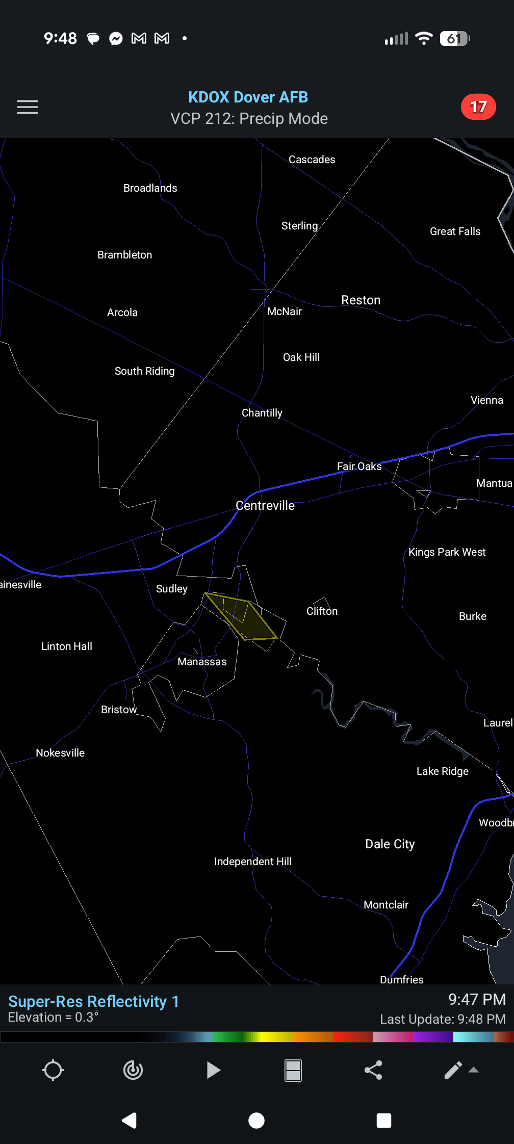
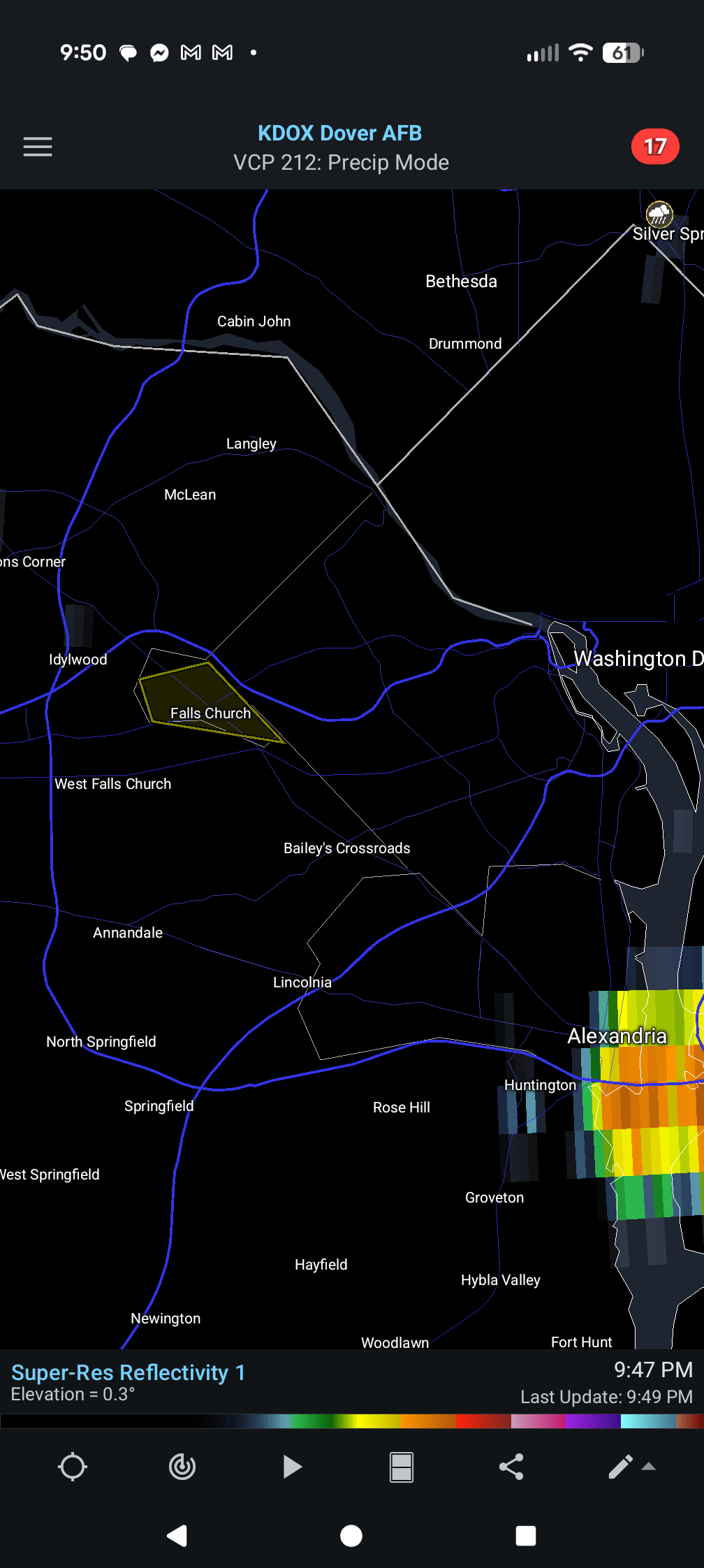
Rotation near Landover? -
2026 Mid-Atlantic Severe Storm General Discussion
AlexD1990 replied to Kmlwx's topic in Mid Atlantic
And also falls Church

-
2026 Mid-Atlantic Severe Storm General Discussion
AlexD1990 replied to Kmlwx's topic in Mid Atlantic
Lol apparently this one little part of Virginia is still under the watch...now that's pinpoint forecasting
- 1,011 replies
-
- 1
-

-
- severe
- thunderstorms
- (and 7 more)
-
2026 Mid-Atlantic Severe Storm General Discussion
AlexD1990 replied to Kmlwx's topic in Mid Atlantic
Never got a thing over here, after being blasted last night with a one off. -
thats the rule of thumb down here too, at least for annuals. I already have some perennials and shrubs in, but I know better than to get annuals yet.
-
I cant remember a recent Spring that had this many temperature swings. One day I'm having to blast my furnace & space heaters, the next, screen doors open and window fans blasting. I've been trying to avoid uncovering the AC units, but with this warm stretch, and people visiting on Easter, I don't think I have a choice.
-
is this week one of those backdoor cold front deals? local met says 70s-80s all week, NWS says see-saw warm-cold warm-cold
-
It's time to grade Winter 2025-26(now that it's actually over)
AlexD1990 replied to CAPE's topic in Mid Atlantic
The blizzard puts it as an A-. Largest snowfall since 2010, howling winds, drifts. The snowcrete storm in January stuck around long than any other snow event I can remember. November & December were cold enough to feel seasonally appropriate. The huge 50 degree cold front with snow to end it all in March. The 1st coastal bomb that missed and only hit part of NC was tough to lose, and I wish we had had more storms overall/into March, but this was a very solid winter overall by my standards. Not many change to rain while DC get buried events, which is always a plus in my book. -
29 degree difference over 97 miles
-
PHI NWS sending survey teams to Kent Co, MD for possible tornado damage.
- 1,093 replies
-
- 1
-

-
- severe
- thunderstorms
- (and 1 more)
-
Seeing some pic of social media of damage near Camden & Federica that looks very tornado like. I'm thinking at least one of those warnings may verify. 33 this morning! lol, March gonna March
- 1,093 replies
-
- 1
-
-
- severe
- thunderstorms
- (and 1 more)
-
Yep just watched that one pop up. Watching WBOC live coverage
-
@CAPEtornado warning near you
-
Lol mudslide report on mPING near Manchester
-
Will it hold across the bay tho?
-
Lol they reissued a severe thunderstorm watch for me?
-
Hard to tell, we have been back in the clouds after a bit of sun earlier.
-
TOR watch expanded to DE
-
sun coming out under the cloud deck in rehoboth
-
So is the convection firing tonight unexpected or no?
-
Southern MD / Lower Eastern Shore weather discussion
AlexD1990 replied to AnEndlessMaze's topic in Mid Atlantic
Was definitely surreal to have accumulating snow house after 70 degree weather. Truly a fun winter. But I'm ready for spring. just ordered some bareroot plants for my garden