StormchaserChuck!
-
Posts
2,274 -
Joined
-
Last visited
Content Type
Profiles
Blogs
Forums
American Weather
Media Demo
Store
Gallery
Everything posted by StormchaserChuck!
-
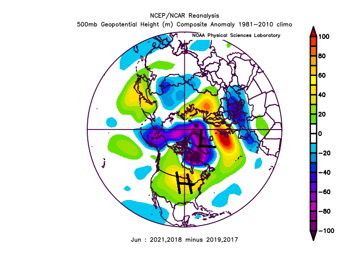
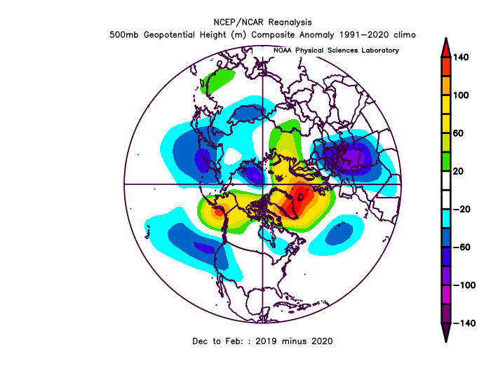
It's going to be a -PNA January and -PNA February, so here's a starting point (v reverse), I think we'll go reverse-this in the UM/eastern Rockies area because of ENSO subsurface warming
-
Happy 50th birthday Aunt Ang
-
Georgia

-
Love that north of Hawaii Hadley Cell. could flex Atlantic Hadley Cell down the road.
-
That's going to verify warmer.. I love +EPO's, especially with 591dm ridge under it.
-

2021-2022 ENSO
StormchaserChuck! replied to StormchaserChuck!'s topic in Weather Forecasting and Discussion
It's actually been a straight correlation in the 3,000 mile region of North Pacific, when the subsurface center went warm, >0.0, -PNA stopped completely, That will probably continue into Winter. surface doesn't really matter for the 30N-90 Jet -
2021-2022 ENSO
StormchaserChuck! replied to StormchaserChuck!'s topic in Weather Forecasting and Discussion
Short-lived La Nina burst in the Northern Hemisphere. It's not really holding right now. 3/15 days.. something like 3/last 100 days too. -
We'll do it something like 5/7 or 5/8 of next Winter's, unless there is volcano explosion or something. +10-year signal. lalala
-
Still like the idea of the SW High pressure spilling NE. We are entering +10 year range of that UM/GL's cold anomaly to be a mathematical anomaly-exponentially if it continues. mathematics.
-
Yeah, it's been record +SOI. They show it's going to last next 4 weeks, until Aug 1 just as strong. N. Hemisphere is disconnected right now though. I think CanSHIPS shows what it is in stability. After following weather for so long and doing research, somethings start to show up.
-
2021-2022 ENSO
StormchaserChuck! replied to StormchaserChuck!'s topic in Weather Forecasting and Discussion
What's really going on down there?? -
Actually, it would evolve pretty above average.
-
2021-2022 ENSO
StormchaserChuck! replied to StormchaserChuck!'s topic in Weather Forecasting and Discussion
Yeah, that 4-6-month SOI was only matched by 2011 (apr 23.9), which was the Dec 2010 I keep comparing too, as a significant anomaly correlation to this last Winter. Then 1994 (reverse) 1994 4 -19.9 93,92,91 were all <-10 .. so we are reverse-early 1990s. Wierd because that was a 5-year subsurface El Nino, but surface was Neutral. we are + in the subsurface now, which does not match. Showdown I guess lol. -
1940s into 1950s is the best match to now long cycle-wise. I really like the stretch actually from 1948-1951 as a pretty good matching event sequence.
-
+NAO May 7-16
StormchaserChuck! replied to StormchaserChuck!'s topic in Weather Forecasting and Discussion
As usual with these things, it's about a 60-70% match
-
+10QBO for May https://www.cpc.ncep.noaa.gov/data/indices/qbo.u50.index
-
I like the general signal of -PDO/-NAO
-
The last few 30mbQBO-match Winter's https://www.cpc.ncep.noaa.gov/data/indices/qbo.u50.index
-
DCA _ NYC _ BOS __ ORD _ ATL _ IAH ___ DEN _ PHX _ SEA 2.7 2.8 2.5 3.0 1.8 0.8 2.5 2.0 1.5
-
Rapidly rising Nino3.4 June-Aug
StormchaserChuck! replied to StormchaserChuck!'s topic in Weather Forecasting and Discussion
Let's see if we hit this pattern
-
2021-2022 ENSO
StormchaserChuck! replied to StormchaserChuck!'s topic in Weather Forecasting and Discussion
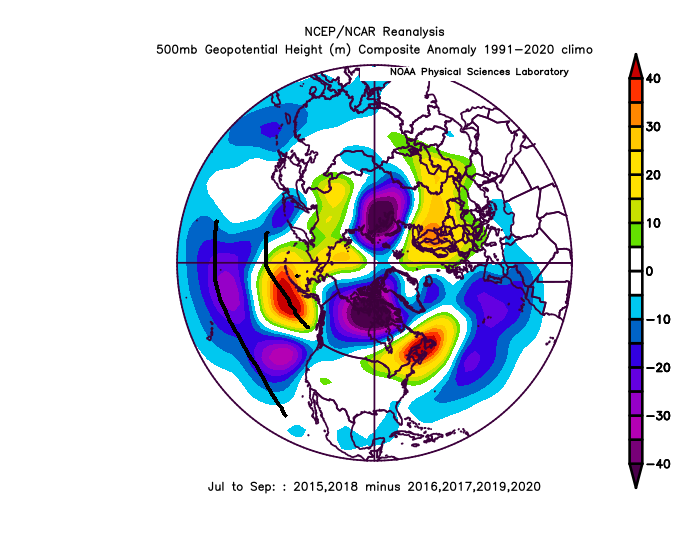
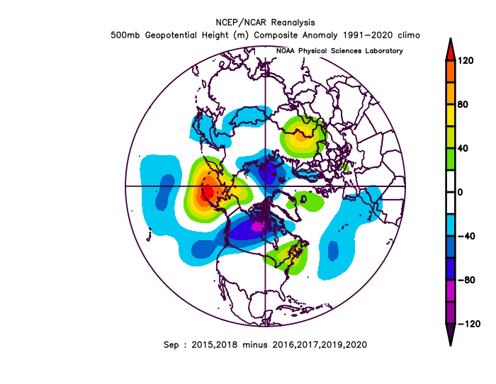
It will neutralize the La Nina at least -PNA will cool the subsurface, but we should go +ENSO by August and September. Flirting around low-Weak El Nino for the Fall is still my guess..thumb.gif.cbd0c22573e5211b16643c27d37185eb.gif)
-
2021-2022 ENSO
StormchaserChuck! replied to StormchaserChuck!'s topic in Weather Forecasting and Discussion
Never hit -3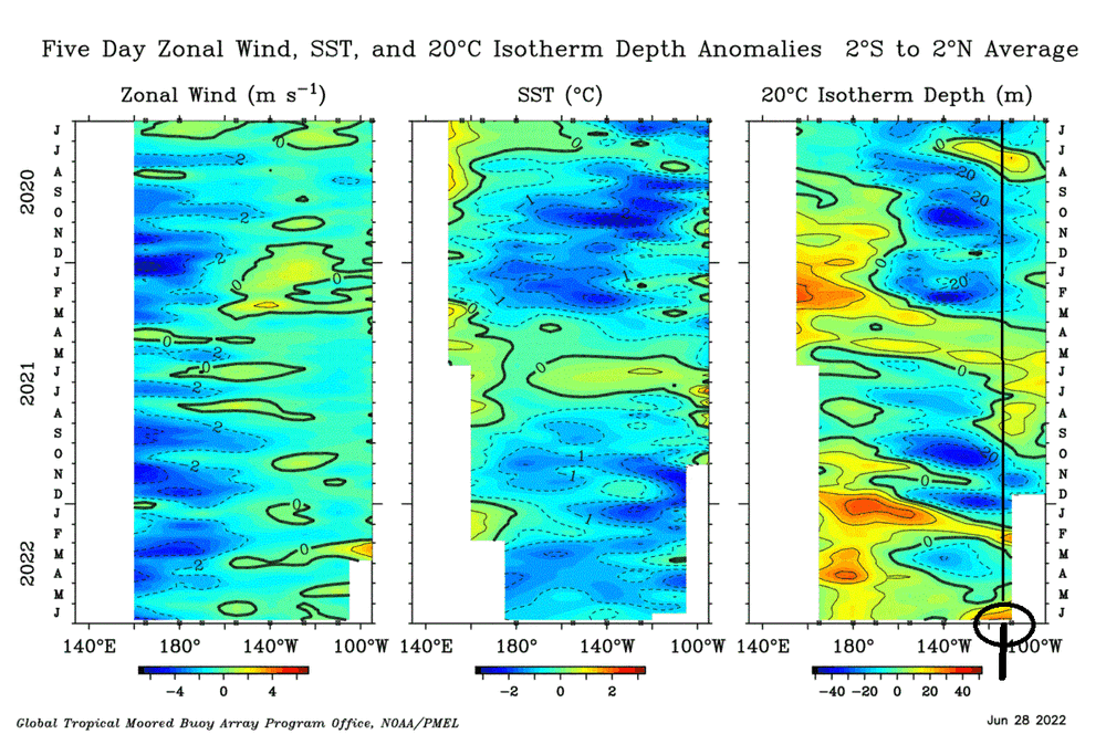

-
2021-2022 ENSO
StormchaserChuck! replied to StormchaserChuck!'s topic in Weather Forecasting and Discussion
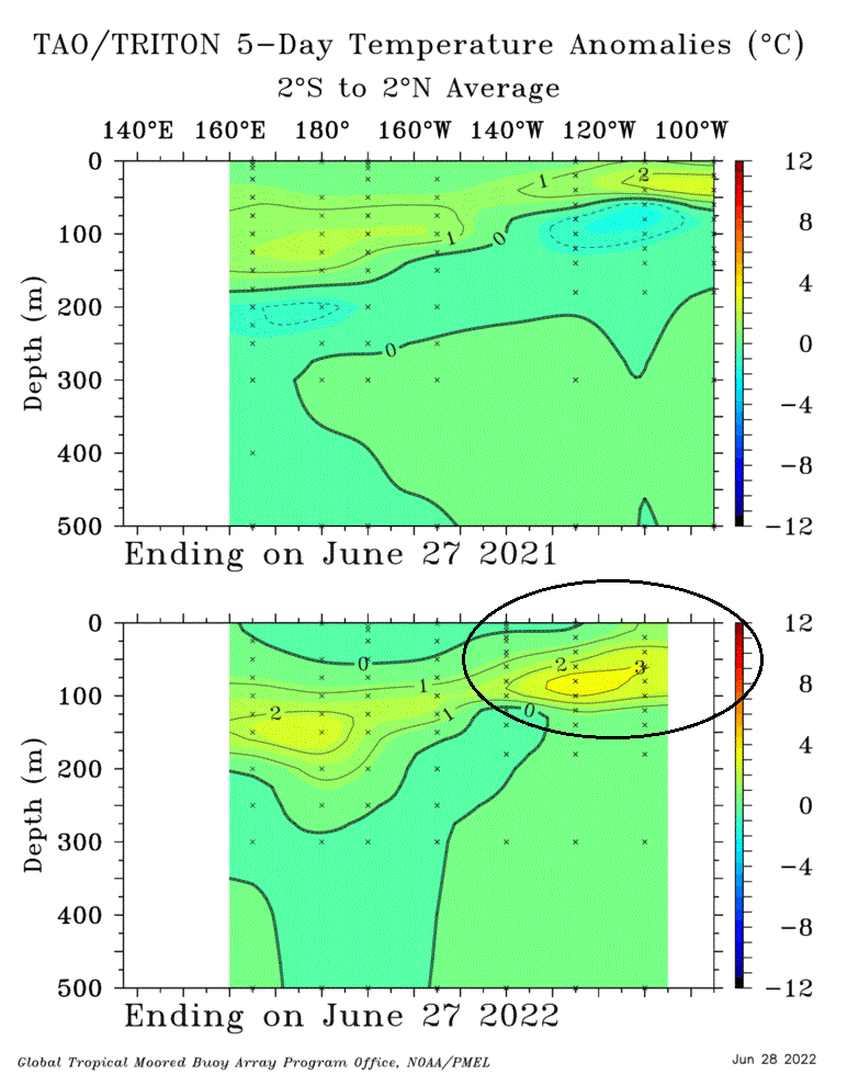
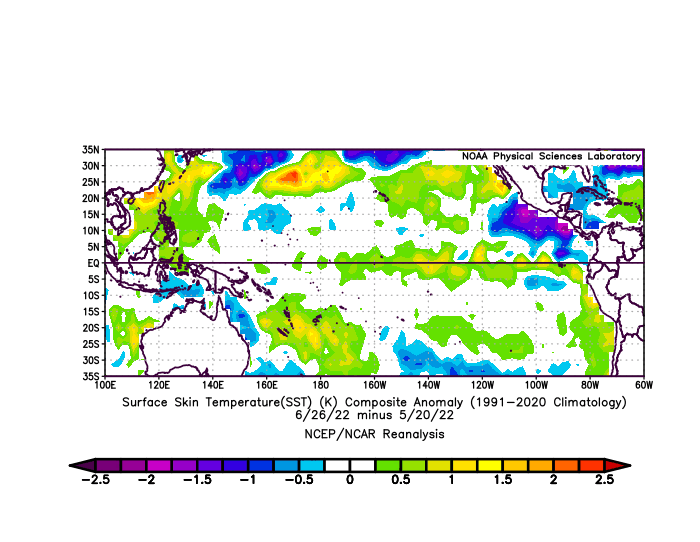
I don't know who pays attention, because there are like 2 posts on this forum a day, do different people see different things? The surface warming hasn't yet begun. I expect some Northern Hemisphere 500mb patterns when that does happen. There is a +3c bubble just below the subsurface.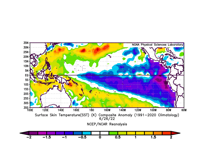

-
one more.. SOI+anomaly evened out
-
It's been cooler than that.. July will probably be very +above average. I was also looking at this


.gif.807916b800758924f5d56bc9ccedc1a4.gif)