StormchaserChuck!
-
Posts
2,274 -
Joined
-
Last visited
Content Type
Profiles
Blogs
Forums
American Weather
Media Demo
Store
Gallery
Everything posted by StormchaserChuck!
-

2021-2022 ENSO
StormchaserChuck! replied to StormchaserChuck!'s topic in Weather Forecasting and Discussion
Models LR models not going La Nina at all.. no signs of -PNA since April -
2022 Atlantic Hurricane season
StormchaserChuck! replied to StormchaserChuck!'s topic in Tropical Headquarters
Warm GOM 7-10 never had less than 16 named storms since 2003. 14 since 1995. (cold GOM had 12 NS' -in a La Nina in 1999) -
-1.19 to +1.19 is neutral this Winter as per 500mb pattern. It might look like La Nina in jan and feb,.. I dont know
-
Warm GOM SST 7-10's since 1995(AMO+cycle) for December there's my -PNA/El Nino v
-
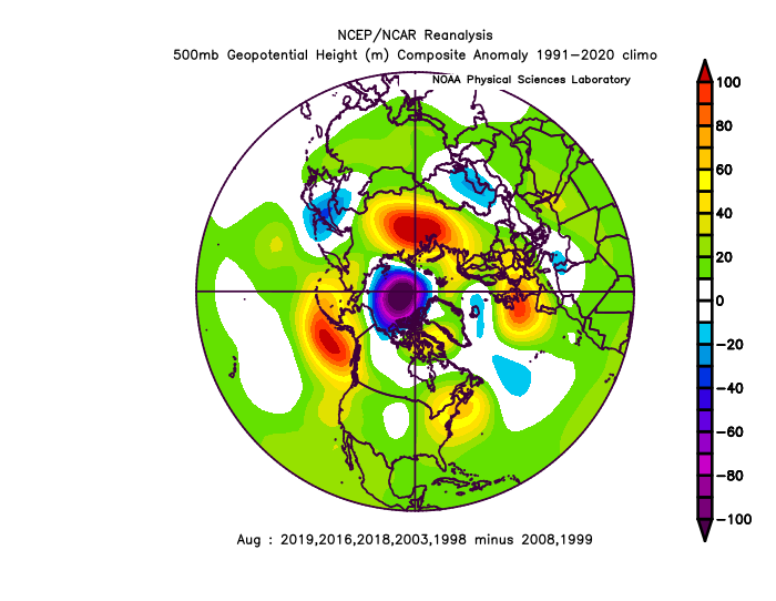
1995> Atlantic , some interesting stuff, the SST of these July's wasn't even Atlantic-based 500mb going forward into August is time warp late July on models \
.thumb.gif.4e99aa45030379b08971a090460f7fff.gif)
.thumb.gif.aae65d18db10b5e71f58b7f7a0f10dfd.gif)
-
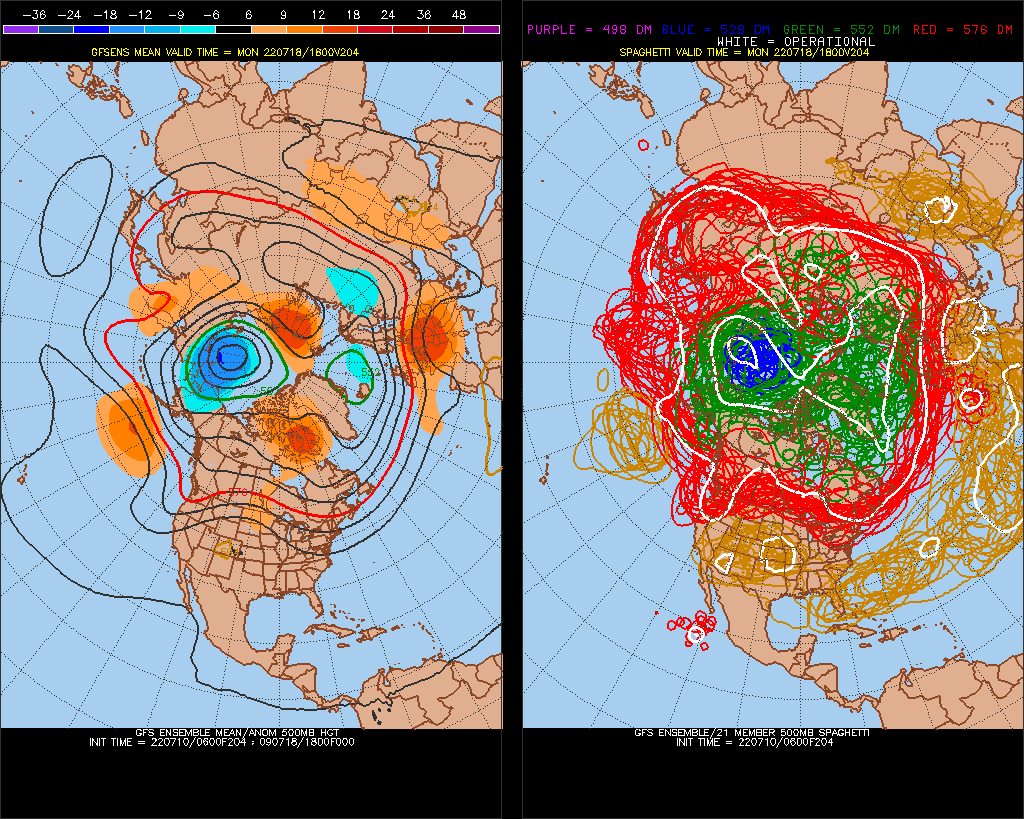
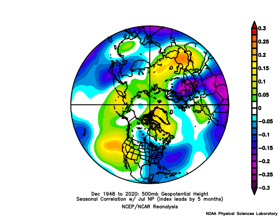
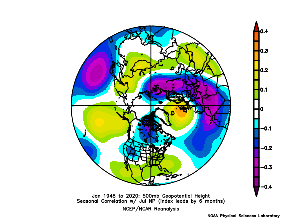
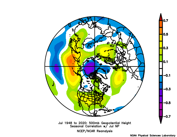
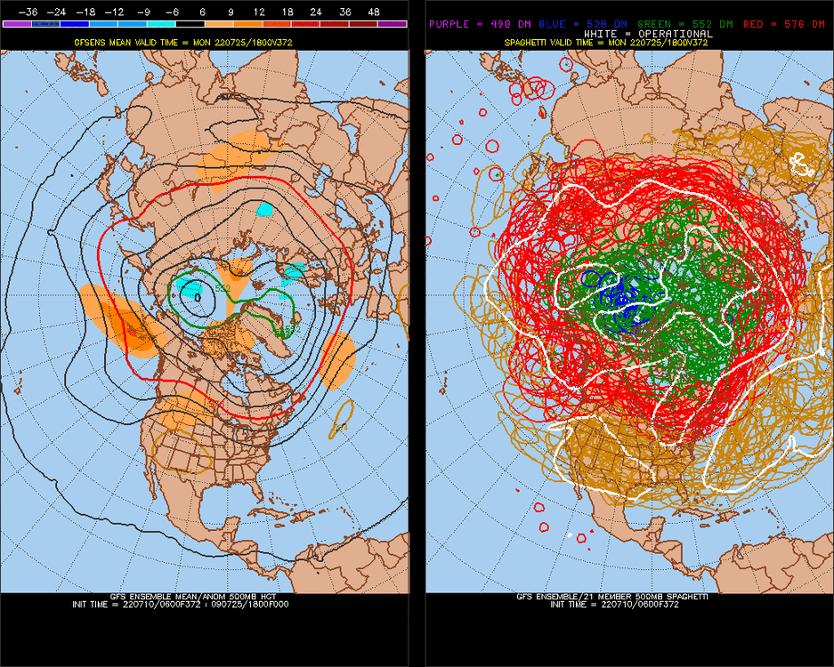
North Pole/Arctic PV July 1-16
StormchaserChuck! replied to StormchaserChuck!'s topic in Weather Forecasting and Discussion
Hit really strong last year and in 2018.. US ridge/RNA ridge collapsed any cold Fall prelude to a cold Winter. -
2021-2022 ENSO
StormchaserChuck! replied to StormchaserChuck!'s topic in Weather Forecasting and Discussion
Waves and stuff.. I once found with global currencies, when they move >1% in a day, the next down they were opposite 52% of the time, >10,000 examples. -
2022-23 Winter NAO N. Atlantic SST index
StormchaserChuck! replied to StormchaserChuck!'s topic in Mid Atlantic
Time flies.. already almost half way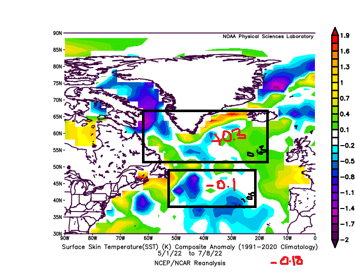
-
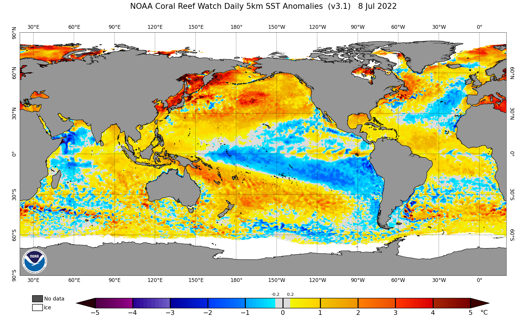
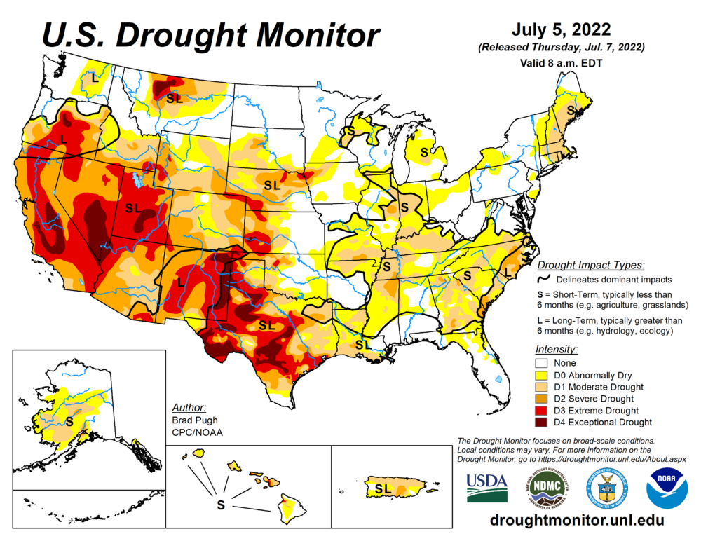
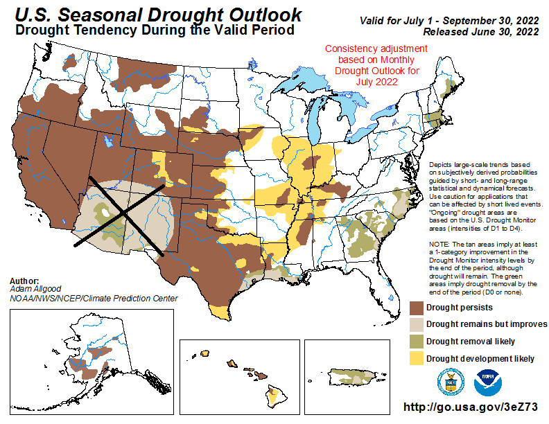
SW, US Drought. West Coast High pressure building
StormchaserChuck! posted a topic in Climate Change
Getting worse, SST evolution in the North Pacific looks like 2013-2015.thumb.png.5a63290aaae3b568f2caa2cf3dcd5fd7.png)
-
2021-2022 ENSO
StormchaserChuck! replied to StormchaserChuck!'s topic in Weather Forecasting and Discussion
Here comes El Nino waves.. -PNA for first time in a long time. +PDO thing is setting up a lot like year 13-15,.thumb.png.dc99266faf38ae5a1dcd6598c183fcc5.png)
-
I think so.. 03-04, 04-05 analogy (We only average 3" of snow in December)
-
Let's see how it evolves. I would skew warmer in the SW/West
-
2021-2022 ENSO
StormchaserChuck! replied to StormchaserChuck!'s topic in Weather Forecasting and Discussion
I should have saw it coming.. when ENSO surface warms to lite El Nino, PNA in N. Pacific would go negative 0time. -
-
3 shots of 3rd contour-PNA, which we really haven't seen in that location since December 2021.. as ENSO surface is warming1st time.


-
2021-2022 ENSO
StormchaserChuck! replied to StormchaserChuck!'s topic in Weather Forecasting and Discussion
The fake-PNA as ENSO warms


-
A lot of pattern-energy for it to happen. Clouds aren't building so high in the atmosphere as they could.
-
La Nina is not succeeding. and we have a PDO evolution starting to look like 13-15.

-
^will verify warmer, 95-100 for a probable average of 5 days in there somewhere. 1 or 2 days may break 100, 101, 102.
-
+EPO's always overperform as temps.. that it's origins have been in spinning at 90N in arctic circle for 10 days is my only doubt though, It could be a stronger 90N vortex +timelag, vs the actual +EPO
-
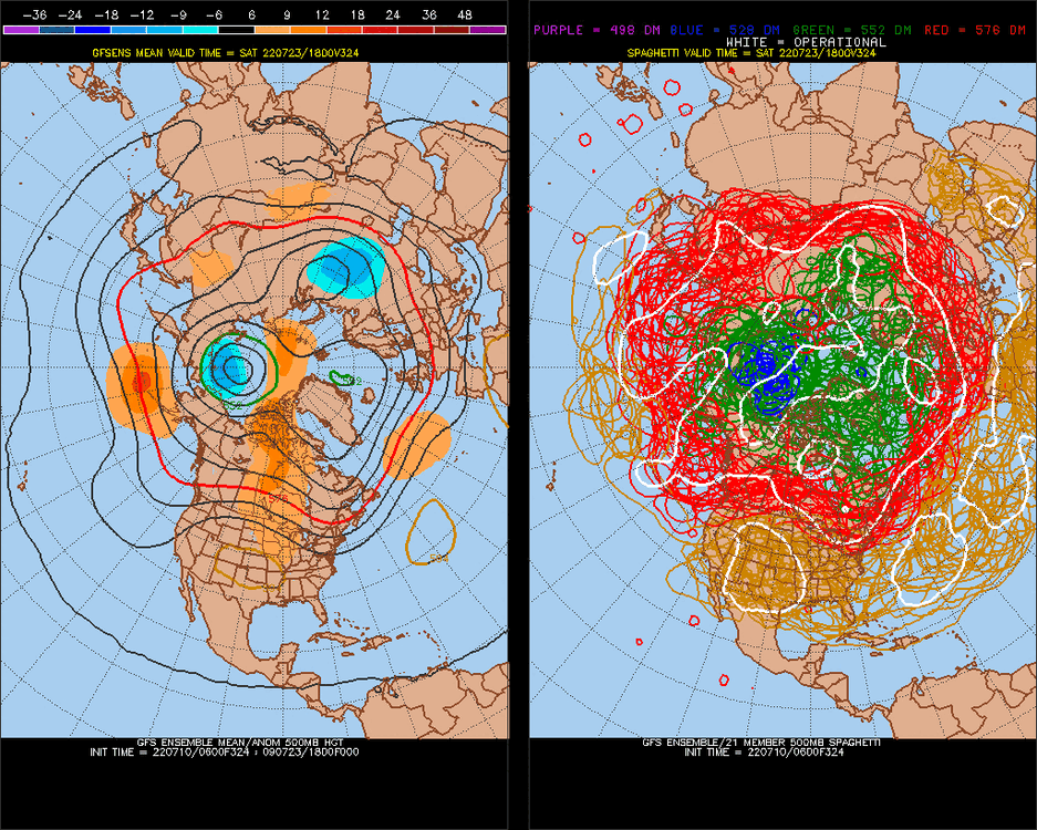
Real hot pattern setting up for July 17-23.
-
15 day GFS ensemble mean hits it at like 85-90% for a stronger signal-pattern (>120dm in the mean). There are different intentions for different things.
-
July 17-23 may be hot. Could be nearing 100, or go over it.
-
Watch about July 17-23 to be particularly hot.
-
ECMWF ensb still trash.. probably will always be. You need to build a model on science.

.gif.03b081df1b81339b9ec465dc7546770f.gif)
.gif.ed5a674c1e539334df8aa3f5052f25cf.gif)
.png.c5c27ac66528e3503242a67463828f13.png)

.png.adb8e7007c1f7fbe1160537bf23c7b46.png)