

Daniel Boone
-
Posts
2,098 -
Joined
-
Last visited
Content Type
Profiles
Blogs
Forums
American Weather
Media Demo
Store
Gallery
Posts posted by Daniel Boone
-
-
43 minutes ago, GaWx said:
The Euro Weeklies are weaker with the SE cold for Feb 12-19 averaged out vs the run 3 days ago, which is due to a little can kicking/short delay in the start of the BN. One can see that delay by comparing the EPS daily maps for Feb 11-12 over the last couple of days.
Fri’s Jan 26 run: pretty solid signal for BN SE Feb 12-19
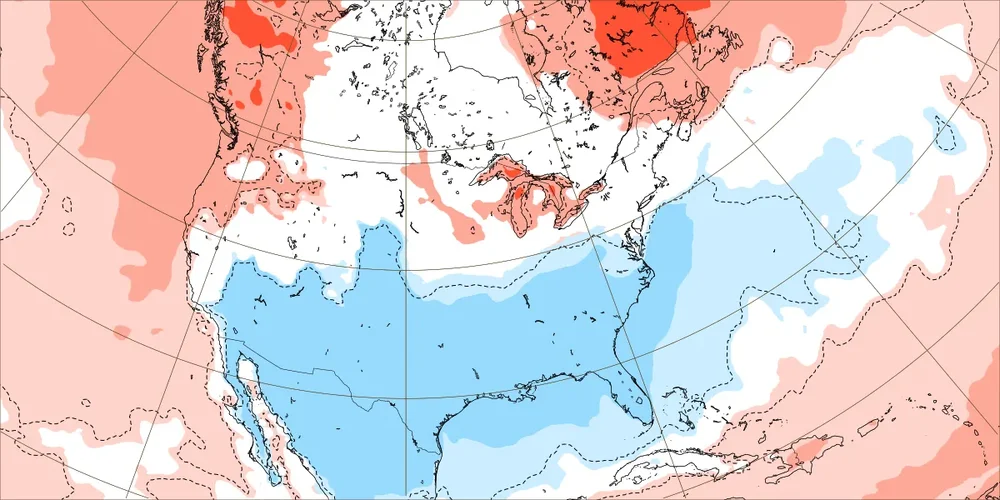
Today’s (Jan 29) run: weaker BN signal in SE for Feb 12-19 due to delay
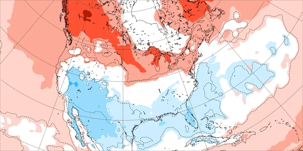
Otherwise, the Euro Weeklies are about the same (Feb 19th+) calling for a pretty solid BN signal for 3 weeks into early March. The best opportunity for a Miller A GOM based SE winter storm in the Weeklies still appears to be during the subsequent week, Feb 19-26, though that leans more toward NC/SC/GA (more qpf).
Pretty good back off looks like. Appears to be maybe showing a semblance of a SW hanging back trough. I don't know if Weekly version has any hanging back with energy in the Southwest like the regular Euro but if so, could be what we're seeing.
-
 1
1
-
 1
1
-
-
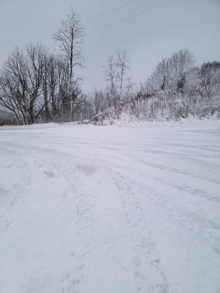
4 hours ago, Met1985 said:
Snow pics from the cement.
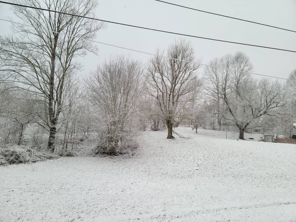


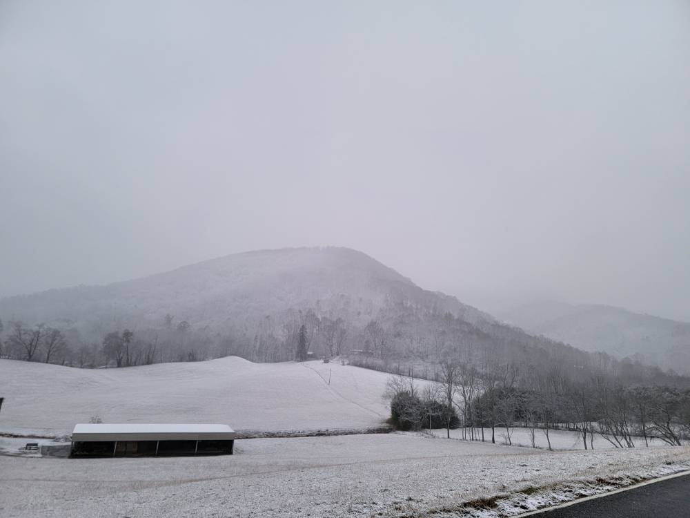
Sent from my SM-G998U using Tapatalk
Congrats on the appetizer there man ! I'm sure you're stoked for the biggie next week.

-
1
-
-
30 minutes ago, Holston_River_Rambler said:
GFS is back to obliterating western NC: @Met1985
If we can just will that to encompass the whole area. Temps are going to be marginal for Valleys even if it does. Hopefully low Dews and heavy rates will be realized.
-
3
-
-
3 hours ago, jaxjagman said:
Meh,lets let it go,i shouldnt have said anything myself .
You didn't mean anything wrong man. It's alright brother.
-
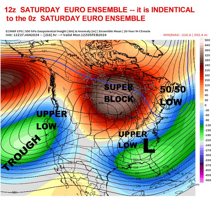
7 hours ago, Matthew70 said:
Do what. Thats 216 hours away. Believing anything that far out is fools gold.
Aa far as believing, not that I do but, no different than believing 70 degrees that far out or posting something regarding a mild rainstorm. Are you criticising any of that ? As far as DT, I'm not a fan of him personally ( attitude problem) but, he is still overall a good Meteorologist.
-
2
-
-
2 hours ago, Carvers Gap said:
I don't think any of them have been particularly good this winter. They have not handled the Nino rotations well. It is almost like they are pre-programmed to Nina tendencies, and have missed badly due to that.
Think you nailed alot of the Problem.
-
1
-
-
1 hour ago, Itryatgolf70 said:
If ensembles are the way to go, then that's when i will get on the bandwagon, if you will, for a potential change to colder whenever that is lol
Without coming across being pompous in any way, I've been in the Meteorology Field for 40 years. I do follow Ensembles more at range but, I also know they're still just Model output and are as good as what goes into them. Carvers covered the Computer aspect very well.
I also have alot of experience under my belt and made valid points in that Post. Last Season under the same Pac Pattern as now you would not be getting the cool shot and Mountain Snow nor the several days cooler stretch. More than likely a bulging SER and very mild Temps. The enhanced STJ is something factoring in the equation as well. As far as Pattern Change to dominate Eastern Trough , yeah that looks to be later as most agree on.
-
3
-
-
1 hour ago, jaxjagman said:
The whole patterm looks nothing more than a meridonal flow into Feb
He's obviously buying the Euro Solution. Feb. 5-6 is timeframe he listed.
-
3
-
-
23 minutes ago, Itryatgolf70 said:
Imo, if it keeps getting delayed, it just may not happen for reasons why I'm not a meteorologist lol. I do agree that maybe not the only way but the most important way for us to get cold is when the mjo gets to the cold phases.
Let's not forget other Drivers can mitigate or alter the typical downstream affects of the MJO and western PAC. We just had a SSW that is already starting to show it's fingerprint.
Feb 5-6 looks like a legit threat. Higher elevations as early as tomorrow evening should cash in in this " warm, gloom and doom" Period.
-
2
-
-
Excerpt from DT: INCREASING THREAT FOR MAJOR WINTER STORM FOR TENN VALLEY AND MID ATLANTIC FEB 4-5
-
2
-
-
2 hours ago, Weather Will said:
Latest EPS MJO appears to finally want to move again through 7 toward 8.

Convection finally been flaring in Central eq Pac. Should continue to PH. 8 imo.
-
-
36 minutes ago, Met1985 said:
If you follow the ensembles they have cooled greatly just over the past few days.
Yeah, we have a couple things warring against the MJO Phase. SSW affects instigating blocking. The Central Pac( modoki area) Convection enhancing the STJ. Even though the MJO is in the western area this helps to counter it.
-
2
-
-
Just now, Carvers Gap said:
True on 2015 here in Kingsport. We had snow on the ground for about a month. I have roughly 30 inches of snow at my house. It is the most I have seen during a season.
Yep. Problem with official Records was KTRI just to your East only recorded around 10 inches as they had mixing issues quite a bit. That was a Kingsport west and North Bonanza.
-
1 hour ago, jaxjagman said:
Euro MJO seems to go bonkers into the WP because its been showing another WWB as we get into Feb,its been holding on to keeping the MJO into the WP for a extended stay and hasnt backed down much of any.CFS has been showing the same thing on the velocity but its also been showing a suppressed MJO signal with the 2nd WWB and the MJO is more advanced headed towards Africa and the Western IO into wk2 of Feb today
.thumb.png.d3452a68676b4dc76ae35b3f2c8d8a23.png)
.thumb.png.79b8b1efe7368db550ee553a174877f4.png)
.thumb.png.90d4e947bb7a31b525d29443808850f1.png)
Ph 7 has been good in Ninos.
-
2
-
-
3 hours ago, Carvers Gap said:
Actually, I didn't put it in the thread, because I doubted it. (I certainly doubt the snow record for TRI.) I just thought it was kind of cool. I lived in Knox during the 70s, and we had plenty of snow. But I don't remember it staying around like this storm. I did also live in Knoxville during the 95-96 winter. Similar to 93-94, it hung around for a long time. I think that post by MRX indeed might be correct for lower elevations in Knoxville. Knoxville, being right smack on the river, doesn't keep snow like other areas. Kingsport is the same. So, seeing snow last this long is rare IMBY. North facing slopes here still have plenty of snow as do north facing concert sidewalks. That is ten days from the onset of snow, which is incredibly impressive. Glad for the warm-up!!!!!
I had a Weather Diary from the late '70's that I recorded daily obs; rain , snow, highs and lows. There was over 2 month stretches of Snow cover on the North facing slopes and in Shady areas in both Winters of 1976-77 and 1977-78 here in Lee County. I'm sure John can attest to that in his local. On a more recent occurrence, Feb. 2015 had Snow cover from Feb. 12 to March 8 th on North facing areas and shades. Solid cover of 4" or more from Feb. 16th to March 1.
-
2
-
1
-
-
1 hour ago, Carvers Gap said:
Euro Weeklies look right on track for cold to return around the 14th, give or take 48 hours at this range. The control is bitterly cold around the 20th, and the CFSv2 has a similar signal. Most global ensembles are showing the initial transition around d15-16. Remember, transition does not mean the day we get cold. Should be 4-7 days after that initial transition. Looks like a similar window (Against mid Feb norms and not mid Jan) to the one we just departed. A very 95-96 or 14-15 cycle of cold. MJO is ruling the roost and it is super squirrelly right now. We should see opportunities with this, and it looks centered slightly more eastward. JB mentioned that adjustment and that looks to be the case.
Hopefully, we get a surprise before then. Even a 1-2 inch deal would dull the 2 week snow drought. Who knows, maybe the SSW induced blocking will speed things up a bit.
-
51 minutes ago, WEATHER53 said:
I have a hand written winter weather diary from 1965 until I stopped in 2015.
i would like to publish it maybe or find some way to share copies of it. There are some staggering hourlies that we just rarely have put together in last 25 years.
One excetpt from Blizzard of 66 is “…19 degrees ant 2 and just snowed 3” in last 2 hours so up to 10” and dad says radio said winds are 40 mph. I can’t see dad standing by the lamppost…”
It would be interesting to check out that Diary. Good stuff !
-
52 minutes ago, WEATHER53 said:
Remember in 1979 when the ocean froze along OC.? Took a while to figure out but extreme cold and very heavy snow allowed slush to accumulate and it froze. It’s also believed that very strong n-nne winds pushed similar ice and snow formation from out of Delaware Bay and down to OC coastline. I’ve got pics of me about 150 feet into the frozen mass and at that point I began to feel something different under my feet so headed back in.
Remember it well. Post the pic if you can.
-
3 hours ago, WEATHER53 said:
I think in 1977 it went below freezing for like 37 consecutive days
Those late 70's Winter's were something to have witnessed for us old timer's Howard. Without Pic's, Video's etc..many wouldn't believe how incredible they were.
-
1
-
-
4 minutes ago, John1122 said:
Went out and did several measurements. Still close to 5 inches on the ground. Made it to 42 today but I'm back in the 30s now.
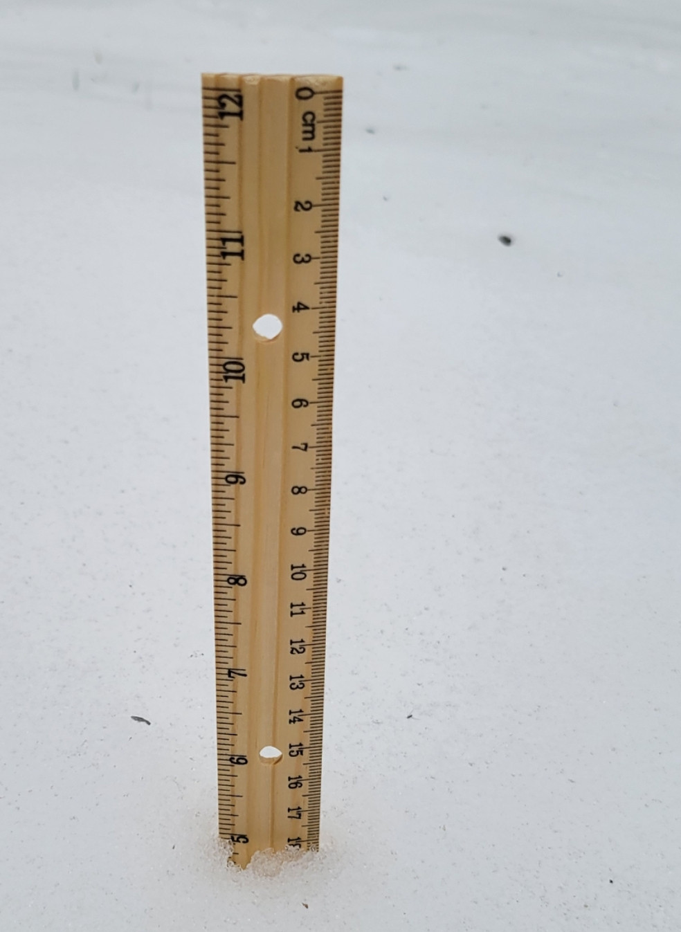
Wow , melting fast here. Had 5-5.5 this morning now about 3. Hit 52 here as had a few periods of Sun. Currently 51.
-
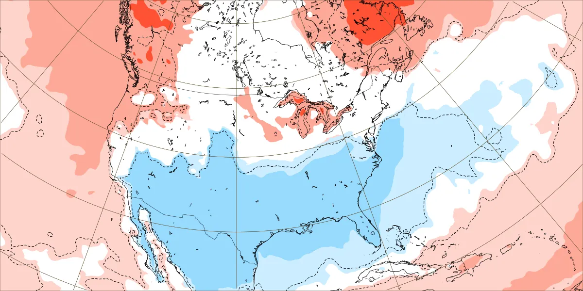
1 hour ago, GaWx said:
Thanks for posting this. I need to also add that the maps I posted are for all ENSO rather than just El Niño, which itself tends to have lower heights in the S US especially in Feb.
Yeah, that was the point I was making in my original post regarding Ph 7 being different during Nino that I thought you had researched. Makes sense when looking at the typical Nino 500 mb Pattern really. Quite probable the reason p 7 shows as slightly warmer in the east in the full MJO Chart. Nino Years would scale back the Temps from what would be if they weren't included.
-
1
-
-
1 hour ago, John1122 said:
February El Nino MJO Phase 7.
Thanks for posting that John. I suspected something like that.
-
2 hours ago, GaWx said:
I can’t take credit for the phase 7 snow analysis. I believe that was from Eric Webb and specifically was addressing NC, possibly only at Raleigh. Also, I can’t recall whether or not Eric was looking only at El Niño cases.
My big thing in recent years of MJO analyses for the SE has been to harp on the tendency for cold and wintry wx to favor weak MJO: just outside, near, or inside the circle. For example, off the top of my head I recall discovering that every major ATL ZR and IP (as far back as MJO charts go, which is mid 1970s) has been when the MJO was weak. I’m sure that streak will end at some point as the sample size isn’t large (I think it is only 8), but OTOH it makes sense that it would favor weak since weak tends to be colder than strong. Also, I wasn’t looking specifically at the TN Valley, which may be quite different.
Yeah, my mistake there. i think may of been discussed in same thread. It was Webb about the MJO 7 deal.
-
1
-

.png.672877b677a736cdc62188e4a77d7b90.png)
.png.e1087828776d9a7fef9f2b9f0c6162ba.png)
.png.2fd6a0a00bd79aa918e81492eda4db4a.png)
Mid to Long Range Discussion ~ 2024
in Southeastern States
Posted
Perfect for this area.