MattPetrulli
-
Posts
1,734 -
Joined
-
Last visited
Content Type
Profiles
Blogs
Forums
American Weather
Media Demo
Store
Gallery
Everything posted by MattPetrulli
-
Big blow up near the center
-
Curious to see how NHC treats new data. 990 MB is a large drop with a 55 knot SFMR recorded. Wonder if they'll put out an update statement or wait until 8 PM.
-
MUCH more organized system
-
Surge will be bad, but lets not under estimate the potential for a Cat 2-3 eyewall to be going through Tampa. They have great building codes but that would cause significant damage regardless.
-
Recon already finding a more organized storm than last run
-
Significant east shift now
-
Yep east tick continues.
-
Honestly, I know the circulation is aligned and all and gradual intensification is occurring. But man given the favorable conditions Ian looks like trash currently lol. I fully expect that to change today but man it looks like crap right now.
-
-
Curious what recon finds in the next pass. They found a circulation way to the SE of it with no convection so assuming its an old circulation or MLC that is severely decoupled. Looks ugly on satellite still, although evidence of convection firing towards end of the loop near the center near or slightly above 15 degrees, as placed by NHC.
-
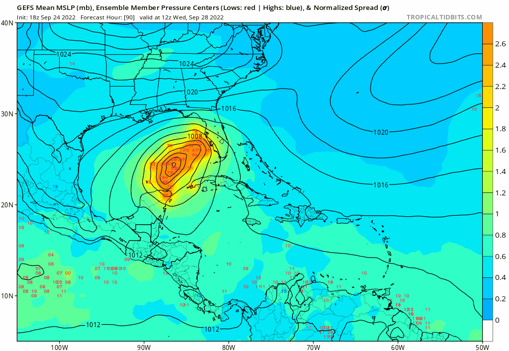
GEFS east shift, still mainly west however

-
Can change quick, but looks very disorganized at the moment. Weird given the parameters. Probably will change during the night, however.
-
Really curious about how surge impacts are communicated by NHC. Not too familiar with surge forecasting, but the Big Bend area and west coast of Florida are very surge prone. This, along with discrepancies about the size of the storm on models create for an interesting situation. Me thinks this will be a big surge event, but I am somewhat ignorant to surge forecasting.
-
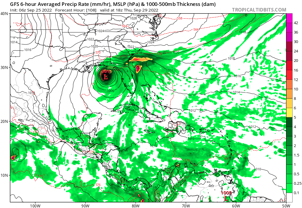
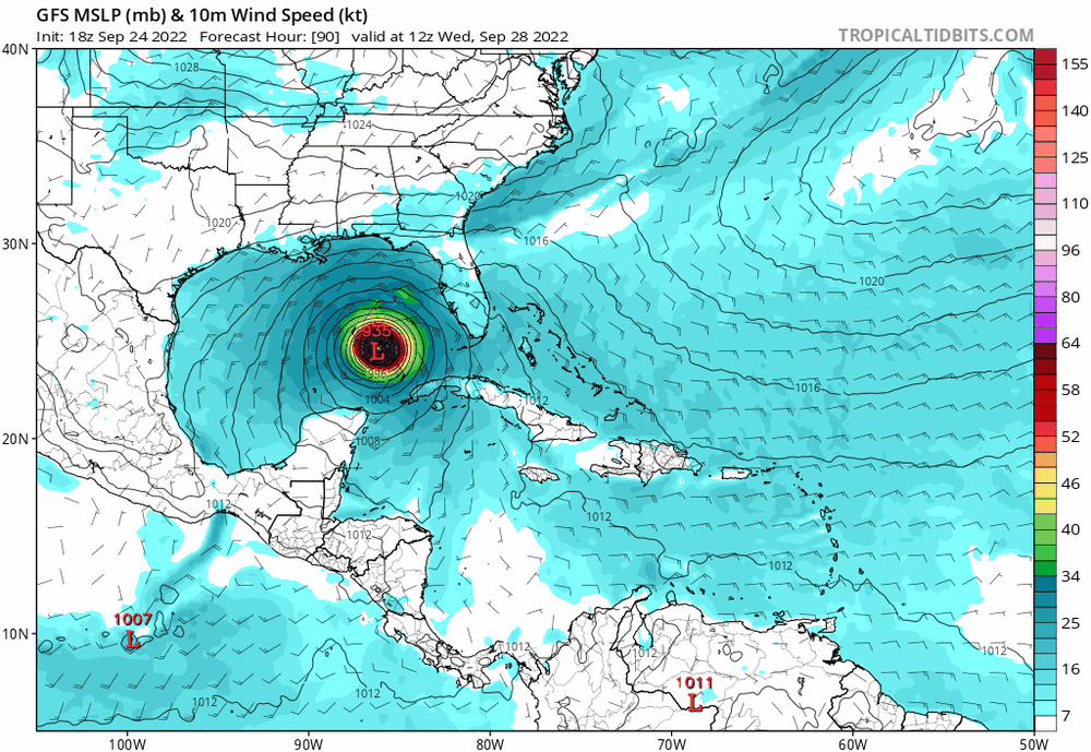
New cone goes slightly westward, peak intensity raised to 140 mph, however from Wednesday Night to Thursday Night, the intensity goes from 130 mph to 90 mph. Anticipating very rapid weakening
-
Nah that's 18z look at bottom right
-

Tropical Storm Hermine
MattPetrulli replied to Prismshine Productions's topic in Tropical Headquarters
I mean it had a closed circulation with consistent convection and gale force winds. Pretty sure that is what is called a tropical storm. -
00z with a tick east
-
18z Euro virtually the same as 12z Euro
-
Also curious to see if new center relocation to the north will affect track discrepancies at all.
-
It's reasonable if a landfall in the big bend were to occur, Tampa still gets coastal flooding. Very surge prone area.
-
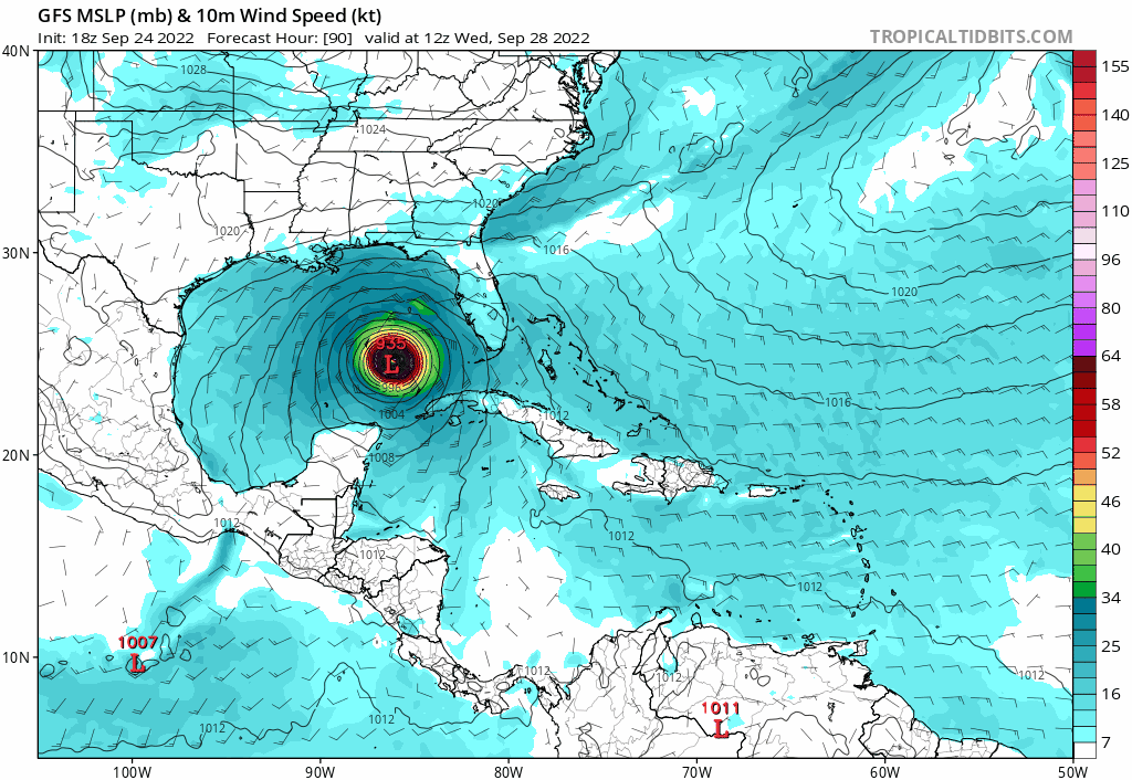
As a high Cat 2/low Cat 3 too
-
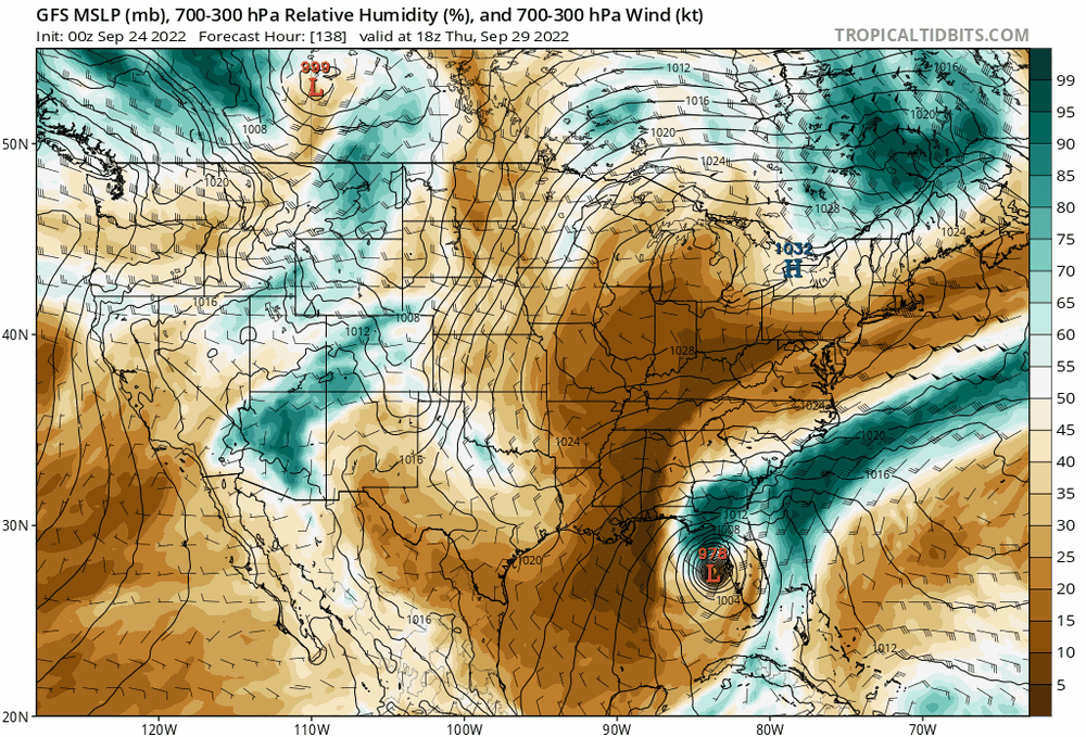
Tampa landfall Thursday morning on 12z Euro
-
Something of note also, GFS trending a little lesser with the dry air the more west it goes
-
12z GFS may be a Hurricane Dennis like scenario of a weakening, but major hurricane affecting that area. Still would have significant impacts.