
nw baltimore wx
-
Posts
12,177 -
Joined
-
Last visited
Content Type
Profiles
Blogs
Forums
American Weather
Media Demo
Store
Gallery
Everything posted by nw baltimore wx
-
We’re going to need a bigger wall filter.
-
It’s not on the books but that doesn’t mean it won’t happen.
-
Perfection this evening too. Nice to get a stretch of nice porch evenings during the weekend for those that are still doing the weekday grind.
-
I’m heading to Spain for three weeks culminating with the eclipse in Mallorca. It’s going to be 100+ for the first week but I’m looking forward to a real feel less than actual temps.
-
And possibly less injured arms. I feel like Albernaz has mismanaged the pitching staff all year, but I don’t care anymore. He might end up being a good manager, but I still think the front office goofed going with an unproven guy with this team.
-
I saw one sitting here on the porch, and that made me think of it, but I haven’t heard any. I blame the lantern flies.
-
By the way, where are all the annual cicadas??? I haven’t heard any this year.
-
Whiskey on the porch here!
-
Can we finally put any talk of the O’s being buyers to rest?
-
Picked up 0.89” here, which isn’t as much as I thought. I was in the city last night and they definitely got more.
-
It seems that I got lucky yesterday compared to nearly CoCoRaHS stations, and ended up with .77” from early and afternoon storms. The two closest stations to my east got about half that. I also didn’t expect to still smell smoke today.
-
Make sure you check for ticks!
-
Nice thunderstorm this morning. 0.42”
-
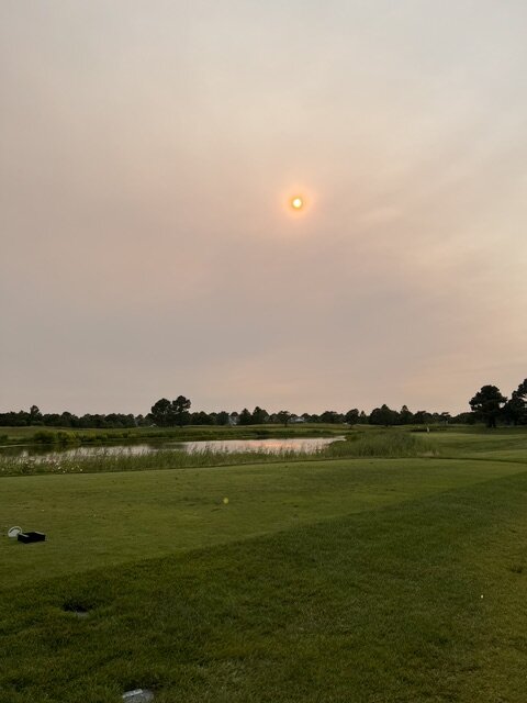
It still looks smoky, and the purple air numbers are still solidly high, but on my walk this evening, all I smell is weed. Kind of normal.
-
Just went outside for the first time since about 3pm and I can definitely smell the smoke.
-
Does altitude play a role in smokiness? Specifically, are higher altitudes at a higher risk?
-
Go España!
-
Milky white skies at 6PM just west of Bethany, DE.
-
I remember feeling a little off the rest of the day after riding the ferry. If you’re anything like me, take a Dramamine.
-
It always worries me when I get a pop up storm right over me this early in the day. It makes me feel like I’ll miss out on all the good stuff later.
-
Haven’t had many wins like this one this year so I’m making an old fashioned.
-
Impressive fail.
-
I was in PG county then, and the ‘83 blizzard had the best thunder and lightning snow that I have ever seen. It was pouring potato chips and you could literally see the snow accumulating during the height of the storm.
-
I know it’s a long shot but I also know I’ll be mad when it doesn’t make it.
-
Anything for the hangover?


