

snowman19
-
Posts
7,400 -
Joined
Content Type
Profiles
Blogs
Forums
American Weather
Media Demo
Store
Gallery
Posts posted by snowman19
-
-
49 minutes ago, SnowGoose69 said:
It’s likely due to the warm AMO. I would expect over the next 20-25 years we will see less big events
Good point. We have been slowly going into a long term -AMO cycle for the last couple of years. Once we get into the negative flip, I also expect more +NAO and less KU events overall. Research has shown -AMO periods (late 1970’s-early 1990’s) favor +NAO and a drop in the number of KU storms. This was especially true in the 1980’s during our last long term -AMO cycle
-
13 minutes ago, Snow88 said:
The Euro didn't trend north. There is more overrunning on this run.
Euro is 2-4 for nyc south with ratios
Yea exactly. It actually didn’t trend north at all. In fact, the main heavier precipitation shield down in the DC area moved south this run from 0z
-
1 hour ago, SnowGoose69 said:
I would be surprised if the pattern isn’t really great from 1/25-2/28. That doesn’t mean we will get snow though. I’m not sure about March. Some of the especially lousy El Niño December’s have lousy Marches. I think someone posted the closer to 0 or above that the SOI averages in an El Niño December the worse March is. It’s not a big sample size though
That’s what I mentioned a couple weeks about the post 1/21 period; cold and dry. I always felt that was the threat, especially with a TPV nearby
-
5 minutes ago, SnowGoose69 said:
You would think a KU was coming based on this
-
 1
1
-
-
17 minutes ago, bluewave said:
A light snow event or suppression look like the only 2 options with the very strong NPAC jet continuing. While the MJO 8 is bringing the cold, the Pacific Jet is still too unfavorable for a classic BM KU event. Need to see that jet back off and allow the STJ to take over so it can ride north when we have cold in place.

That right there (unrelenting Pacific jet) is one of the reasons why I do not believe we are headed for a ‘14-‘15 esque late January to early March comeback. The other reason is the PDO. Jan-Mar ‘15 had a severely positive PDO, over +2. We have nothing close to that this time around. I believe the extremely positive PDO is what drove a lot of that winter
-
Unless the Euro does something later, the Para GFS is a big time outlier tonight. The UKMET just came in OTS
-
Didn’t NOAA put a statement out yesterday about the GFS having major problems that they can’t fix due to the shutdown? I’m trying to find the actual article
-
1 hour ago, Brian5671 said:
weak amplitude in 5 or 6, but that needs to be watched if the amplitude is higher, we'll be back to the warmth in no time...amazing how it races through the cold phases, but crawled through the warm phases...just doesn't seem to be lining up for any thing long lasting cold wise....
MJO re-emergence in phases 5&6 in late January would definitely not be good, to say the very least
-
13 minutes ago, TriPol said:
'Tis the season for Mid-Atlantic storms suppressed to the south. Hope I'm wrong.
This synoptic setup is reminiscent of the early December storm honestly
-
 1
1
-
-
2 minutes ago, Snow88 said:
The gfs made a big improvement at 12z. I don't see how the 12z gfs looked worse.
I’m going to keep quiet for the remainder of the tracking of this storm so I don’t get accused of anything and I’m not going to give my opinion of what I think is going to happen. All I’ll say is don’t get emotionally invested in this storm
-
 1
1
-
-
58 minutes ago, Juliancolton said:
That synoptic evolution was about ten steps back compared to the previous two runs. I wouldn't fall in love with this yet.

I didn’t want to be the one to say it. But yea, if it keeps progressing like that on future runs it’s going to push it further and further south and east.
-
2 hours ago, SnoSki14 said:
Europe for now has been benefitting from the SSWE, and we'll likely have to wait our turn.
But if the winter never turns then it wouldn't be the first time, all or nothing winters are very common. It's recently happened in 11/12, 07/08, 01/02, 97/98 and so forth.
It does seem that once the pattern is set, it's very hard to break whether that be cold/snowy or warm/wet. However sometimes you get multiple forces that turn the pattern either very early like 10/11, 89/90 or much later like 14/15, 17/18.
I’m having doubts about the pattern going cold and snowy after 1/21 now, I had been optimistic until Friday night’s guidance. I will say this, if we get to 2/1 without a major pattern change, that isn’t transient, already in place, it will be a very, very bad sign
-
1 hour ago, SnowGoose69 said:
If we can hold some sort of El Niño semblance I think there’s a tendency for spring to be mild. There aren’t a ton of cases of back to back El Niño’s (I think just 4 in the last 80 years) but I believe they all had warm early springs following the first winter. 1953 and 1991 I think are two
I’m still of the opinion that March is warmer than normal this time around, unlike the last few. El Niño climo as one reason yes. Another factor is that the +QBO will be strengthening and descended into the bottom of the stratosphere by the beginning of March. I think the high latitude blocking breaks down, pattern retrogrades and it’s spring time
-
33 minutes ago, SnoSki14 said:
I think a dry pattern is highly unlikely. Even when the pattern turns colder, we'll likely still be dealing with the Pacific jet as well as the classic Nino southern stream/subtropical jet.
SSWE are also quite stormy once they get propagate down to the troposphere (see last March).
Cold and dry is certainly possible
-
A change to colder is coming. Going to be post 1/21 but it’s coming. Question is how long it lasts and is it snowy or dry?
-
1 minute ago, SnoSki14 said:
Still interested in the 8th, east based -NAO continues to trend stronger on Gfs.
Could be a redeveloper, SNE and especially CNE look to benefit the most right now.
East based -NAOs don’t help us
-
8 minutes ago, bluewave said:
Looks like the warmer SST’s.
On the role of anomalous ocean surface temperatures for promoting the record Madden‐Julian Oscillation in March 2015
https://agupubs.onlinelibrary.wiley.com/doi/full/10.1002/2015GL066984
We are in a real bad positive feedback loop in the tropical Pacific, the mild forcing is just going to keep repeating over and over. I think we’re in big trouble TBH. The new JMA just did a huge flip to a very mild pattern right through the end of this month
-
1
-
-
28 minutes ago, donsutherland1 said:
It's a waiting game with the MJO. The guidance is in big disagreement on its evolution and amplitude. With the exception of Australia's BOM, none of the other tools have had a good handle on its progression in recent weeks.
The SSW is a polar vortex-splitting event, not a displacement event. The latter typically has a larger, more wintry impact on North America.
There are some additional developments that will need watching.
My guess is that by January 15-20, winter's end game will be readily apparent. For now, it's a matter of waiting, as that's still more than two weeks away.
Have a great New Year. Hopefully, winter will revive in coming weeks to make the wait worth it.
From the research I’ve read, getting a wind reversal is one of the most important factors in a SSW, it has a profound impact on the NAM state
-
1 minute ago, Snow88 said:
Maybe but the eps might be wrong here considering the mjo and other factors.
It’s not budging an inch, and the pattern depicted at the end of its run is showing no signs of breaking down, by then we will be beyond mid January. I guess we’ll see
-
1
-
-
The EPS absolutely refuses to budge. Still shows a horrible Pacific pattern blasting in right until the end of its new run. We have to consider the possibility now that the Pacific is still awful after mid-month
-
3 hours ago, Snow88 said:
Why wouldn't you count on it ?
You don't know what's going to happen when the pattern changes.
Majority of winter forecasts have near 40 inches for our area.
I don’t ever count on getting over 40 inches of snow between late January and early March. As Don already pointed out, it’s only happened one time in NYC weather history (winter 14-15)
-
1
-
-
11 minutes ago, Snow88 said:
Or winter of 2014-2015
I definitely wouldn’t count on a 14-15 redux. The amount of snow we got from late January to early March that winter was a historic first in the entire history of weather record keeping for NYC
-
1
-
-
3 hours ago, NittanyWx said:
Tried to explain this a couple of days ago. It has really struggled with the tropics since we moved into this 4-5-6 phase space. I've noticed this is when it is at some of its lowest skill.
The AAM and Pacific remain the biggest barriers to cold. You still got one off chances for a storm next week, but in terms of meaningfully turning the pattern on it's head, it's still a function (to me) of the AAM calming down and the MJO progressing. And it is progressing slowly, unfortunately.
If this pattern change progression gets delayed/slowed beyond 1/21 then we will be depending on February and March to produce at that point. If we look at past history, that’s definitely not a good situation to recover from. Still certainly doable but boy oh boy talk about the definition of backloaded and coming from behind
-
Just now, Snow88 said:
21st? Seems late
I like around the 10-15.
The Euro has us in transition 1/15-1/21, still not yet a cold pattern during that transition period. I like that timing, I think it really does take until about the 21st or so before we are in a solid below normal regime
-
1
-


January 2019 General Discussion & Observations
in New York City Metro
Posted
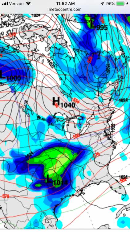
Don’t even have to look at the rest of it, the Euro is going to be suppressed, even DC is going to have totals cut back from 12z. Weaker too