qg_omega
-
Posts
3,843 -
Joined
-
Last visited
Content Type
Profiles
Blogs
Forums
American Weather
Media Demo
Store
Gallery
Everything posted by qg_omega
-
NYC needs 0.2 to go above 3 inches, Kalshi odds only 45 percent for December. Seems low to me
-
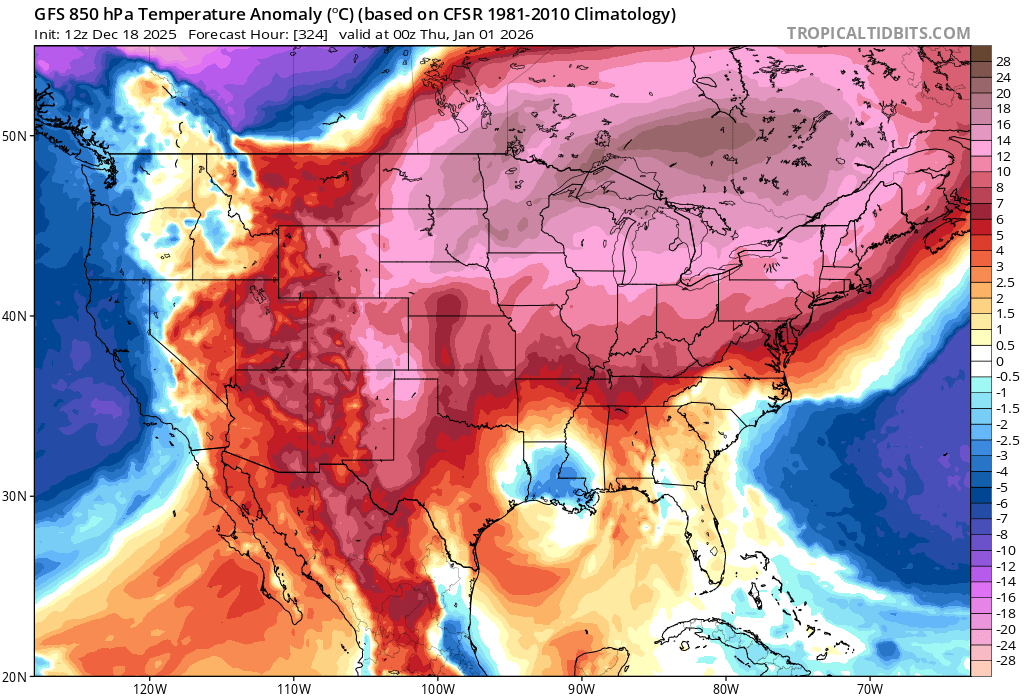
Historic warmth in a Nina December, it’s a climate emergency
-

-

-
We went from historic phase 8 length to 4 days of verification
-
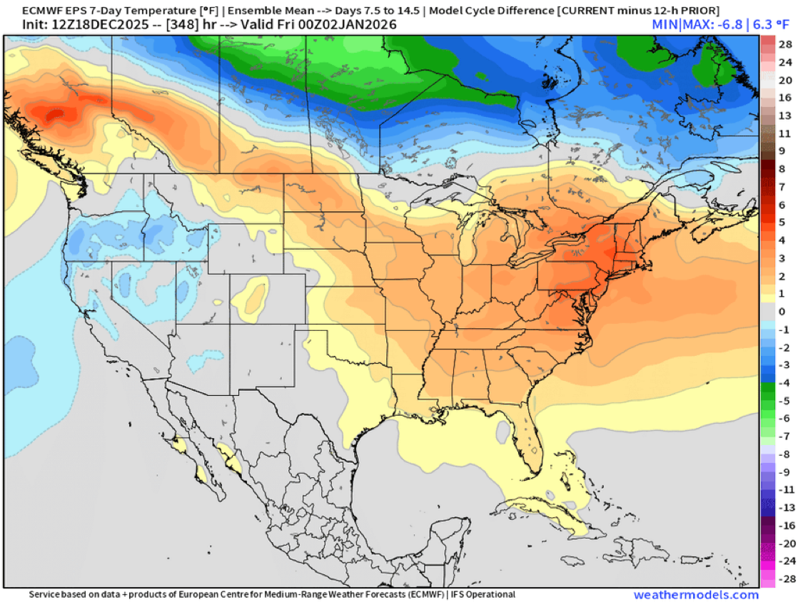
Weeklies are wall to wall warmth for January
-
Looks like winter is over, complete breakdown of the pattern to a full on CONUS torch
-
Pattern reversal is pretty amazing
-
It’s very concerning with all the money now trading on predict markets where CPK measurements are the benchmark
-
Looks like NW NJ jackpot due the warm BL temps missed by many
-
Light snow decent coating, 31
-
Moderate snowfall 12/14/2025 WWA up for most of the area
qg_omega replied to WeatherGeek2025's topic in New York City Metro
Snowing good now and below freezing -
Moderate snowfall 12/14/2025 WWA up for most of the area
qg_omega replied to WeatherGeek2025's topic in New York City Metro
Lots of dry air -
Moderate snowfall 12/14/2025 WWA up for most of the area
qg_omega replied to WeatherGeek2025's topic in New York City Metro
Chances NYC gets 3 inches, 50 percent? -
Moderate snowfall 12/14/2025 WWA up for most of the area
qg_omega replied to WeatherGeek2025's topic in New York City Metro
I will be shocked if DC doesn’t do well, pattern always favored DC area for this one -
Impressive snow band!
-
You seem to care more about verifying your seasonal forecast than anything else which is a bit strange unless you have paying customers and this is your business?
-
Still looks good for DC
-
For DC or SNE?
-
Only question is how warm and do we go 70s or not
-
Pattern favors DC to VA area
-
-
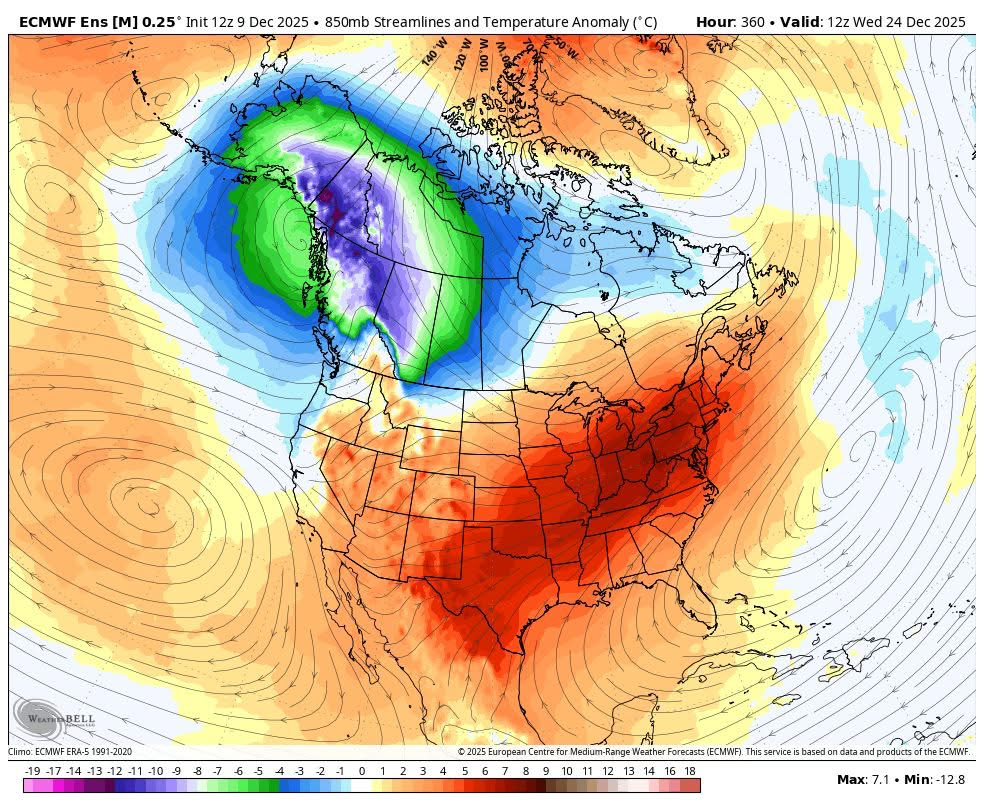
Historic torch is gearing up for second half of December, rubber band going to snap back hard
-
Historic warmth looks likely Xmas week as the pattern completely flips
-
Impressive cold days