Blizzard of 93
-
Posts
13,024 -
Joined
-
Last visited
Content Type
Profiles
Blogs
Forums
American Weather
Media Demo
Store
Gallery
Everything posted by Blizzard of 93
-
Welcome back @Itstrainingtime !
-
31 for my Marysville low.
-
39 in Marysville currently. .18 of rain overnight. .31 since yesterday am.
-
I wish that we could get noon temps from @Bubbler86 & @Itstrainingtime just for old times sake.
-
My temp is slowly dropping… now down to 48 in Marysville… just a few minutes before noon.
-
.SHORT TERM /6 PM THIS EVENING THROUGH 6 PM MONDAY/... As the colder air gradually deepens later today and tonight (with the Dendritic Growth Zone dipping into the upper quarter of the cloud layer over the high terrain of the North and West), showers will mix with or even change to wet snow across the Northern Mtns, and to a lesser deg over the Laurel Highlands. A relatively weak wave of low pressure will move northeast along this nearly stalled out frontal boundary later tonight and early Monday, bringing a 6 to 10 hour period of rain in the south and mixed rain and wet snow across portions of the Central Mountains and Middle Susquehanna Region. Mixed precipitation or wet snow will likely overspread the region from the Southwest this evening and continue overnight as snow over the Mtns of Northern PA. Up to 2 inches of accumulation is possible across the higher terrain of Northern PA (with the target area appearing to be near and up to 25 NM north of I-80 in NCentral PA), mainly at elevations over 1500
-
CTP says my area might mix with sleet tonight. Tonight Rain showers likely before 2am, then rain showers likely, possibly mixed with sleet. Cloudy, with a low around 37. Northeast wind 7 to 9 mph. Chance of precipitation is 70%. Little or no sleet accumulation expected.
-
.09 overnight rain in Marysville.
-
.07 of rain with that short lived heavy shower that just rolled through the LSV.
-
MDT only recorded .37 overnight.
-
.90 of drought denting rain overnight in Marysville. 1.32 of rain total this week so far.
-
Thunder & lightning in Marysville with a couple short rounds of heavy rain.
-
Everyone should try to stick around. We have a good group that is entertaining & informative. There is a role here for everyone. We all know each other’s tendencies & general personalities. The common ground is an interest in the weather. Some of us can push each other’s buttons at times, but most of the time we resolve it quickly and at times laugh it off & then move on to the next day. Hopefully in a little time we can get the band back together.
-
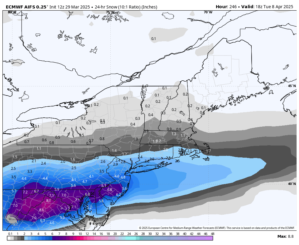
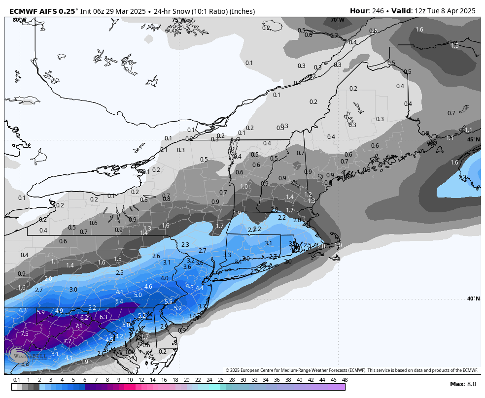
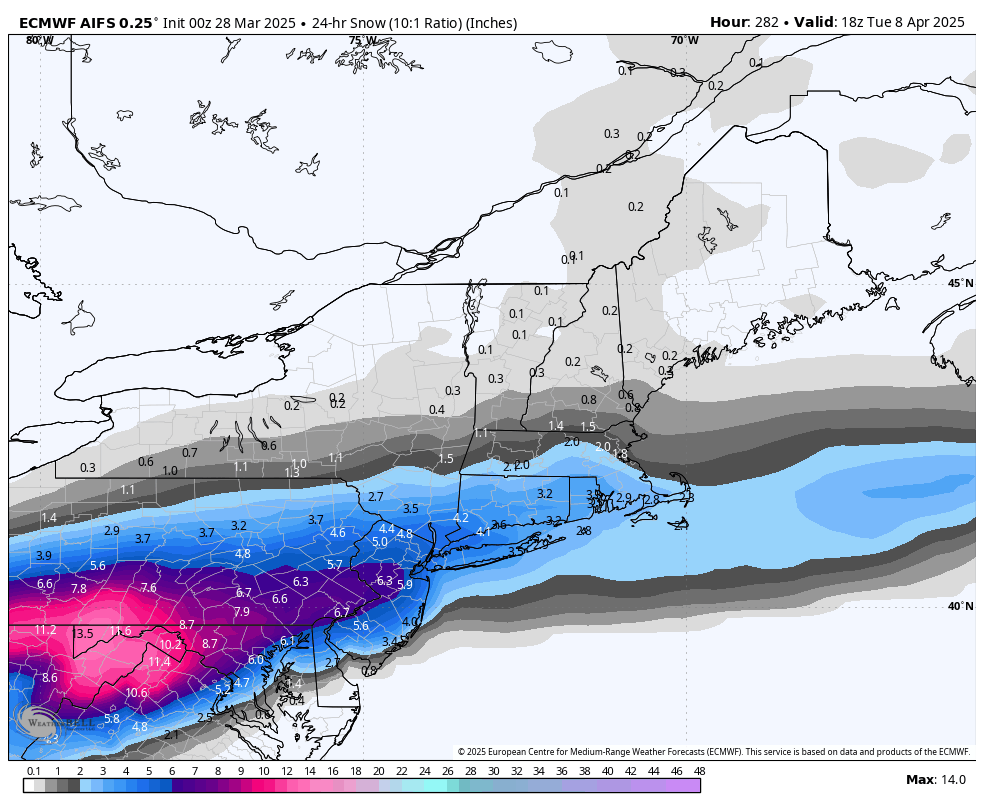
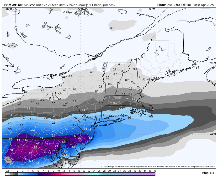
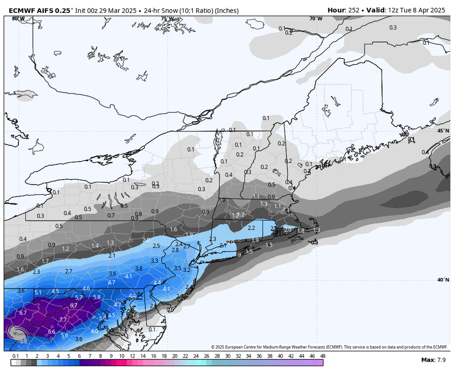
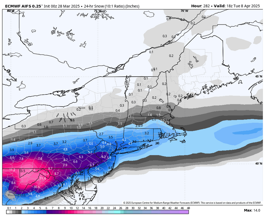
12z AI Euro still has the snow chance for the 8th.
-

-
The last 2 runs of the Euro AI have brought back the late season snow look for us around April 8th.
-
Lol, what happened to your 82 call?
-
I’m still tracking late season snow chances.
-
Thanks, something seemed off with how cold the rest of our region was this Winter.
-
The latest Euro AI run likes this idea, right on the Anniversary of April 82.
-
35 in Marysville now.
-
I’ve officially had enough of the wind this year already. This week was my breaking point. It’s actually remarkable when there is Not any wind at any given time, Lol!
-
Maybe we get another April of 82 event next month to up the seasonal snow totals?
-
Furthermore, MU’s rough average Met Winter temperature for the 3 monthly departures that you listed above would be an average of +43. His prediction of +2 for the season was a bit off if we’re being technical (which I know that you appreciate…lol).
-
They made a good call on the snow, but we just missed out on a few events that could have padded the stats. There was plenty of cold air around this year, but the lack of moisture continued to be an issue. MDT finished -2.2 in average temps for Met Winter. The coldest Met Winter in 10 years. Lol, MU must be located on a heat island similar to where you & @canderson live. How the heck did MU finish above normal in December & February?