Blizzard of 93
-
Posts
13,024 -
Joined
-
Last visited
Content Type
Profiles
Blogs
Forums
American Weather
Media Demo
Store
Gallery
Everything posted by Blizzard of 93
-
Low of 26 in Marysville this am.
-
Mrs. Blizz reported that there were flurries today in Colonial Park. My kids also said that there were flurries at school today as well.
-
I miss him as well. Hopefully he returns soon.
-
Just wait until our early Spring snow…
-
18z GFS had this early April chance this run.

-
That wind was brutal today indeed.
-
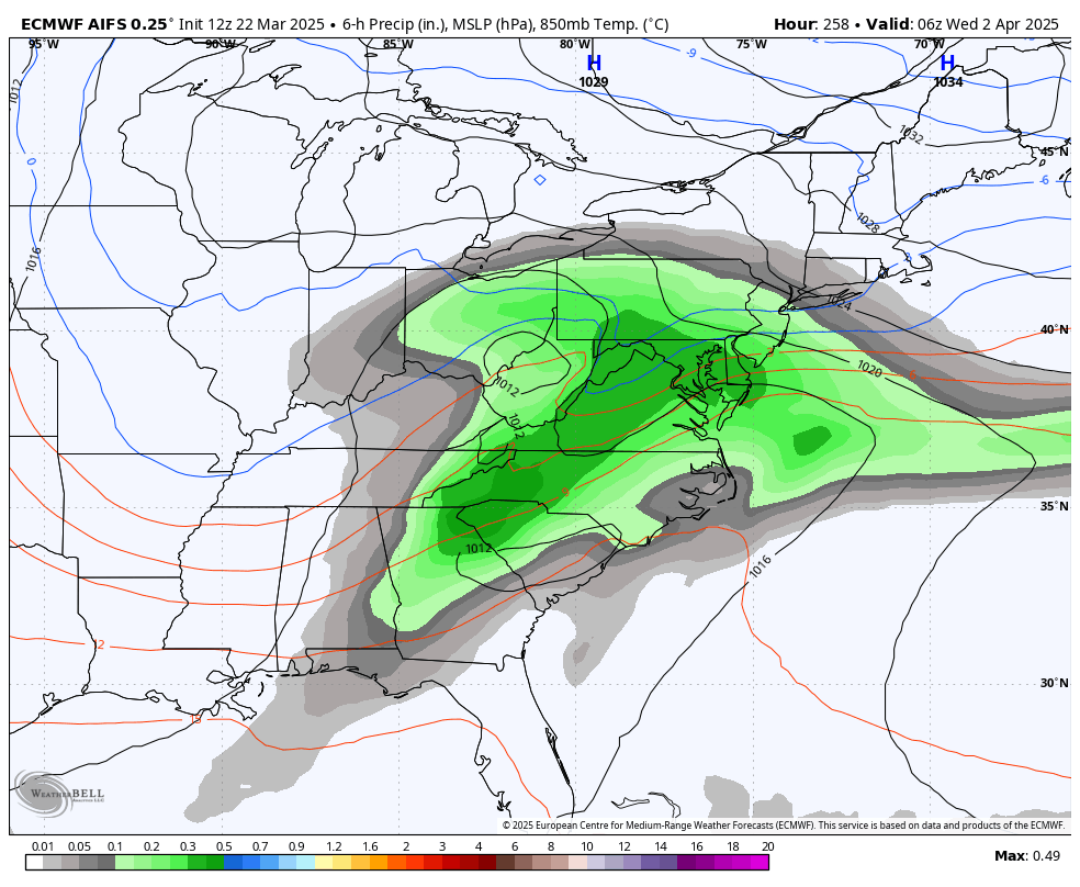
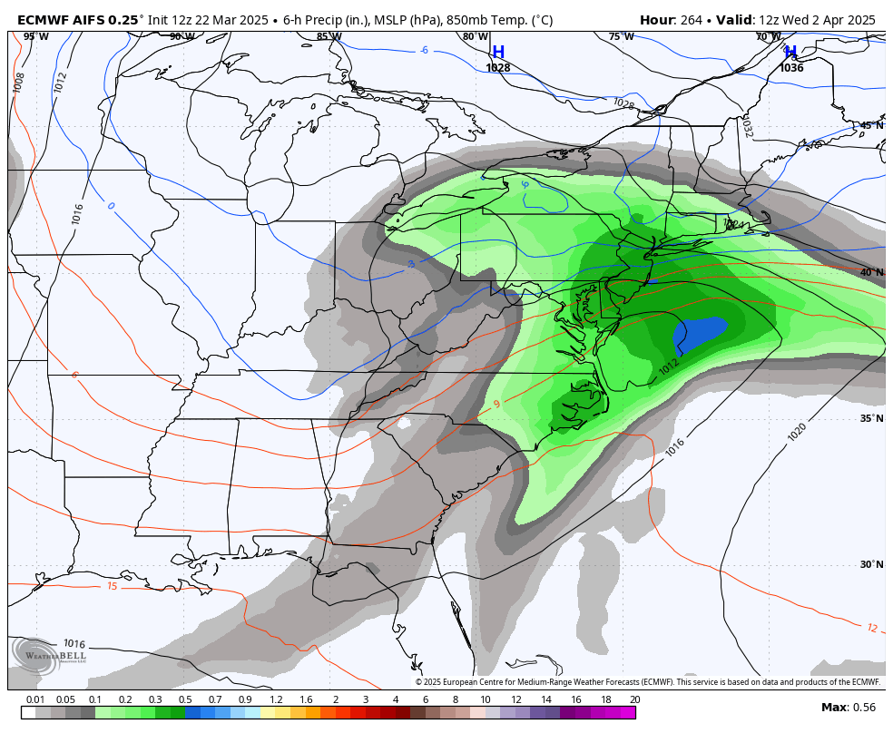
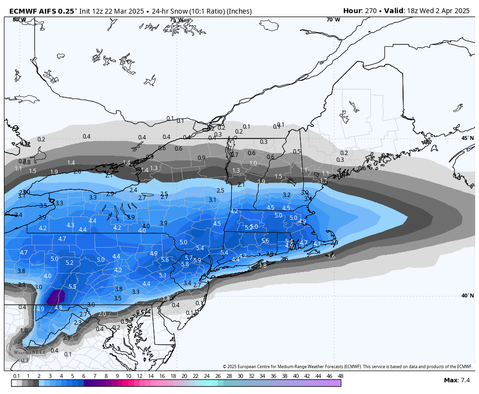
12z Euro AI has some early April snow for us & and he Northeast this run.


-
-
12z Canadian & Euro both like the idea of a little CTP snow on Wednesday am.
-
It looks like a line of light showers are approaching the western half of the LSV now.
-
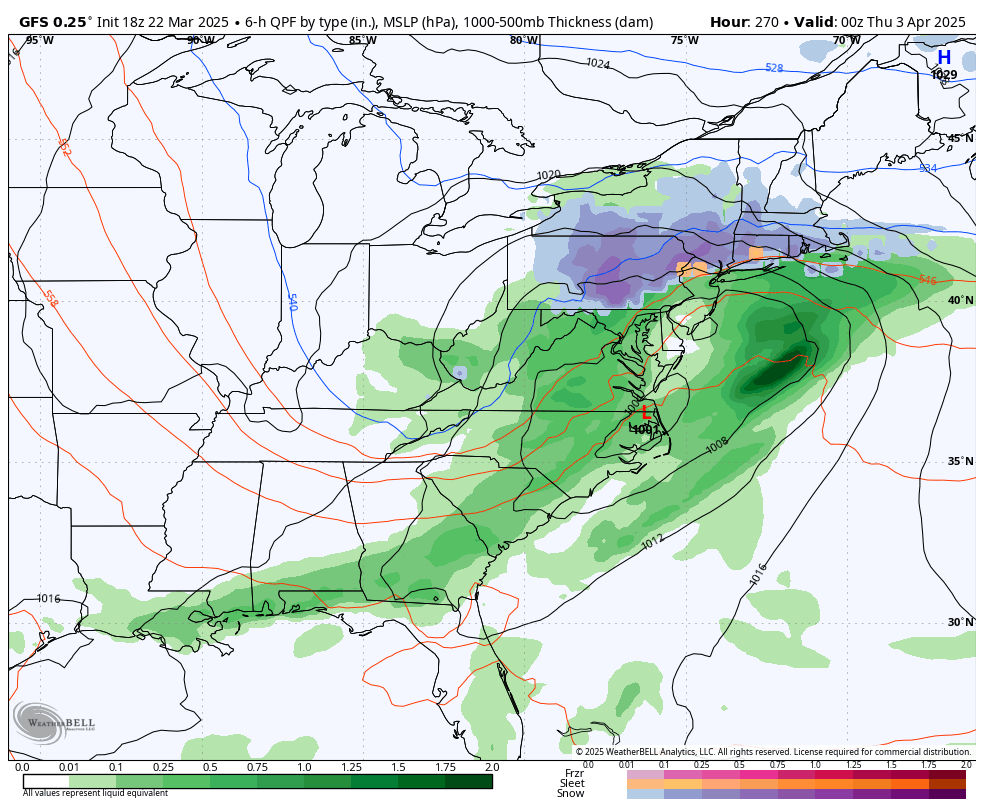
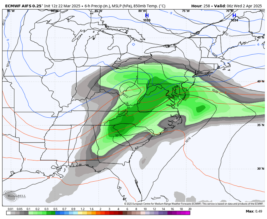
0z GFS had this April Fool’s special for us, Lol.
-
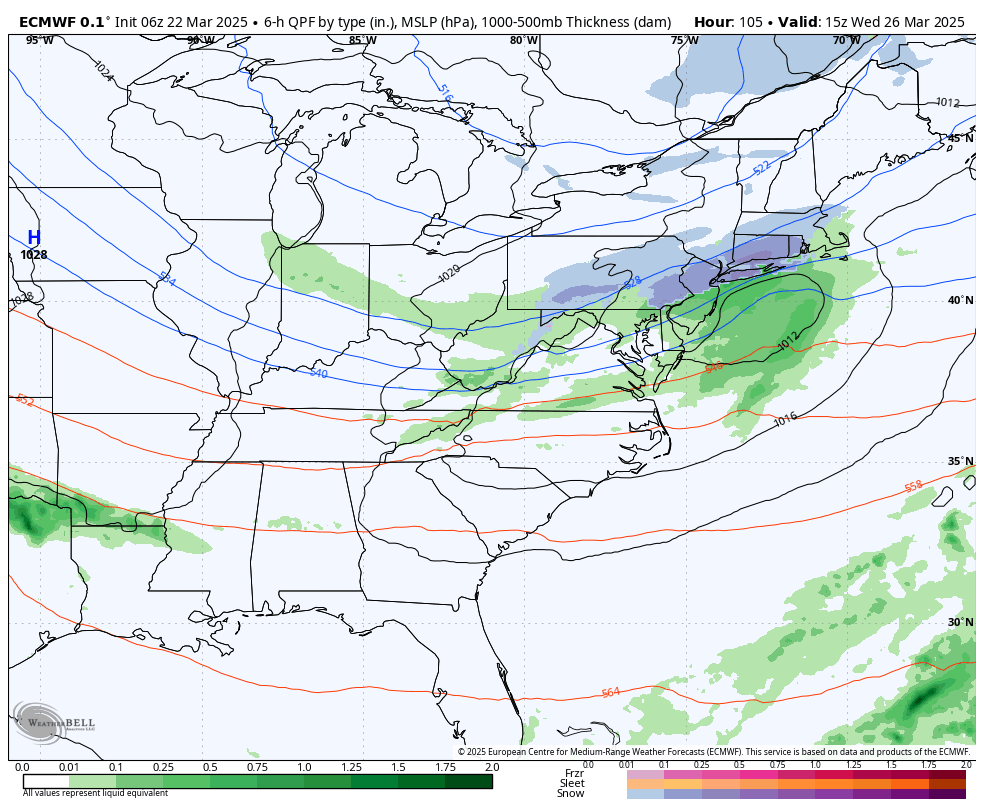
The last few Euro Op runs show a little s ow for many of us this Wednesday am
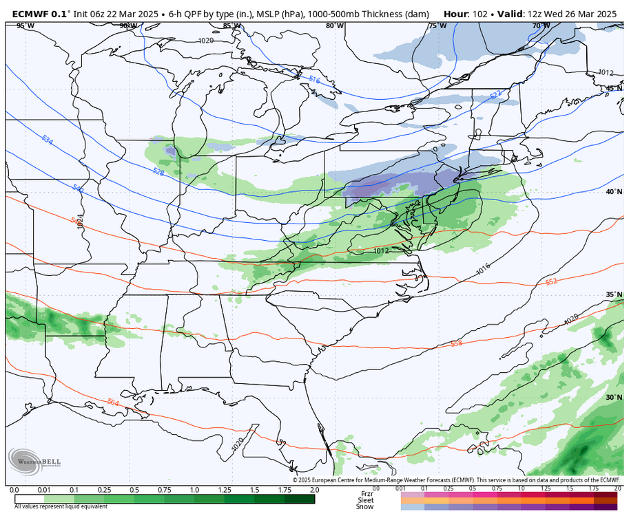

-
6z GFS brought back an early April snow chance this run. Enjoy (or not, lol) for 6 hours…
-
Only .19 of rain from the event yesterday in Marysville.
-
Sadly & shockingly, it’s gone again at 18z. My old handbook of course says it’s an off hour run, so we toss it, lol!
-
6z GFS also has a parade of Winter storm chances this run to close out our season.
-
0z GFS
-
Lol, this GFS run basically has us scoring 3 touchdowns after the 2 minute Warning to save our snow totals for the season. I’d be thrilled to see one more solid Advisory snow event.
-
Agreed, but might as well track to the end & maybe we get lucky before time truly runs out in a couple of weeks.
-
The 12z Euro also showed a major storm at the end of the run to close out March.
-
0z Euro & Canadian say we are not done yet with Winter weather chances for early next week.
-
1.17 of rain in Marysville for the event.
-
Same here in Marysville now.
-
Would you say “it’s training time”? Lol
-
Sky is brightening in Marysville as well.