Blizzard of 93
-
Posts
13,024 -
Joined
-
Last visited
Content Type
Profiles
Blogs
Forums
American Weather
Media Demo
Store
Gallery
Everything posted by Blizzard of 93
-
Central PA Winter 25/26 Discussion and Obs
Blizzard of 93 replied to MAG5035's topic in Upstate New York/Pennsylvania
6z GFS has some light snow & mix on Tuesday. -
Central PA Winter 25/26 Discussion and Obs
Blizzard of 93 replied to MAG5035's topic in Upstate New York/Pennsylvania
Longer term, the GFS & Euro both are showing the potential of a more significant coastal type of storm towards New Year’s in response to the -NAO blocking pattern that looks to become established the last week of tye month. -
Central PA Winter 25/26 Discussion and Obs
Blizzard of 93 replied to MAG5035's topic in Upstate New York/Pennsylvania
The overnight models are still trying to resolve the potential of a weak wave around Christmas that could deliver a mix for many of us.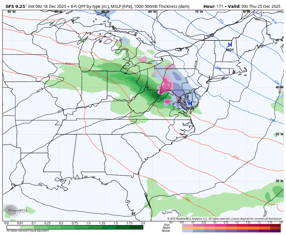
-
Central PA Winter 25/26 Discussion and Obs
Blizzard of 93 replied to MAG5035's topic in Upstate New York/Pennsylvania
It is truly remarkable that MDT is running 9 degrees below normal temperature for the month through 12/16. What a cold stretch, along with above normal snow for the season to date at 4.7 inches. Great start to the season & hopefully we are on our way to a good Winter that is overdue for many of us. -
Central PA Winter 25/26 Discussion and Obs
Blizzard of 93 replied to MAG5035's topic in Upstate New York/Pennsylvania
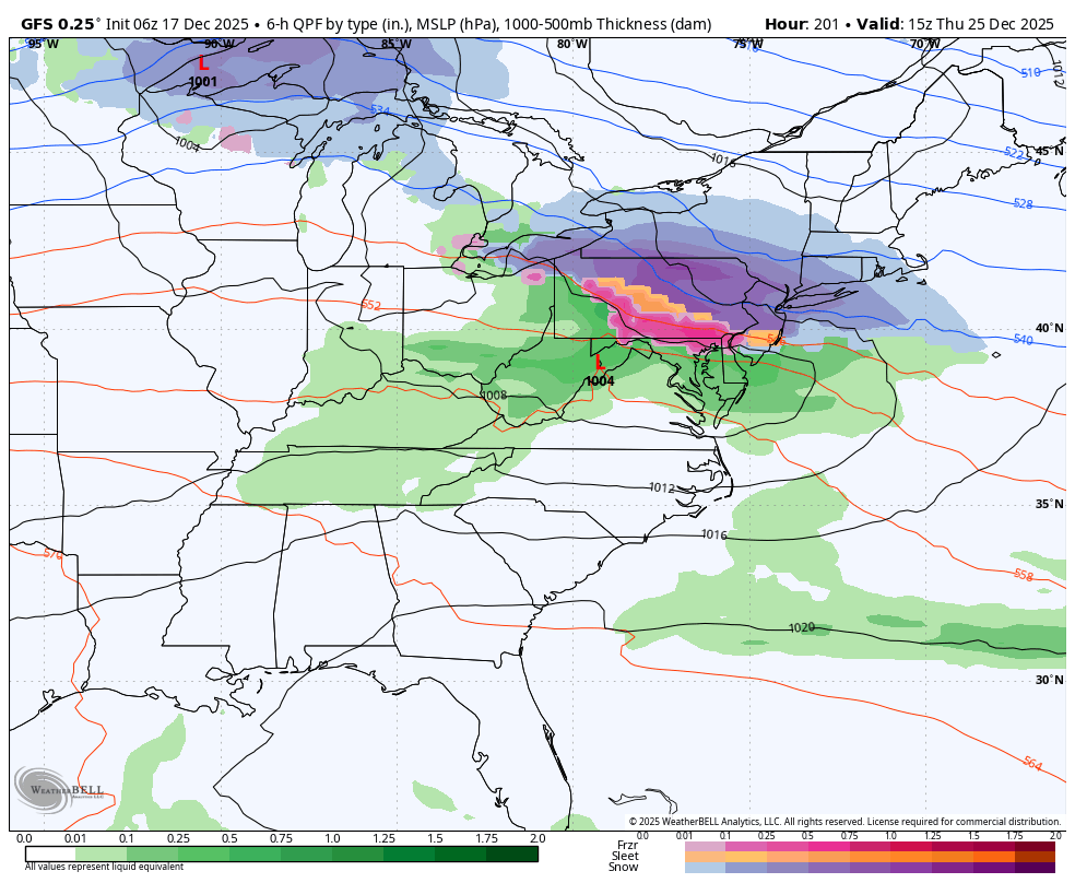
The Euro has a similar look but is displaced a little further north & east with mostly rain for CTP around Christmas. The GFS has been bouncing around today. The general idea of a wave tracking near us is there sometime around Christmas Day, but the details need resolved as the week goes on. Hopefully we end up on the right side of the boundary to get a couple of inches of snow to a mix if we get the right track & the cold in the northeast can hold in enough east of the mountains. -
Central PA Winter 25/26 Discussion and Obs
Blizzard of 93 replied to MAG5035's topic in Upstate New York/Pennsylvania
The Canadian looks a lot like the 6z GFS from earlier today with a chance of a little snow to icy mix for many of us. -
Central PA Winter 25/26 Discussion and Obs
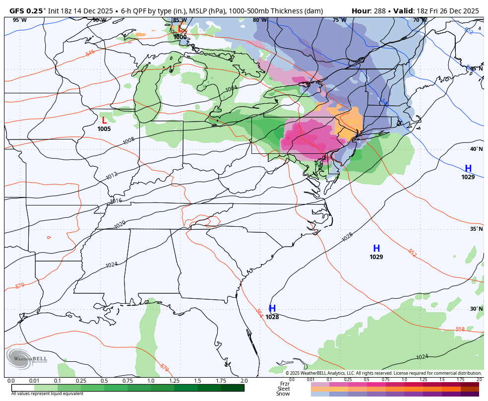
Blizzard of 93 replied to MAG5035's topic in Upstate New York/Pennsylvania
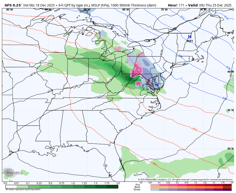
0z & 6z GFS both showed potential for Christmas wintry weather with a possible icy mix & snow for most of CTP. The Canadian last night had a mix as well. The Euro was not on board. Here is the 6z GFS for Christmas.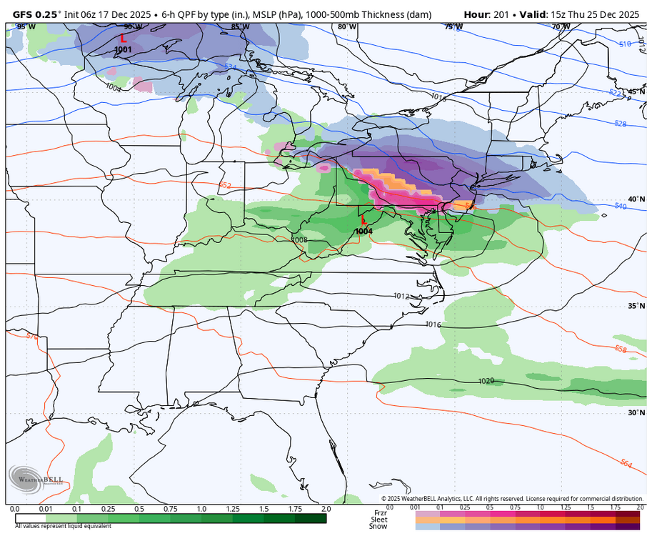
-
Central PA Winter 25/26 Discussion and Obs
Blizzard of 93 replied to MAG5035's topic in Upstate New York/Pennsylvania
18z GFS is still trying to give us the chance of some light snow or mix with 2 wave potentials toward Christmas. -
Central PA Winter 25/26 Discussion and Obs
Blizzard of 93 replied to MAG5035's topic in Upstate New York/Pennsylvania
That’s great to hear! Many of us on here were thinking of you & rooting for your recovery! I’m looking forward to tracking our next snow chance on here with you! -
Central PA Winter 25/26 Discussion and Obs
Blizzard of 93 replied to MAG5035's topic in Upstate New York/Pennsylvania
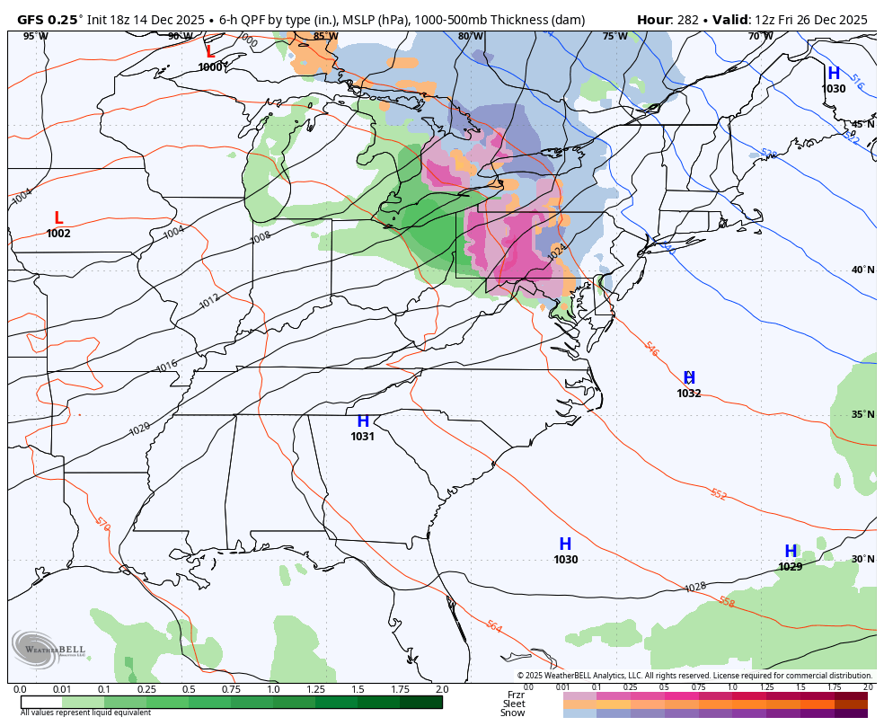
It’s going to be tough to get wintry precip before Christmas with the advertised pattern. Temps should be relatively seasonable after our few day warm up later this week. The period between just after Christmas & before New Year’s showed some potential for chances on the 0z GFS. It looks potentially active, so hopefully we are on the right side of the boundary. -
Central PA Winter 25/26 Discussion and Obs
Blizzard of 93 replied to MAG5035's topic in Upstate New York/Pennsylvania
Great to hear from you! How are you doing? -
Central PA Winter 25/26 Discussion and Obs
Blizzard of 93 replied to MAG5035's topic in Upstate New York/Pennsylvania
Low in Marysville this morning was 7, which is coldest of the season here. -
Central PA Winter 25/26 Discussion and Obs
Blizzard of 93 replied to MAG5035's topic in Upstate New York/Pennsylvania
MDT is down to 9 this morning. -
Central PA Winter 25/26 Discussion and Obs
Blizzard of 93 replied to MAG5035's topic in Upstate New York/Pennsylvania
The Euro is the only model that I could find that had it at 12z just as @mitchnick mentioned a little earlier. CTP had a 20% chance of a snow shower. Even a special weather statement for the LSV would have been nice especially with it hitting at rush hour. I-81 was crawling & road conditions were not great. My normal 15 minute commute was more than doubled.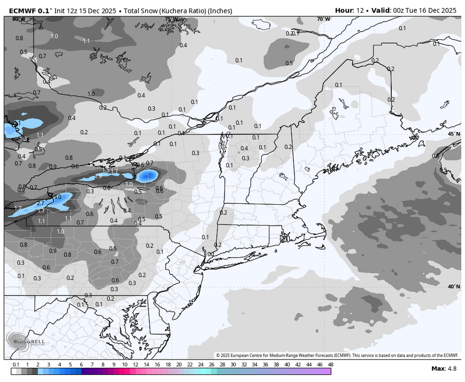
-
Central PA Winter 25/26 Discussion and Obs
Blizzard of 93 replied to MAG5035's topic in Upstate New York/Pennsylvania
I just measured .4” in Marysville! Beatuful surprise snow to freshen up the snow pack. -
Central PA Winter 25/26 Discussion and Obs
Blizzard of 93 replied to MAG5035's topic in Upstate New York/Pennsylvania
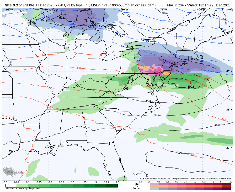
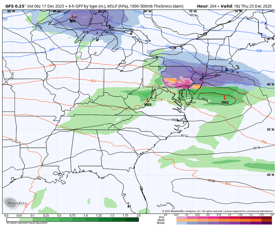
Back to tracking… The 18z GFS this run shows the chance of a Christmas Day icy mix.

-
Central PA Winter 25/26 Discussion and Obs
Blizzard of 93 replied to MAG5035's topic in Upstate New York/Pennsylvania
I just looked back at the posts & didn’t see anything more than usual snow event banter & Observations. -
Central PA Winter 25/26 Discussion and Obs
Blizzard of 93 replied to MAG5035's topic in Upstate New York/Pennsylvania
See my post above. I have no idea where he got that idea. It was clearly a couple a long time posters joking around. -
Central PA Winter 25/26 Discussion and Obs
Blizzard of 93 replied to MAG5035's topic in Upstate New York/Pennsylvania
If you are referring to me, I was joking around with @canderson last night when I asked if he had some beers. He has posted many times over the years about having some weekend or travel drinks. He had bad luck with snow in the city last night & I was joking around with him. I don’t recall any attempt at him coming after my or anyone else’s character. We go way back on here, so I was just having a little fun, but I believed his observations. Now that I know he’s done with drinking at this time, I won’t joke about it anymore. Let’s keep the peace in here please. We have a good group. -
Central PA Winter 25/26 Discussion and Obs
Blizzard of 93 replied to MAG5035's topic in Upstate New York/Pennsylvania
I ended up at 1.8” of snow. Radar looked great here with what appeared to be heavier returns at times overnight, so I thought I was on my way to over 3, but the rates & flake size did not match up. It’s a beautiful Winter morning with all surfaces snow covered. Congrats to those that cashed in on this event! -
Central PA Winter 25/26 Discussion and Obs
Blizzard of 93 replied to MAG5035's topic in Upstate New York/Pennsylvania
Lol, you can’t make this stuff up. Dauphin county was Advised at 3:35 am. I’m sure that really helped to alert the public in the Capital region… Winter Weather Advisory URGENT - WINTER WEATHER MESSAGE National Weather Service State College PA 335 AM EST Sun Dec 14 2025 PAZ057-141300- /O.EXA.KCTP.WW.Y.0025.000000T0000Z-251214T1300Z/ Dauphin- Including the cities of Harrisburg and Hershey 335 AM EST Sun Dec 14 2025 ...WINTER WEATHER ADVISORY IN EFFECT UNTIL 8 AM EST THIS MORNING... * WHAT...Snow. Total snow accumulations 2 to 4 inches. * WHERE...Dauphin County. * WHEN...Until 8 AM EST this morning. -
Central PA Winter 25/26 Discussion and Obs
Blizzard of 93 replied to MAG5035's topic in Upstate New York/Pennsylvania
Currently having the best rates & flake size of the event. Eyeballing around 1 inch as of 12:45 am in Marysville. -
Central PA Winter 25/26 Discussion and Obs
Blizzard of 93 replied to MAG5035's topic in Upstate New York/Pennsylvania
How many beers tonight? -
Central PA Winter 25/26 Discussion and Obs
Blizzard of 93 replied to MAG5035's topic in Upstate New York/Pennsylvania
One last look at the RGEM & NBM at 0z. -
Central PA Winter 25/26 Discussion and Obs
Blizzard of 93 replied to MAG5035's topic in Upstate New York/Pennsylvania
Roads caving in Marysville as well. Temp is 32