palmettoweather
-
Posts
124 -
Joined
-
Last visited
Content Type
Profiles
Blogs
Forums
American Weather
Media Demo
Store
Gallery
Everything posted by palmettoweather
-

January 25/26 Jimbo Back Surgery Storm
palmettoweather replied to Jimbo!'s topic in Southeastern States
Agreed. Watching the early returns from 0z suite, there isn’t the support for the massive ice totals being forecasted, from both QPF and temperature perspective. It’s early, but out to 45, GFS seems to be moving towards 0z NAM. -
1/10-11 super awesome winter SE OBS thread
palmettoweather replied to strongwxnc's topic in Southeastern States
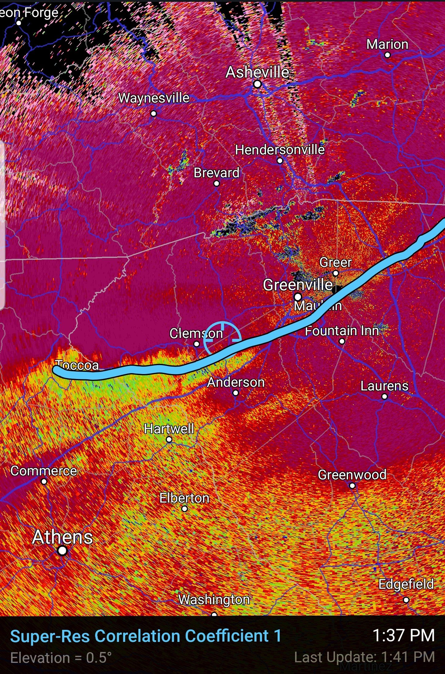
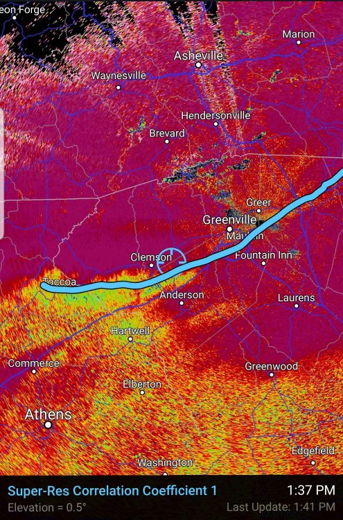
Changed over to sleet here, correlation coefficient map on RadarScope is correct per usual. That line is racing north earlier than I thought here in Pendleton. . -
1/10-11 super awesome winter SE OBS thread
palmettoweather replied to strongwxnc's topic in Southeastern States
29 deg in Pendleton, SC, light snow has begun. . -
Glad to see so many people get to enjoy snow, including the RDU, E NC and the Midlands/Pee Dee of SC. Hope we all have one more!
-
January 20-22 “bring the mojo” winter storm threat
palmettoweather replied to lilj4425's topic in Southeastern States
https://www.weather.gov/ilm/ChristmasSnow1989 It's rare, but growing up in the Pee Dee, it is definitely not impossible. -
https://nwschat.weather.gov/p.php?pid=202102071609-KGSP-NOUS42-PNSGSP
-
Good flakes here outside of Pendleton (extreme Northern Anderson county near Central) , looks to be the end of the show with the warm nose creeping this way and precip ending. Never will complain about a surprise 2" snowfall in the South though. I hope a lot more people get to see some snow out of this, pulling for you.
-

-
Mostly snow/sleet in Pendleton. Ground turning white. Have to give Bull and Burrel credit, I was pretty cynical on HRRR. Already below temp I was supposed to be tonight. 32.9/32.1
-
35.1/33.8, flakes mixing in here.
-
Well temp is down to 40.5/35.4 here outside of Pendleton. Definitely crashed 6 degrees in the last 30 minutes due to evaporative cooling, but rate driven event will have to take it from here. Still hope HRRR knows something.
-
I'll never doubt the NAM again. HRRR is fool's gold, hope I'm wrong. Hard to doubt what it is seeing in regards to thermals.
-
34/27 in Pendleton, clouds have moved in. Hoping burrel reels us one in indeed!
-
If it has a warm bubble all the way into NE GA and the Western Upstate, you can count on it...
-
As one of the mets posted on here the other day, the 12 km NAM is usually pretty goofy with its surface depiction. It is bad about displaying widespread QPF as one consistent mass. The 3km is higher resolution and it is usually has a reasonably accurate depiction of reflectivity in that there will be bands, not one continuous mass of precipitation in this system.
-
2020/2021 Fall/Winter Mountain thread
palmettoweather replied to Met1985's topic in Southeastern States
Man that's awesome, happy for y'all in the mountains getting some snow! Hopefully that bodes well for the rest of the Southeast. -
Happy to see you got some snow man, that's awesome!
-
Big flakes here as well now, but still 37. Not gonna stick like 2/8.
-
Finally some flakes mixing in with heavier returns NE of Pendleton, 38.
-
I can't find you a page that quickly, but you are looking for Correlation Coefficient. It's usually dead on, however, I'm North of it in Pendleton/Central and I'm rain/sleet. Too warm at the surface I guess, and tricked CC. Edit: I'm using app on Android, RadarScope, but I believe it is a one time pay product.
-
48/32 E of Pendleton, SC
-
Just as an observation from a few previous winters, the 12K NAM's surface output often seems a bit odd and tends to overdo the QPF in quantity and spread it out over a massive region. I've hunted verification scores at 500 and surface between the different resolutions of the NAM, but I have not found any. 3KM NAM should give us more clarity once it is in range, I'm wary of this 12KM output.
-
Something under 240 for a lot of the board on the GFS. There have been several runs hinting at something in this timeframe. Interested to see what ECMWF thinks.
-
Southeast Sanitarium - A Place to Vent
palmettoweather replied to Jonathan's topic in Southeastern States
So true, I feel the pain in Pendleton. I'm not sure if location in regards to the mountains and blocking a cold air source is more the cause or the manmade lakes warming the Upper Savannah River Valley a crucial degree or two. Would be interested to see if one could decouple other variables and see if the manmade lakes have caused a drop in snowfall since their creation. May not have anything to do with it, just a thought. Sent from my SM-G950U using Tapatalk -
At 96, SW move now underway, but much closer to shore and 20-30 mb weaker. Touching coast at Little River/Calabash at 96. Stalling closer to shore weakened the storm significantly this run, but probably means SE NC paid the price in storm surge if this verified.