

Spartman
-
Posts
1,219 -
Joined
-
Last visited
Content Type
Profiles
Blogs
Forums
American Weather
Media Demo
Store
Gallery
Everything posted by Spartman
-
Winter 2023/24 Medium/Long Range Discussion
Spartman replied to Chicago Storm's topic in Lakes/Ohio Valley
-
Can't be as worse as December 2023, right?
-
The lowest temp of this season so far is 17F, which occurred last month. The lowest temp of this month is only 24F set on the 14th and 15th.
-
Winter 2023/24 Medium/Long Range Discussion
Spartman replied to Chicago Storm's topic in Lakes/Ohio Valley
-
Winter 2023/24 Medium/Long Range Discussion
Spartman replied to Chicago Storm's topic in Lakes/Ohio Valley
From today's AFD from NWS IND: .Beyond day 7... Some hints in ensemble guidance of a trend towards a more active pattern. Longer range guidance has been hinting at a sudden stratospheric warming event occurring in the Arctic come early to mid January. This correlates nicely with the Arctic Oscillation going negative as shown by many ensembles. Will be watching this closely as this could lead to a period of winter-like weather and colder temperatures come mid January into February. -
-
Winter 2023/24 Medium/Long Range Discussion
Spartman replied to Chicago Storm's topic in Lakes/Ohio Valley
-
Winter 2023/24 Medium/Long Range Discussion
Spartman replied to Chicago Storm's topic in Lakes/Ohio Valley
Wonder if the cutoff low just screwed up the opportunity for the "pattern change" that was supposed to occur next week. Only have 0.8" of snow so far for '23-24, all during this December. Wonder if '23-24 will be one of those seasons where it ends up with single-digit snowfall totals by spring. -
Winter 2023/24 Medium/Long Range Discussion
Spartman replied to Chicago Storm's topic in Lakes/Ohio Valley
-
An awful stretch coming up over the next week
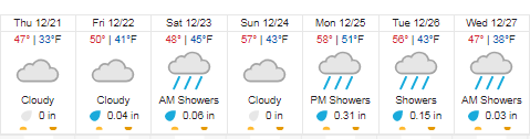
-
Winter 2023/24 Medium/Long Range Discussion
Spartman replied to Chicago Storm's topic in Lakes/Ohio Valley
-
Got 0.74" from the storm today. Suicide weather to finish off the weekend tomorrow.
-
Winter 2023/24 Medium/Long Range Discussion
Spartman replied to Chicago Storm's topic in Lakes/Ohio Valley
-
Winter 2023/24 Medium/Long Range Discussion
Spartman replied to Chicago Storm's topic in Lakes/Ohio Valley
-
Shades of December '14
-
Winter 2023/24 Medium/Long Range Discussion
Spartman replied to Chicago Storm's topic in Lakes/Ohio Valley
-
Only a trace of snow so far of the 23-24 season (as of 11/28). Only 0.27" of rain to kick off the month. A day of suicide weather ahead tomorrow.
-
December 2014 says hello
-
A long overcast stretch to start the month
-
From the Tennessee Valley forum:
-
Looks like December kicks off the way December 2014 started. December 2014 was not only the least snowiest December on record, but one of the cloudiest ones for many.
-
Got 0.31" of rain, 2nd highest daily rainfall for this month. Up to 1.41" for the month now.
-
Next month is shot
-
It's going to be one of those weeks that the sun will be in much shorter supply. The upcoming weekend doesn't look great, either. The only day we'll have any luck getting sun over the next several days will be Thanksgiving. Overall, a pretty dreary Thanksgiving week ahead, with a few days of rain and some days of suicide weather.
-


