

Spartman
-
Posts
1,219 -
Joined
-
Last visited
Content Type
Profiles
Blogs
Forums
American Weather
Media Demo
Store
Gallery
Everything posted by Spartman
-
NWS IND: .CLIMATE... Issued at 231 PM EDT Fri Mar 29 2024 The eclipse is now 10 days away, and we`re starting to pick up on a few long range signals. At 10 days out, there is still a lot of ambiguity and uncertainty in the forecast, but given a few consistent signals, a few assertions can be made. Let`s start off with the 2-4 day outlook and how it will impact April 8th. As mentioned previously, a deep trough is developing over the Eastern Pacific, and will pass through the Midwest early next week. The associated low pressure system is expected to reach the Mid-Atlantic region late next week, and should subsequently rapidly deepen as it interacts with increased coastal moisture. A upper level system over Canada is also expected to merge, further amplifying the East Coast trough/low. Given a strongly negative NAO and PNA, synoptic scale influence should dictate the pattern, and the rapidly deepening low pressure system should "bottle-up" the upstream waves. This can be visualized by a relatively tight Mountain-West ridge in the GEFS 500mb height spaghetti plot around 140-200 hours from initialization. Many ensembles are subsequently picking up on a Rex block type pattern over the CONUS next weekend as we approach eclipse day. As stated, there is still some uncertainty on where this blocking pattern will be positioned, but typically, long range models are too progressive with Rex blocks, leading to the current belief that downstream ridging will be present over the Ohio Valley by eclipse day. It`s difficult to downscale this synoptic pattern into a specific cloud forecast for April 8th, but we will continue to monitor pattern signals/consistency and update as needed.
-
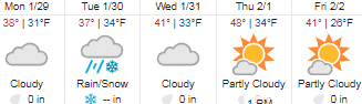
Only reached 48, temps significantly underperformed with the afternoon cloud cover and "warm" air advection. NWS ILN seems to treating it like it was one of the most siginificant underperformances ever. Daytime highs today underperformed thanks to northerly flow and decent cloud cover. Therefore, temperatures are in the upper 30s to low 40s across the region at the time of this writing. Overnight lows fall to the mid/low 30s across the region, but by the time subfreezing thermal profiles arrive, precipitation will have tapered off for the most part. Therefore, not anticipating anything other than a cold rain and possibly a brief rain/snow mix for some isolated areas.
-
Ji bringing up March 1958 in the Mid Atlantic forum
-
Suicide weather today. It's looking wet Friday into Saturday. Either way, we're in for quite a prolonged overcast stretch through the weekend. Dreading this month will be dealing with a hangover from the very cloudy January many of us had earlier this year.
-
A day of suicide weather ahead to kick off the first weekend of March, though NWS ILN seems to pushing for it to be the case the entire weekend.
-
Let’s talk winter!! Ohio and surrounding states!!
Spartman replied to Steve's topic in Lakes/Ohio Valley
Got 4.6" of the snow today. It's the highest daily snowfall we're going to see this Winter. Now at 13" for the season. -
Pretty much through the end of the month according to 00z GFS. So going for one of the least snowiest Februaries the second year in a row is a lock. No surprise how February is turning out following a very cloudy January.
-
Let’s talk winter!! Ohio and surrounding states!!
Spartman replied to Steve's topic in Lakes/Ohio Valley
GFS finally started to cave as of the 18z run. -
Winter 2023/24 Medium/Long Range Discussion
Spartman replied to Chicago Storm's topic in Lakes/Ohio Valley
-
Let’s talk winter!! Ohio and surrounding states!!
Spartman replied to Steve's topic in Lakes/Ohio Valley
00z GFS is more bullish. Unlike the 00z Euro and 06z NAM that are more South and a bit conservative -
Winter 2023/24 Medium/Long Range Discussion
Spartman replied to Chicago Storm's topic in Lakes/Ohio Valley
Another nail in the coffin -
10:1 ratio:
-
Winter 2023/24 Medium/Long Range Discussion
Spartman replied to Chicago Storm's topic in Lakes/Ohio Valley
Just had an SOI crash -
-
000 CXUS51 KILN 010647 CCA CF6DAY PRELIMINARY LOCAL CLIMATOLOGICAL DATA (WS FORM: F-6)...CORRECTED... STATION: DAYTON OH MONTH: JANUARY YEAR: 2024 LATITUDE: 39 54 N LONGITUDE: 84 12 W TEMPERATURE IN F: :PCPN: SNOW: WIND :SUNSHINE: SKY :PK WND ================================================================================ 1 2 3 4 5 6A 6B 7 8 9 10 11 12 13 14 15 16 17 18 12Z AVG MX 2MIN DY MAX MIN AVG DEP HDD CDD WTR SNW DPTH SPD SPD DIR MIN PSBL S-S WX SPD DR ================================================================================ 1 37 31 34 3 31 0 0.01 0.2 T 8.5 15 270 M M 10 1 17 340 2 35 27 31 0 34 0 0.00 0.0 0 11.6 20 250 M M 9 23 250 3 41 27 34 4 31 0 T 0.0 0 9.5 17 260 M M 6 18 21 260 4 35 21 28 -2 37 0 T T T 7.4 16 330 M M 6 1 21 330 5 37 19 28 -2 37 0 0.00 0.0 0 5.5 12 110 M M 7 15 110 6 37 31 34 4 31 0 0.10 0.5 0 6.0 10 250 M M 10 128 13 250 7 35 33 34 4 31 0 0.05 0.6 1 11.0 23 270 M M 10 18 30 290 8 39 33 36 6 29 0 T T 0 10.1 23 140 M M 10 27 150 9 50 35 43 13 22 0 1.63 0.1 0 17.2 33 240 M M 10 14 43 240 10 38 32 35 5 30 0 T T 0 17.8 30 240 M M 10 1 38 280 11 45 28 37 8 28 0 0.00 0.0 0 12.8 24 260 M M 7 32 240 12 48 30 39 10 26 0 0.79 0.1 0 17.8 37 220 M M 9 14 42 220 13 38 20 29 0 36 0 0.07 1.2 T 23.7 36 240 M M 10 1 46 230 14 24 2 13 -16 52 0 0.01 0.3 1 14.9 30 280 M M 8 18 38 290 15 12 0 6 -23 59 0 0.00 0.0 T 6.3 15 270 M M 8 18 260 16 13 6 10 -19 55 0 0.05 0.9 1 12.1 21 270 M M 5 18 24 270 17 27 3 15 -14 50 0 0.00 0.0 T 15.5 23 230 M M 3 31 230 18 27 22 25 -4 40 0 T 0.3 T 8.2 15 200 M M 10 18 20 190 19 25 11 18 -11 47 0 0.12 2.3 1 12.7 23 290 M M 10 18 28 290 20 17 4 11 -18 54 0 T 0.1 1 12.6 20 270 M M 8 18 24 290 21 25 11 18 -11 47 0 T T 1 5.8 13 290 M M 6 18 180 22 41 14 28 -1 37 0 T 0.0 1 9.6 21 210 M M 8 1 25 220 23 44 34 39 10 26 0 0.35 0.0 T 7.0 15 170 M M 10 12 19 170 24 54 43 49 20 16 0 0.54 0.0 0 8.8 16 190 M M 10 12 25 170 25 57 50 54 25 11 0 0.64 0.0 0 4.7 15 100 M M 10 12 17 100 26 58 42 50 21 15 0 0.01 0.0 0 12.4 30 240 M M 10 1 37 240 27 43 39 41 12 24 0 0.67 0.0 0 8.2 24 50 M M 10 1 31 30 28 42 37 40 11 25 0 0.23 0.0 0 17.0 25 360 M M 10 1 33 360 29 37 33 35 6 30 0 T 0.1 0 9.9 17 320 M M 10 1 24 340 30 35 32 34 4 31 0 0.16 0.8 0 9.5 18 180 M M 10 14 24 180 31 41 35 38 8 27 0 T 0.0 0 7.3 12 210 M M 10 1 14 270 ================================================================================ SM 1137 785 1049 0 5.43 7.5 341.4 M 270 ================================================================================ AV 36.7 25.3 11.0 FASTST M M 9 MAX(MPH) MISC ----> 37 220 46 230 ================================================================================ NOTES: # LAST OF SEVERAL OCCURRENCES COLUMN 17 PEAK WIND IN M.P.H. PRELIMINARY LOCAL CLIMATOLOGICAL DATA (WS FORM: F-6) , PAGE 2 STATION: DAYTON OH MONTH: JANUARY YEAR: 2024 LATITUDE: 39 54 N LONGITUDE: 84 12 W [TEMPERATURE DATA] [PRECIPITATION DATA] SYMBOLS USED IN COLUMN 16 AVERAGE MONTHLY: 31.0 TOTAL FOR MONTH: 5.43 1 = FOG OR MIST DPTR FM NORMAL: 1.6 DPTR FM NORMAL: 2.35 2 = FOG REDUCING VISIBILITY HIGHEST: 58 ON 26 GRTST 24HR 1.63 ON 9- 9 TO 1/4 MILE OR LESS LOWEST: 0 ON 15 3 = THUNDER SNOW, ICE PELLETS, HAIL 4 = ICE PELLETS TOTAL MONTH: 7.6 INCHES 5 = HAIL GRTST 24HR 2.3 ON 19-19 6 = FREEZING RAIN OR DRIZZLE GRTST DEPTH: 1 ON 22,21 7 = DUSTSTORM OR SANDSTORM: VSBY 1/2 MILE OR LESS 8 = SMOKE OR HAZE [NO. OF DAYS WITH] [WEATHER - DAYS WITH] 9 = BLOWING SNOW X = TORNADO MAX 32 OR BELOW: 8 0.01 INCH OR MORE: 16 MAX 90 OR ABOVE: 0 0.10 INCH OR MORE: 10 MIN 32 OR BELOW: 20 0.50 INCH OR MORE: 5 MIN 0 OR BELOW: 1 1.00 INCH OR MORE: 1 [HDD (BASE 65) ] TOTAL THIS MO. 1049 CLEAR (SCALE 0-3) 0 DPTR FM NORMAL -53 PTCLDY (SCALE 4-7) 11 TOTAL FM JUL 1 2672 CLOUDY (SCALE 8-10) 20 DPTR FM NORMAL -374 [CDD (BASE 65) ] TOTAL THIS MO. 0 DPTR FM NORMAL 0 [PRESSURE DATA] TOTAL FM JAN 1 0 HIGHEST SLP M ON M DPTR FM NORMAL 0 LOWEST SLP 28.96 ON 9 [REMARKS] #FINAL-01-24# Not one clear/mostly sunny day in January. Other than the highest snowfall of the season to date on the 19th, good riddance.
-
The overcast stretch that has been in place since early last week looks to continue into Groundhog Day for some areas just before a very nice first weekend of February comes. Here's to some groundhogs predicting an early spring.
-
According to Tom Skilling, because the sun came back in Chicago on Monday, Chicago's overcast stretch ended at 7 consecutive days that matched an exact stretch occurring just last year and in 1998. If the sun didn't return Monday, Chicago's overcast stretch would've been 8 consecutive days and counting. https://www.facebook.com/TomSkilling/posts/pfbid031tqr8jNe5QjMt8uq1549gSjkkTRUrF8tBHZ69iQAfCFxYJxegKxenAKX68s2JbMvl?__cft__[0]=AZWO58oiJkSoGVRunLpBslVBng0oTlhJvKJ8OumpAFruN4ouoUc0wXtDDVjgXNnTMPaOhuyri-tkLAJ5lEZdO6Xu-_q49LiJwMdgvbu4a8dGhXH-ugW8CCL80ZeliPHK8cvMqqa09lEMeiKQX1wLMfszq859KPjkLdLmDDgvPckayAUszEU__TeXIUM0Gweyo_Y&__tn__=%2CO%2CP-R
-
Now we wait for Jonathan Erdman to release an article about overcast stretches and records on weather.com soon, like in 2017 and 2020. Especially when his two articles say at the end: "We've also passed what is, on average, the coldest time of the year in most of the country. There may be more cold snaps through February and into March, but the climatological dice for these cold outbreaks more often favors January, rather than February. Your possible sunshine is increasing minute-by-minute through the summer solstice, as the sun's energy gradually becomes more direct. And in just a couple of weeks, pitchers and catchers report for spring training. Now there's something to sweep away January's gloom."
-
The first half of the month has AN temperatures and not in the way of any snow.
-
Winter 2023/24 Medium/Long Range Discussion
Spartman replied to Chicago Storm's topic in Lakes/Ohio Valley
BAMWX now having doubts about the middle of next month and beyond: -
Currently the 3rd cloudiest January ever in Cleveland https://fox8.com/weather/is-it-the-cloudiest-january-ever-no-but-its-close/
-
Winter 2023/24 Medium/Long Range Discussion
Spartman replied to Chicago Storm's topic in Lakes/Ohio Valley
Winters where Januaries are cloudier than Decembers usually mean a mild/snowless February like last year, 2020, 2017, or 1998. If only that would help trump the trends: -
Can't wait for the month to end, though. A couple days of suicide weather as part of the next few days. Definitely reminiscent of January 2020 because that stretch and the current one occurred around the same timeframe (the final third of January).
-
Winter 2023/24 Medium/Long Range Discussion
Spartman replied to Chicago Storm's topic in Lakes/Ohio Valley
And yet.... -
Winter 2023/24 Medium/Long Range Discussion
Spartman replied to Chicago Storm's topic in Lakes/Ohio Valley


