PDS severe thunderstorm watch issued for portions of MN, ND, and SD. >95%/80% severe wind probabilities.
The NWS Storm Prediction Center has issued a
* Severe Thunderstorm Watch for portions of
Northern and central Minnesota
Southeast North Dakota
Northern South Dakota
* Effective this Friday afternoon and Saturday morning from 535
PM until 100 AM CDT.
...THIS IS A PARTICULARLY DANGEROUS SITUATION...
* Primary threats include...
Widespread damaging winds expected with scattered significant
gusts to 90 mph likely
Scattered large hail and isolated very large hail events to 2.5
inches in diameter possible
A couple tornadoes possible
SUMMARY...An intense linear-type complex of storms is expected to
evolve into a derecho this evening and produce
widespread/significant damaging winds as it accelerates
east-southeastward across the region. Isolated large hail is also
possible, and a tornado risk cannot be ruled out, particularly near
the warm front.
...Guyer


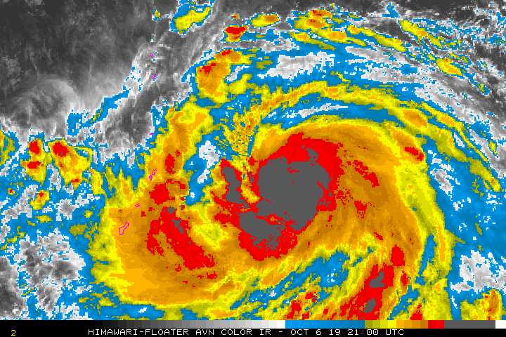
 Typhoon Hagibis approaching the Marianas. Easily one of the most impressive displays of rapid intensification I’ve personally seen. Up there with Wilma?