OhioWX
-
Posts
173 -
Joined
-
Last visited
About OhioWX

Recent Profile Visitors
2,114 profile views


-
Big flakes have begun to mix in with the heavy sleet in Mason.
-
Disgusting.
-
Severe Weather October 10th-12th 2021
OhioWX replied to Sydney Claridge's topic in Central/Western States
-
Severe Weather October 10th-12th 2021
OhioWX replied to Sydney Claridge's topic in Central/Western States
New scan came in... wow, I think that answered my question. That came out of nowhere! -
Severe Weather October 10th-12th 2021
OhioWX replied to Sydney Claridge's topic in Central/Western States
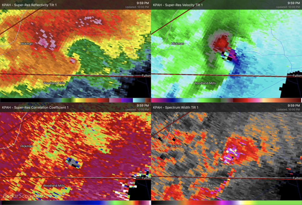
That storm near Frederick, OK has got my eye... hard to tell since it's so close to the radar but is that a debris ball? -
Severe Weather October 10th-12th 2021
OhioWX replied to Sydney Claridge's topic in Central/Western States
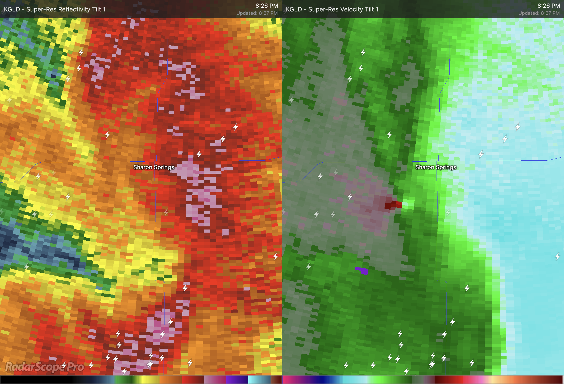
Likely a tornado near Sharon Springs, KS.
-
Severe Weather October 10th-12th 2021
OhioWX replied to Sydney Claridge's topic in Central/Western States
Wouldn't cold air aloft be enough to erode the cap over time, especially near the triple point? I'm concerned about the cap keeping significant convection from developing until later this evening/tonight when the environment is becoming increasingly favorable for tornadoes. -
Severe Weather October 10th-12th 2021
OhioWX replied to Sydney Claridge's topic in Central/Western States
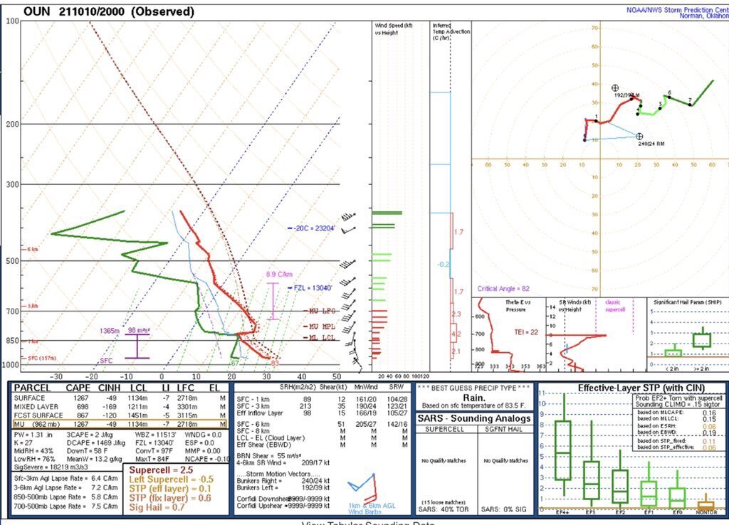
Special 20z OUN sounding. Once that cap erodes...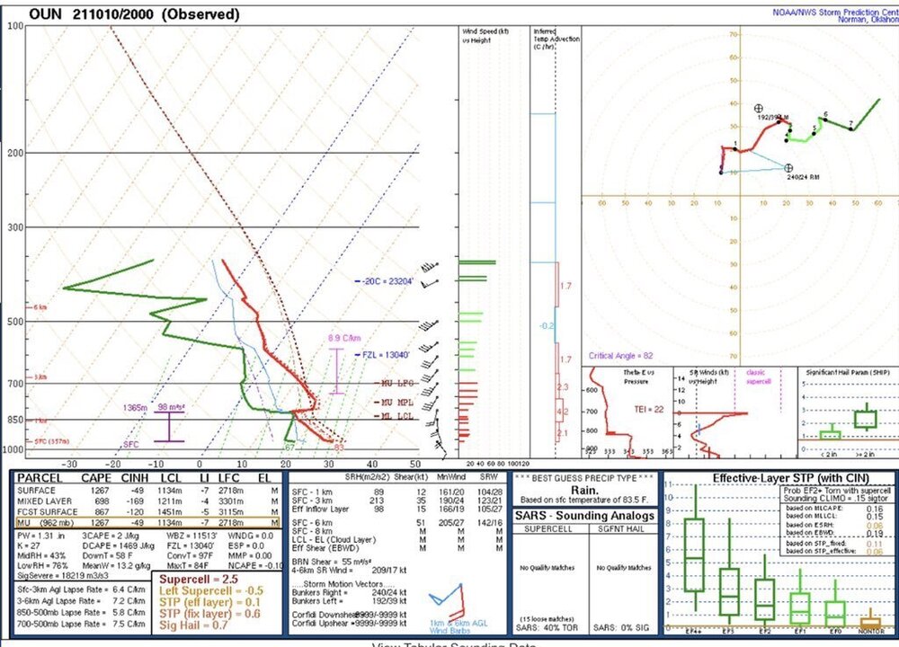
-
Severe Weather October 10th-12th 2021
OhioWX replied to Sydney Claridge's topic in Central/Western States
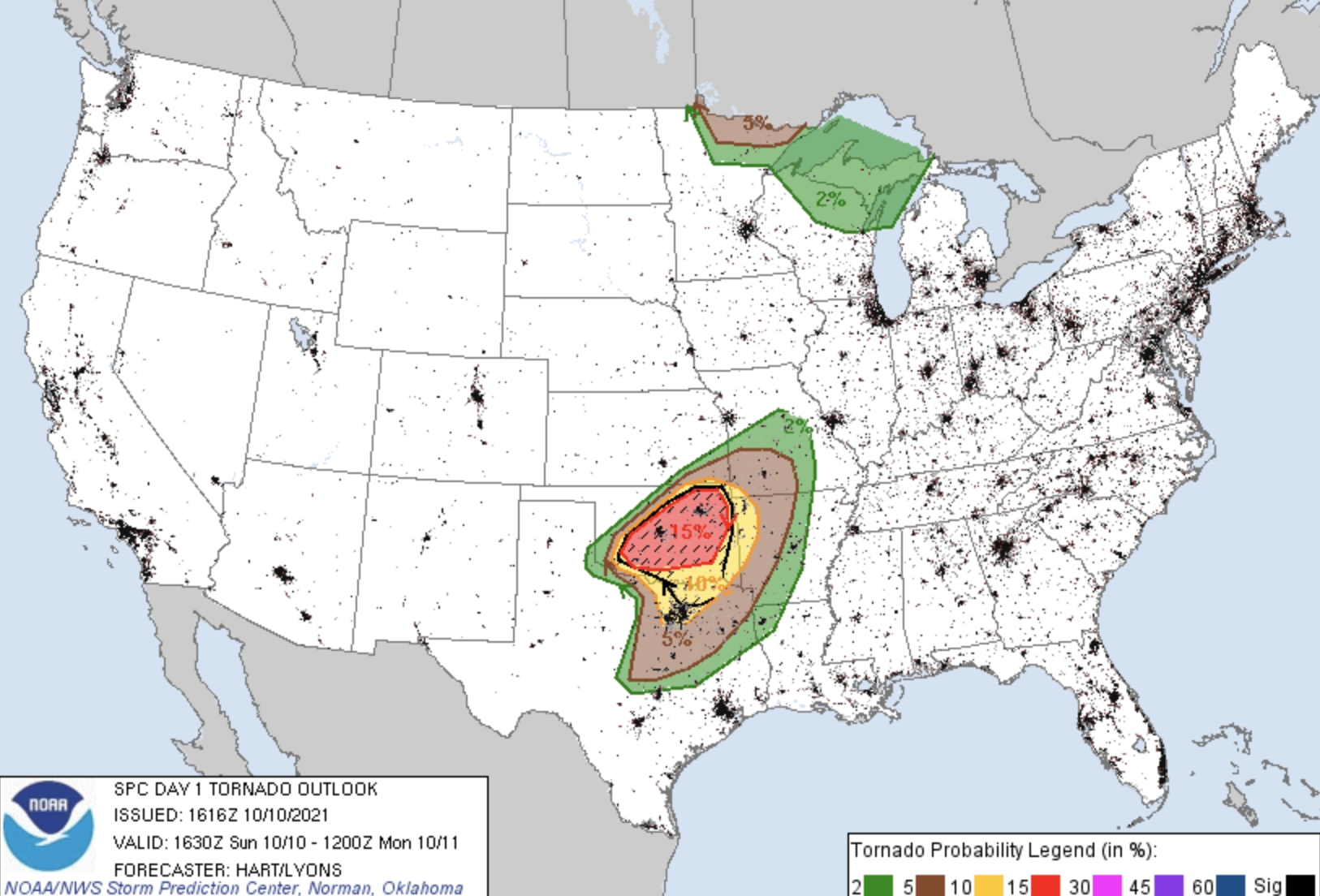
Latest mesoscale model runs have been very concerning and have trended towards more discrete activity in Oklahoma, notably threatening the Norman/Moore/OKC area and even up into Tulsa later on tonight. Latest SPC outlook expands the moderate risk to the north, putting the mentioned cities deeper within the 15% hatched tornado contour. In addition, DFW has now been included in the 10% tornado contour.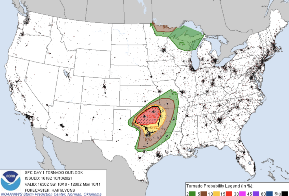
-
The rate in which Sam has intensified this afternoon is stunning. I'm anxious to see what recon will find.
-
The original vortex appears to be reintensifying and might be trying to become dominate again. The "new" vortex is fizzling out.
-
No doubt Ida is putting on a show for recon.
-
Eyewall is coming ashore. This looks really bad.
-
The typically aggressive HWRF on its latest run is a far cry from reality.
-
I'm very concerned about Concord. Looks to have taken a direct hit by a possibly intense spin-up tornado. Another one may have tracked right over I-94 just north of Farmington.